Hart’s Pass to Canada to Stehekin

image
Sister Wife, Catwater, Dan
image
Profile me, I’m in Canada about to step back into the USA
image
Ma and Pa Sterley
image
Catwater, Puff Puff, Sister Wife
image
Puff Puff on the trail

image image image image

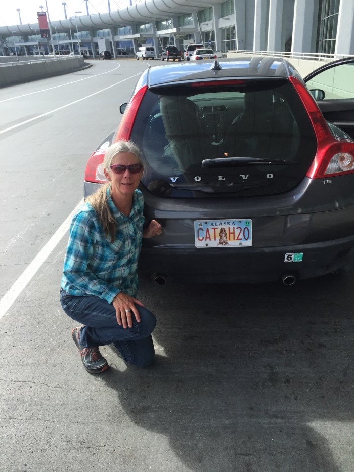
Glen dropped me at ANC airport (again) and off I went. A few flights later, I ….

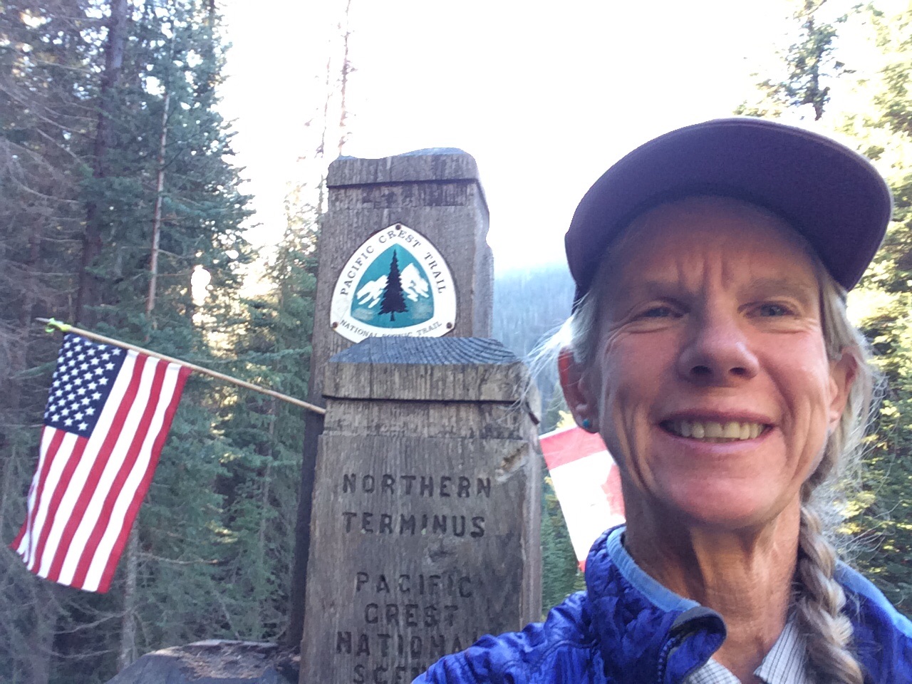
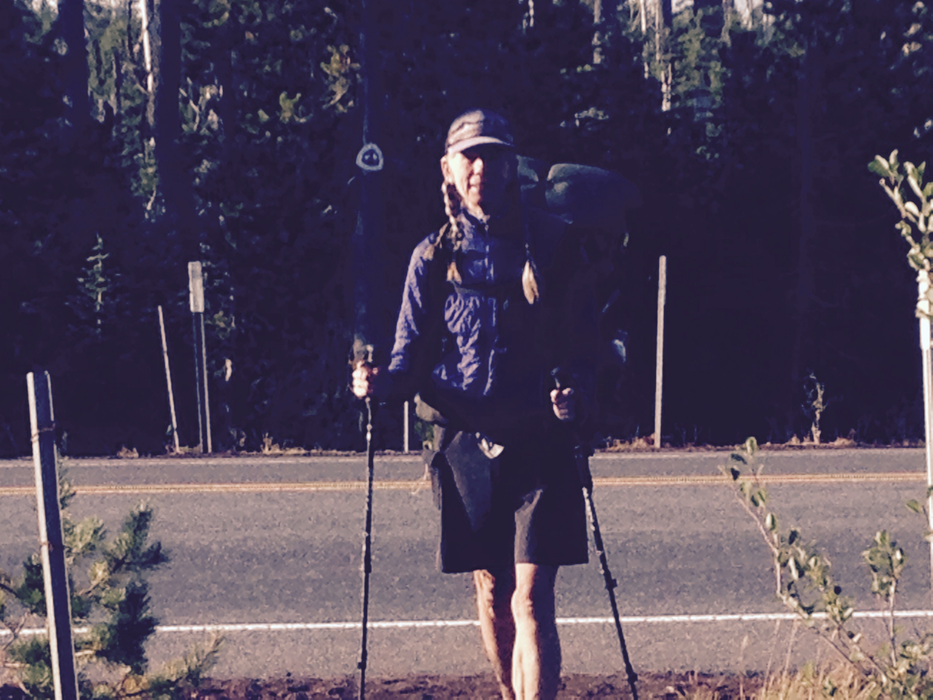
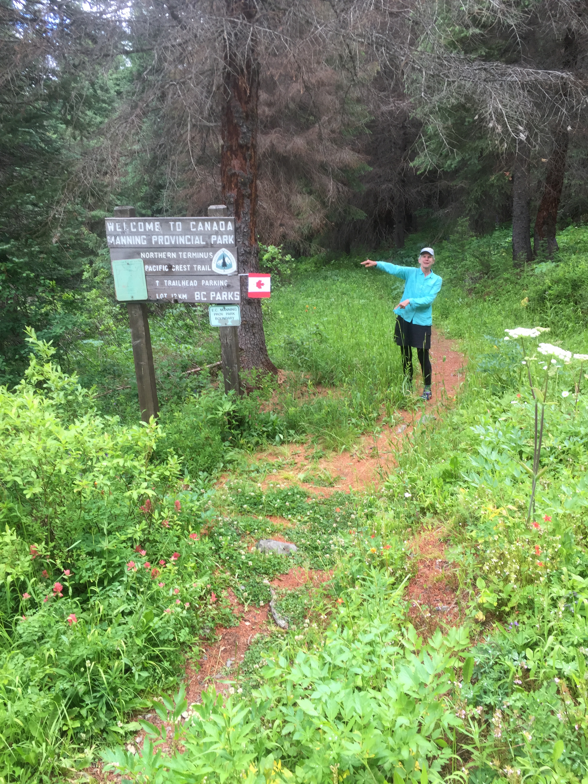
Met Dan, and we stayed with his bro Dave and sis-in-law Teresa north of Spokane before they relayed us to Tonasket where Rick and Vicky hosted us and drove us to Mazama where we picked up Jackie from Nick, and then met Marvin and Sue who were transporting Puff Puff to Hart’s Pass for the launch north to the border. Whew. Started hiking 12:30 July 15.

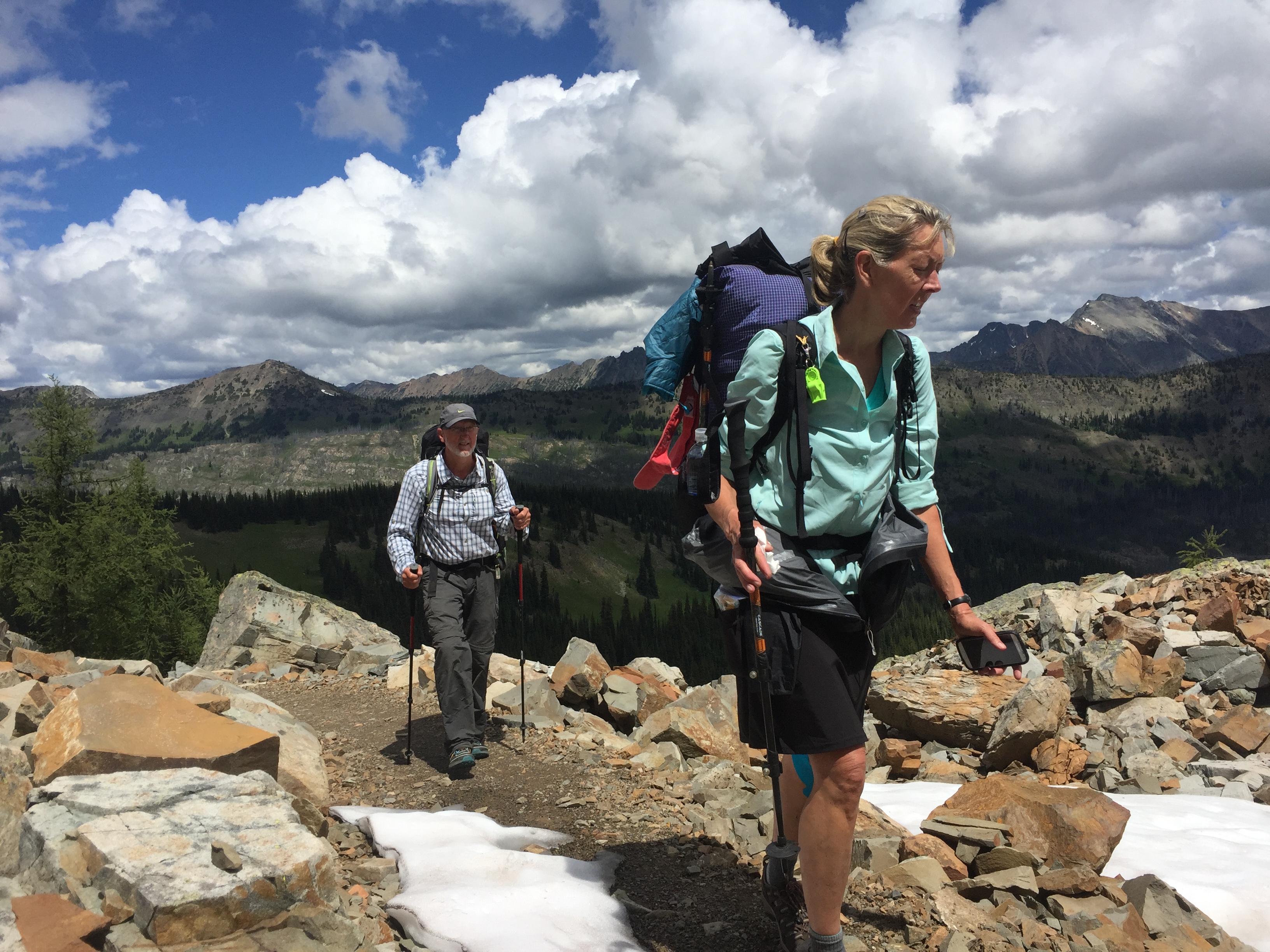
First of all, it was so cool to reunite with Puff Puff.  Remember she hiked the NOBO last year too!  I have made a modest miles plan to help Dan  and Jackie ease into the long distance hiking thing which she graciously accommodated until Stehekin. The first day we went just 11 miles, the second 13, in a cloud most of the time which meant there was very little view payoff for the work.  We all dove into our tents in the middle of the day to escape the wet and the bugs, oh boy what fun.  Day 3 we slack packed to Monument 78 and back, a lovely day that felt as if we were finally “starting” the SOBO.  The Grateful Red camped with us but we’ll never see him again, he’s hiking big miles right out of the box. You will know him when you see him, long dark red hair with a nipple length red beard.

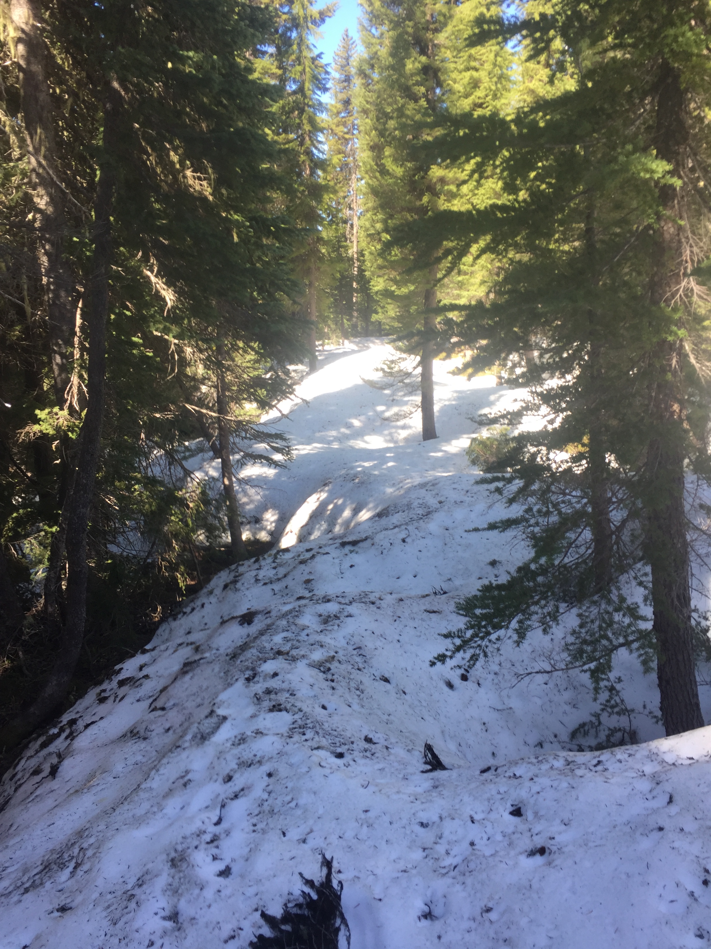
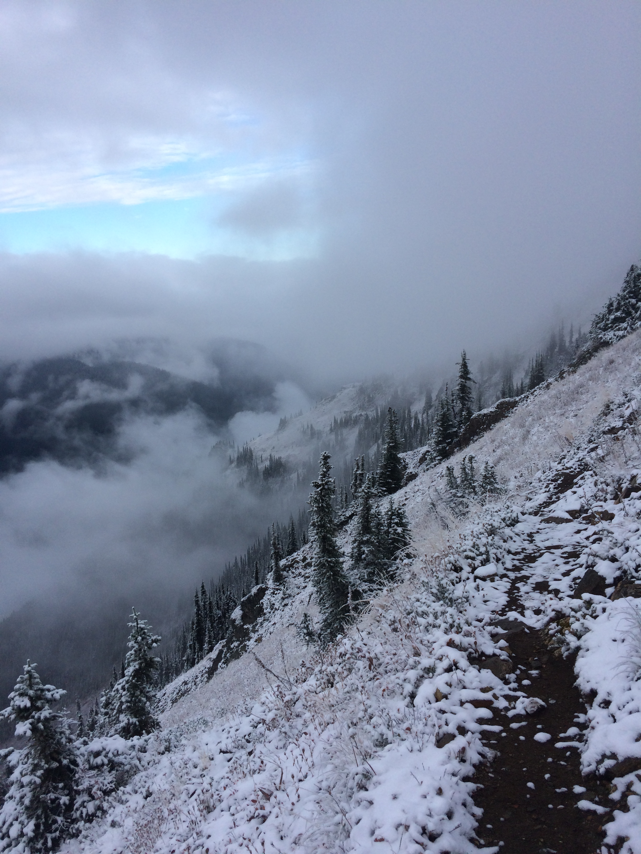
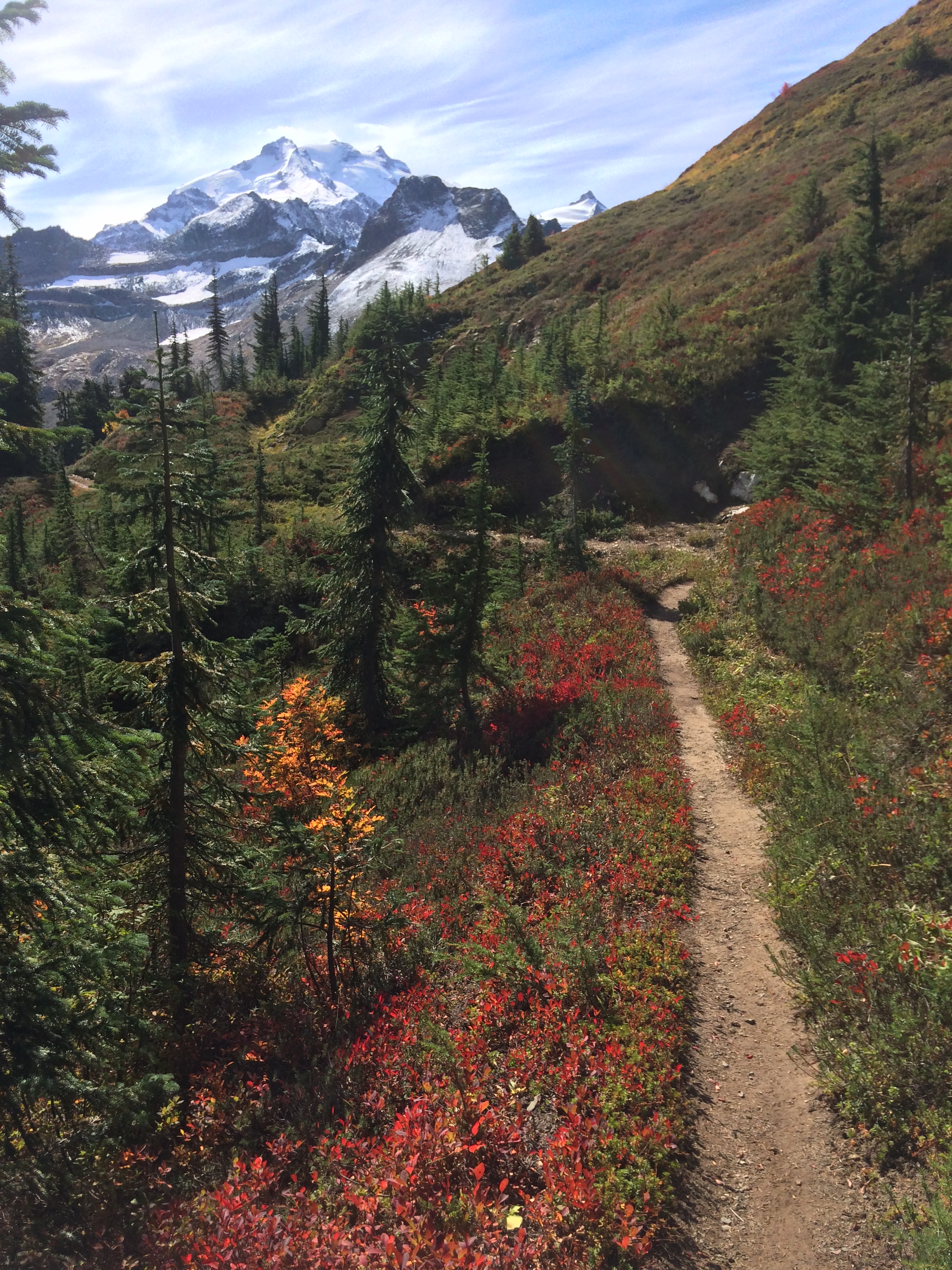
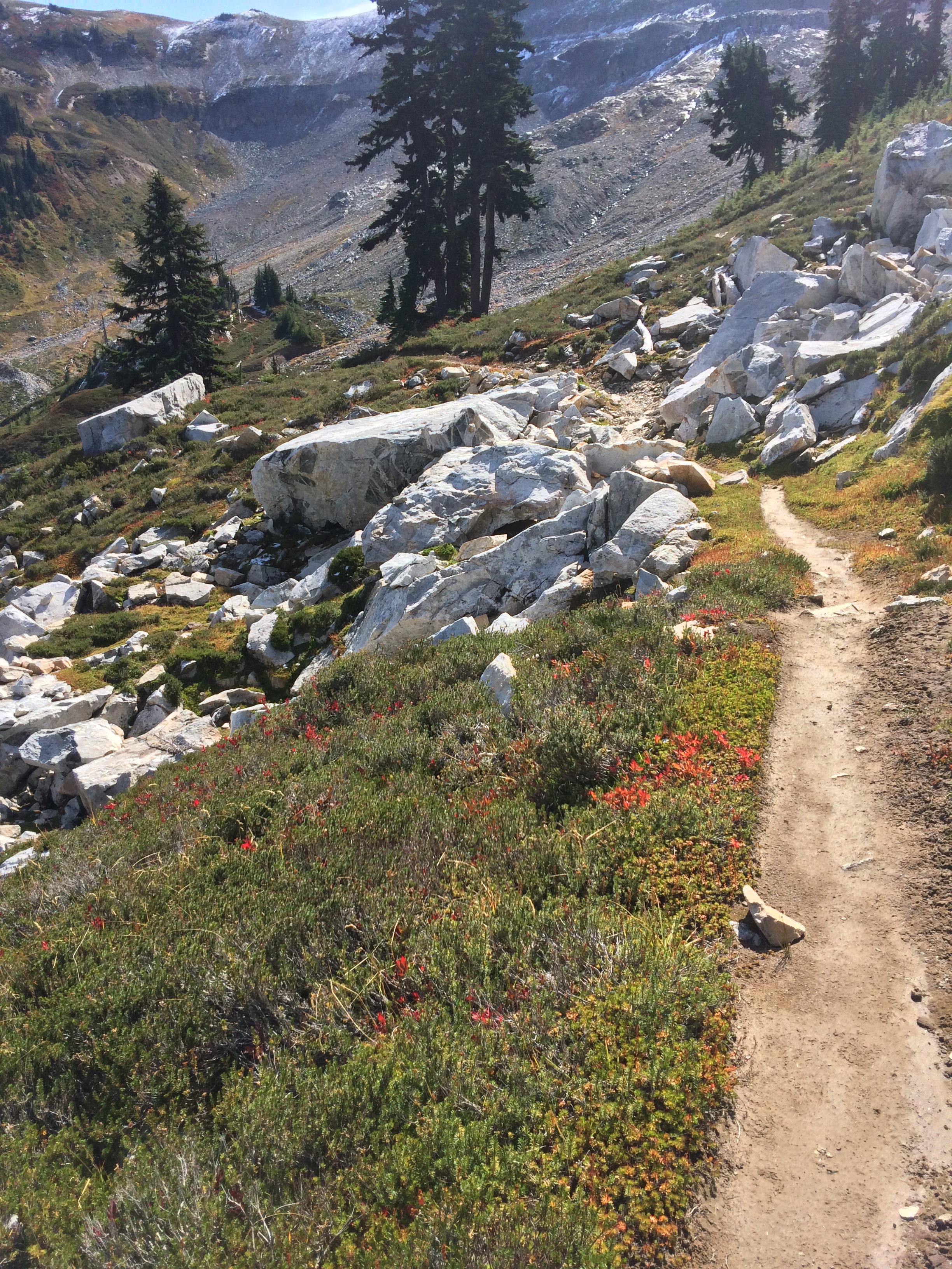
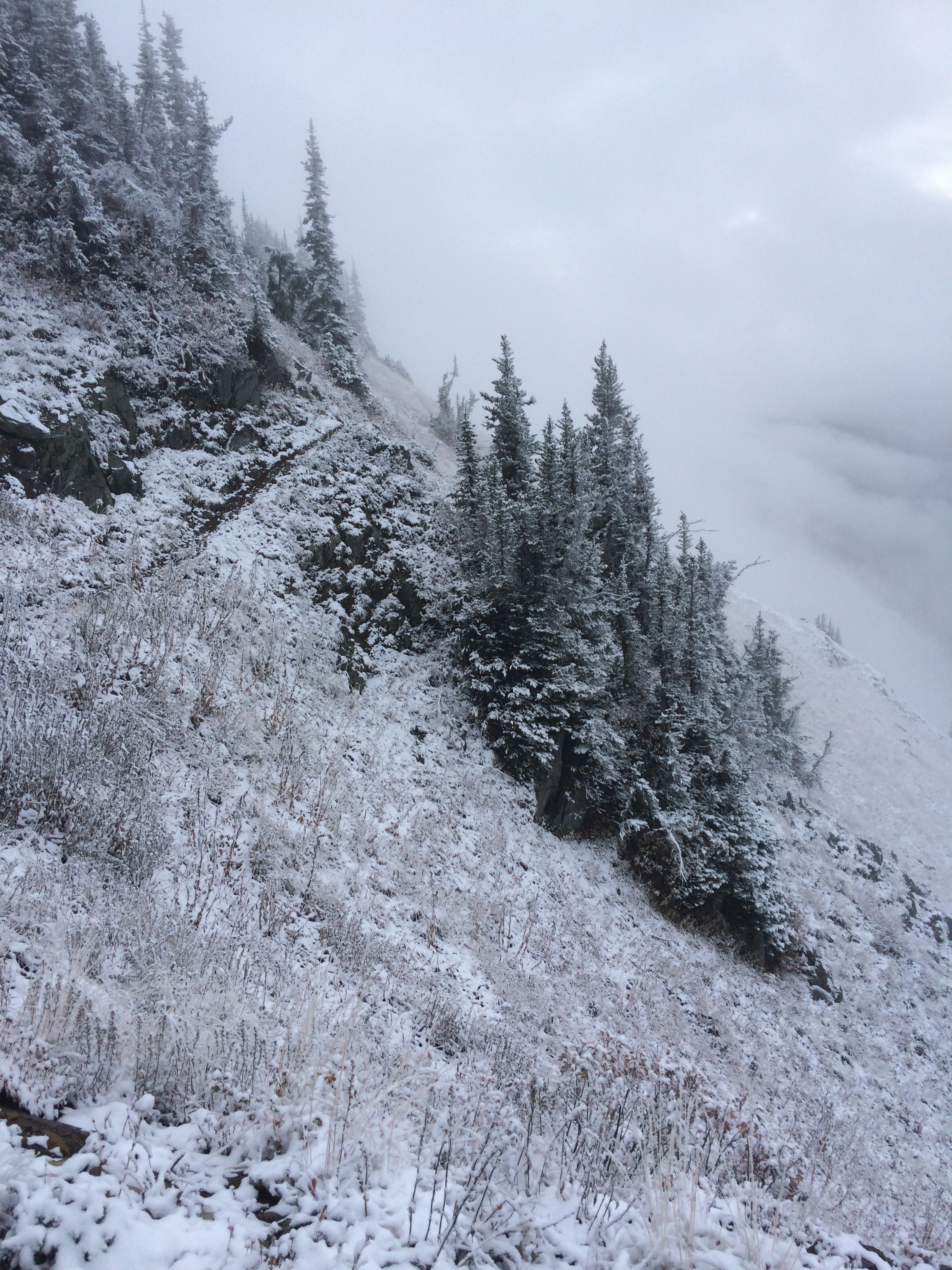
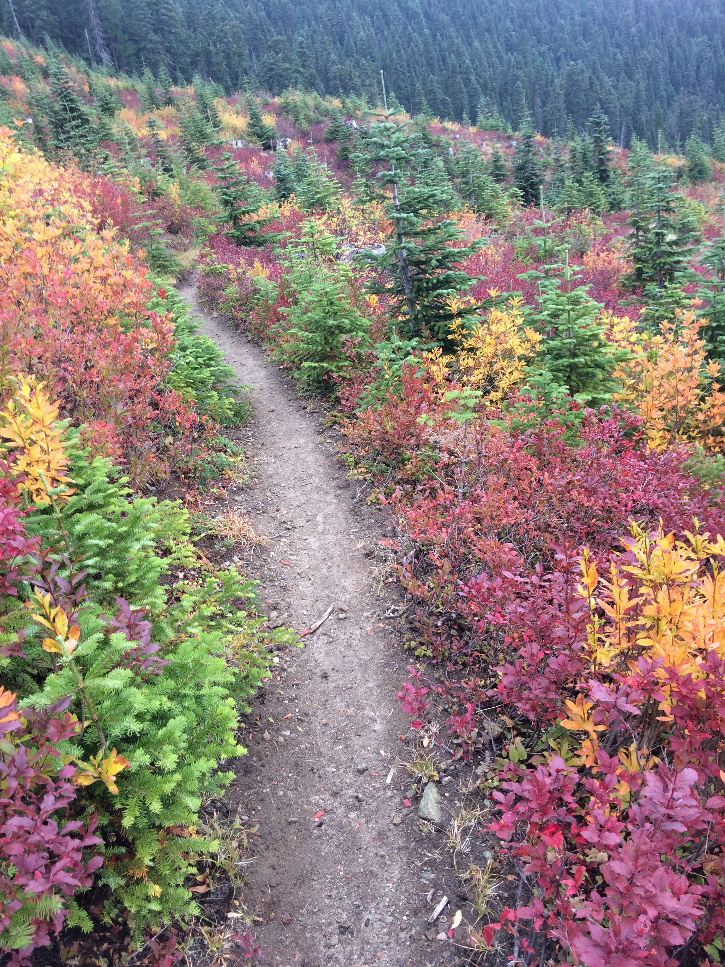
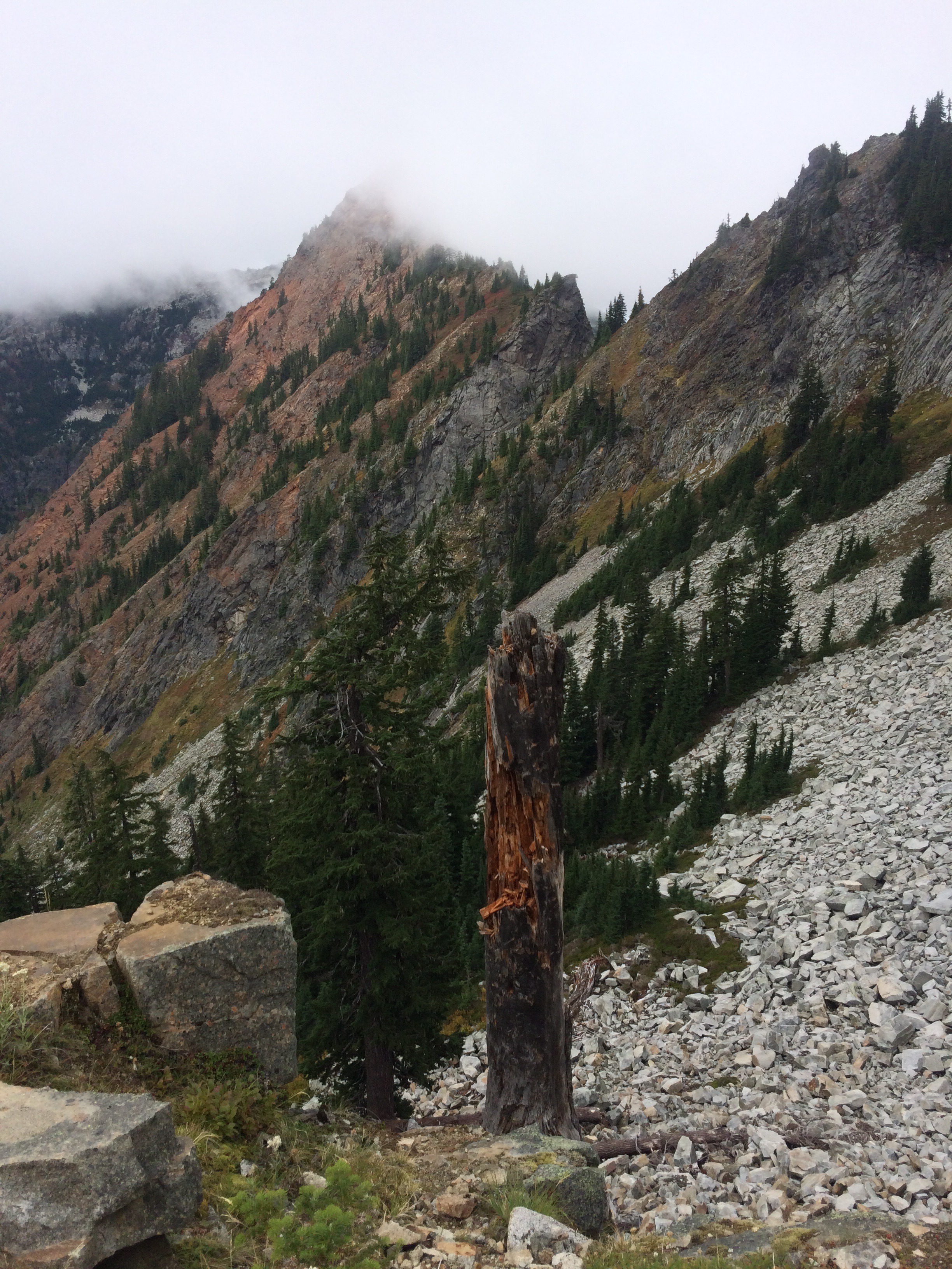
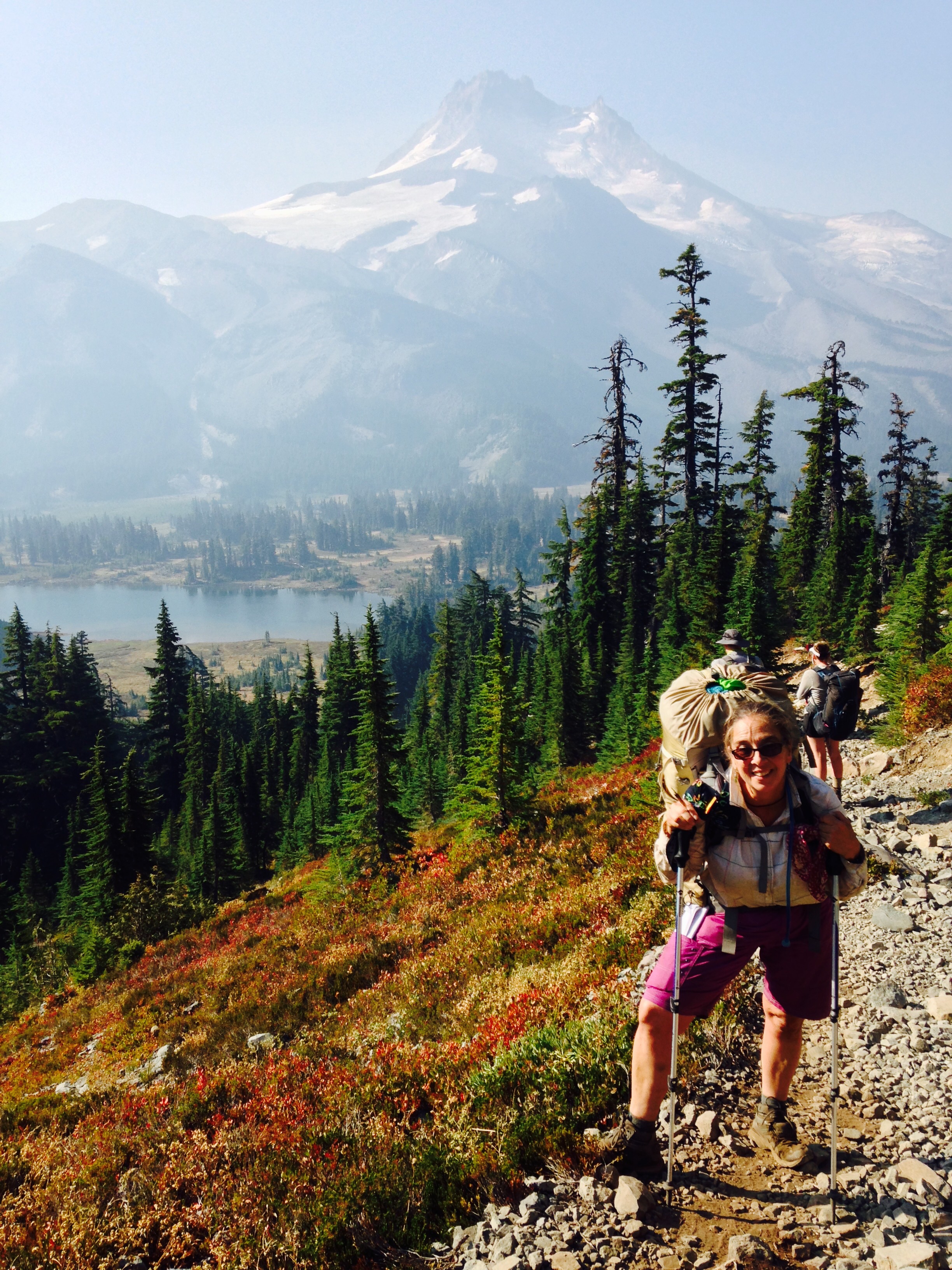
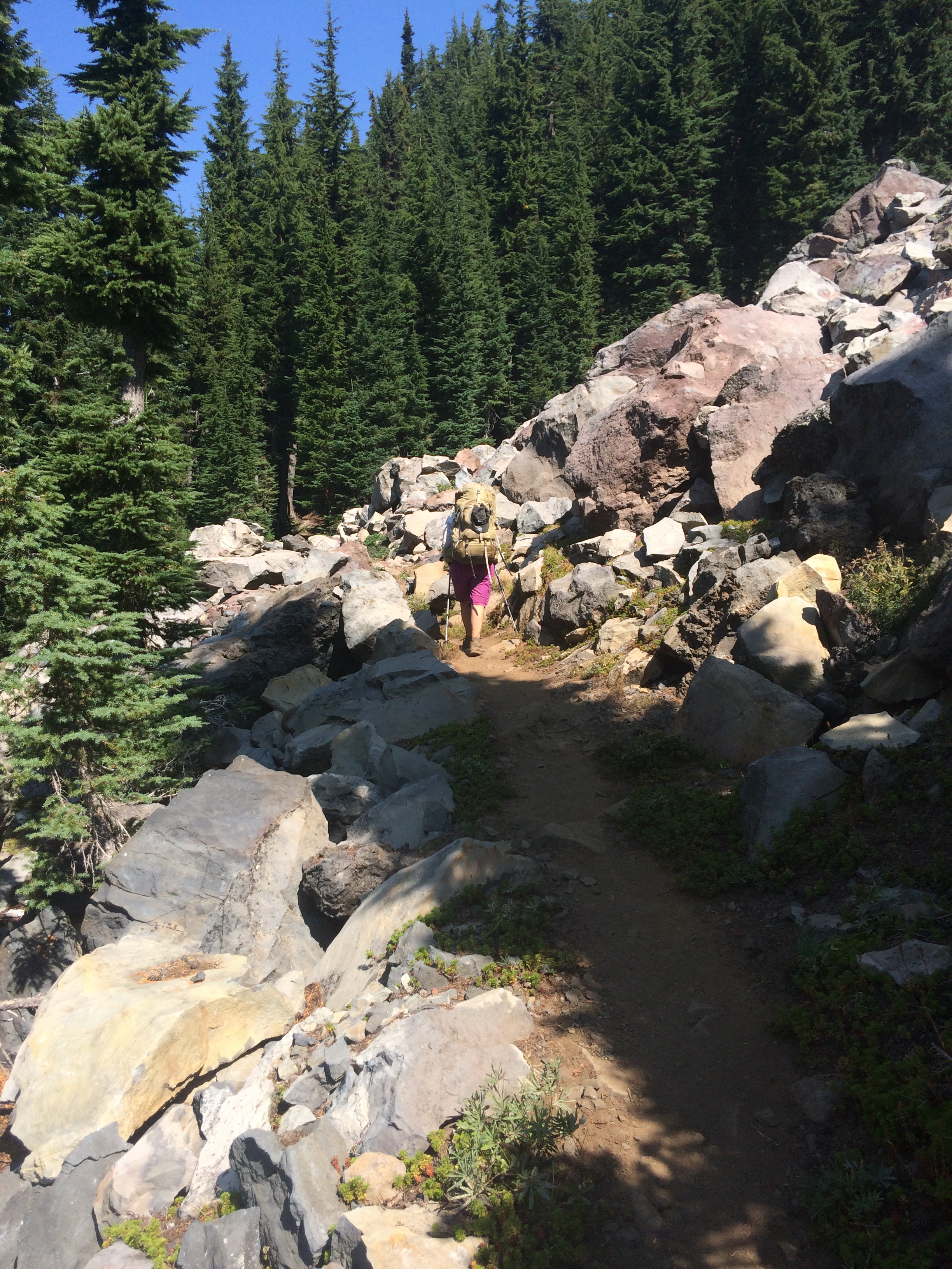
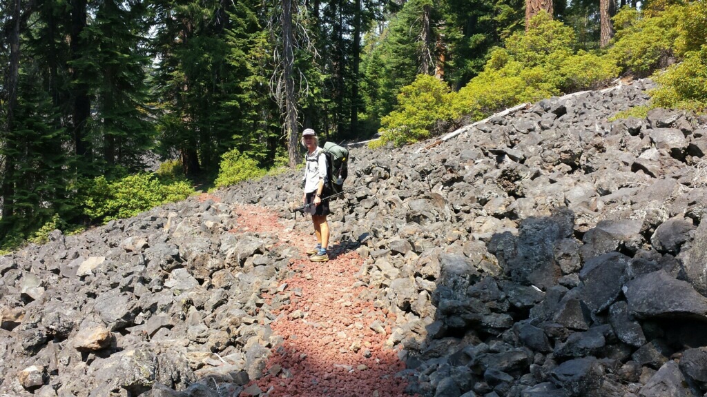
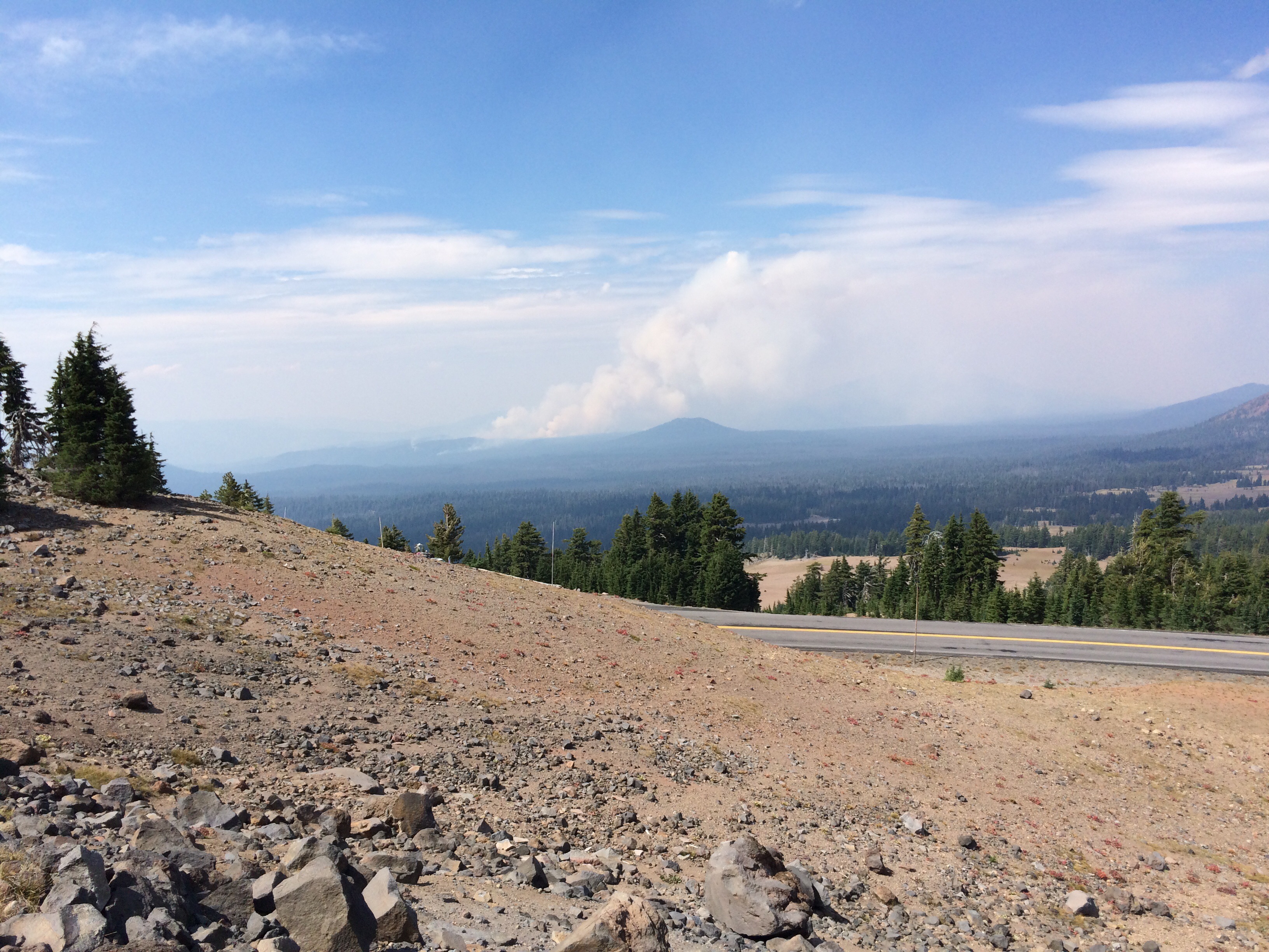
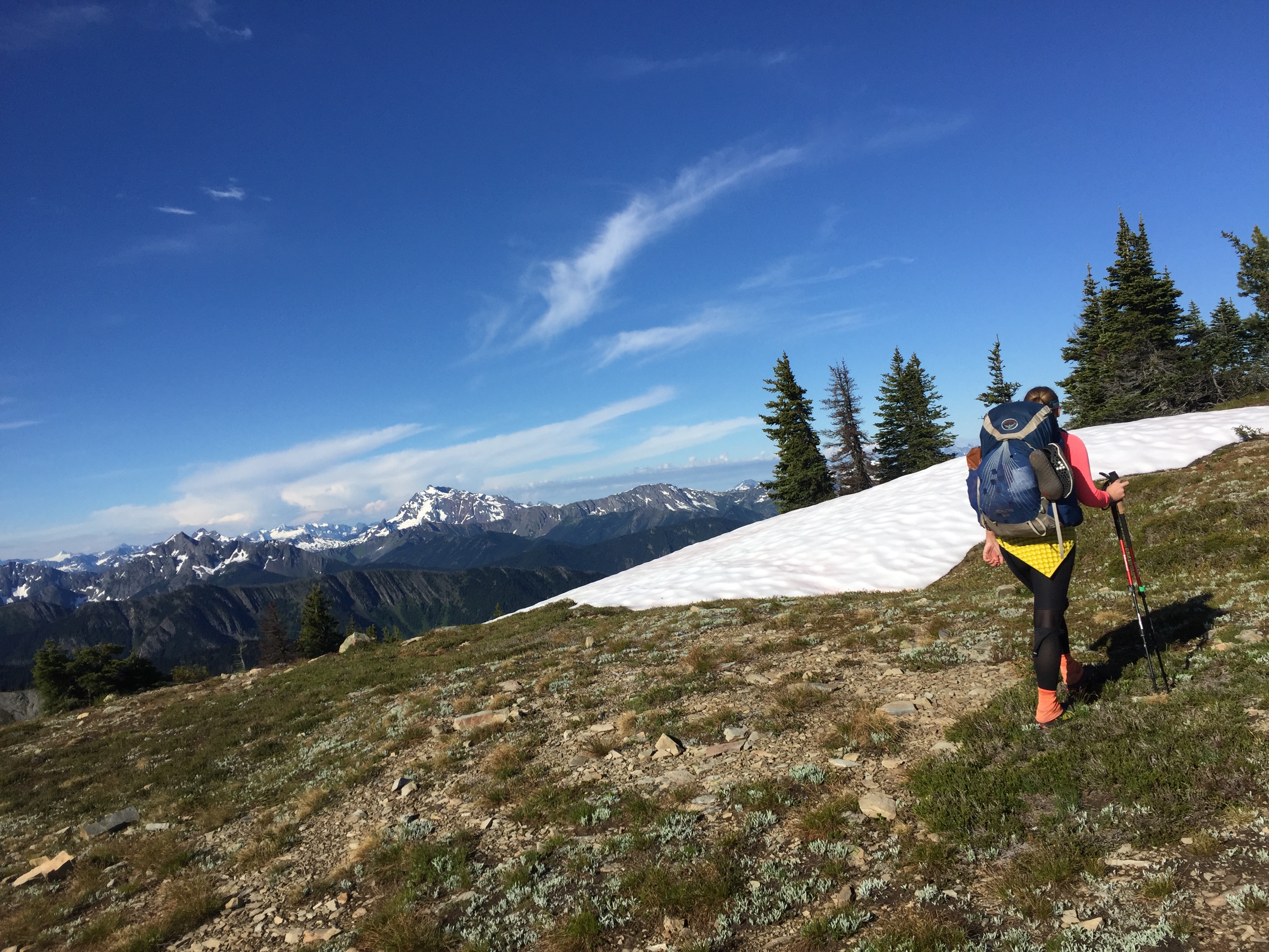
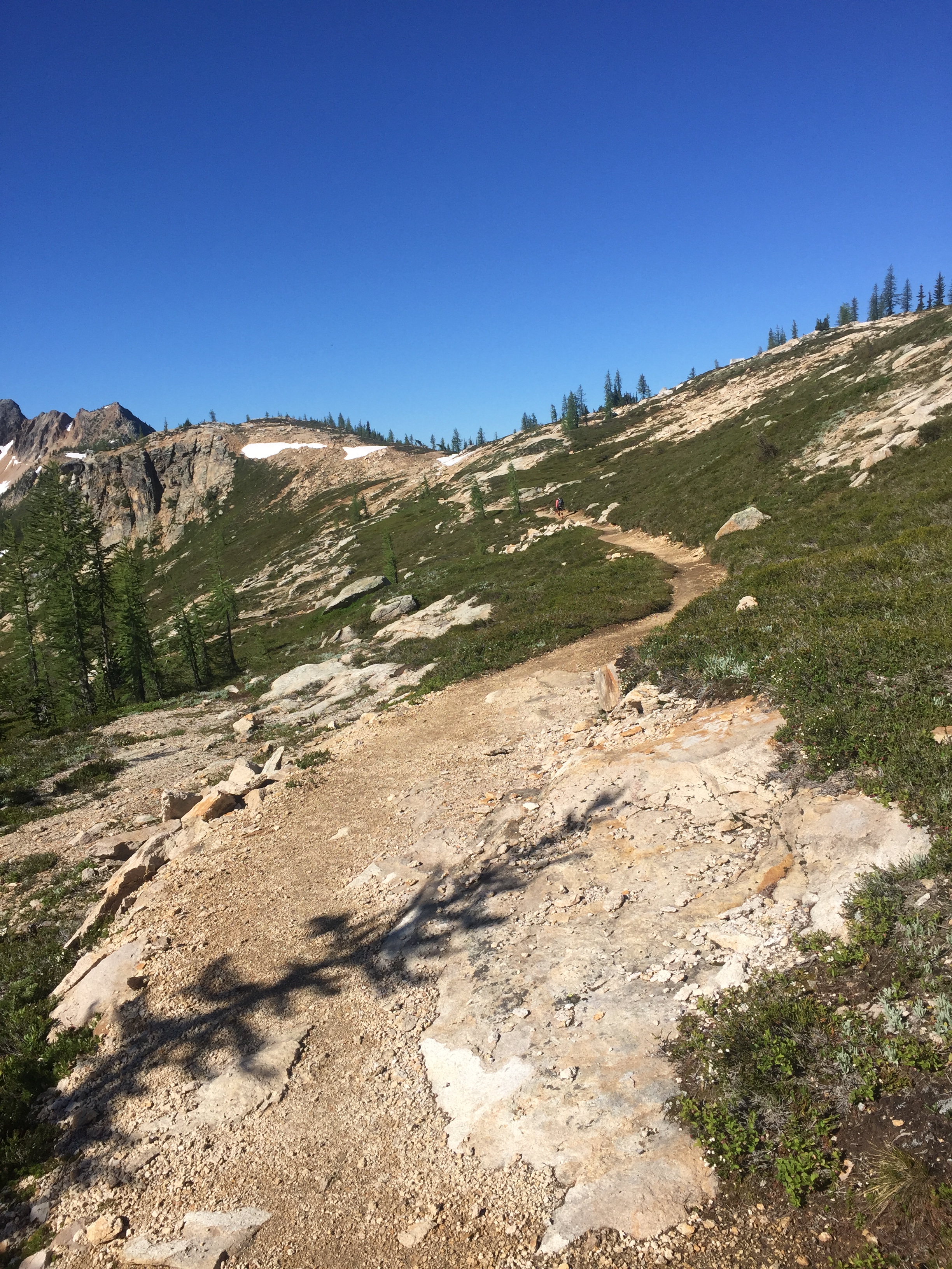
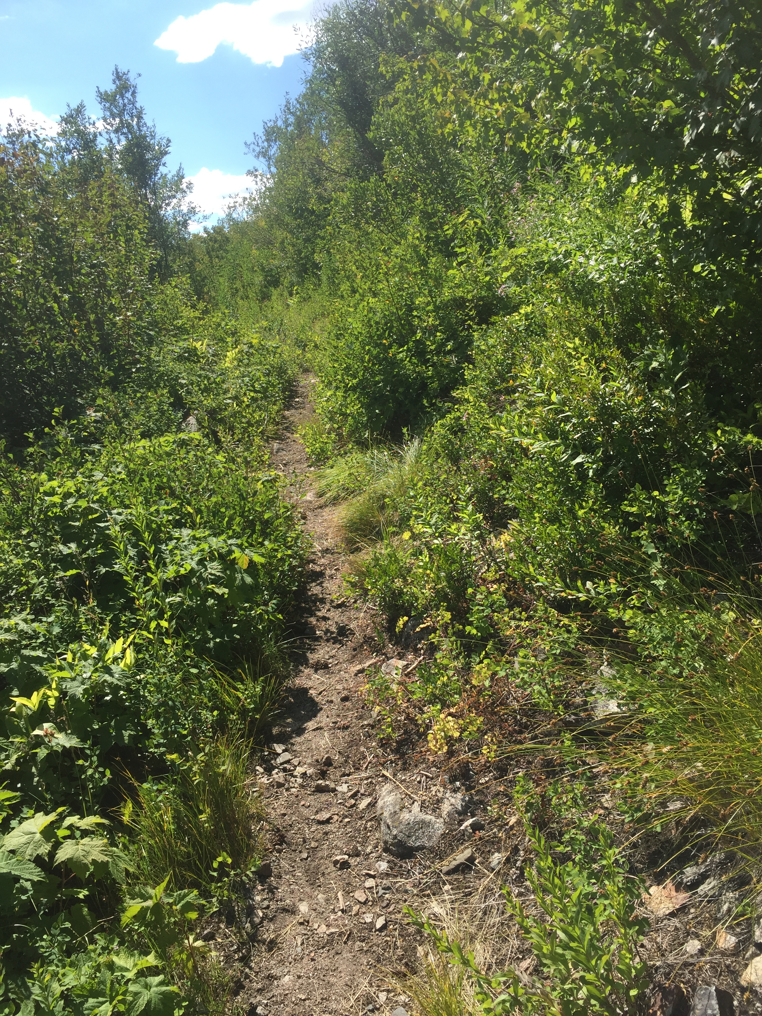
We endured torrential rain on Day 4, the trail filled up and was running a river, but things improved as we passed through Hart’s Pass and camped 6 miles beyond on a clear warm night.  Everybody’s mood was lifted as we continued through the alpine glory of the North Cascades.  We walked down to the Methow River bridge through blow down so bad the trail was nowhere to be found.  Gigantic trees were tossed and piled every which way, sometimes I had to crawl over a stack of 4 or 5 at a time, sometimes I crawled on my belly underneath, pushing my pack ahead of me.  Exhausting, slow, and annoying.  We met Scott here and he joined us for the next couple camp spots.  Cutthroat Pass was the reward for struggling uphill through even more blow down.  We camped under the Buck Moon, a night so bright and beautiful in a little saddle that no head lamps were necessary for the midnight creep to a pee spot. The temperature nearly reached freezing overnight while the next day’s hike down into North Cascades NP was like descending into a sauna.  Scott, Puff Puff and I camped after about 21 miles just as a thunder storm broke and cooled the air off enough to sleep.  Meanwhile Dan and Jackie camped with a troop of teenage boys after hiking their personal record of 18 miles!  Amazingly, and I assume because it’s a National Park and not USFS, the blow down had been cut off the trail for the 17 miles to High Bridge. Thank you NPS!

Our 2 little groups met at the bus stop for the ride into Stehekin.  First stop The Bakery.  Real food for the first time in the very long, slow 8 days it took to get here.  We had a reservation at the Stehekin Valley Ranch for the 4 of us for a zero: Puff Puff, Dan, Jackie and me.  Laundry, prime rib, beds, kitties and people who smelled clean.  Plus everybody who lives and works in this area makes you feel welcome!

Here’s  a weird note about this blog.  I keep a journal when I hike or travel solo, which is mostly.  But when I have companions, I tend to babble every little thought out loud, rather than quietly muse on paper.  Once it’s out of my mouth, it appears to be out of my brain too.  So these blog entries might be a little circumspect for awhile.  Which might be a good thing.  I’m enjoying the company of the Nearly Dead  although it’s weird worrying about other people’s blisters and mileage and being responsible for picking the day’s destination.  Definitely pushing  the limits of my comfort zone.  It’s easier if I imagine they’re just little skier punks I need to direct.

What I Did Next

image
Obsidian
image
Snow and obsidian
image
Campsite near Belknap
image
Sunset behind a lava bed
image
This is why
image
Consolidated snow on the trail 10-12′ deep but the route is relatively broad and flat so not a big problem, just kind of slow progress

What I Did Next
Santiam Pass to Elk Lake

I took a couple of days in Sisters, OR.  I love this area and this town: recreational opportunities year round and super friendly locals.  The weather continued to be unsettled, clouds and rain in Sisters, snow up higher.  Catwater’s Kid drove 6 hours from Seattle to spend the weekend providing “emotional rescue” to Mom.  It worked!  Clean clothes, a comfy bed,  good food, great coffee and beer didn’t hurt either.   

I got back on the PCT at Santiam Pass, Hwy 20 and a short while later, walked into Big Lake Youth Camp (BLYC) to collect my resupply box.  While unloading the contents and stuffing my backpack, I had great conversation with the youth counsellors who had the day off and were heading out to hike or climb or do something else fun on this fine, sunny day.  Last year on the NOBO, I happened to arrive at BLYC the day after camp ended, and the counsellors and staff were all on a retreat.  I had no idea what I was missing.  My in-laws were Seventh Day Adventists in eastern Washington and they were the most wonderful people I’ve ever known.  Glen and Marie, and their church community, were excellent representatives of this branch of Christianity.  (I went to Unitarian Sunday school as a kid in the college towns where my atheist father was a professor and my lapsed Lutheran mother thought we needed to at least learn about the world’s religions so we could “choose.”  Do parents still raise kids like this?  To choose a religion?) They knew how to have good clean fun, laughing and joking and celebrating life without meat, beer or crass humor.  BLYC is expanding and improving the building they provide PCT hikers but they already offer showers, laundry, a hiker hangout with hiker boxes and plug ins, the ability to mail your resupply boxes there, and a very positive vibe.

Resupplied, I headed back to the trail and continued a few miles and camped on the edge of the lava fields, the a’a’ lava piled behind my tent was pocked with snow patches that I collected and melted for drinking water.  The following day I got back up into snow fields, but the terrain was easy to navigate.  The third day out was as slow as the previous one, hiking through blowdown and snowfields is just time consuming and I wasn’t making the miles I needed to stay on my new schedule.  But it was insanely beautiful the fourth day walking through the Obsidian Limited Area, sun on snow through valleys and canyons with the black glitter of piles and piles of obsidian everywhere.  Across one gulley I saw a robustly fluffy, red fox hunting varmints in piles of rocks.  Deer tracks, human tracks to follow, rabbits, and chipmunks, made the slow miles glorious, if no less arduous plodding through snow. 

Having made my point to myself, I walked into Elk Lake Resort and took a shower while waiting for Oregon friends, Nick and Jackie, who were camping in the area, to pick me up and get me to the Medford airport in a few days.  Somewhere on the trail south of Timberline I had had an exchange of voicemails with my dermatologist’s nurse who told me that I needed plastic surgery on my throat to remove the margins of a basal cell cancer that had been initially and conservatively removed a week before I headed out of town for the PCT.  A consult had been scheduled back home, appropriately, per the surgeon’s schedule, not mine (“you shouldn’t wait 5 months till you’re done hiking to take care of this”) and so I’m back in Alaska and have had to change my hiking schedule.  As Noreen says, “It will all work out!”

I left a voicemail with the Pacific Crest Trail Association (PCTA) over the weekend because I was angry and upset that they would “share” an article about me without either checking their membership database or my blog which is listed on the trail journals section of their website, a “share” that set me up for public humiliation, criticism and shaming.  I got a return call from Jack Haskel and we had a lengthy discussion.  He started by telling me that first of all he was glad I was safe and we went from there.  I really, really appreciate the return call, Jack’s sincerity, honesty and time. The PCTA is a non-profit that has a huge variety of tasks, responsibilities and types of members.  As usual with non-profits (I donate to and volunteer for many) the budget is limited.  So in answer to my question to Jack about what the stats were on Search and Rescue (SAR) missions on the PCT—how many, where, top causes for rescues—there is no database.  As thru-hikers and other PCT advocates know, the trail goes through a zillion different regulatory agency jurisdictions, volunteer SAR group boundaries, and law enforcement jurisdictions.  To collect data on rescues would require someone first researching who all these groups are, then reaching out to each of them, developing a standardized but quickly completed debrief of a rescue, then sorting and analyzing stats—it actually sounds like something I’d enjoy doing as a volunteer.  I mean does everybody who calls SAR get slammed for calling SAR?  Last year I knew people that SAR responded to for injury glissading or falling down the snow chutes on the Sierra passes, for being incapacitated by GI infections, for dehydration, and for snake bite.  As I said before, shit happens in the wilderness.  Who at home gets to decide and deride one type of shit as preventable and another type as not?  To set the record straight for the cretins who don’t think it is SAR’s job to respond to preventable incidents:  you’re wrong, rescuing idiots like me is what they love to do and it is in the job description.  I hit the button before my situation got so dire that I’d place other human beings at greater risk to get to me.   That was a conscientious decision.  Although lost, I got a lot of the rest of it right, I had proper cold weather gear, extra food and a sturdy shelter for example.

And shouldn’t there be greater emphasis on educating about high incidence causes of SAR responses? We can’t teach or learn if we don’t have the facts.  While I’ve been back in Alaska just a couple of days, there have been two true searches for lost people.  Two hikers overdue on their trek out to the “Into the Wild” bus on Stampede Road outside Denali Park were found and rescued, they carried no tracking satellite device.  And another SAR for a man way up on the North Slope who drove out to go on a hike and didn’t turn up for work on Monday.  No tracking device.  The list of aircraft and skilled personnel searching for this man is extensive, so far no luck.  I hope he is found, I hope he is safe.  Life is precious, he is worth the effort.  Nobody goes out there thinking they can take risks because there’s someone to come save them if things go bad.  Nobody goes out there with a 100% guarantee that their skills and gear are all that is needed to be successful—even the best prepared can run into trouble and need help.  We’re humans, crazy, wonderful human animals, a dominant and adaptive species of life, but life is messy.

I’ve learned some lessons, maybe not the ones all the Facebook critics think I should have learned, but who are they to me?  A bunch of internet addicts reacting to a poorly written article about a rescue, inexperienced fraidy-cats, PCT groupies, worst of the Wild crew, people who think that reading about the PCT gives them the right to peer over the tops of their computer screens and instruct me and the SAR community.  My contempt for the people who judge me so blithely is unhealthy.  I have to let it go.  But there are calmer, more rational commenters too, and my friends and family, people who know me, have reached out and helped.  The tiny hiking news cycle has spun on and my name and story have dropped to the bottom of the feeds.

Four of us intend to start at Hart’s Pass July 15, heading north to Monument 78, turning around and hiking SOBO.  As of now, the road to Hart’s is still blocked but other hikers are walking past the blockage and getting on to the PCT.  There are alternate routes to the PCT from Ross Lake or Rainy Pass.  Snow persists up there, as in Oregon.

So my revised, revised, revised master plan is:  WA SOBO to Cascade Locks, bump down to Ashland and go SOBO through Yosemite and the JMT, making it through the Sierra in October.  Bump back and pick up the missed OR sections SOBO.  Finish “the desert” of Central and Southern California a bit later in the Fall.  We’ll see how it plays out.  Never back down.

Part 1 PCT SOBO: Cascade Locks to Timberline Lodge

image
Leaving Anchorage International Airport

Sarah, trail angel name Catwater’s Kid, picked me up in Seattle for a wonderful weekend in Cascade Locks and he Columbia Gorge. We drove to Timberline on a blazing hot day and walked north on the PCT a little way to discover snow patches on the trail, consolidated and melting fast, not going to be an issue. We day hiked to falls from the 100 year old scenic highway running above Hwy 84 on he Oregon side. It was in the 100’s, good thing I’d been acclimatized to heat in Hawaii a few weeks ago. We had a great time and I had a hard time saying so long as I began the interminable trudge up out of the lowest point in the PCT in the heat. Over the next 3 nights I camped alone and saw very few hikers, such a different beginning from the Campo end last April. Second night I was at disgusting Salvation Spring where I camped last year heading north (1 night between Timberline and CL) and about 7:30 pm I heard music a long way off, thankful the couple with the speakers on their packs continued on past me.

Cascade Locks trailhead
Spring flowes
Spring flowers
Timberline
Timberline

After trying to explain to a few people what I’m doing, I think the simple explanation works the best: “I’m hiking the PCT SOBO with family and friends beginning July 15 from Canada. I’m warming up by hiking south through Oregon.”

Lots of bugs and blowdown on the Columbia Gorge side of the trail, but also hummingbirds zipping around buzzing like mini bombers, fuschia to pink rhododendrons, and a zillion other flowers in bloom.  The trail tread is in good shape, the stream crossings are shallow and safe, but I’m definitely looking forward to walking downhill off Mt Hood.

Funny how the trail routines come back without thought: scanning for flat places to camp, mixing Aqua Mira water purification drops, heating water in the morning for coffee and granola, listening and looking as I trudge along, happy to be able to hike in the wild.  Plus I did a good deed already!  Day 1, 2 brothers going north asked me to pick up their lost, fancy 11 oz water bottle and bring it to Timberline for them.  They were super nice and understood the weight penalty they were giving me.  I found it within 15″ and carried it the rest of the way.  This too is what I love about trail life.

Post Trail Blues

Two months ago, I promised my hiking friend Poppy an explanation about post trail blues. She is considering thru hiking the PCT in a couple of years.  Hiking would mean taking 5 months off from her Occupational Therapist job working with children, a job she loves.  It would mean leaving her dog in someone else’s care, leaving family and friends.  She is happy in her life.   “I hesitate to do a thru if in the end I feel sad and discontented.”

Why do thru hikers finish the trail and get the blues, Poppy asks, is some of it missing your new trail family and trail home? Feeling like you accomplished something and other people just don’t get it?  The answer to the first question is yes but its a no to the second.

Hikers will tell you that the hike “changed” them. But what does that mean?  For me, the change was subtle yet profound.  On the trail, I felt more content, more accepting of myself, more comfortable and compassionate with other human beings than ever before.  This has carried over into my off-trail life to some degree.  I worry very little about how people see me, I smile and say “hi” to strangers on the street, just like I did on the trail.  If they don’t respond, no worries.  It’s their problem, not mine.

I fall back on a phrase a lot in my life: “You don’t know what you don’t know.”  In every culture there are some restless souls who wonder or wander.  The PCT is a perfect fit for us.  At home, every night I fall asleep counting campsites one after another, retracing my route north, finding the calm and peace of the trail.  In my heart, the trail will always be there.  But I want to physically be there hiking a long trail too.

Like Poppy, I didn’t hike to “be fixed” or “find myself.” But Poppy found that in her time on the trail she realized that there was a part of her that needed to be fixed, her faith in humanity through the kindness of strangers was restored although she didn’t know she’d lost it.  For me, every single day out there, even the hard ones, I was happy and content in my own skin. I didn’t know that was possible.  It was the best therapy possible.

Of course, any traveler returning to the world after 5 months has stuff to catch up on. A lot of the younger hikers needed to find a new job and a place to live.  Others of us returned to home and family and jobs.  Some hikers intended the PCT to be a major break from the old life and didn’t know what they would do next, they hoped that the trail experience would help them see their way forward.  But I would say, that nearly all of us thru hikers found ourselves lost, for the first time in months, truly lost in the so-called real world.

I’ve been busy and traveling and spending time doing things outside that I love, running and snowboarding, but I only started feeling better when my husband decided he’d like to hike through Washington, the country he grew up in. I would like to see the Cascades in a different season, when I’m not so fatigued from hiking 2000 miles. I jumped at the plan, and could stop trying to keep secret that the accomplishment of thru-hiking the PCT wasn’t a check mark on a bucket list, but an addiction and the new plan for my “one wild and precious life” as Mary Oliver says.

So the plan is for us to hike slowly and carefully for awhile, until Dan flies home to Alaska to catch our yearly supply of red salmon and I continue south on the PCT to Mexico.  It will look different going the other direction, I will have way less company but I am good with solitude.  I would love to be hiking a different trail, the CDT, and see something new, but I truly love the PCT and I think I mostly just need to be walking, day after day, for months. The cure for post trail blues turns out to be planning the next long hike.

Catwater, 62, Alaskan….


Stevens Pass to Stehekin to the End

September 23

PCT Mile 2660

Washington has been really, really tough.  Here’s why:

  1. Cumulative fatigue and weight loss
  2. The weather sucks
  3. Lots of elevation gain in a day, and lots of downs
  4. There’s a bush that smells like stinky feet and it’s everywhere
  5. Friends have been getting off trail for various reasons
  6. When it’s not raining or snowing, the yellow jackets are out and stinging the back of my legs

However, the Cascades are stunning!

image
Camped in the snow, walked in the snow
image
Fall colors
image
Beautiful pass
image
Log bridges all along this stretch
image
Reunited with Puff-Puff and Julien from the desert in Stehekin!

Hikers just a week or so ahead of me had to make a tough decision since there was a trail closure at the Suiattle River due to fire.  This closure had been in place for weeks and those of us hundreds of miles south had been stressing too.  The most popular choice was to get a ride from Stevens Pass to Chelan, take the ferry to Stehekin, and resume the PCT, but skipping 107 miles of PCT.  I figured that was what I would do and had lined up Sarah to drive me.  And then the closure was lifted!  All the crappy weather helped the firefighters.  I am impressed that in the midst of dealing with the devastating loss of life and property and the complexity of fire logistics deploying resources and personnel, that the PCT was reopened to the tiny population of hikers.  Who do I thank?  The US gets so many things right: we invented National Parks, the Forest Service and long distance National Scenic Trails.  Walking along I was thinking about this and humming “….land of the free, and home of the brave” guaranteed to choke me up like nothing else.  If I’m ever cast in a movie and have to cry on cue, I won’t be thinking about losing my favorite cat, I’ll be visualizing an Olympic award ceremony with the US flag in the gold medal position and some poor athlete stumbling over the words of the anthem, hand on heart.

I got a slightly late start out of Stevens Pass, making just 16 miles till dark and a camp in the clouds.  Over the next few days I could not make up the miles, only getting 20-22 a day.  The trail was dreadfully unmaintained, brush overgrowing the trail pulling at my pack and drenching me with water. I couldn’t see my feet and was walking blind.  Trees were down, years and years of trees, that I had to scramble over, under, or around.  The trail was a rocky rut for miles and I picked my way slowly along, it would not be good to get injured so close to the end, plus how the f would Search and Rescue reach me?  So I was 5 nights out, instead if the 4 I’d hoped for.

A quick 7 mile walk to the Ranger Station where a bunch of us got the shuttle bus to Stehekin with a stop at the most incredible bakery of the entire trail.  All you who know my real life eating habits would laugh to see me eat a sandwich, a Dr Pepper, a slice of Quiche Lorraine and 2 blackberry cheese Danish.  And I was still hungry.

I got a room, and started all the usual chores: pick up the resupply box, inventory and make a list of what else to dig out of the hiker box (fuel, TP, more food) or buy at the little store, hang up and dry the tent and bag, shower, laundry, eat. And then I heard a voice I knew scream, “Catwater!” Just like a movie, Puff Puff and I ran to each other, arms wide.  And there was Julien too!  What a reunion!  I last saw Puff Puff in Mammoth but follow her blog alexandramason.wordpress.com and had lots of trail news drifting back to me.  Trail registers, where they exist, told me how far ahead she was, she just got faster and faster, and I didn’t.  Puff Puff, from England, is one of my heroes.  What strength and resilience this woman developed on the trail.  And although the trail closure was in effect when she reached the Northern Terminus, when it was reopened, she made her way back to Stevens Pass and hiked the 107 miles she’d been forced to skip.  Not many hikers have done that.

Julien I’ve been leapfrogging with since the desert.  This man, from Quebec, has unfailingly smiled through the entire trail, all the fatigue, pain, hunger, there he is, cheerful, gracious, amiable.

Waiting for the single washer/dryer in Stehekin, a bunch of us beautiful, scrawny, tattered, shaggy, tired hiker trash sat outside at a picnic table drinking beer and talking about making it to the final resupply before The Border.  I was happy to learn that a couple who met on the trail, that I met in Sierra City, will be a couple in post trail life!  And Sunshine recovered from a badly swollen shin in Crater Lake and will finish the PCT.  Oh I love trail life and all the interesting unique individuals who have walked this path.  Even though I am so ready to be done!

This final leg, I planned very carefully to climb high and sleep low, so as not to freeze at night. The first night the rain held off till 4pm and quit at 4 am, a long enough dry spell that my tent was dry when I packed it.  And then, miracle, the skies stayed entirely cloud free for the next 3 days, 2 nights to Manning Park.  The northern Cascades, all the Cascade Mountains really, are soul freeing.  In the alpine, the blue sky contrasts with the high white hanging glaciers, glacial moraines, and fall reds, oranges and yellows.  Below, the lush rain forest, Devil’s Club leaves as large as garbage can lids, ferns, maple, cedar, the stink of low bush cranberry and decaying plant life.  Winter is coming.

I passed the Doobie Brothers and 2 other thru hikers heading back to Harts Pass.  Not everybody enters Canada after making the Northern Terminus of the PCT at The Border.  Big grins, we all congratulated each other on thru hiking the Pacific Crest Trail from Mexico to Canada.

On my last day, less than a mile from Manning Park, Dan comes striding down the trail towards me, a little misty eyed behind the grin. I confess I was too.  I did it!

How is it possible I made it to the end?  So many did not.  I felt content when I got to Kennedy Meadows south, 700 miles of The Desert behind me, the portion of the trail I was most intimidated by.  All the miles and country I traveled through after that were bonus.  I saw my Dad, devastated by dementia in late June, and kept hiking.  I got off the trail in late July to gather with family in the wake of his release from a life he didn’t want, and got back on the trail a few days later. I sprained my ankle in Oregon and kept hiking.  I flirted with hypothermia in Washington and was fully miserable, stalled out in White Pass, but headed back out on the trail.  Velcro and I talked about what it took to hike the whole trail, he concluded it is 50% physical and 50% mental.  I think it gets more and more mental when the going is tough.  I know that I had to toughen up mentally and that what gave me strength was love.  You, my family and friends, old and new, gave me power through your love and belief in my ability to finish this long, long trail, you all are part of this journey.  Life is meant to be lived with people.  Life is meant to be lived with love.

Fun day, glad I have switched from trail runners to Gortex lined Keen boots

White Pass to Stevens Pass

September 12
PCT Mile 2461

I finally saw aountain in Washington! Rainier?
I finally saw a mountain in Washington! Rainier?
image
This place will be on the PCT Snowboard Trek

Fall colors light up the gloom hiking in clouds and overcast
I'm gonna freeze again
I’m gonna freeze again
Abandoned weather station with unlocked doors and electric still on = sanctuary
image
Drying my stuff out inside the abandoned weather station
image
I love the Cascades
image
Morning view looking north from my tent 15 miles south of Stevens Pass

Leaving White Pass Village Inn was difficult.  At least it wasn’t raining.  The first day went fine and I camped after about 21 miles.  The next day it rained, then hailed, then snowed, as I climbed and descended, climbed and descended.  I got to a campsite after a hard day, but kept going another hour to get below snow line where I pitched my tent in saturated ground under dripping trees.  It was a cold, uncomfortable night with condensation dripping off my single wall tent onto my down bag.  I packed up and hiked in the rain to the Urich Cabin where I hung all my wet stuff to dry over the wood stove stoked by several south bound hikers.  They told me about the abandoned weather station 27 miles north, which I reached the following day after another cold, windy, wet night.  Creepy by myself, “U.S. Government No Trespassing,” signs on the unlocked doors.  It took 2 hours but my stuff dried, then the rain stopped and I went on a few miles to camp on a long abandoned dirt road, a wonderful campsite.  As it was getting dark, I heard a solitary animal yip once about a 1/4 mile away, a yip with a low throaty bark undertone.  After a few seconds, the same voice yipping, no reply.  A coyote? Fox? Wolf?  After half an hour of this, it was completely dark and I yelled into the blackness, “Knock it off!  I’m trying to sleep!”  It didn’t work right away but eventually it turned into a beautiful completely quiet night.

My hiking buddy from Day 1 at Scout and Frodo’s up to Big Bear at mile 266, met me at the trailhead 5 miles before Snoqualmie with trail magic.  Poppy brought donuts, chocolate milk and IPA.  I have missed her company for so long, somehow we had found ourselves on the same general hiking program and had hiked in to Big Bear Hostel together where she woke up the next morning with a devastating infection in her foot and had to go home.  We chatted while I ate donuts, then she took my pack and I slack packed the final miles to Snoqualmie.  It was awesome to sleep in a bed, dry out everything thoroughly and catch up with hiker friends Captain ( who I’ve known since the desert), Rainbow, Splash, Risng Sun, Zackley, Rainbow, Trail Bride and Cope.

I hiked out in clear skies.  The first night I got up to pee in the middle of the night and got quite a shock. Stars!  The Big Dipper with just below, bands of white Aurora Borealis dancing from right to left.  I camped the second night near a little creek and it didn’t rain.  The third night was at high elevation and warm and I awoke to a beautiful view of Mt Baker (I think, our maps only show the narrow corridor the PCT travels through).  Velcro camped next to me.  The next day we caught up to Zackley and made it to Stevens Pass where trail angel, Chris, retired NPS, waited to give hikers rides to Skykomish and Baring.

I checked in to the Cascadia Inn and waited for my daughter Sarah to drive out from Seatle after work.  What a lovely, well kept old railroad town with friendly, helpful locals!  Sarah brought me the skookum gear I ordered: boots, new socks, waterproof mitts and an additional bag liner.  Also she brought IPA and a mini van to shuttle hikers.  Over the next day and a half she met or gave rides to Rising Sun, Velcro, Sodwinder, Not A Bear, The Doobie Brothers, Bender, Wall-eeand Snow White.  It made me so happy to share a bit of trail life with Sarah!  While I have been hiking, she has been busy bragging about me, recruiting trail magic and generally increasing PCT awareness.  And toward the end of our visit, she calmly and quietly said, “I’m thinking about hiking the PCT in 2 years.”

PCT Mexico to Canada: I did it!

image
Berry filled bear napping on a ledge above the trail out of Stehekin
image
One of the hundreds of Blue Grouse loitering around begging me to bean them with a rock and cook them on my Jetboil
image
At the Monument
image
Quick 5 mile hike into Msnning Park, woohoo!

I’ll catch up the blogs, but I reached the Northern Terminus of the PCT September 22 and hiked into Manning Park this morning. Woohoo!!!

Bridge of the Gods to White Pass

August 31
PCT Mile 2292

“All I have to do is get across the stinking bridge and I’ll be in Washington.” There seems to be another panic in Cascade Locks, OR. People are deciding this is the end of their hike, they’ll save Washington, in its entirety, for another time because of the smoke and fires and trail closures I guess. Having been through the panic at Kennedy Meadows where people skipped the Sierra when they suddenly realized that “low snow year,” did not mean “no snow year,” I surround myself with positive thinkers: the Ravens, GG, Zackley, Velcro, Rainbow, Milkshake, Sticky Buns and others resupplying in Cascade Locks. I think I’ll keep going as far as possible and hike what’s not closed. I won’t be disrespectful of communities who are dealing with fire though. But the conditions and hiker recommendations change daily and I’ve got hundreds of miles of Washington before the big fire complexes up north.

GG and I hiked across the bridge after she asked the toll booth attendant to take our picture. 11 miles of uphill and another 8 to camp and water where we were joined by Zackley, Velcro, Fish Out Of Water (a marine biologist!), and Apache. A tree fell in the night, right next to the lower tent sites, waking up everybody. Spooky.

Hiked the next day through trees and smoky gloom to a beautiful little pitch with a view to the south. Oh, and trail magic during the day just after I bitched that 85% of the trail magic caches were empty when I passed them (beer, soda, sweets, chips, conversation) with 2 guys who hiked the PCT in 2013. Trail Bride and Cope were there, maybe they still are, haven’t seen them since. Feeling the impending weather prediction for 5 days of rain, I pushed as far as I could the following day, camping again by myself next to the trail. It started raining that night and continued off and on through the day. Oh joy.

Zackley, Velcro and I reached Highway 23 mid afternoon, where a 24 mile stretch of trail is closed because of fire. The go-around is 11 miles of a paved highway walk followed by 16 miles of dirt roads. I headed out and within an hour the 4th car heading in the opposite direction stopped, backed up and gave me an orange  and an IPA. More trail magic! Made the rain seem less wet and the pavement less hard. A couple miles later, the first vehicle going my way stopped and offered me a ride. I hesitated until passenger Rising Sun leaned over and said, “He’s going all the way to the trailhead.” Done deal. Zackley and Velcro behind me had turned it down. 2 hikers ahead said no. The last 2 spots went to Apache and Fish Out Of Water. It was a really long drive and I was very grateful since I have been eating deep into my food bag and knew I’d be on short rations. Camped after a shortish 21-mile day in the rain.

The next day was a 6 on the miserable scale. Poured rain, the trail was ankle deep water, and uphill. Since all my socks were wet and it hadn’t been dry enough to dry anything, I put ziplock bags over my wet socks, which kept my feet from being completely numb. I met Blazing Star heading back down the trail. She attempted the pass and Knife Edge earlier but she said it was a white-out, couldn’t see the trail, she was completely soaked and that she would need to go to Trout Lake to dry out and get more food. She is an extremely competent and experienced hiker and I trust her judgement. Hmm, Rising Sun’s latest weather update was that it might clear a bit the following day. I would be cautious the next day and retreat if necessary.

I camped at Mile 2272 with Apache and Fish-etc. and headed out the next morning, telling them to call Search and Rescue if they saw my footprints going off the knife edge. I met up with Middle a bit later and together we navigated where the trail vanished into scree and a snowfield. A little sketch. We kept climbing and found the trail in a pretty big wind amongst the clouds. No view, wind chill, felt like hiking at home on top of the Chugach Mountains. I know how to do this. I was glad to get over and back down in the trees. For the first time, I used my inReach satellite text to ask Dan to get me a reservation at the White Pass Village Inn. I just needed to allay my anxiety that I would never be dry or warm again. My tent had been soaking wet for days, my down bag still kept me warm although it was damp. Western Mountaineering sleeping bags are the bomb! One of the toughest days I’ve had, call it a 7 on the miserable scale. That freaking hike down from San Jacinto to Cabazon is still my top miserable day. It’s too cold to stop and eat but you need the calories. You’re not thirsty but you need to hydrate for warmth. I’m pathetically skinny, I have no body fat left to help insulate me or burn for heat. My ankles and feet hurt and I’m out of Advil. It’s so dark under the trees and clouds you need a headlamp. The worst part? I’ve been out of Snickers for 3 days. And then I ate the last of my bacon jerky. Call in the heli’s, this is getting serious. I stumbled in after 6 to a warm welcome, guess I’ll live to hike another day.

I love the White Pass Village Inn. Hikers are everywhere! Saw Unbreakable for the 1st time since Idyllwild, they’ve done the flip flop. Saw the Doobie Brothers for the first time since Chester. Wall-ee and Snow White are here. Milkshake and Sticky Buns are hiking out. Zackley is here waiting for Velcro who had to hitch from Trout Lake to White Pass to pick up his replacement hiking Chacos since his current pair rotted off his feet and then go back and hike the trail. GG came in this morning and we’re eating dinner together.

If we ever get winter in the West again, I’m going to do a snowboard tour of all the snowboard resorts the PCT goes by from Washington way down to So Cal, including this place, White Pass. Hey, USASA Series Directors, watch for me at your contests. Catwater hikes, Catwater rides!

2000 Miles, A Thousand Words

August 21

PCT Mile 2096

image
Obsidian mountains
image
Obsidian everywhere
image
Back to braids and a jacket
image
Catwater and Tarcey
image
Tarcey in the Hood
image
Made my day finding this message in the dirt!
image
Tarcey on the trail

I loved the the stretch from Shelter Cove north. Tons of little lakes, flattish, not hot.  I walked into lava fields, which were hot and the footing stunk, but one night I had a perfect campsite on a bluff under trees with a view of the sunset, and also sunrise, both red and brilliant from all the forest fire smoke.  A small spring was nearby and I was utterly alone, perfectly quiet.

I know a picture is worth a thousand words, but  my phone photos of the special Obsidian Area do not capture the glitter of this place.  Black obsidian hills and hummocks on a rare sunny day sparkled like crystal shards in a giant garbage dump of volcanic activity.  Huge boulders of obsidian, rounded and matte black, were scattered on the landscape as if the old gods had spit out enormous wads of black licorice chewing gum.  I wondered about the first people discovering this treasure of tool making materials and what trade routes this stone has traveled.  I drank water bubbling from the ground, a spring with arrowhead and axe head sized obsidian rocks piled like scree all around.  Were some of the edges chipped and worked by human hands and then discarded, imperfect?

Hiked the following day uphill through massive fields of rotted black lava on a loose, slipping trail of red cinders.  As difficult as it was, the unknown trail engineer and construction crew did a stellar job with the alignment and grade.  The downhill was horrendous though, with chunks of lava sticking up through a bed of sand and dirt.

My friend Tarcey joined me at Big Lake Youth Camp, a 7th Day Adventist camp that has a hiker room, showers, laundry, etc. before mid-August. I got there the day after the last day of camp and it looked like a personnel bomb had gone off. Felt like The Walking Dead were imminent. Got my chores done and Tarcey and I camped a few miles up the trail by a pond.

The next days weren’t kind to Tarcey, heat, uphill and bad water tested her limits.  She made it though and returned to the area a day or two later to pick me up from the trail and to a motel: shower, laundry, food, beer and battery charging! And back to the trail so I could slack pack the last 5 1/2 miles to Timberline Lodge.

“0h goddammit,” I yelled as my good ankle rolled on a loose rock, the pain as ligaments or tendons or something wrenched out of place across the bone.  I could see my hike ending just as suddenly.  I nearly blacked out but really I’d hiked last year on a far more painful injury of my other ankle, maybe the inevitable swelling would allow me to keep walking. RICE is overrated in my personal experience.  “2000 miles is all I get?”  I limped 3 miles to Ollalie Lake, a mere 13 for the day and considered my options.  A day or two off to see how bad it was?  A 2 hour hitch to a doctor?  I went to the tiny store and bought an IPA, an Ace bandage, a bag of Fritos and 2 Hostess cherry pies.  Trail tranquilizers.  I took some Advil and camped there.  The next morning my ankle was puffy but I could walk without limping or much pain.  The trail was flat and soft, I camped after 25 miles, about 5:30 to rest the ankle.  It’s healing. I’m hiking on. Don’t try this at home. I’m an idiot.

I’ve talked about it before, how your perception of time changes on the trail. Time is how many days of food you carry, resupply to resupply, a 100 miles. I think about going from South Lake Tahoe to Sierra City or from Mazama Village to Shelter Cove.  On the trail, there’s a daily goal, where’s the next water? Will there be a tent site in 25 miles or should I stop earlier or go later? We ask each other, “Where’d you camp last night?” “Oh, around 1879.” The miles measure time, we hike 2.5 miles to the hour, or 3, we go 10 hours or 12 hours or longer, day after day. Some of us get up early, some get up late and walk till dark, or past. The 100’s just seem to tick by. A hiker will suddenly appear and I’ll have to place him by what mile I saw him last, what place, never what week or day, the weeks and days are anchorless, they don’t attach to miles or resupply locations. The people working in trail towns tease us for never knowing what day of the week it is. We know our start date, we know we’ll run out of trail someday and go back to real life, but for now there is the trail we walk every day, always different, time consuming yet timeless.

Ashland to mile 1950 Photos

Miles of burn areas
Miles of burn areas
Smoke near Crater Lake, they closed the trail shortly after I went through
Jackie and Catwater heading into the trail
image
A shadow of my former halibut shaped self
image
Crater Lake in the smoke
image
In the burning hot lava
We are here
We are here
Beautiful silver trees from an old burn
Silvery burn area
Silvery burn area
Not so high highest point
image
Crater Lake
Lots of smoky views
Lots of smoky views