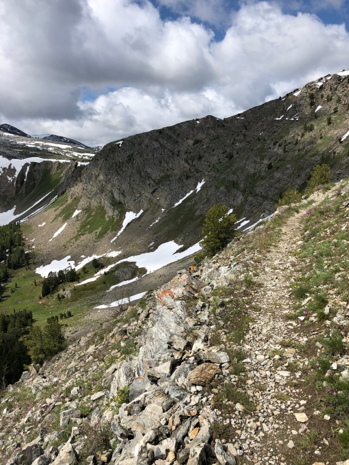
This trail scares the snot out of me. So why do it? And how? And why?
My main motivation is dumb really, I want the Triple Crown of hiking. The rain, the brutal trail rocks, the ups and downs without switchbacks, the crowds, the frequent towns, I have to immerse myself in a new hiking culture and try not to compare it to other trail cultures. That’s the true challenge, mentally reorienting myself. Will I become part of a so-called trail family, a “tramily?” Will I hunker for days in a hostel because I can’t face hiking out in rain? Well maybe if it’s warm rain, I’ll hike out, humidity doesn’t bother me, cold does. (I know, I know, I’m Alaskan, I surely love the cold and dark, right?)
I’ve been so accustomed to low numbers of humans on the CDT, enough companionship to make me happy but not so many as to make me nervous about filled up campsites or hostels in town.
I can’t start the AT till April 15. But what about weather and winter heading north in April? I just don’t know. I have a hard time leaving a nice comfy motel room when it’s raining and I think it rains a lot back East. I’ve become pretty good at figuring out logistics though. And I have a hiking umbrella with an extra long telescoping handle I can tuck into my pack for hands free hiking.
From social media it appears that huge numbers of prospective hikers know little about hiking or camping and live back East with the AT built into their conscience as a great thing to do. Attrition rate reaches 70% by the 1/2 way point. The PCT attrition rate is something like 50% by the end.
Why do it? The Ravens and Puff Puff, the people I’ve spent hundreds of miles hiking with, have commented in their blogs that I’d hate it. So I found a book, The Appalachian Trials, written for newbie hikers but applicable to me anyway, that says write a list of whys, laminate it, and read it on the trail when you feel in need of motivation. Top of my list, to get the Triple Crown of long distance hiking (PCT, CDT, AT) which is kind of lame but that’s my main motivator. Others: explore more history, give my snowboarding friends the chance to help me along the way while visiting their states, walk through new mountains, face my Northerner’s fear of the East, and experience the super hiker friendliness the people along the AT are known for.
The AT purist attitude is where the dumb “thru hike” phrase comes from, as in “I’m going to thru-hike a 31 mile section of the AT,” or “It’s not a thru-hike if you don’t… “. These people have yet to hear of the concept of connecting your footsteps even if not the actual blazed trail. Apparently somewhere there is a rule that you have 12 months to hike every foot of the current white-blazed trail in order to be a thru-hiker. I’m hiking the AT, I’m a long distance hiker, I intend to hike the entire AT, I connect my footsteps in an unbroken track, sometimes it will be wearing a daypack, sometimes I may take an alternate, and if a section of the trail is closed, for whatever reason, I won’t hike it.
The insanity of the social media sites devoted to discussing the AT is mind blowing. “What’s the best underwear?” “How many pairs?” Food storage is huge with people claiming their method is “perfect” and others countering with horror stories about said “perfect” method. Some people have never backpacked before and are building their entire kit from scratch and are understandably anxious and confused over what pack, bag, shoes or boots, tent or hammock, etc to get. “How many miles a day are you all going to hike?”
I started thinking about what scared me about other hikes I’ve done. I remember camping on my own many years ago, that scared me until I did it. My first PCT in 2015, I was terrified of starting in the desert at the Mexican border until I did it. Now I’m terrified of overflowing shelters and tent sites, until I do it.
What does not scare me about the AT? Snakes, ticks, sidearm packing Southerners, bear, coyotes, day trippers, pitching my tent, running out of food, blisters, sprains, snow, hiking 10-hour days, or crappy IPAs.
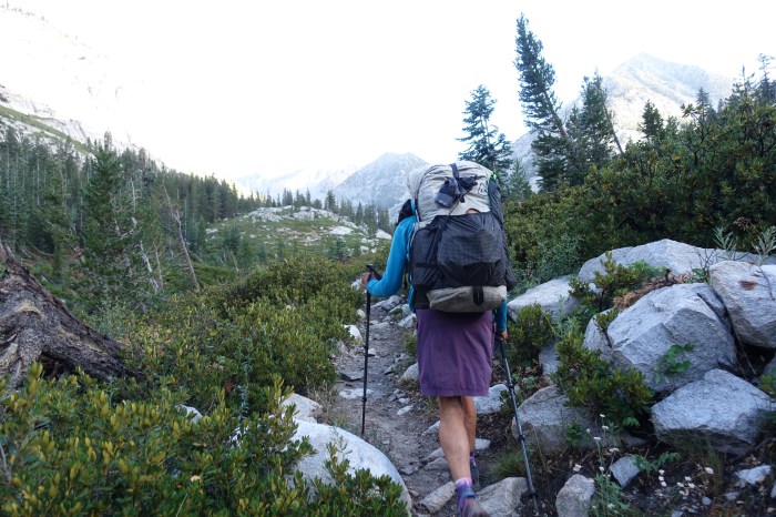
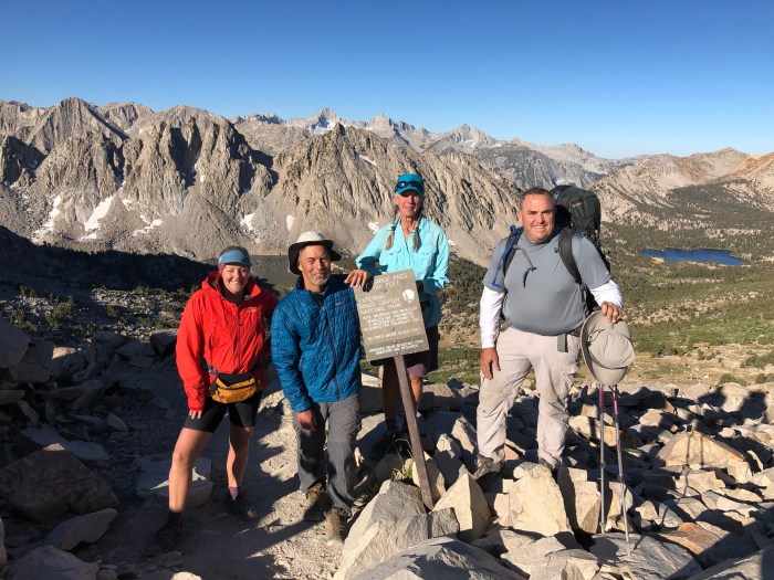
We had dropped off our resupply at Independence Inn, so that was easy. Innkeeper Jim brought us back up to the Onion Valley trailhead at 6:45 am for a proper early start. Amazing he was willing to drive us so early! That never happens.
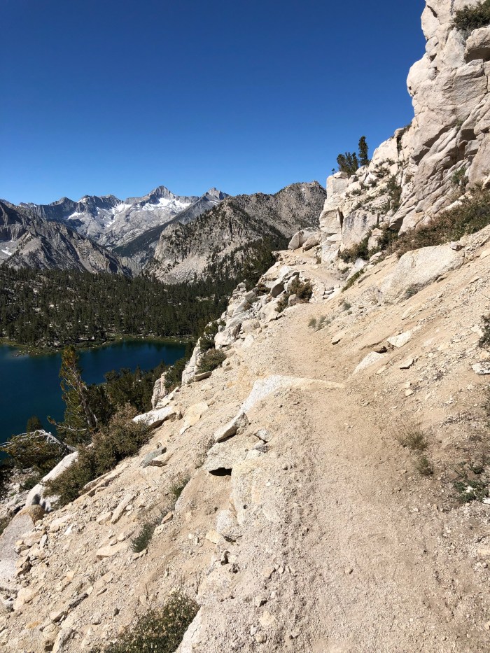
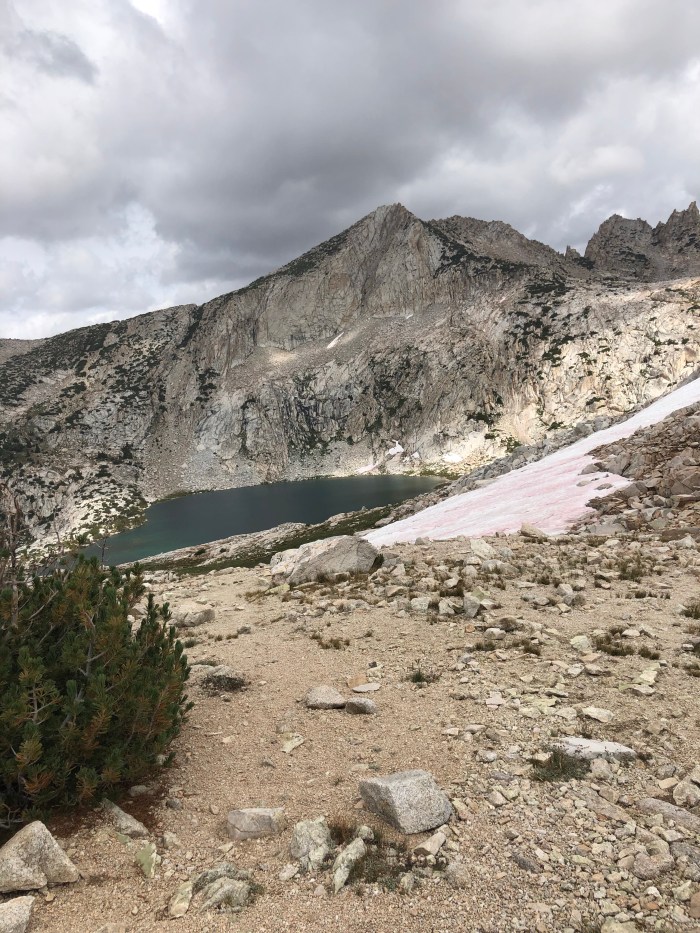
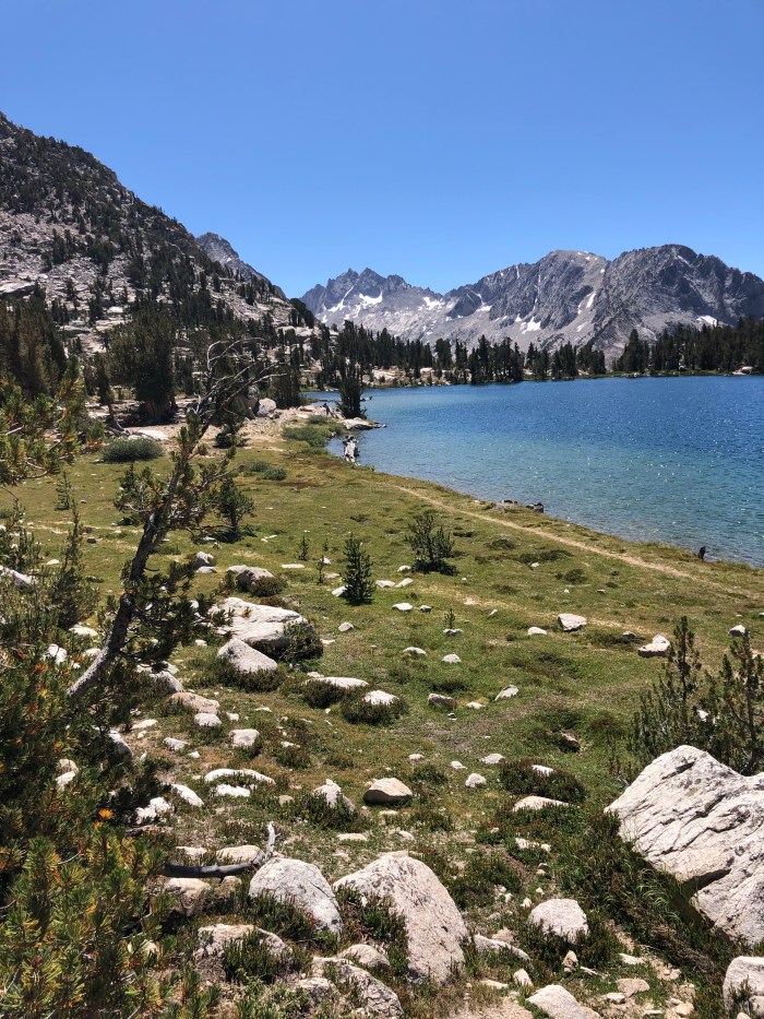
We hiked over Kearsarge Pass back to the JMT and headed up Glen Pass. It was a lot of climbing. We walked down and along beautiful Rae Lakes, reminiscing about 2016. Puff Puff recollected that she’d struggled up this Pass, I recollected I was called a goddess by some older, slower hikers.
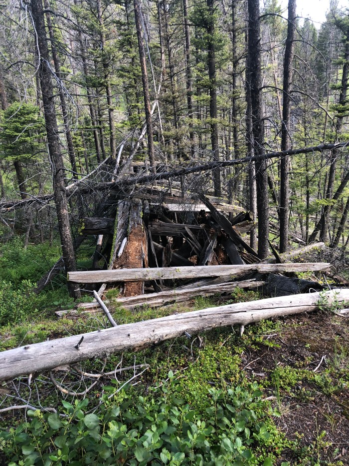
We got to Dollar Lakes and I pitched my tent in the same place I put it in 2013, 2014, and 2018. A couple hours later a ranger came by and asked us to move. I said we would of course but pointed out it wouldn’t make any difference unless actual restoration work happened. I don’t disagree that people shouldn’t camp next to the lake and asked if he’d like me to move some obstructions to the nice flat, hammered tent sites. After he left, that’s what I did the next morning, for all the good it will do–people will just move them out of the way. I should join a volunteer crew next summer, this park doesn’t have any volunteers that I’ve ever seen, although I have thanked professional trail crews out here.
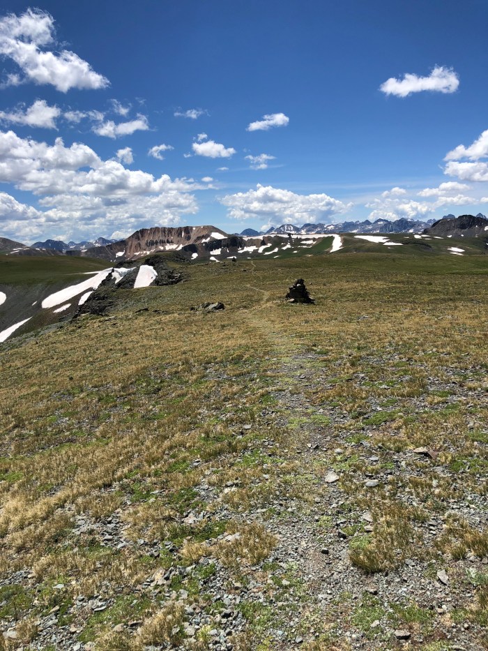
Glen Pass
9/2 16.1 7-5pm
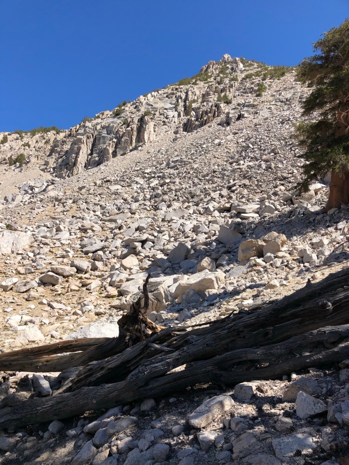
We were both dreading the climb up Pinchot Pass. We’d had similar experiences in 2015 on the PCT, it’s just a long, awful climb, and we’d both wound up camping on the uphill after not enough miles and way too much fatigue. Together in 2016 going SOBO, this was a day that went on forever, we had camped at the bottom of Mather Pass and we went up and over Mather, then up and over Pinchot Pass, one of the few times we camped after dark. We kept pushing because of the wind and cold, Puff Puff’s tent was jury rigged and we needed to find wind protection. I lagged way behind. But in 2016, I woke up the next day and absolutely stomped it, going up and over both Glen and Kearsarge Passes.
So we grumbled and just got it done, it was an easy down from Dollar Lake to the suspension bridge, then 5 hours to the top of Pinchot. The last bit is a short set of switchbacks, like Forester and Glen before them so I waited at the top as it started raining at 1 pm. We started to hustle on the way down as thunderstorms moved closer and closer. Wind, rain, then skin breaking hail. I stopped to pull on my rain pants and yelled at Puff Puff as she passed me, “Run!” Each woman for herself in a bid to survive, it was hypothermia cold, the lightening was right on us and we were totally exposed on slab granite. She was out of sight in seconds and then I too ran downhill to the lake and trees. Down, down, down past the lakes and down to the river, the tree sheltered hole with a river run I g through it, between Pinchot and Mather. We found the campsite I’d talked about, protected. It started to rain shortly after we got our tents up, protection from both the horrendous bugs and the rain.
As I lay in my tent I heard a bear bell, turns out it was on a horse with a rider who was herding a mule train ahead of him. Much later, 11-ish, I heard a bear bell again, but I either fell asleep or I didn’t hear the mules heading back the other way. I love mules on the trail, they work hard and do their job, and have sweet faces and adorable personality quirks that the packers learn to manage.
9/3 16.9 miles
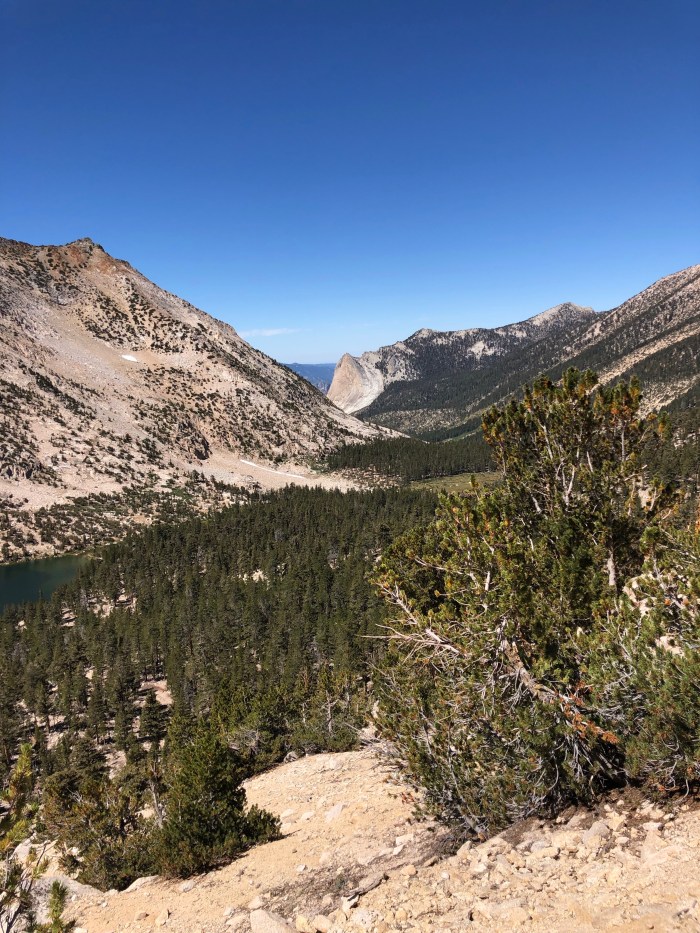
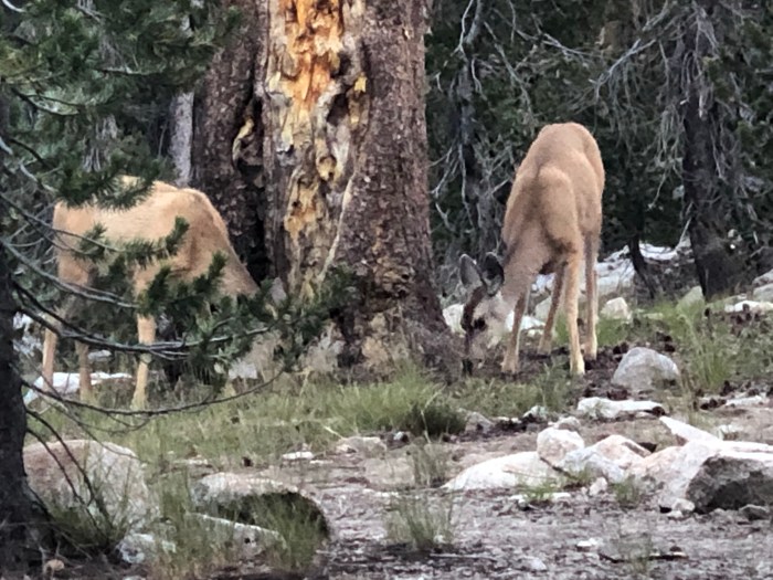
I woke up to the sight of 3 deer across the way munching some mushrooms. A good start to a beautiful day. I felt great and pretty much lead to the top of Mather Pass, passing two couples going our way. What a difference a day makes in the Sierra. Mather was clear and I didn’t mind waiting a half hour for Puff Puff and taking time for photos and contemplation. She blazed out downhill and I didn’t catch her for hours, which I didn’t mind. So many favorite spots on this trail, so many memories. We decided to camp at Grouse Meadow where I’ve never camped before. It feels like there are a lot of people on the trail in this section, I know there’s several side trails leading to the JMT. I met Just Jeff, finishing up the PCT in the Sierra which he had to skip due to the big snow year, and his trail friend from Germany I think, Christine. We camped just past them and zipped ourselves into our tents pretty quickly again away from the mosquito hell. Well after dark, some dork came hiking by with his speakers blasting Jimi Hendrix, probably thinks All Along the Watchtower is going to scare some bears. Funny, I’ve seen a bear right here before and they already know to hightail it to higher ground, Jimi or no Jimi. At least the dork had good taste in music.
Morning, deer!
Looking back where we came from, Mather Pass
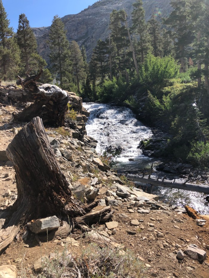
Grouse Meadow
9/4 16.4 miles to Evolution Basin
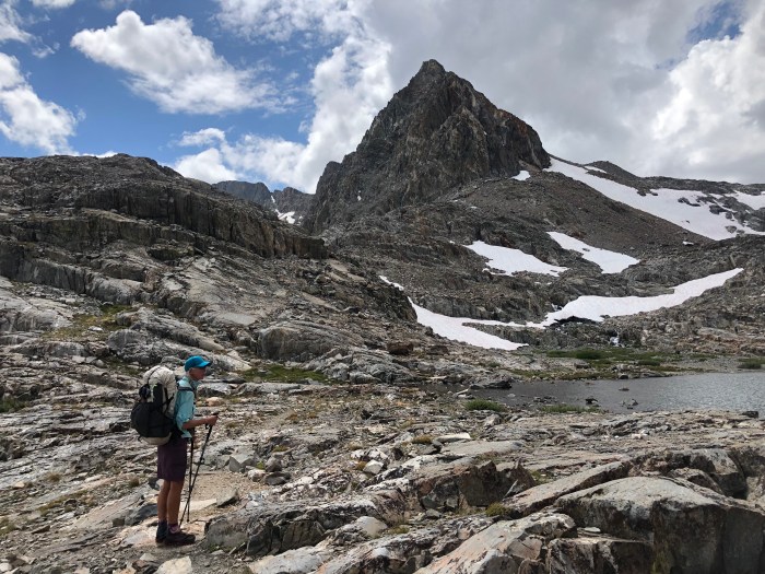
Glorious! Since the sketchy weather day coming down Pinchot, we’re a tad aware of the building clouds as we head up Muir Pass. I’ve probably said it before, but there are some nationalities on the trail that I really like, not that there are nationalities on the trail that I don’t like. If you’re hiking, backpacking, we share a common language. We leap frogged with 2 Korean guys, one of whom was having knee problems and going slow according to his partner who we passed as he was waiting. Puff Puff and I heard a tremendous squawking of birds behind us, crows maybe, and joked with each other that that was the last time we’d see Bum Knee again, the vultures were eating him already. (For the rest of the JMT, everytime we’d hear a bunch of noisy birds again, we’d make a crack along the lines of “Hiker down.”)
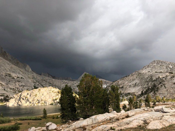
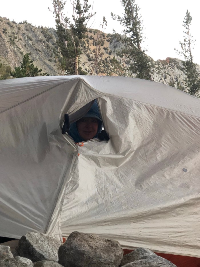
We got to Muir Hut just before the storm hit, but it was not a big deal and petered out pretty quickly on the descent after the obligatory photo session. Today I counted 100 SOBOs and we passed 5 NOBOs going our way. Our goal, early or late, was to camp at Evolution Lake. We both remembered this place from 2016. A few campsites are just places to pitch your tent and rest. This place though—pellucid, luminous, serene, when we were together here before. Last year, also perfect, I camped here in the still, cool Sierra air. We lucked out again, pitching camp before a spectacular storm rolled through, with winds so fierce I was hanging onto my tent from inside as a stake popped out and the poles flexed hard. The sky darkened over the mountains, not a solid bank of black, but layers and layers of neutral grays and blacks, and the wind pushed that dank smell of wet granite up my nose. It blew and rained fiercely, flash flood amounts of water that poured under and around our tents, the sandy gravel and granite providing no resistance. And then, it was like that game the teacher played with us as school kids– rub your hands together for the sound of the storm gathering, snap your fingers for the sound of raindrops on the tent, clap and stomp for thunder, then snap fingers, rub hands together and stop. The clouds lifted and lightened, the setting sun lit up rock and clouds and lake and it was over. We came out of our tents, laughing and cheering as I made little sand check dams to direct the runoff away from my tent. It was spectacular. Oh this place, these mountains own my soul.
9/5 18.5 miles
We made quick work of the downhill to Muir Trail Ranch (MTR) the next day. MTR does a brisk business in holding resupply buckets for hikers and every time I’ve been here before (I usually rent a cabin for a rest day and the family style meals) the extra food and supplies have filled buckets to overflowing with anything you might need to hike on for a few more days. This year though we walked the extra couple miles in to a weird vibe. I had sent my resupply box to Vermillion Valley Resort (VVR) a couple more days ahead but we hoped to get a few more calories to tide us over. The pickings were slim, partly due to a couple who were grabbing every freeze dried dinner that hit the table, so much so that they’d filled their packs and were now filling 5 gallon buckets. They claimed they were going 250 miles to their next resupply. Weird. Fortunately, Craig and Scott, from the Whitney/Forester section, had redirected Scott’s girlfriend’s resupply to Puff Puff, since the woman couldn’t hike the trail and she’d already sent the bucket. So cool. We also saw Just Jeff and Christine again, and she was giving all her spare resupply to Jeff. Anyway we kept going, thinking to get part way up the climb to Selden Pass. Puff Puff talked me into getting up all the switchbacks (“You’ll be glad you did when it’s over.” And I was) and we found a lovely little campsite in the trees near water, a complete contrast from last night’s campsite high in the granite) and camped early again at about 5pm. This is the second day that she’s dogged my heels, insisting that I take the lead, even when I say I’d rather follow. I find it annoying and a change from all the days that came before and how it was in 2016. Oh well.
9/6 24 miles we think, who knows? To VVR
VVR is well off the JMT/PCT and there are 2 different trails to get there from the southside of the trail. I’ve hiked down to and up out of there on Bear Ridge Trail I think it’s called but in 2015 Puff Puff, Growler and Cool Breeze took a different cut-off at Bear Creek Trail so we decided to try that. It cuts out a PUD, in this case a pointless climb up switchbacks, followed by a really long down. The maps were a little vague about the mileage but we figured we could camp along the way if it was too far. Up and over Selden Pass and along gorgeous Marie Lake, then down past my favorite secret campsite (shh, only Tarcey knows where it is), just below which Humpty Dumpty took a big fall, tripping over a root or rock going downhill. It hurt my knees, forearm and finger but since Puff Puff was on my heels I didn’t yell “F**k” as much as I would if I was alone, I didn’t need to overly alarm her, it hurt but after the quick little assessment your brain does, I knew nothing was too bent or broken. I took a few minutes and got her to go ahead for awhile.
Selden Pass looking north over Marie LakeShowing off my boo boosPretty cool having someone taking my photo, I suck at selfies
Dave’s giving us a ride!Puff Puff’s one true love, DaveCheers!
We got to the junction and she followed me onto trail new to me, and forgotten to her. It follows Bear Creek, more or less, then turns off uphill (dang, really?, the lake is below!) before eventually coming out at an uninhabited campground accessed by a dirt road, about 14 fairly quick miles from the JMT. We figured we’d head down to the dam and walk the shorter route along the edge of the water to VVR. But I’d read that you might be able to get a ride so we semi-had our hopes up all day even though it’s definitely not the height of summer anymore. Nobody, no traffic, no campers so we started out on the dirt road when a pick up truck appeared behind us. If we’d been 2 minutes slower, we wouldn’t have got this amazing ride from Dave who was hauling hiker resupply boxes and buckets to VVR! I figure the trail gods had accepted my blood sacrifice and gave us Dave. Puff Puff said although a little old for her, Dave is the love of her life.
There’s a backpacker’s campground in front of the store, a laundry and shower room, some motel rooms, tent cabins, RV park, and a cafe–everything a hiker needs. And it was packed, so many tents pitched. I asked about a room but hit the jackpot with a wall tent with 4 cots for $70 with the shower/laundry building blocking the raucous party developing at the fire pit and deck outside the cafe. Dinner, shower, laundry done and we spread out in our comfy canvas kingdom.
9/7 14.8 miles VVR to Virginia Lake
So I had no idea it was her birthday today. It really would have been useful information and maybe besides paying for the cabin, as usual, I could have bought her breakfast as a gift, or a Twix. We had a comfy night and a good breakfast, then got on the first shuttle boat ride to the north end of the lake where a mile long access trail connects to the JMT/PCT. If you have ATT, which I don’t, you can get a connection on the lake. It felt annoyingly like the real world as I looked around at the 12-15 other people on the boat all staring at their phones.
9/8 15.2 miles to Red’s Meadow
We camped last night at Virginia Lake, again making it just as the weather hit. We were up on the same knob where Tarcey camped in 2013, and where Puff Puff, Growler and Cool Breeze camped in 2015.
An easy day to Red’s Meadow where Noreen and the best dog in the world, Walker, is going to meet us and camp. We got there at 2pm and I took a shower and did laundry, ate in the cafe, and had some good conversations with some Canadians heading SOBO on the JMT. One of them, Ken, says he and his 21-year old daughter plan to hike the PCT next year, starting from opposite ends and meeting on the trail. Cool!
Noreen and Walker brought us beer! Pizza! Twix for Puff Puff! We camped together in the nearby campground and it was so good to spend some time with my friend! Plus, I’m still laughing over her question, a first for me after all these years of hiking in a Purple Rain skirt. “Do you wear underwear under your skirt?” Noreen! Yes!
Might have been cold at Virginia Lake
Noreen, Catwater, Walker
9/9 15.6 miles via JMT not PCT
We all ate hot breakfast at Red’s. Well, not Walker. Then we said goodbye and took the JMT, not PCT, route across the river. There was a lot of up and lots and lots of hikers. We passed tons of tents pitched already by 3 pm. It was getting really windy and I hoped to camp in the trees somewhere with a little wind blocking. So we stopped on the near side of Thousand Island Lake and huddled in our tents out of the cold.
9/10 21.6 to Tuolumne Meadows
Craziness! The original plan was to camp in Lyell Canyon at least 4 miles before getting to Tuolumne Meadows, then walk in the next morning, get breakfast at the Grill, try for a Half Dome permit and continue out towards Cathedral Lakes. But we made good time over Island and Donahue Passes and it’s pretty much down or flat all the way to Tuolumne Meadows. Just Jeff was at the top of Donahue talking with Puff Puff. Christine stayed in Mammoth for free at a trail friend’s place for a few days so as not to get done too soon before her flight back to Germany. Jeff needs to get to Tahoe to finish the PCT before his flight, I don’t see how he can make it in the time left. We met 2 women Katlyn and Hannah, hiking the JMT before starting grad school, obviously trail runners. We’d met them before and one of them heard my name as Cat Pee, which made Puff Puff laugh. I think it’s funny too, because of course the thought runs through most people’s minds when they hear my trail name is Catwater. Duh.
Puff Puff kept on ahead and Jeff and I walked some miles together with the new revise plan, get to the Grill before it closed at 6 pm. I saw the NPS Restoration crew is just volunteered with before starting this hike on the trail and they recognized me! That was fun! I showed Jeff the trail to the campground and we got to the Grill with plenty of time to spare. Burger! Puff Puff was there, not having waited for me at all. We ate and found the backpacker’s campground and settled in for another cold night.
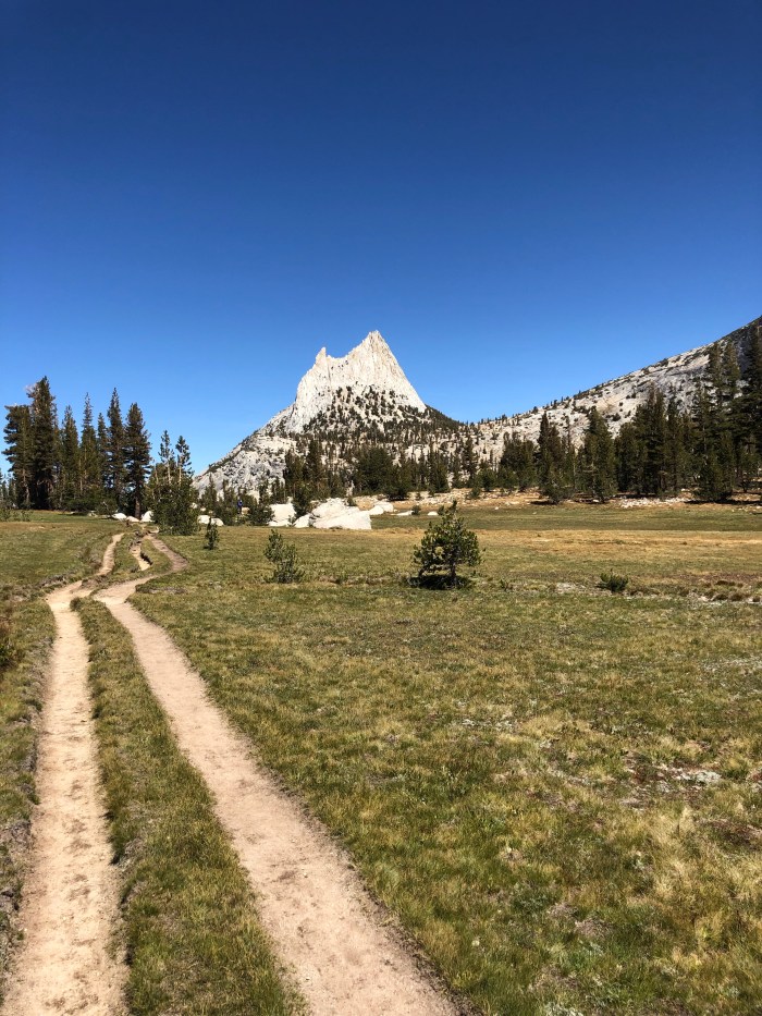
9/11 18.3 to Cloud’s Rest/JMT Junction
We ate a hot breakfast at the Grill when they opened at 8 am, then walked over to the Wilderness Permit office on the off chance that there might be Half Dome permits for the next day or maybe the day after that. Most of the permits are by lottery months in advance but they hold a few back for walk ins. Holy moly, we got the last 2 for tomorrow! I’ve been up the cables a few times, but Puff Puff never has. The PCT and JMT separate at Tuolumne Meadows so if you’re on the PCT it’s a side trip to Yosemite Valley, just like it’s a side trip off the PCT to the top of Whitney. We hefted our packs and headed out over one last Pass–Cathedral. We got a great tip from a woman heading the opposite direction and camped near the junction of the JMT and Clouds Rest Trail, which lines us up for a quick hike to the Half Dome trail in the morning and hopefully up the cables before the crowds get there and it looks like the 1898 Gold Rush over Chilkoot Pass in Alaska.
9/12 up Half Dome, down to the JMT by 9:30, Happy Isles by 2:30 pm
Well that was the perfect day to be on Half Dome! We got down to Happy Isles, got on the shuttle bus, got off at Camp Curry and a while later Jim, Joan, and Annie met us. Jim drove us up to Noreen’s beautiful rental, Cloud’s Rest Cabin, in Foresta, which she is gifting us for 2 nights until Saturday when we’ll catch a ride to Fresno with Jim to put Annie on the plane home to Alaska and to put me in a rental car for a few days. I’ve got some business to do in Calaveras County, a visit to my stepmom Merry in Davis, and a Mumford and Sons concert in San Francisco with Tarcey. Then I fly home to Alaska. Puff Puff will tag along until San Francisco and experience a bit more of California and people I love. Her flight home is a few days after mine and she has a trail friend who will host her for a few days.
I hiked the JMT for the first time in 2013 with Tarcey. In 2014 I yoyo’d it south from Tuolumne Meadows to Mt Whitney, then north out of Horseshoe Meadows, with a stop at Crabtree Meadows to day hike to Mt Whitney, and back to TM where I stashed my overnight gear and slackpacked to the Valley. In 2015 and 2016 I hiked through on the PCT. Last year I hiked from Red’s Meadow to Whitney and out. So not complete JMT hikes but this year I’m calling it JMT #7 anyway. And going all the way to the Valley!
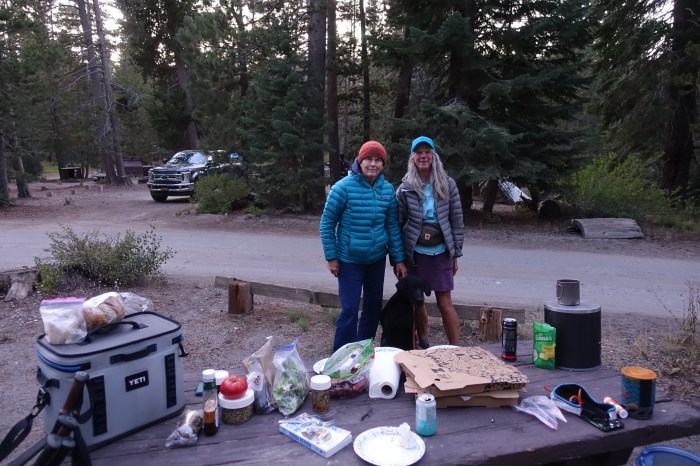
After a wonderful week of camping and volunteering with 6 friends in Tuolumne Meadows at Yosemite NP, I spent the night in Mammoth at Joan’s and organized my pack and food, then threw work and travel clothes, and real books into a giant duffel bag that Joan will haul around until I walk into Yosemite Valley where she’ll be doing another work week with the Yosemite Conservancy a couple weeks from now.
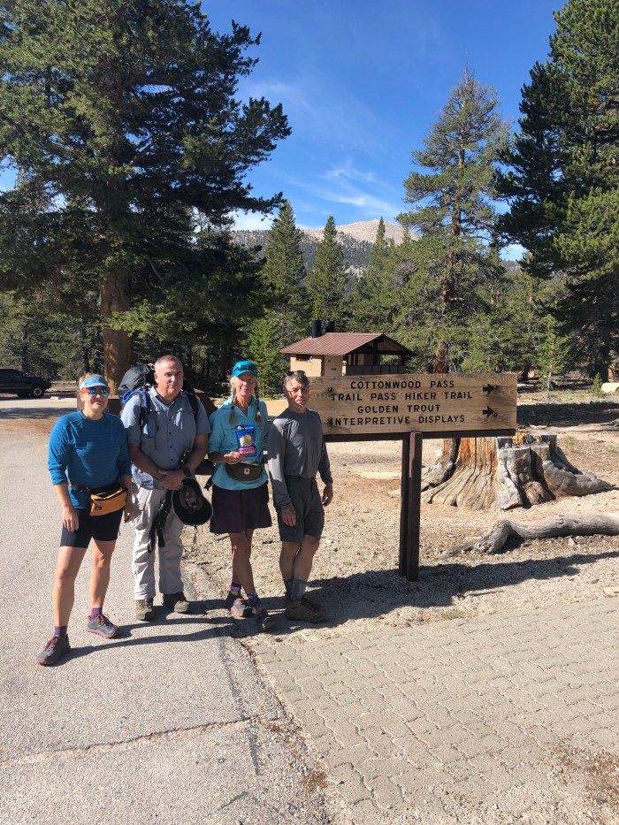
Joan had to work Sunday morning as a Mammoth Mountain Host, then we took off south on “the 395” in LA-speak, to Bishop. Puff Puff had flown from England to LAX and made her way to the hostel in Bishop. Reunion! We said good bye in November 2016 after 1600 miles together on the PCT SOBO. Joan dropped us in Lone Pine where we met Sunset (Jim), Lonesome Duck (Tom) and Tim’s wife Ellen who will chauffeur us to our start at Horseshoe Meadows.
I’ve been plotting this hike with friends since last spring when I got the permits. Jim and I have been friends for years, meeting as Yosemite volunteers. Tom is Jim’s friend and we’ve hiked together too, most notably on a trip to Rae Lakes in 2014 when he earned the name Lonesome Duck. His cheerfulness and good nature helps off set Jim and my tendency towards sarcasm and grumpiness. I promised Jim that I would be nice about the low 10-mile days for the short stretch they could hike with me–just out over Kearsarge Pass to Onion Valley. I promised! Some hiking challenges are mental.
8/26 We all acknowledged that I was trail fit and they were not. Still it doesn’t make it any easier for them to hike with me when I’m obviously not struggling and they are. We dry camped after 9 miles, a new experience for Jim and Tom I think having to pick up water a short while before camp. It was pin drop quiet at night, blissful.
Searching Guthook for campsites ahead
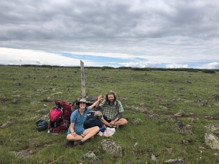
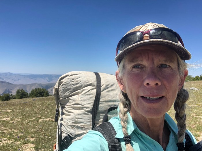
8/27 The next day Puff Puff and I searched the maps for our destination and picked the closest place to camp by water, 11.1 miles away which was more than the agreed 10 miles. We met 2 really cool guys doing the JMT together 20 years after their first trip. Craig Fowler is the only double Triple Crowner, having separately hiked and biked the PCT, CDT and AT. Scott told us that because Craig wasn’t going to. He has the mileages of all 6 tattooed on his inner forearms.
At the Crabtree junction, Puff Puff continued towards Mt Whitney with Craig and Scott. She’ll summit Whitney and catch up to us in a couple days. Perfect, clear weather, it’s going to be spectacular.
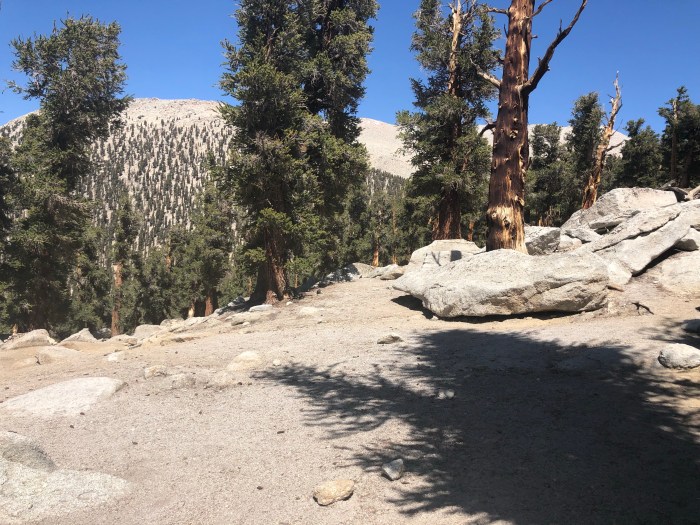
I camp with Sunset and Lonesome Duck, I scouted us a lovely little area behind some big slab granite above the creek, we have it all to ourselves. I pitched my tent a bit above them and relished the solitude. Tomorrow we’ll have a short day to Tyndall Creek camp and rest up for the climb up and over glorious Forrester Pass. They’ve never done it and are intimidated even though I’ve tried to reassure them.
8/28 Knowing it was a short day but kinda worried that Tyndall would be camped up with all the SOBO JMTers I hiked my own pace, enjoying the views and clear skies and all the memories from my other hikes on this stretch. I chatted with several hikers coming at me, including one woman who waxed poetic about joining the “Ladies of the JMT,” a FB group Tarcey and I were invited into in 2013. I love that this is a support and celebrate group for women. But the online newbie questions wear me out, even though I get it, the anxiety of a first long hike. This trail is well loved and is the first long trail for so many. With the thousands of miles I’ve now hiked, I have to guard against offering unsolicited advice and I hope nobody can read my mind. “Are you freaking kidding me? You’re carrying a camp chair?”
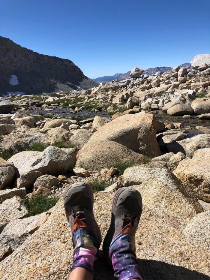
I stopped on Bighorn Plateau in the shade and ate lunch with Sunset and Lonesome Duck. I have a hard time taking long breaks, even when I know I don’t have far to go and hours to get there. So I got to Tyndall Creek ahead of the guys, after an 80″ break. I wanted time to scout campsites away from water and the trail, proper LNT (Leave No Trace). SO MANY HIKERS, so many camping crazy early, even earlier than us!
There are good rocks to cross the creek but when I got there a man walking on the rocks was helping a little old lady who chose to wade barefooted through the water. I didn’t understand what I was looking at, but backed off quietly as the man gave me a nod and a shrug. Once they were across, I followed. A bit later the man told me he’d just come across her and she’d told him the rangers knew she was there (a ranger cabin is a short way off the trail here) and had given her food and she said she was going to hike over Forrester. Weird. I moved on wondering if she needed help but pretending to myself she was OK because the rangers knew about her.
I found some campsites, and put a note and bandana next to the trail for Puff Puff. I doubt if she gets this far tonight after doing Whitney but that was our arrangement. I’ll pick them up on our way out tomorrow.
8/29 The big day! Forrester Pass!
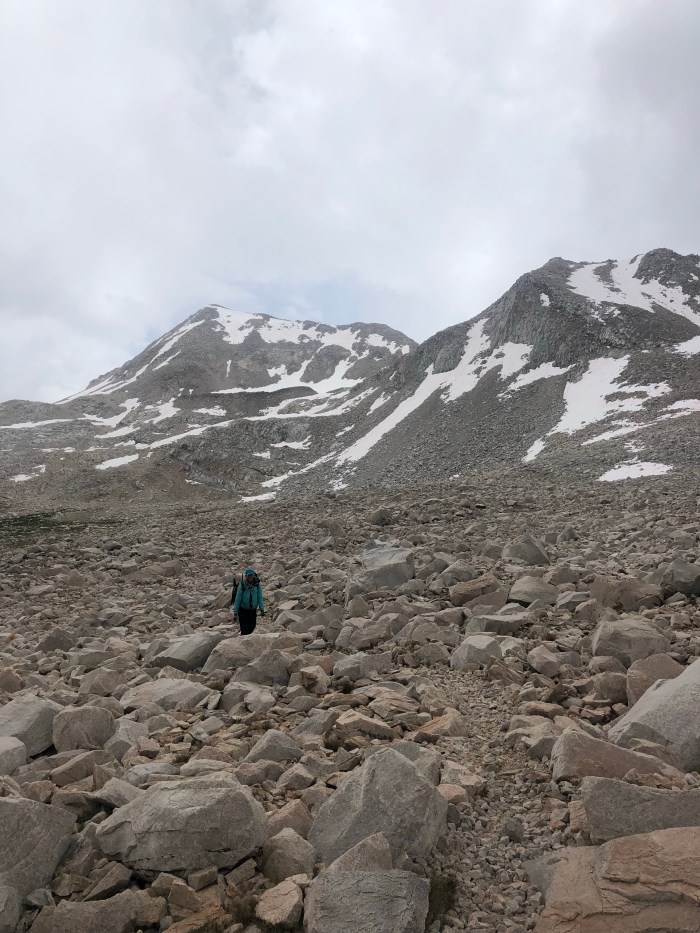
Whelp she walked right past the eye level note and blazing red bandana early this morning. A hiker coming at me, then another, said she was waiting ahead, well below the Pass. I found her and sat and in not too long the guys joined us. From here, you can finally tell where the Pass is and it does look daunting. I tell them, “it’s only switchbacks the last bit and it’s much easier going over it from this direction.” True!
I think I told them all that I did the NOBO switchbacks in half an hour in 2014 and that it was a good 2 hours going down the other side. So I decided to try for the half hour again. I did it, boom. A beautiful day again, warm and clear, glorious on top.
Needlessly worried about finding 4 tent sites at treeline the other side of the Pass, I scouted uphill a bit and found awesome wind blocked sites for all. A ways below these sites are what I call the cliff dwellings, numerous tent sites on beaten earth crowded with a dozen tents, they’re highly visible right next to the trail and are the first campsites coming SOBO after a really long uphill so that’s why they’re always full. Puff Puff looks exhausted, Whitney yesterday, then up at 5:15 to catch up to us and we didn’t start till 8:20, now 3 pm after 7.8 miles. Jim seems happy and relaxed, he made it! Tom may claim he struggles but he is so even tempered, why can’t I be like that? Tomorrow should be quick, we’re going to camp this side of Kearsarge Pass for a short 4 miles out on the guys last day on trail.
I watched this guy crawl into the shade and wished I had some
8/30 Easy 8 and we got a big, open campsite near the lake. The rest of them dove in, while I got cold just looking at their goose bumps.
At dinner time, sitting on rocks around our freeze dried dinners and camp stoves, Tom thanked me for taking them hiking and then sang me Beautiful Dreamer, with Jim taking a stanza too. On a chocolate bar wrapper that I’ll keep forever, he wrote:
“Catwater aka Beautiful Dreamer
Thanks for the great trip! Lonesome Duck”
Awww…and he’ll drive us from Onion Valley to Lone Pine for lunch then back to our motel in Independence. Sweet!
8/31
We made it over Kearsarge Pass and to the parking lot!
7/28 United Airlines still sucks as bad as the last time I flew them, let me see, to Europe about 10 years ago. SLC to DEN but all flights DEN to Durango apparently have issues. “Waiting for an aircraft,” “Waiting for flight crew to clear security,” meant my original 45″ flight delayed 9 hours but the replacement only delayed 3 hours.
7/29 But Durango is cool, got a replacement FjallRaven fanny pack and turquoise Arcteryx ball cap.
7/30 18 miles
I took an UBER 84 miles to Wolf Creek Pass ($111) vs hitching through Pagosa Springs or the $300 to the same shuttle company I had to pay $50 for a ride from the Durango airport to town. The UBER driver has only moved to Durango from Texas 2 months ago and has not been up to the pass. Google maps and Guthook got us there.
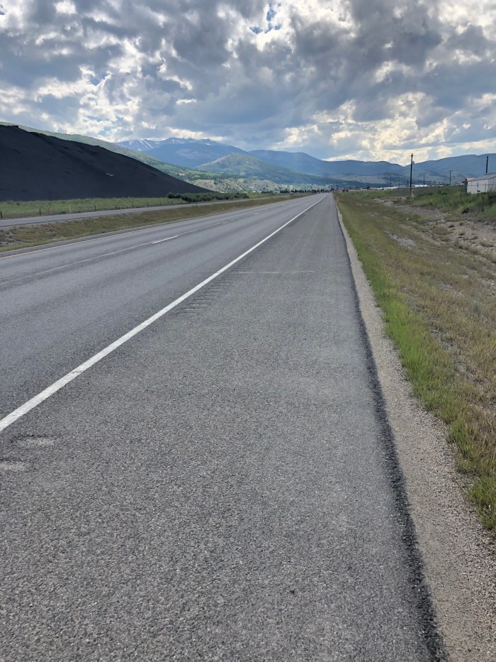
I wrestled with which route to hike to Creede, intending the short (42 miles) Creede Cutoff which climbs to just 11,000′ but due to my late start (9:45) and the gathering thunderstorms, I settled on the chicken shit highway walk because I am only carrying food for 1 night, 2 days and last year it was my only option due to the San Juan forest being closed for fire danger. As I walked on the paved shoulder I came up with a list of other excuses for doing the chicken shit.
I’m a wimp
I would never make 42 miles of trail in 2 days and lightening and I have a reservation in Creede
The highway is downhill
I need pavement miles for my NYC Marathon training–true story
Thunderstorms are predicted
Should have hiked it last year, despite closures
And then a couple of things happened on the road walk:
(1) About 3 hours in, a CDOT guy driving a snowplow/dump truck stopped to ask if I would accept a ride from “one of his guys” through “the Narrows” for my own safety. I cannot publish his name or photo because, you know, civilians aren’t supposed to ride in State rigs. He was sincere, concerned and respectful. “Yes,” I said and a couple miles later I climbed into his truck for a couple miles. I felt like a kid, so fun to ride in that truck!
(2) Memory. You forget stuff but place, specific places, spark memories. Chama, NM to Wolf Creek Pass, CO, was a tough stretch last year. Ups and downs, sketchy snow traverses (my campsite-sharing Brit buddies strapped on mini-crampons and slung ice axes this stretch, I used my sticks and didn’t slip ) and I was tired. After hitching to Pagosa Springs for resupply, I hiked NOBO out of Creede 2 days later feeling weak. I camped early, barely kept dinner down, and woke the next morning nauseous, puking, weak. I made it 7 or 8 miles to a trailhead marked on my map where I thought I could call the USFS maybe to get me. I lucked out and waited till the only day hiker with a car parked there arrived. I asked for a ride to the nearest town (I had no idea what town that would be) which turned out to be Gunnison. After a couple bad nights in a cheap motel I walked to the Clinic and “hit the jackpot” as the ER doctor said, with a Giardia diagnosis. So, last bullet:
I need to overlay those miles of bad memory with a good one
Anyway, yay, skipped just a couple of miles due to the Good Samaritan CDOT dude and stayed in a South Fork motel, cooking my Packit Gourmet freeze dried dinner in my room.
7/31 24 miles
OK, so I’m Aqua Mira treating the hotel water in South Fork and Creede. However I got Giardia last year, it wasn’t from not treating wilderness water, it was from filthy pipes in old buildings and not treating that water.
It was a gentle uphill most of the day, not horrible. A few cloud bursts but the road is not exposed so I wasn’t paranoid about the lightening.
And new owners at the Snowshoe Motel in Creede, super nice and the absolute best breakfast-included of anywhere on the CDT.
8/1 0 miles
Storm clouds in the morning so I asked for another night and wandered this old mining town in my rain gear. I bought a new Columbia CPG hiking shirt but wrapped it in plastic and shoved it to the bottom of my pack. My current shirt is of course permanently pack dirt stained and the stink won’t wash out. Seriously nasty. The new shirt will be deployed when I travel back home in a week.
8/2 15.4 miles
It’s a 10.5 walk uphill out of Creede to get back on the CDT/CT and I did it last year already and I hoped someone would give me a ride. And for 3 miles, a father-son duo did just that, thank you! Over all too soon, but saved me an hour and a half of the uphill.
I joined the CDT/CT and passed an old guy. Apparently doing 10 miles max a day. I told him I was camping early because of the 4000′ of gain I’d done. It was only another mile from where we met, a campsite noted on Guthook. I figured he’d do the same so I waited to set up my tent cause I didn’t want to be right next to someone. Sure enough he hobbled in. We cooked dinner together after a short get-to-know-you conversation opened by him saying, “I have a serious question for you.” Uh oh. “Have you accepted Jesus as your personal savior?” “No.” And then we moved on to other topics. I retreated to my tent after dinner and enjoyed the quiet at 12,000′, no wind, no cold, just mountains around me.
8/3 9.9 miles
Beautiful, started early to beat the storms and walked across a pass, then Snow Mesa. I headed down as the rumbling started and the clouds built. Nearly to the highway at Spring Creek Pass, I talked to some dayhikers heading up into the exposed alpine. A few minutes later I got to the road trying to decide whether I should climb another 9 miles into the thunderclouds.
The day hikers Barbara, Jim, and Carla yelled from across the road. “Wanna ride to Lake City?” “Yes!” So they dropped 2 of us off at the hostel at about 1 pm. I met 11 Colorado Trail hikers including Leo the lab and his people Tammy and Greg, Brook and Kyle, Hermit, Dab and Mose, Pete, and Snow Day. I wasn’t planning on going to Lake City or sleeping in a bunk room with 7 other people, but it turned out just fine. Lucky me got to be “inspirational” to another young couple. I’m such a freak.
8/4 18.8 miles
Hitched out at 7:45, got a ride in 2″ to the pass. After 9-ish miles, at the last water for 10 miles after a 7 mile climb, a CT hiker vortex developed, like a dozen hikers? Should we climb or should we camp? There were clouds but not horrible. After 4 others finally headed up, so did I. Got a deadline to make, I can’t keep wasting days for crappy weather!
The grade was just fine, only one steep pitch in 7 miles. Got to the Colorado Trail high point, then just 3 miles down to water and I found a beautiful campsite about 6:30. About 8pm, Snow Day joined me. I liked talking with him in Lake City, he’s from LA and has 3 cats he rescued. I loved the story and photos of how he gradually coaxed a litter of feral kittens in.
Brook and Kyle, CT thru hikers
Tarp Tent Notch Li with an incredible view
8/5 18.6 miles
I left in the morning and never saw Snow Day. Guess he’s one of the CT’ers who get up late and hike late. 8 climbs today, PUDs really but lovely as you cross from valley to cirque to valley. Played tag with the Stoners, a couple of Virginia guys under 21 who take multiple smoke breaks. “It’s illegal where we live and you can’t even buy tobacco or a lighter unless you’re 21!” Nice guys, good hikers.
At some point I realized I could walk into Silverton on a bike alternate (they can’t ride in Wilderness) 20 miles before I thought I could, so I did. I am really sick of shit weather at 12-13,000′, I am. I saw the guys cross the road ahead of me back into trail as I hiked down Stony Pass Road, a steep old wagon road built in the1870’s to access mining country. Eventually I wound up at the Blair Street Hostel in Silverton. Blair Street is an historic district, so the exteriors of the buildings maintain a shabby authenticity amidst the hordes of tourists. I collected my resupply box and contemplated the fact that I was running down the clock on time I had left in Colorado before I get to go home to Alaska for a few days before my next trip to Yosemite.
8/6-8 Does the train from Silverton to Durango count? I called this morning and got a 1-way ticket with narration, it was an incredible 3 1/2 hour journey!
I rented a car in Durango and drove to Mesa Verde NP. As I put it in a Facebook post, I visited for a few minutes on a family trip when I was a kid. It was raining so my mom made my dad keep driving. From my mom though, I inherited 2 perfect pieces of Mesa Verde pottery “collected” by my Great-Great Uncle Clayton Theodore Sallee in the 1880’s. My mom said he was on a hunting trip, but I think now that he took a tour of Mesa Verde in the pre-1906 Antiquities Act era where you were encouraged to grab artifacts. At any rate, I had them evaluated and appraised years ago by an expert. They are 1000+ years old with no provenance and can’t be returned. I have wanted to see where they were made by human hands for a long time. And, wow. Like the cliff dwellings in the Gila, it makes you think about all the cultures and tribes that have moved through the Americas through time, the stories we know, the stories we don’t. Foot travel, then horse travel later. I bought a reprint of the first archaeological study, published 1893. I can’t to read it and set it next to my pillaged pottery.
Good thing I took the early ride back to the trail because otherwise it would have been hard not to stay in Leadore as the thunderclouds built up. Put on my rain gear at noon, huddled under a tree at 12:30 for 30″ as the lightening started going off in an exposed section of the ridge. But it was rather beautiful going from road to trail. Too much steep climbing because of the usual, the heavy pack on Day 1 of a 5 day stretch. There’s some some delicate tipping point in pack weight, where you don’t feel it, but then add a water haul (2.2 lbs per liter) or food (I pack instant disgusting oatmeal on 5 day hauls cause it weighs less, no wonder I’m melting away into scrawniness) and it slows you down and hurts and makes you crabby.
The trail went to dirt road and I hit the wall about 6:30 as I contemplated the umpteenth straight up another dumb hill just to go down the umpteenth hill. I flung my pack on the ground, a flat spot next to the trail in a little dip on the ridge. Nom came by and asked how I was doing. A casual question you should never ask me out of politeness because I’m incapable of not giving an honest answer. Which in this case was a little obscenity laden diatribe on how you can never find a tent site on the CDT when you want it. She kept going and I crawled into my tent as the wind picked up and vibrated the dyneema fabric so loudly I put earplugs in. But it was flat.
The wind died down at dark (10-ish currently), then picked up a few hours later, then died an hour before I got up.
7/23 22 miles
Much happier day and I made up the miles. A couple hours in, I saw who I’ve been looking for–Nuthatch! Party Saver! They’re heading NOBO for 800-900 miles and this was the section we’d overlap. I was also hoping to see Dassie and Mud Slide from 2017, but we figure they took an alternate down to Leadore cause they were a half day ahead of Nuthatch. I think this encounter with Nuthatch and exuberant Party Saver gave me an energy blast you can’t package and label. Oh the friends you make hiking!
Cloudy all day but the biting flies were the worst. My legs itch insanely. I finally had to put on the bug tights since I lost my Deet. Neighbor Bob in Jackson called it. There was a bushwhacking section in the tundra where Mobama passed me–nice people, they met in Davis, where I went to high school. I think they camped just down from the tundra walk after we got trail back. A couple miles later I stopped and talked with Totoro before walking another couple miles and camping in a spot Acorn commented on in Guthooks in 2017. Thanks Acorn! Protected by trees just before heading back out into sagebrush, cow country. No wind!
Hmm, Continental Divide Trail III, from No. 9 to III, inconsistent
7/24 24.3 miles
Acorn also called out a cutoff on cow roads downhill to a crotch and uphill to Deadman Lake that worked great, cutting out 4.5 miles or so? I liked the cows and even saw a bull with balls head butting his buddy, a steer. Seems weird he was out this time of year when all the girls had calves but I know nothing, Jon Snow.
I saw Cantaloupe and Honey Dew in another traverse and Mobama caught up to me again.
It was hot again, especially with the bug tights but glorious open country and it’s Day 3 so my pack weight is lighter. I’m happy and healthy.
I walked from as far back as the eye can see
Cows, like beauty marks
7/25 20.9 miles
Brutal, slow, beautiful. Perfect blue sky with a breeze for this high exposed day on the Divide. Where is everybody? I can see for miles ahead and miles behind and there’s nobody. Is there some fantastic alternate that everybody took that I don’t know about? I pitched my tent, knowing I could get a ride tomorrow scheduled at noon or 5. Like on the first night of this stretch I was on the ridge with views to both sides and no cover. I heard a sound like a very large marmot so I got out and looked a couple of ridges over to see proof of the sheep shit I’d been stepping over all day. A sheep itself, who saw me and galloped away.
At 9:40 pm, Cantaloupe and Honey Dew passed me as it was almost dark.
Honey Dew and Cantaloupe
7/26 13 miles 6-11:15 am!
I walked as fast as I can on a non-tread, straight up, straight down ridge with slippery gravel and sagebrush claws. But it was only a few miles before I hit broad, gravel road, complete with hat-tipping cowboys in flatbed trucks. Then I ran, kinda, my pack is light so it’s not that hard. I wanted to make the noon pickup. Cantaloupe and Honey Dew (from Sitka, I know I’ve said it but it’s so awesome) got there about the same time. Shortly thereafter, Mike, from Mountain View Motel in Lima (like Lima bean!) got us.
And loitering at the motel was Dogma! From Pie Town! Her sweet pup Tullik, Trail name Tulips, is off trail with Dogma’s sister recovering from a hiker injury, but Dogma is hiking NOBO.
Obama, Morning Glory, Nom, Joe Dirt, Cantaloupe, Honey Dew and I went to the grill your own steak place. When we all raised our beer glasses to celebrate my CDT finish, the 3 guys at the bar cheered too.
Dogma and Catwater
7/27 On a bus to Salt Lake City, then a plane to Durango via Denver, then a day to resupply and then get a ride to Wolf Creek Pass, Colorado to hike a CDT alternate to join the CDT where it runs concurrently with the Colorado Trail (CT). I’m going to hike SOBO to finish, hopefully, the CT at Durango. Just because Colorado is crazy beautiful and to hike this is less than 200 miles. When I’ve been here before the trail was snow choked or closed because of fire danger. Fingers crossed.
Bunkhouse Hotel (and Post Office), Jackson, MTCatwater, Lid, Pot, engineer Zack, owner Rick in frontAbby
7/18 19.7 miles
My feet felt great today. Weird. Due to sunny skies? The flat ups? Advil @ 2 pm? Camped at about 9000′ in a flat little meadow near a Snotel installation ( I think) which kind of annoyed the little bunch of deer who came grazing an hour or so later.
7/19 23.8 miles
I had to keep going cause there was a 19 mile waterless stretch. The morning started with a cold wind, then a steep climb to 9500′ but the rest of the day was gentle, walking mostly right on the Divide or through open woods, burn areas of all vintages and on decent tread. Getting water at the last “spring” before the dry stretch was kind of funky, I had to use my titanium coffee mug to squish into the tundra and scoop up moss flavored water. Plus it was a quarter mile off the trail down a dirt track. Had to do it. Towards the end of the day, downhill for once (yay!) I was passed by Toy Story, another 20-something with a beard and a fast pace. As I was navigating on good dirt roads the last mile to the Sacajawea Memorial Campground (and spring), Two Forks was walking out and described how to find the water. “I walk as long as there’s daylight” he told me at 7:30 pm when I’m dying of hunger and just want to pitch my tent and be still for awhile.
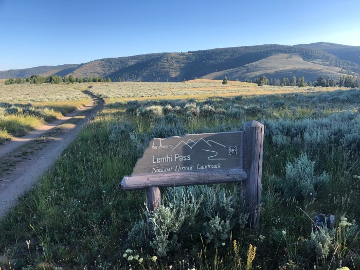
So this spring is where William Clark’s Corps of Discovery crew is believed to have stood straddling this tiny little trickle–the source of the mighty Missouri River. I did the same and drank the delicious water. What an incredible expedition, I’m fascinated all over again. “Undaunted Courage” indeed. What we CDT hikers do is nothing, we have maps, a path, roads, information. President Jefferson, what vision, what inspiration, what American imagination. Sacajawea, absolutely critical to the success of Lewis and Clark and company. And here I am seeing what they saw, the vast spread of the folds and ripples of the Continental Divide on both sides as I walk, the Divide! Water running east and west from this ridge, the Atlantic and Pacific Oceans so far away as to be nearly figments of imagination, my faith in their existence the only proof.
Got to the spring and met Honey Dew and Cantaloupe, a couple my approximate age, and Toy Story, we all camped here, with picnic tables and a clean outhouse, with toilet paper! Great end to a long day, although it is kind of hard hammering in my tent stakes with a rock into a hard gravel campsite made for giant freestanding family tents, not my little ultralight shelter.
7/20 21.3 miles
Woke up at 6 and everybody was gone! Trying to make the 27 to Leadore? A beautiful day, sunshine, even if hot, makes me very happy. I realized that I don’t think I want to hike the rainy green tunnel of the Appalachian Trail. When I came out into an open field, sagebrush, at 9000′ with the mountains and valleys arrayed as far ahead and far back as I could see, I nearly cried at the beauty. Lewis and Clark Corps of Discovery country.
I camped about 5.5 miles from the road and once again satellite texted Dan to call in a pick up time for the next morning to get to town from the little used road ahead. A lovely little pitch in the woods. Reading “Apache Wars” I was startled by a weird shriek screech. Hmm, not a bird, not a cat, not a bear, WTF? Oh well, felt harmless and it was a ways away, so lights out, sleep tight.
7/21 5.5 miles
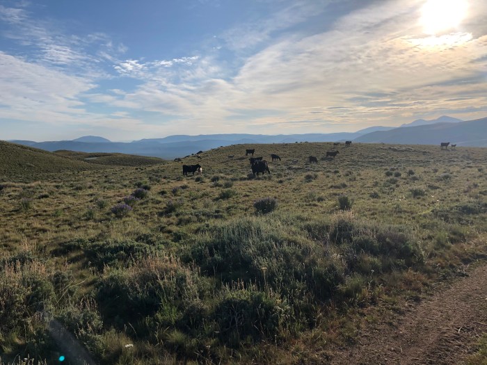
Walked through gobs of cows this morning. And…screech explained. Some of these cows must be taking voice lessons, because, wow, how else do they learn to make all these horrible bleeds and bellows? I have to talk to them to get them out of my way. Today’s query was, “Don’t make me hug a tree, you’re not a moose. Mooove it!”
Well that was easy. I got to the trailhead at 8:45 for a 10 am pickup. Until he lost it in the Seven Sacred Pools in Hawaii, my Dad used to wear an inherited signet ring from his Dad’s mother’s side of the family, translated to “Always ready, never late.” There you have it. Shortly after I got to the trailhead, 4 more hikers walked in: Everest, Nom, Seeker and____. Sam, who owns the 4-room Leadore Inn, was a fantastic host. Hikers can camp on the lawn, shower, do laundry, pick up resupply boxes and hang out on the porch in the shade recharging devices, drinking beer and talking story. Japanese hiker Totoro is here (finally saw his name written down in the hiker register that Sam keeps), as are Toy Story, Honey Dew and Cantaloupe (from Sitka!!), Joe Dirt, Obama and Morning Glory (or Mobama as they are known together). 4 of us put our filthy clothes in one load and they came out the cleanest, least stinky I’ve ever had in the trail. True the washer took “3 hours” per load, but wow, what a treat! I ate twice at the restaurant, contributed a 12-pack of beer from the convenience store to the porch crew and just sat around really enjoying the camaraderie of Sam and the hiker trash. I went to sleep knowing I’d catch a ride back to the trail with Sam by a modest, but welcome, 8 am.
Assorted hiker trash and Sam (white socks)Toy StoryNom from Tasmania
Forced myself out of the Darby, MT motel when the rain stopped. I crossed the street and stuck out my thumb. Within minutes a woman stopped. Kim Maynard, former Smokejumper, went out of her way to give me a lift right up to Chief Joseph Pass. She worked with my sister’s partner, smokejumper Bert Mitman, in Fairbanks.
Started on dirt roads, saw an elk! Then too many straight ups, straight downs for a weighty 6 day food carry. I mean seriously you never know what the route is put together from–forest service roads, abandoned mining, ranching or logging road alignments, eroded scrambles, modern graded switchbacks, who knows?
So having a bit of a late start, 9:45, I decided to camp at a spot marked Parking. There was another hiker, Japanese, there already so I settled in. He helped look for the trail to the water. An hour later I heard German chatter and Ninja and Snapper walked up the road. Talking through my camouflage tent, I asked if they wanted to camp with me. They did and gathered by my tent to eat and chat. Turns out when I passed them on a pass a few days ago, Ninja didn’t feel well so they found a side trail, hiked out and got her to a clinic. Tonight marks 24 hours on an anti-Lyme med while they wait for test results.
An hour later a crew of teenage ICC rolled in and set up camp and quieted down in good order. After dark their gear trucks came in lights blazing, Diesel engines rumbling. 2 hours later lightening lit up my tent, and thunder blasted like cannons overhead. All was silent at 4. I got up at 6:30 and Snapper whispered through his screen that Ninja was not well. Bummer! They are so funny, so sweet, so direct, so German. I hope it’s not Lyme.
7/15 17.4 miles
So much uphill, so slow. Finally at 3:30 I got over the other side to spectacular views of rock, snow, mountains. Just starting to pick up some miles when a few raindrops fell. Sigh. I stopped to put on my rain jacket as hail shellacked me, turning to fierce rain. Sigh. I pitched my tent at 6:30. Dammit. Now instead of 3 more nights to Leadore, I’m looking at 4. I poured my food sack on my sleeping bag to recalculate my rations.
7/16 21.1 miles
Bailed!! I satellite texted Dan to call Rick at Bunkhouse Hotel in Jackson, MT about 17 miles off trail to see if he would pick me up and had a room. I walked downhill fast 5 trail miles then 3 extra dirt road miles off trail to get picked up at 7:15pm. Of course got rained on at 6:30 again.
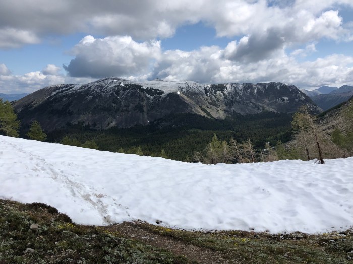
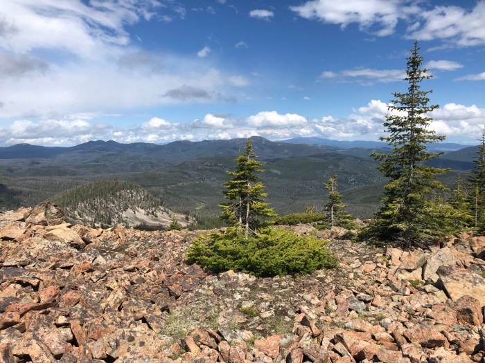
The day was good though, the ups at 9000′ are still hard but better carrying less weight. 4 ups but #4 had the most snow of any so far this year but not a problem. The last 2 ups were gorgeous rock cirques like I’ve seen in the Sierra.
I stopped and talked with the Japanese hiker where he was camped at the beginning of the extra 3 miles. I still can’t pronounce his name. I need to get him to write it down for me.
Now at this super cool old hotel. Clean hostel for hikers and bikers, laundry, beer, frozen food, perfect! Also, Pot and Lid, whom I met in 2015 in the desert of the PCT are here. Got a ride back to the trail arranged with neighbor Bob after a second night escape from the thunderstorms. “No, this is not normal for Montana. Never seen anything like it.” Sigh.
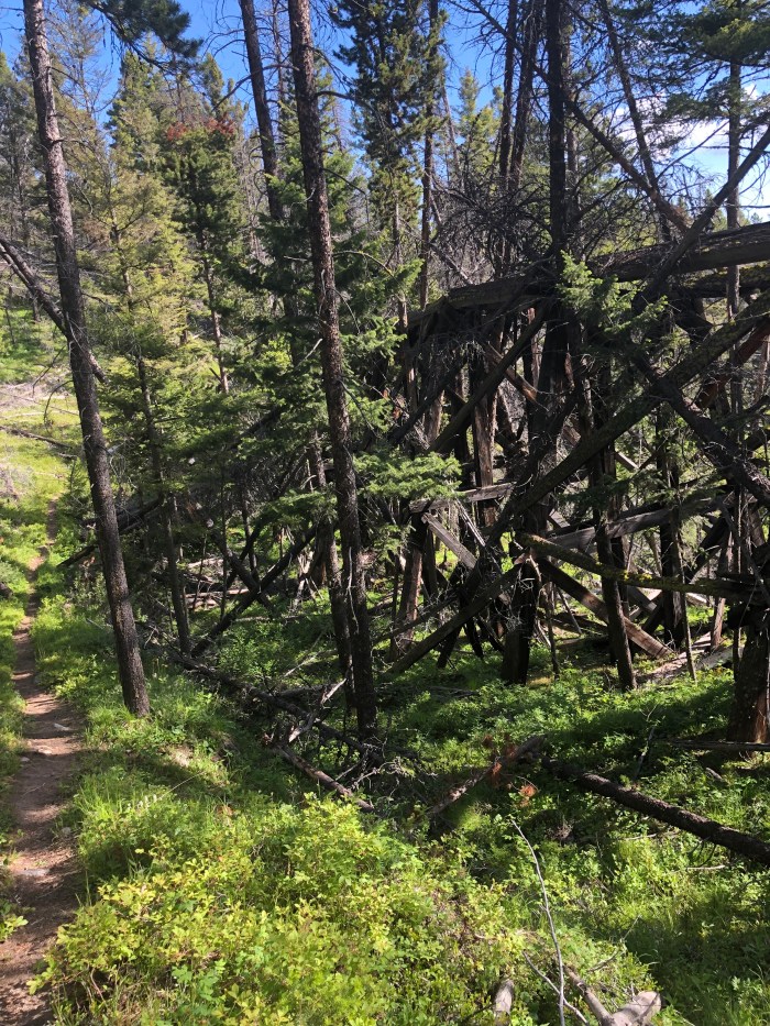
Decaying cabin near Twin Lakes, MTAnd it’s outhouseCampsite at Twin Lakes
7/8 20 miles
Road walk out of town uphill. Rather than stay on the 2-lane Highway 1, there are several little dirt roads that parallel it so that helps to get away from the noise. Beautiful countryside and finally you turn off on USFS roads to trail. Whew. It was easy walking and I got an early start so could have gone for more hours but I rewarded myself with an early camp by the upper Twin Lake. The bugs are out!
7/9 20.8 miles
Tough day of climbs but I leap frogged with Sunshine, Sugar Rush, Rain Skirt, Snapper and Ninja. 3 passes, up and over, down down then climb back up. Camped by a creek in warm and quiet 2 miles below Warren Lake where the others were heading. Wore my rain pants all day as the weather never warmed up. There was one scary traverse with a sheer drop on a rotting patch of snow. My inside foot punched through about 3′ and I had to carefully, shakily, yard myself up without over balancing and falling off the mountain. Fortunately it was near the top of the pass so I used the fear adrenaline to power up the last 1/2 mile. The Anaconda Cutoff here joins the official CDT which is where Sugar Rush and Rain Skirt we’re hiking.
Of course there were two more passes to go all the way up and all the way down. I couldn’t face any more up at 7pm which is why I stopped at the creek. No bugs, weird.
Fresh snow todayPatchy snow easily crossedKinda sketchy traverses todayRain Skirt from SpainSunshine from Germany
7/10 21.1 miles in 12 hours
More passes, went by Snapper and Ninja, camped in a flat clear spot near the trail with no view at all. But it’s flat. First day I had to use stinky bug dope, dang the mosquitoes drove me crazy.
7/11 21.6 miles
Today was the first sunny morning the whole of Montana. Looked like an easy profile but then I hit the dead zone in an old burn, sunshine, uphill through tons of deadfall in the broiling sun. But that was the only bad section and nobody was around to hear me yell about a hundred times when I came to the next gigantic skin shredding blowdown, “Are you f*ing kidding me?” The ups and downs flattened out finally to follow the ridges on the Divide. This I love, views, gentle ups and downs and maybe I’m actually hiking the Divide. I only made it 22 not the 25 I wanted. Camped by Vortex who’d blazed by me earlier shortly after another in short shorts did the same.
Bug dope plus head net. No bites! Washed up so I’d stink less for hitching. My pack reeks, my shoes reek, I reek. The days blend of Arborvitae oil and Bens bug dope is barely better than stinky feet fumes.
7/12 Quick 19 miles and hitched a ride to Darby with Samson the Bear, stopping at Sula to get my box. Our ride Chuck said they’re filming Kevin Costner’s TV show “Yellowstone” in Darby but not right now. The little motel I’m in has no laundry and there’s no laundromat in town–bummer! Hand washing with dish soap is not that effective. Met my neighbor, sitting out front, he is a retired GP from Holland who has just finished a 1000 mile bicycle trip, bought a car and is on his way across the US to find himself. In one of those fabulous traveler conjunctions, he protested the Viet Nam war in Europe as I was doing the same in the US. How does that even come up in a conversation over Coors Banquet on a porch in Darby, Montana?
Are there Continental Divide Trail numbers 1-8 somewhere?
Hopper thingie Just a ladder on a random treeHitching spot at border of MT and ID
Dan dropped me off and I was on the trail by 8:30, sad that he had to leave and sad he also left the trail angel job and I’d be once again dependent on the kindness of strangers–hitching rides to and from resupply points. But I guess after he caught the biggest steelhead of his life at Benchmark, why stick around? And there are some cats in Anchorage missing their human being.
ShredSami in the winter maze
Treadmill’s summer suit
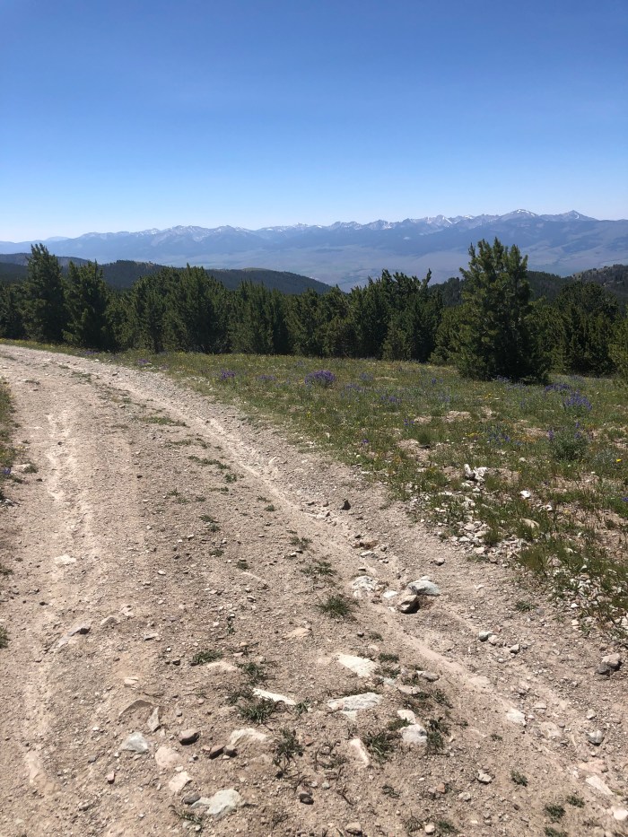
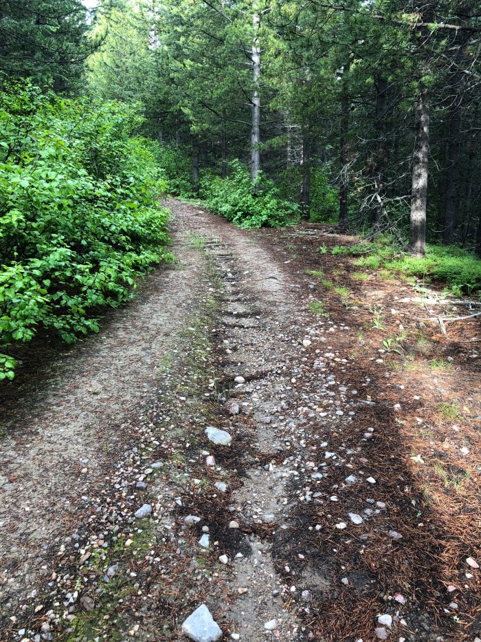
Finding campsites on the CDT can be tough to find. There is a lot of road walking with private land or barbed wire fences for cows and maybe no flat places without dense trees, rocks, or wet bumpy meadow. So when comments on Guthook call them out, I’m inclined to listen. Then the weather report this morning predicted 4 days of thunderstorms with a clear day between another week of thunderstorms. In Colorado they call this monsoon season. I pitched my tent next to the road but well past several miles of McMansions each set on their large parcels of forest. Ten minutes later the rain and thunderstorm hit. A real hiker would pack up and go when it passed. Think I’ll just start early instead, or not. I’ve allowed plenty of time for this stretch.
7/3 19.3 miles
Slept well in the quiet and stillness with straight down rain off and on. It was warm enough that I used my bag as a quilt. Still cloudy in the morning as I continued on the broad gravel road I’d been on for a bunch of miles the previous day. The route took me to trail as the skies darkened that by 10:30 I wondered if I should get out my headlamp. I felt a couple drops and stopped under a cluster of trees to get out my rain gear just as giant hail pellets bombarded the trail, filling it up in 10″ as I laughed from my cozy little shelter. It got lighter and I crept out like a ground squirrel and continued on. A bit later, it rained for an hour, and my biggest concern was if my hands were getting too cold to open the bag with my smashed bagel and cheese lunch. Then the sun came out, I ate my food and the rest of the day was a small series of ups and downs on good trails. I camped, having walked a second day without seeing anybody.
7/4 18.4
I kind of messed up calculating the mileage for this section, it’s shorter than I thought so I’ve been taking it easy since I’ve got tons of food and should stick with the 4 nights out I’d planned. It’s a little nerve wracking to walk into a small town on a weekend in the summer hoping for a motel room, so I made a reservation from Helena for Anaconda already.
It didn’t rain last night. I went back to sleep after a squirrel, infuriated in the predawn hours, shrieked and screeched like some pop diva at the intruder in her green room. No hurry to get the miles in.
It’s too varied for me to put in the earbuds and listen to an audiobook, but that means I obsessed all day over a couple of issues in the real world.
Arctic Winter Games is a circumpolar sports event every 2 years for youth in about 20 different disciplines. Fairbanks hosted in 2014 and I was recruited to be a Snowboard Official although Alaska did not form a team. Several Canadian provinces and Greenland sent snowboarders. In 2016 I was recruited to direct the snowboard competitions in Greenland, a challenge with immense job satisfaction. I love Greenland and Greenlanders. Because the co-Director of Team Alaska had an eligible snowboarder daughter who wanted to go to Greenland, a team was formed. Sadly the girl was injured and couldn’t make the trip. She aged out and was not eligible for the 2018 games. In 2018, Team Alaska said they didn’t have the budget or coaches for snowboarders but would give me a complimentary spot on their charter to Fort Smith, NWT, Canada so I could volunteer as a snowboard official. I discovered another solid community in NWT and had a blast. The dark spot was the 2 guys who run Team AK who wouldn’t answer my queries about which of the two charter flights coming and going I’d be on. Like I finally found out the day before. Terrible planners or?? “We’ll let you know. The kids come first.” Sounds reasonable unless you know the kids and coaches are housed on cots in classrooms and are seated in coach, while the 2 guys and “mission staff” are in First Class and hotel rooms. Last winter I began asking whether snowboarding would be included in Whitehorse, Yukon 2020. No reply for months. Then a no. Anti-snowboarding is still a thing? Sexism is still a thing? These 2 guys using State of Alaska funds get to lie “no coaches applied”, “no funding available,” without oversight? Happy 4th.
The cool thing is that snowboarding, like hiking, is a community. My Yukon snowboard friend stepped up to make it possible for me to volunteer in 2020 despite the jerks at Team Alaska. I am stoked by the respect and camaraderie! I pay my own transportation, stay with locals, and volunteer officiate on the snowboard courses for kids from other nations since there will be no Alaska kids afforded the opportunity for this unique cultural experience.
The above is the shortened, kinder version of an all day obsession. True trail tale.
What else took over my brain as I hiked through the beautiful forest and cow fields? Last year I celebrated the 4th with Nuthatch and Burning Calves in Frisco, Colorado. BC is German so my thoughts turned to how the German people and government recovered their soul after WWII, recovered the ability to recognize and resist propaganda and represent “Never Again.” Happy 4th.
So anyway….
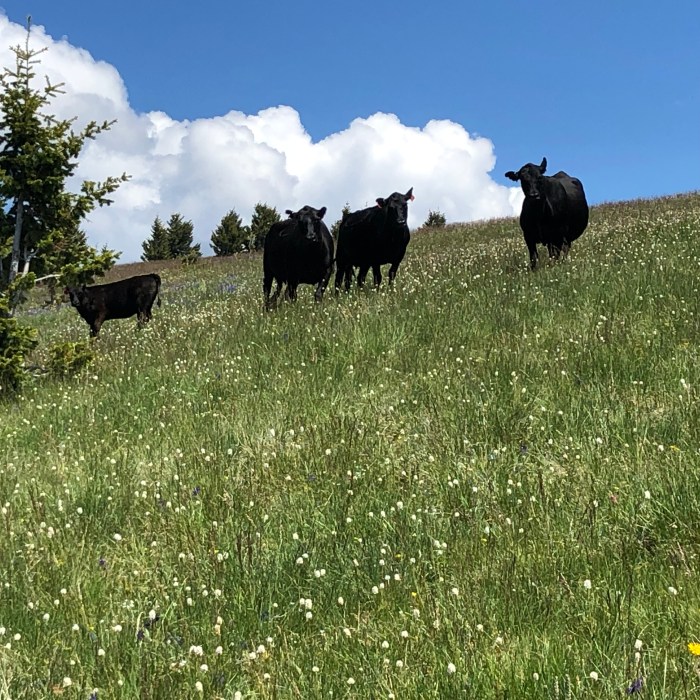
At one point I came out of the woods and into a bunch of cows. Startled the crap out of us all (literally out of several cows). Cows in fields don’t even glance at vehicles. But at humans walking? I always apologize out loud to them and explain I’m a harmless human without armor. They run. Except the second bunch of 5 individuals looked at me, I moved away, they followed. And again. With the lack of seeing anybody for 3 days, and getting stuck in my thoughts, I wondered: have I accidentally entered…the Twilight Zone?
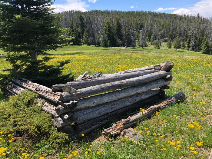
I turned down on the broad gravel road to the Anaconda Cutoff at Four Corners, got some water at a creek with another decaying log structure (love these testaments to human endeavors) and found myself a perfect flat kind of hidden campsite on an abandoned approach above the road. About 24-26 miles to town and 2 days to get there. Rumor has it that there’s a farm about 14 miles away that welcomes hikers to camp. Since it’s all road walk, I doubt if there are any other reasonable camping opportunities although I’d rather stop, say, 5 miles from town.
7/5 24 miles
Need I say more? Even though I started late, it was really quick walking on the gravel road downhill to flat. I met Big Sky section hiking, he’d just been dropped off that morning and is heading NOBO. First human! Got to the farm and it was 12:30, I can’t camp at 12:30! Called the motel but they were full, found Hickory B&B in Anaconda had a room and walked on. Even though this day went from gravel road to paved highway, the countryside is beautiful and the route went by the State of Montana’s “mental hospital” in Warm Springs with lovely historic buildings and grounds. I met two groups of patients and aides strolling. Turned on to the highway with some miles to go and a truck stopped to offer me a ride. I said thanks but it was against the hiking rules. We both laughed. I walked to the B&B, showered and went across the street to eat. As I was talking with the hostess, a head popped up from behind a divider and I wound up eating dinner with 2 hikers I’d last seen at Pietown! They had continued to Chama, NM, flipped and hiked Lander to Encampment, WY, then flipped to Chief Mountain in Glacier NP and hiked SOBO. I was hoping this would happen, that I’d get to see hikers I met in New Mexico!!
After fun with friends and relatives in eastern WA (Teresa, Dave and our son Chris), Trout Lake, WA (Rod and Debbie and all the cool locals they introduced us to) and Grants Pass, OR (Jackie, Nick, Keith and Barbara), 2500 driving miles, none of which I had to do, Dan dropped me off at Hwy 200 east of Lincoln, Montana where I got off the CDT last year.
6/28 13.7 +1 backtracking to a campsite
Started at 11am with a sweaty hike up out of the pass under cloudy, windy skies. Many uphills above treeline along the Divide with downs in notches to the next ridge. Absolutely glorious. I saw a hiker behind me for hours till she finally caught me on about the 10th straight up climb. Sugar Rush from NJ, I like her! We hiked together for awhile, and both failed miserably to find a mysterious water source commented on by last year’s hikers on our Guthook app. Oh well, water finding is an issue when you’re high up, so I have 2L of mud puddle water. As does Sugar Rush. She continued ahead when I camped at 6pm, eating a cold dinner due to all the grizzly crap I’d seen. Yeah it was at least a week old and on the other side of the highway we crossed, but you know, my first night back in Montana.
6/29 20.1+0.75 RT for H2O
Sunny day after raining last night. Stopped after a few hours to dry my tent. Trail to road walking to trail. I followed the route to a Lookout but it was a skinny little traverse on the east side with snow patches and a bunch of blowdown so I bailed uphill to a lovely road walk I saw on the map that paralleled. Based on a comment in Guthook, I decided to look for the Unabomber’s cabin in the area. After seeing a burnt out hulk I was convinced I’d found it. But guess what? The freaking FBI dismantled, transported and reassembled his cabin in their museum. I went off trail to get water after 20 miles and decided on a lovely campsite on the edge of a meadow. I’ll do the 9 miles of climbing tomorrow.
Perfect tent site
CDT this way
6/30 23.5 plus wandering off route accidentally
So it was 10 miles of trail, straight up, straight down, but always on the Divide. So beautiful. The last big climb was the longest but surprisingly graded with switchbacks. Then a long, long descent on abandoned road all eroded, slippery and steep into the woods.
One of my hiking sticks has a screw loose on the clamp that telescopes it. I don’t have a tiny tool to fix it so I’ll probably just wrap tape around it so it quits sliding shorter and shorter. My tent uses a hiking stick to hold it up so I’m using the non screwy one for that.
I got water from a piped spring flowing into a cow tank, no cows yet and the water was clear. Still I treated it. The next hours were on gravel roads, just a few friendly 4-wheelers sharing it with me. After so much steep trail you learn to thoroughly appreciate the road walking. But there was no place to camp, no flat places without the Standing Dead, beetle killed trees, or stump farms. Finally I popped out at a meadow at 8 pm. There I met NOBO Recalculating from CDT 17. He recognized me and asked if I was in touch with Treeman to whom I gave An Application to Marry My Daughter at Ghost Ranch. I need to reach out and see if Treeman married the farmer’s daughter or if he is still in want if a wife…
7/1 11.3
It rained a bit in my cow pasture, with lightning, soundless, lighting up the sky north of me. Knowing Dan would pick me up to go to Helena for a night, I stepped out quickly in the morning. Cow field to lush forest to shoe sucking marsh to 4 miles of uphill trail with hundreds of blowdowns to utterly smooth gravel road down from some kind of communication installation to the highway. Made it by 12:45! After a night in Helena, Dan will return me to MacDonald Pass and head to Spokane to fly back home.