


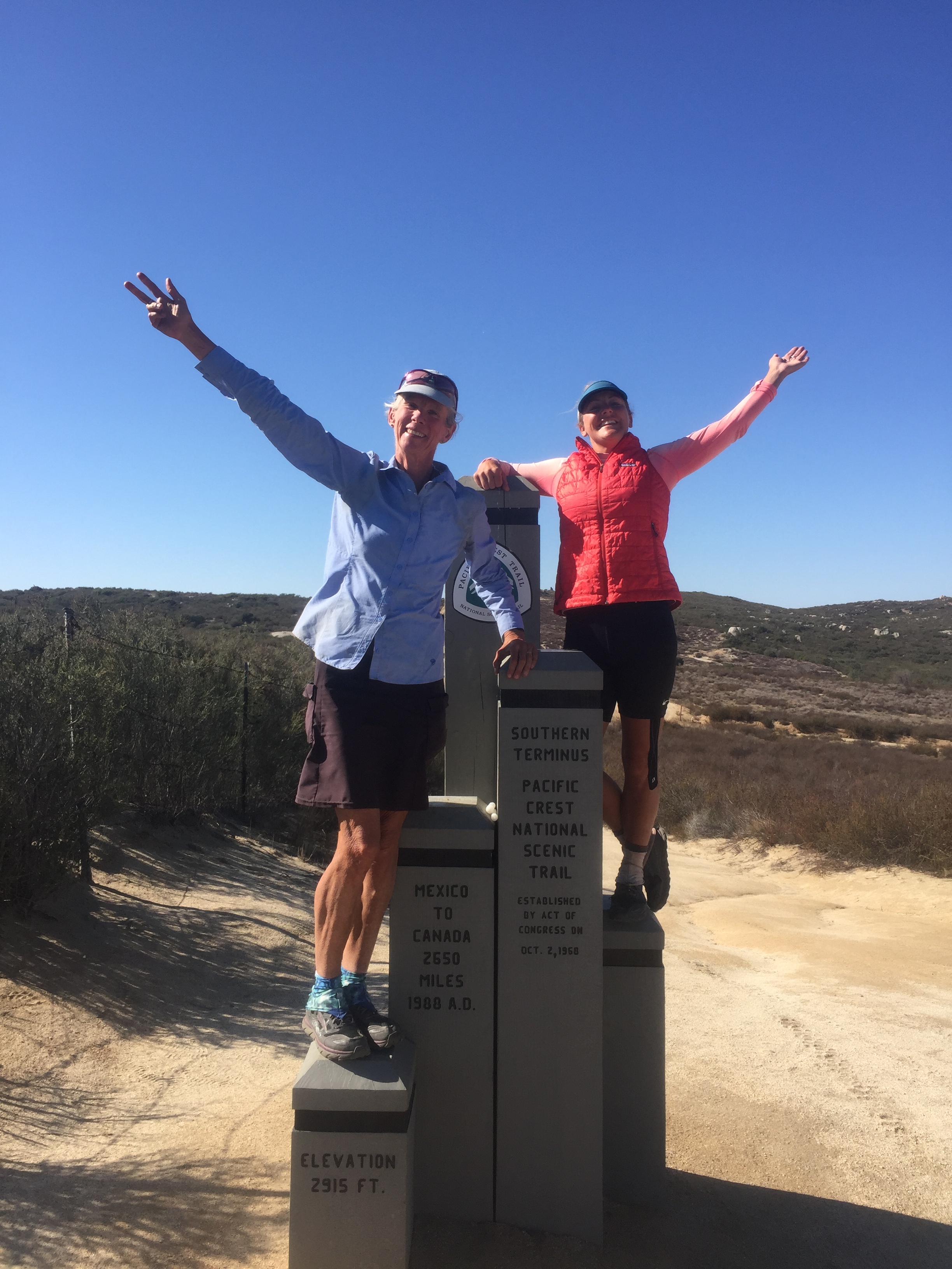
This is the end.
This is the end.

I got an email from Papa Raven with a link to the weather warning, high winds, gusts to 70 mph. During the night I woke up to the sound of rain on the metal roof, it was still pouring at breakfast. I called another hotel to see if they had a room. We talked it over and decided to delay a day rather than start the final leg wet and cold and miserable. I emailed Papa Raven back the revised plan. We moved to the new hotel and went out for lunch. I got a phone call from the front desk telling me I had visitors–Mama and Papa Raven! A perfect way to spend a dreary afternoon in the rain, visiting with friends. One of the coolest things was learning that the day the family met us on trail near Whitewater Preserve was as uplifting for Mama Raven as it was for us, she went home happy. The trail family is real, you truly bond and make lifelong friends.
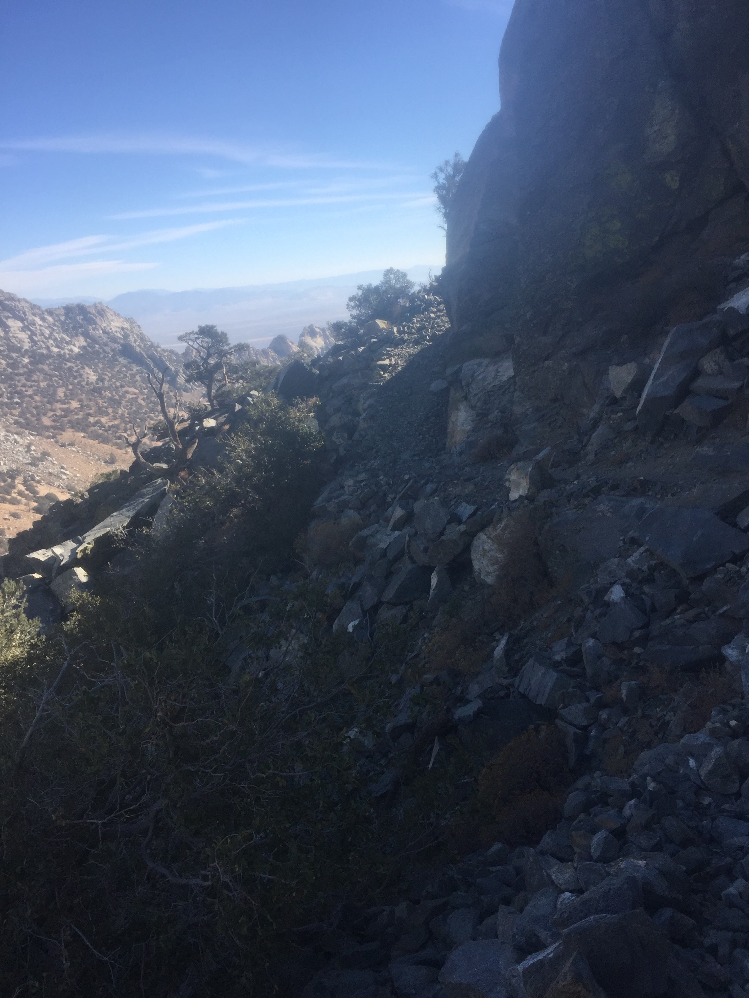
I arranged a shuttle to take us back to Scissors Crossing at 6:30 am. We needed to carry water for a 24 mile waterless stretch. This final 77 miles is filled with memories of the beginning 77 miles I hiked in 2015. I think because it was so new and exciting, hot and painful, I remember more details on this stretch than many others. I was learning about sketchy water sources, how much water I actually needed to have, trying to find tent sites that weren’t overrun with other hikers, meeting and leap frogging with people who I didn’t know if I’d see again, discovering the desert econiches that change with elevation and geology, and transitioning into now long familiar trail life.
And so we camped in a boulder field rocked by wind, then a soft footed campsite under oak trees blasted by wind and sand, and the last night a nice area high on the Crest just 11 miles from the border, the wall, the monument, the finish.
I am exhausted and my feet are painful from the first mile of the day through the last despite liberal doses of ibuprofen. I have been ready to be done for quite some time, determined to finish since the watershed moment between Reds Meadow and the Tulley Hole 900 miles ago. But like last year I don’t want it to end and know that, even at the advanced age of 63, I will start dreaming and planning and living the next adventure. Just as soon as my feet stop hurting.
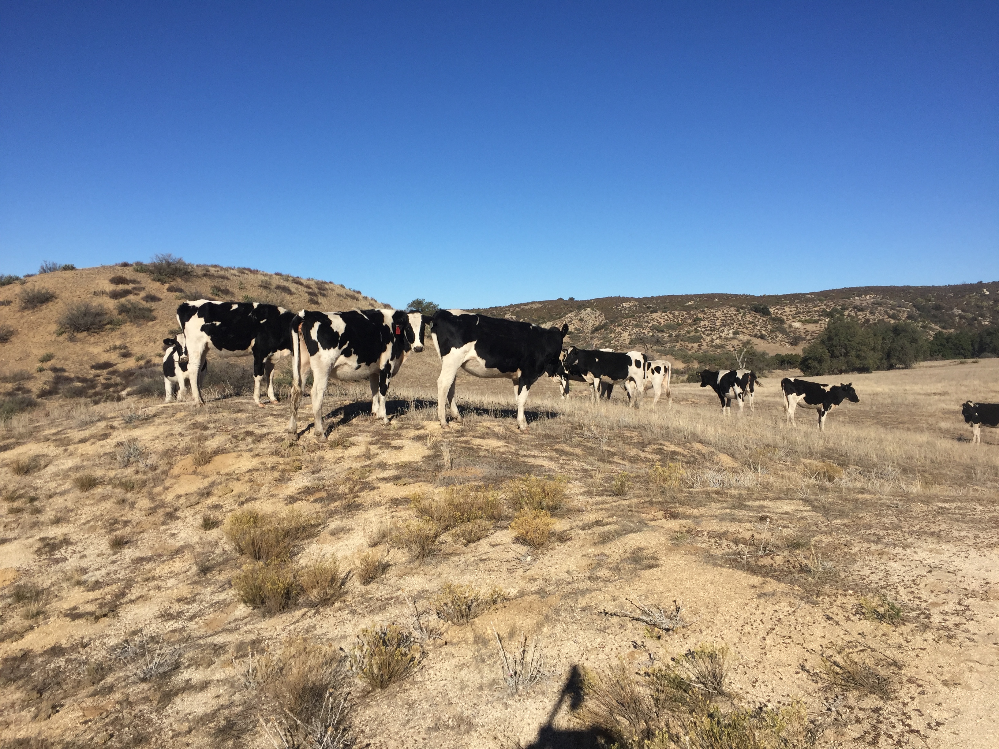
(Ahead of me I saw a bunch of cows on the trail. As Puff Puff tried to get by them, they started following her. Why? Normally cows just look at you with their lovely faces as you scoot by, then return to their foraging. Beautiful creatures, this herd. When I got to them, I just babbled idle threats about hamburgers to let them know I wouldn’t tolerate any bovine hijinks and they didn’t follow me.)
Off season in Idyllwild is tough on thru hikers. Some restaurants, the Bakery and Nomad Adventures are closed mid-week. On the other hand, this is such a hiker friendly community, that I got a ride to town from the first people I saw at the Devil’s Slide trailhead. And while eating dinner at the Mexican restaurant, a woman at the next table called to us “Thru hikers? I’m a trail angel!” Without missing a beat, Puff Puff said something like, “Awesome, do you give rides?” And just like that Stacy agreed to pick us up st 7:30 the next morning.
You may not know this, but Puff Puff likes the worst reality shows on Earth. But good stuff like “The Walking Dead” makes her shudder. Anyhow Idyllwild Inn was restful with plenty of time for dumb TV shows, shopping for food, resting and eating good restaurant fare.
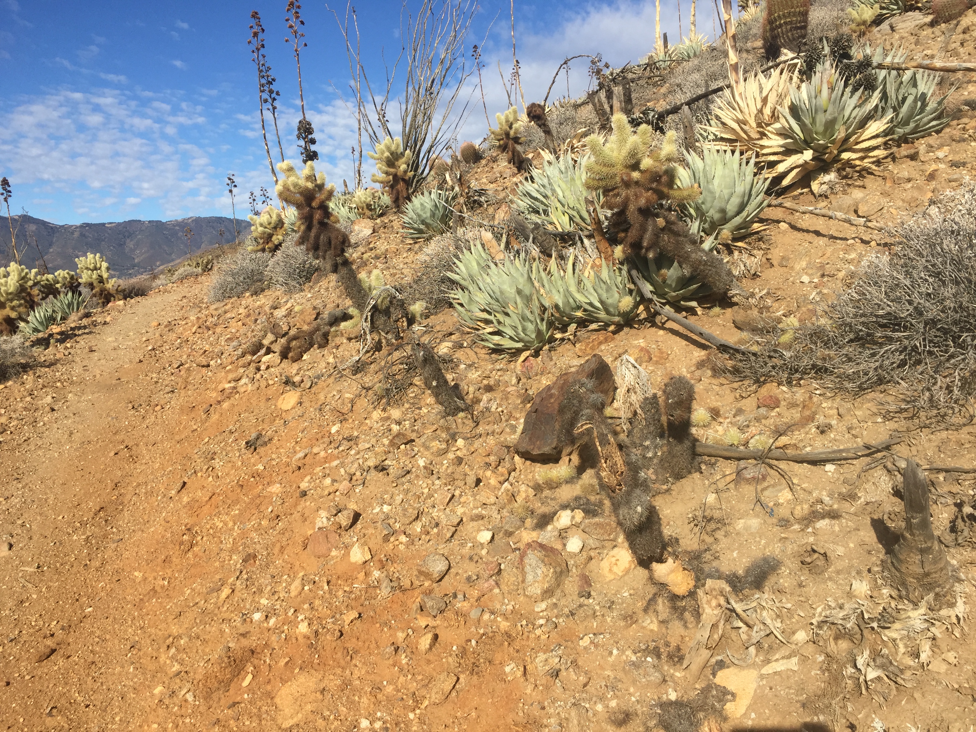
Water sources again. Unlike the hike up the squiggles on my birthday, I did not dread hiking from Idyllwild to Highway 78, a 4 day, 3 night section. The trail is graded beautifully and the desert changes subtly as you gain or lose elevation. No matter where I roam, I love open country, whether the alpine above tree line in the North Cascades, burn areas in Oregon, or desert in Southern California. Like being on the ocean, the vastness and ability to see sky and space makes me feel safe and invisible somehow.
We hiked about 19 miles with another 5 to water the next morning, a water tank provided by Mike Herrera. Day 2 we camped at Warner Springs Resource Center– a shortish day because why push on carrying water if it didn’t save an entire day to the next resupply, just a few miles?-by a chain link fence, a trash can and a running water bathroom. I used earplugs to block the traffic noise, hey it’s pretty civilized wilderness down here. We hiked out the next morning wearing all our layers, it was literally freezing! Of course we start before the sun’s up. There was water in a spring that our water report said was marginal, but it looked fine except for the wasps or bees or whatever that swarmed. Glad I didn’t need to collect water. We wound uphill for several hours then down and around and along the hills on perfect trail, collecting camping water at a cache, before camping in a dry wash after 22 miles. A warm night, quiet, with just a gentle tinkle of rain towards morning, just enough to settle the dust on the trail to our last, I think, resupply stop in Julian.
A storm is predicted for tomorrow so we will decide what to do in the morning. Rain, high winds. But we just want to hit the trail and make our way south.
In my original plan, I would hike into Idyllwild on my birthday, eat a bacon cheeseburger and drink beer that evening, zero the next day for the last time, then hike to Mexico. Whoops. The phone-fry incident in Big Bear meant I would be a day behind that plan.
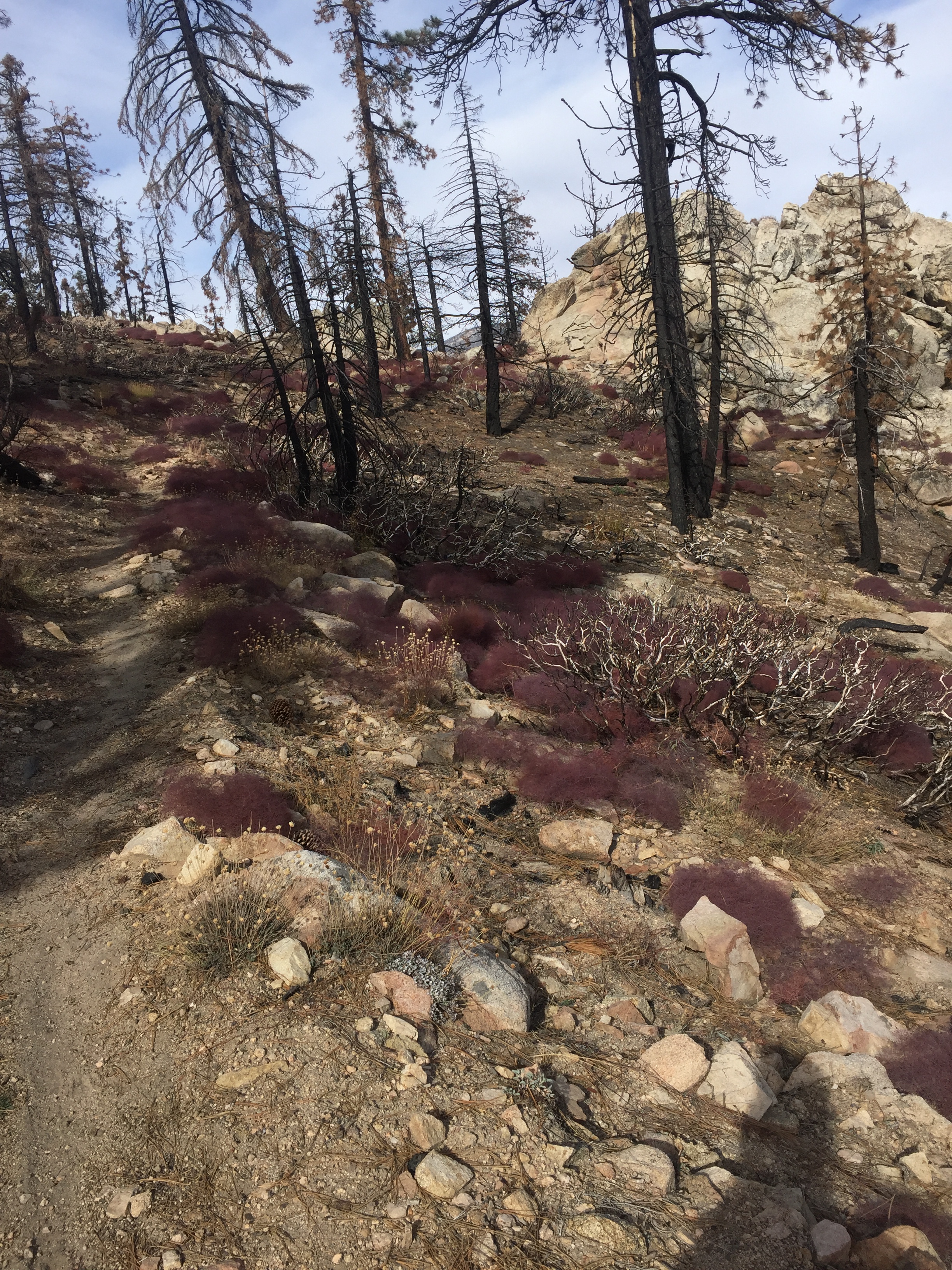
Two nights out of Big Bear I faced a truly horrible 20 miles of relentless uphill to the next water, 6500′ elevation gain, scrub bushes, shade less, squiggles. Noooo, not the squiggly switchbacks again! Not on my birthday! The worst birthday ever! Yeah, yeah, I’m glad I get another birthday, I’m glad I get to spend it outdoors (but really the deserted beach at Waimanalo where I wore a new bikini for my 60th was pleasantly outdoors), I’ve got my health (if not my body fat), blah blah blah. The worst birthday ever coming up!
My typical day’s intake was going to be the same as ever.
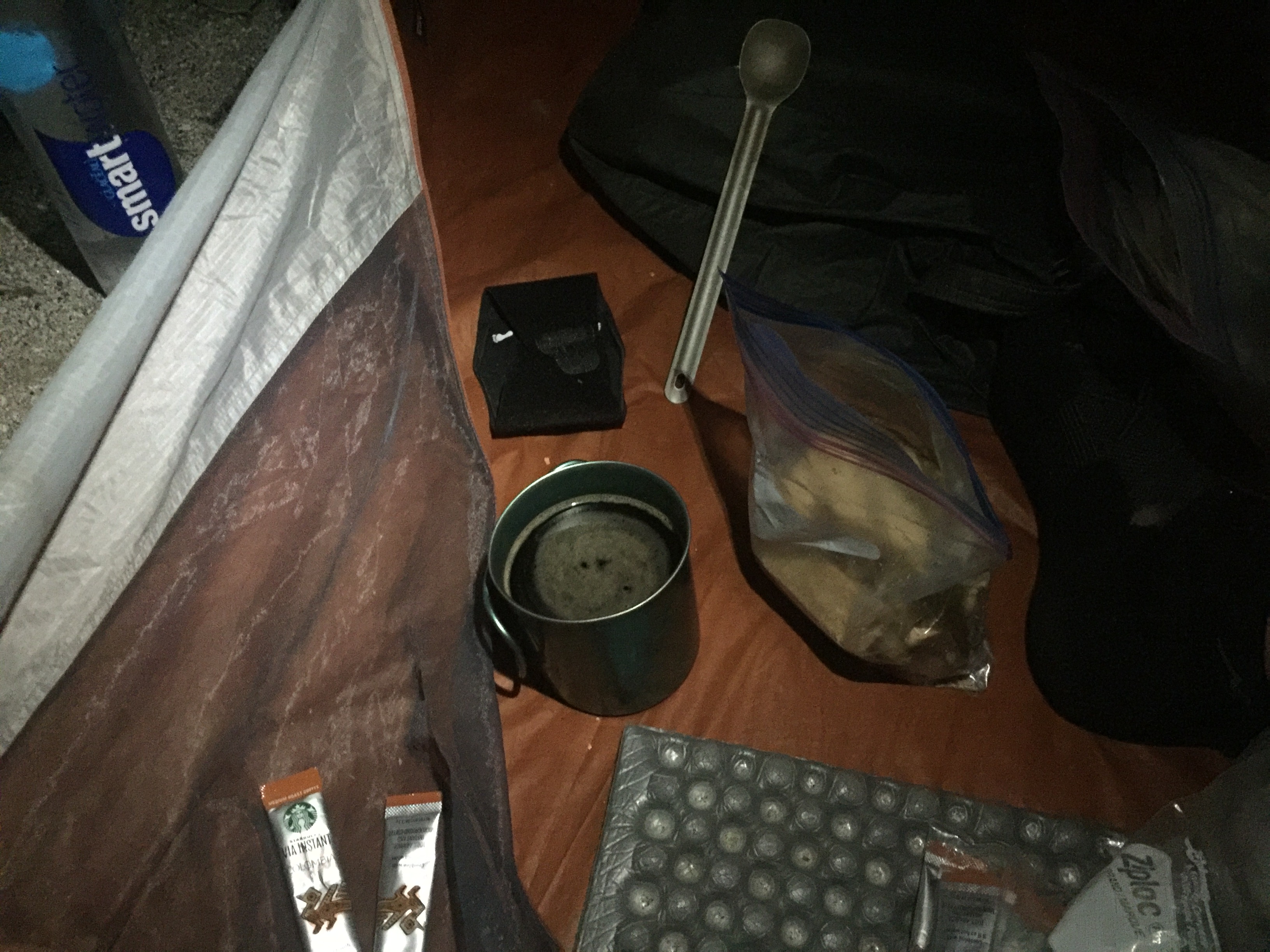
Breakfast: Walkers Shortbread Cookies 8 X 100 calories, Starbucks Via X 4
Snacks: Snickers X 2, Clif bar, Payday X 2, Kind Bar
Lunch: 3oz cheddar on a flat bagel
Beverage: 3 L water treated with Aqua Mira drops
Dinner: Packit Gourmet entree, Tusacan Beef Stew with Polenta
Birthday cake: nope
We were camped next to a water faucet, actually a huge luxury at this point, we could fill up in the morning! As Puff Puff walked to the faucet with her headlamp on, she sang, “Happy Birthday” to me. Awww, so sweet I had to smile between curses.
The slog began in the dark. We had decided to get going super early because uphill is slow, slow, slow, and the hotter it gets the more water you need to drink and the more water you need the heavier your pack and the slower you go. 20 miles to water. I hate my life.
I saw Puff Puff at 11 am, resting and snacking in a tiny blot of shade. I flung my pack down and snarled, “The worst fucking birthday ever,” then changed the subject to try and be a little more upbeat. Uh huh, she didn’t believe it either.
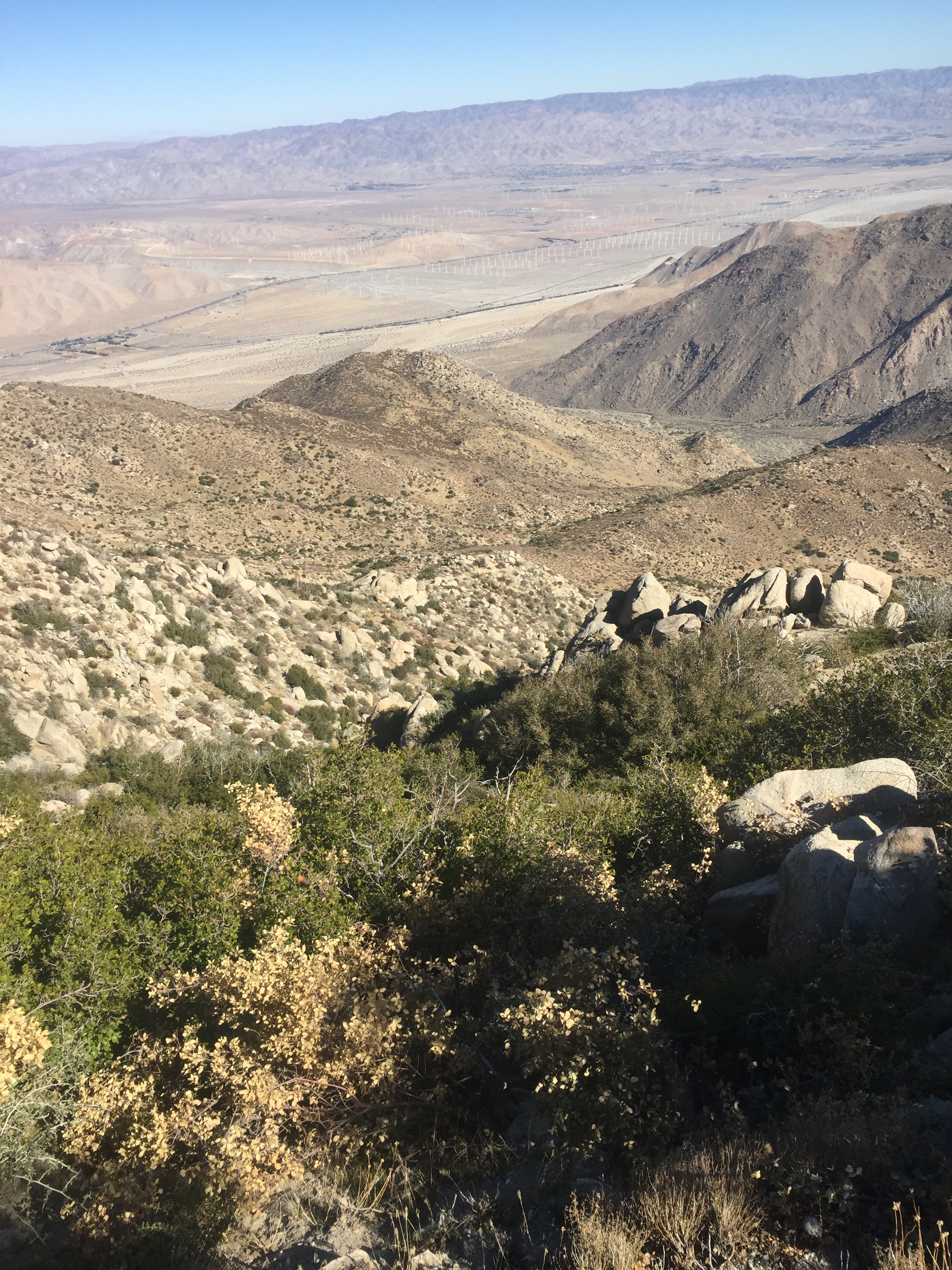
I texted Sliderule, “6 hours, less than halfway, 5 hours of daylight left. I hate my birthday” with this photo showing the valley floor I’d come from for 6 hours.
More slogging. Finally the trail entered trees and granite. Enormous gray squirrels with bushy tails bounded everywhere, flinging themselves from rocks and downed logs into trees. Deer tracks, the ubiquitous black beetles and a few hiker footprints led me uphill. Puff Puff must have waited for me again because I was just behind her at around 3:30, with 10 hours of walking uphill so far, when we spotted a white cooler ahead. Coolers mean somebody has left “trail magic” for PCT thru-hikers, but for hundreds of miles they have been empty, artifacts left untended since the wave of NOBOs months ago. And then we got closer. She yells, “Open it!” but I had to take a photo first. And there was water, Gatorade, soda, beer and sandwiches.
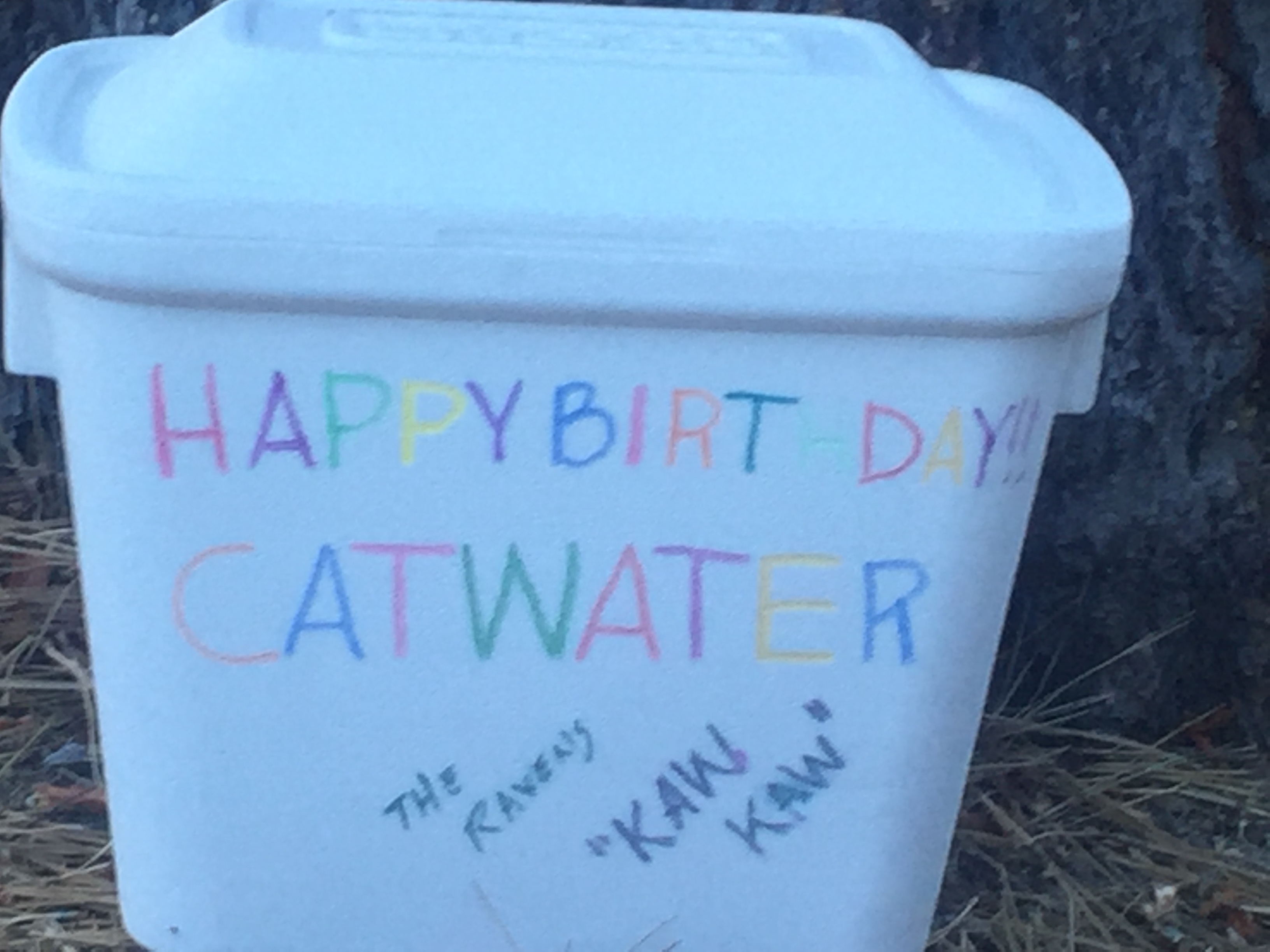

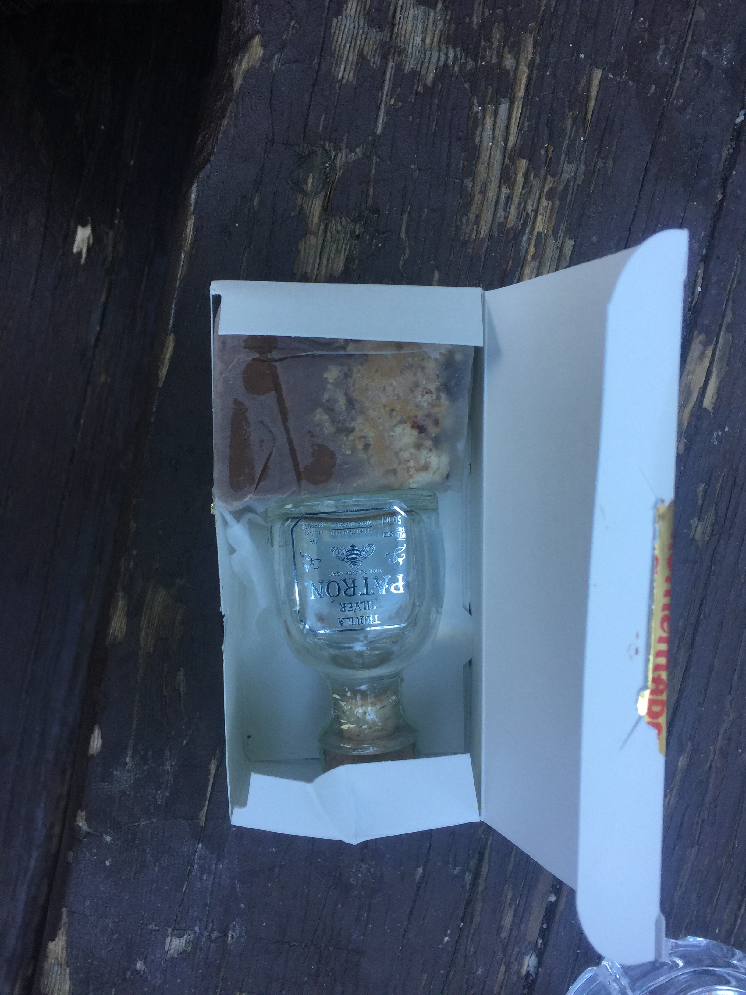
There was so much fluid that we decided to camp then and there, we didn’t need to push on to water and it was only 13 or so miles left the next day to our next resupply in Idyllwild. Wahoo, the Ravens! Kaw, kaw, kaw! I’ve never had such an amazing birthday surprise in my life. Then as we were tucking into the bounty, Puff Puff pulled out a little box she’d been carrying for days. Tarcey had carried a box of treats to give me at the top of Mt Whitney for over 200 miles when we hiked the JMT in 2013. It means a lot. Fudge and Patron Silver, how did she know?
I wrote this little note, put it in a ziploc in the cooler, and hiked on the next day.
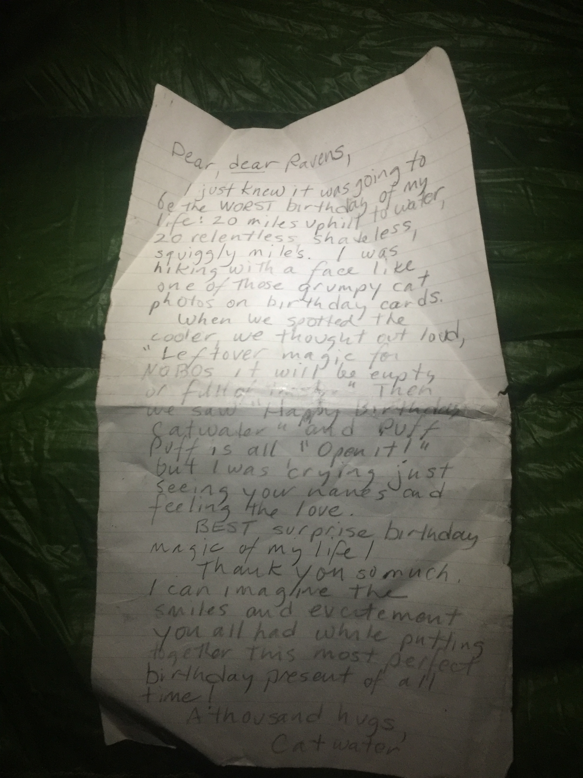
“Dear, dear Ravens,
I just knew it was going to be the WORST birthday of my life: 20 miles uphill to water, 20 relentless, shadeless, squiggly miles. I was hiking with a face like one of those grumpy cat photos on birthday cards. When we spotted the cooler, we thought “Leftover magic for the NOBOs, it will be empty or full of trash.” Then we saw “Happy Birthday Catwater” and Puff Puff is all “Open it!” But I was crying seeing your names and feeling the love.
BEST birthday surprise of my life!
Thank you so much! I can imagine the smiles and excitement you all had while putting together this most perfect birthday present of all time!
A thousand hugs,
Catwater “

Shit happens. We ate a fancy meal and returned to the hostel. In the morning, Puff Puff’s phone was fried. So began a day of looking for solutions. We acknowledge we are tech dependent, in real life and trail life, our mini computers hold contacts, maps, books, photos of info we need (lock codes for entering the hostel, business cards, trail angel lists). Fortunately this happened in a town, we have some leeway in our schedule and I have a credit card. To lighten her mood, I reminded Puff it could be worse, she didn’t have Trump as her president.
Apple support told her to find a computer. UPS Store opened at 8:30. We ate breakfast. The computer solution didn’t work. Apple support then told her to find an Apple Store. That was “down the hill” as they say in Big Bear. Oddly there is a car rental place in a Holiday Inn here in Big Bear. We walked there. A car was being turned in that morning as I inquired about renting at the desk. I took it and we drove off to a giant mall in Rancho Cucamonga, a name Puff Puff couldn’t say without giggling. The customer line-up for help was hours long but the guy who checked her in listened to the English accent, asked if she was traveling, and bumped her 3 1/2 hours ahead! And they fixed her phone. We celebrated by eating lunch at a fish place. The sushi rolls were divine. Then we went to REI where I bought new rain gear to replace the worn out stuff that failed me heading out of Hiker Town. We drove back up the hill, got a room at the Holiday Inn, ate an amazing fried avocado dish at the brewery in Big Bear village and called it a day.
We took a cab to the trail the next morning and headed south. Day 1 was cold as we climbed. Day 2 we camped by Mission Creek and it was really warm, plus 2 coyotes went streaking by at night. Day 3 was hot! After we gathered water from the Whitewater Creek I looked down the trail and saw The Ravens!

We have kept in touch and I knew they wanted to find me on the trail. Hugs and smiles, what a great surprise. Friends from the trail reunited on the trail for the second time this year. Oh the people I get to spend time with out here makes me happy. This family of PCT thru-hikers are so unique yet do grounded.
We said goodbye and continued on to our destination for the evening, tentsites next to the Snow Creek water tap. Stellar. We had to walk by a subdivision, under the freaking I-10, through 3 miles of ankle deep sand, by another subdivision, and up a paved road. Last year I wrote about this area, “Squiggle Engineering” and I hated everything about it. This year, although I wore earplugs to sleep, the view across the I-10 was rather glorious: wind farms lit up with their flashing red lights, the freeway a stream of lights, the barren hills all around folded on themselves like pancake batter before it settles in the bowl and the big moon, full to my eyes, rising over all so bright I cast a shadow.
I went to sleep knowing the next day was going to be my worst birthday ever. A 20 mile climb just to get to the next water source: 6500′ gain, scrub brush, shadeless, squiggly switchbacks.


 Lovely comfortable Hiker Heaven. We had to say goodbye to Doug, the chickens and their evil rooster, the retired thru hiker horse, the pony, the 5 dogs of all sizes, ages and personalities, and the oasis of sociability. When we’re on trail we have only brief interactions with our fellow humans since we’re so focused on making the miles. When we’re in town we get to know people.
Trail angel Mary, from Acton, has probably driven hundreds of hikers from Agua Dulce at about PCT Mile 454 around the closures (444-429) to 419. The extra miles missed have to do with road access mostly. Fortunately I got to hike this stretch last year, including remarkable and much filmed Vasquez Rocks. She picked us 4 women up (me, Puff Puff, Crusher and Witch) and chatted as if we were her first.
A quick sidebar: The staff at the Mexican restaurant in Agua Dulce were extraordinarily welcoming. This is a town that knows hikers, the trail runs through it, but this time of year there is just a trickle of SOBOs, and we were treated like celebrities, free Margaritas, excellent food, and kind conversation.
Water and campsites were my concern as we had got a late start hiking, just part of being dependent on kind souls like Mary to get you where you need to be. There were no campsites called out on Halfmile or Guthook in the area where darkness would descend, but one of the lessons I learned from the desert last year was that “abandoned dirt road” often means plenty of flat ground. So it was. Just a mile or two before the next water source, within ear and eye shot of Highway 2, a lovely flat, pine needled campsite. We will not be far from civilization for the rest of the trail. There are roads and lights and ski lifts from now on, really it is part of what makes the PCT through Southern California so extraordinary. Wild country is abundant amidst this intense population density. Sometimes I grasp how my friends down here who love hiking can love hiking.
I have a bad habit of eating in the middle of the night as I wake up frequently, a life long insomniac. A sound sleeper, usually Puff Puff doesn’t notice, but one time she did and teases me now, “I heard the crinkle of packets last night! ” She finds it hilarious. I have realized it can wreak havoc with my GI system, dang it. So Day 2 out of Hiker Heaven was tortuous for me. We camped at Little Jimmy after 17 miles. There was a lot of steep uphill to get here, very slow due to my stomach issues, but a good choice as this was the last water source before Wrightwood cutoff in 15 miles, so there really wasn’t anything to gain by hauling water uphill to camp in the wind, just would have reached our resupply stop a bit earlier. Day 3 was easy, and as I walked through a trailhead parking lot I stuck out my thumb and a deer hunter pulled over and took us to town, real food, resupply, and an amazing place to overnight “Bear With Us.”
I had an idea. We could Inn-to-Inn hike Wrightwood to the Best Western Cajon Pass, about 28 miles and mostly downhill. The alternative was to hike about 22 to water, a lovely cache next to a dirt road with railroad and freeway noise. Not a bad day’s work although we had the headlamps on for the last hour and a half, including through a sketchy tunnel beneath train tracks and an even sketchier underpass below the I-15. But it was worth it to sleep in a bed, eat a Del Mar burrito and drink a beer.
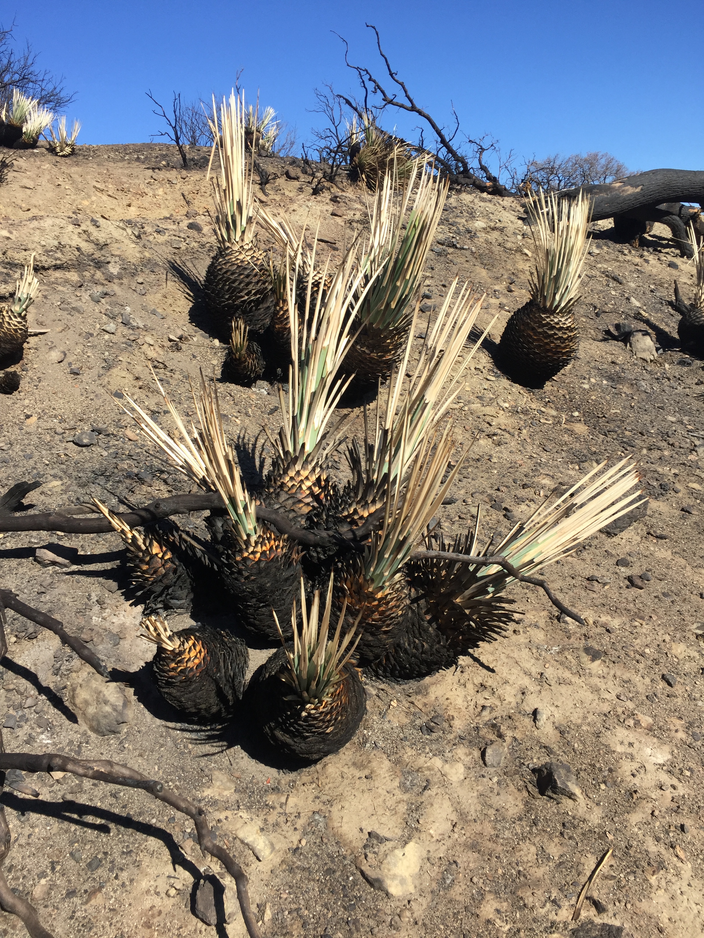
The next three days were uphill. The first night we camped on a ridge in a burn area and listened to a yappy dog and traffic below. But the sky was clear and the escarpment across the way glowed with lights as the quarter moon drifted above. I enjoyed walking through the burn areas, the brush burned black with new green sprouting around the roots and the white sand, the views, the starkness. You could see the bones of the desert hills like the skulls of dead animals reveal the structure and foundation of living creatures.
I got whipped by willows struggling through a crossing made messy by beaver dams. Walking up past a human made dam and then more uphill past Deep Creek HotSprings, an endless canyon. We camped by the river below a bridge. Last year’s spring frogs, or any frogs, absent.
More uphill the next day, picking up enough water to camp and make it to the Highway 78 trailhead 19 miles away. A quiet and cold night,blissfully without cell service on election night. The whole trail when asked, “When will you finish?” I’ve answered, “When’s the election? After that,” and people have laughed but I’m serious. To hike the PCT I’ve given up watching the Olympics which was tough, but missing the media coverage of the Presidental race was truly healthy. Remember when I posted Rick wearing a tee shirt that said, “I already hate our next President?” In 2008 when Palin was on the ticket, I voted early and went to Ecuador. Being someplace besides the US put politics in perspective, we think life hangs in the balance, that the results matter. And they do but not to the extent we imagine. It is hard not to get caught up in the media induced drama so, for me, avoidance of the hype is self preservation. My plan worked. This too shall pass. I’m all Dalai Lama with compassion and patience. For now. I marched in anti-war protests as a teen during the Vietnam war, we made a difference. I’m not afraid to rise up again.
“Many forms of Government have been tried, and will be tried in this world of sin and woe. No one pretends that democracy is perfect or all-wise. Indeed, it has been said that democracy is the worst form of government except all those other forms that have been tried from time to time.”
Sir Winston Churchill (1874 – 1965), Hansard, November 11, 1947
Jim, Larry, Ken and Dan met us on the trail heading into Big Bear, and were perfectly rational and calm. LA wasn’t in flames, rioters stayed at home. The people in Big Bear acted normal. I ate food, talked with good friend Jim, and the only ranting I experienced was on Facebook. The trail, dopamines, IPA, real food, a shower and clean clothes, this is real life.


We hiked 48 miles in 2 days to reach Hiker Town. Yup another water thing, got to keep going so as not to carry extra weight to dry camp. We camped that one night on this section in a dry little draw where minutes before we’d watched 2 dirt bikers in their neon plumage and plastic body armor bounding down the multiuse trails trying to get out of the canyons before dark. Looks like so much fun and it’s the perfect country for it. As night deepened, way down below in the v-notch of the canyon, brilliant yellow lights glowed from a town. Lancaster maybe?
Walking down into the flats of the LA Aqueduct was sunny but cool, in contrast to the wind and heat I walked through last year. Across the valley, the next mountains we would need to climb the following day were shrouded in rain. Hmm.
Hiker Town was deserted, we had the place to ourselves and slept on the couches, ran a load of laundry and Bob gave us a ride to the store/taqueria for a burger. So quiet and warm.
We left before dawn and headed into the 50% chance rain and got rained on for the entire day. I believe that I hiked uphill faster than I have ever gone before! Just trying not to die of hypothermia. I watched Puff Puff’s tracks melt and wash out from the rain and little slip marks where the mud got slimy. We were both in survival mode hoping to get over the top and onto the side of the crest that was out of the weather. While the rain did let up, the trail continued in a dense wet, cold cloud. I glanced quickly at the gigantic wreck of a cistern that earned me my trail name last year but my hands were too cold to push the buttons on my phone to take a photo. I finally camped alone after 20 miles st 3:15 pm because I was sick of being wet and cold and just needed to warm up. Puff 2 continued. I told myself that I could warm up then continue on to join her, but my rain gear was soaked through and it never stopped raining and blowing as I lay comfortably in my sleeping bag, so I stayed put.
Our plan was now to meet at the Rock Inn in Lake Hughes for real food the next morning. I packed up and headed out in daylight for a change, the weather having cleared up about 5 am. It was nice to be able to see the trail. Due to a fire a few years ago, the PCT is closed for 20 miles but there is a detour down through a side trail for 5 miles, then an 11 mile paved road walk, then finally linking back to the trail. As I reached the road debating whether I should walk it or speed things up so Puff wouldn’t be waiting for hours, a truck pulled next to me to offer a ride, the guy owned the real estate office right across from the restaurant 5 miles away. Halloween trick! I accepted and walked into the Inn where Puff Puff was sipping a hot cocoa and expected her to ask how I’d caught up so quickly. In her place I would have asked. But never underestimate British reserve, culture shock to this blunt, direct American. Hours later I had to confess how I cheated! Trick or treat? That is the question, eh?
We had to miss a stay at Casa de Luna since we crossed the road near by at midday but we camped at the old cache site under the mesquite and walked into Agua Dulce for a night at Hiker Heaven. Oh comfort and joy! Just 4 of us SOBOs, all women and volunteer caretaker Country Gold from North Carolina. There’s another closure ahead so we have a ride arranged.
This year I’ve not been giving you the PCT mileposts in the blog titles. Rather I’ve been more or less calling it out by naming the resupply points or town spots. So it is somewhat out of blog character to say I’ve got less than 500 miles to hike. And I’m gleeful about that. Not too many years ago, 500 miles of hiking was a goal, a challenge, a dream. Now it’s a countdown. If you’ve never hiked 2600 miles, or 500 miles, how can you relate? Even for me, it sounds weird. What you need to understand is that it IS weird to think in these terms. And like last year’s PCT NOBO, I both look forward to being done with the hard daily work of walking 10-12 hours and hate for the journey to end.
A few weeks ago, an old guy I met a few days earlier base camping and hiking near Rae Lakes told Puff Puff, not me, on their second encounter on the trail, that I was a goddess. I treasure that. People are impressed by us long distance hikers and truly they should be. I am impressed too but I don’t think I am particularly exceptional in being able to do this thing, there are a lot of us! If you find yourself inspired, give it a chance, discover if you’re capable, don’t say, “I could never do that,” just go out there and try.


Walking south from Horseshoe Meadows and leaving the Sierra behind for “The Desert” meant a new focus: water. I had downloaded the PCTA Water Report and, as expected, water would be scarce and we would have to carefully plan how much water to carry between sources.
There was a lot of uphill out of KM and we were hauling water to dry camp, finding a lovely spot on a dirt road. The next morning we passed Decaf, camped a couple miles beyond, he was looking a little grim. However, he passed us a bit later but we all chatted while gathering water at Fox Mill Spring, a very cool archaeological site I camped at last year, noticing the array of historic and prehistoric debris all jumbled together. Decaf had spent some days off trail due to Giardia. A bit later I saw a man and dog coming down the trail with Decaf just behind. “You’re going the wrong way, dude, ” I said. Decaf had got “sick”again (oh those British euphemisms) but amazingly the one other human out there had seen and offered help. The man with the dog was doing field archaeology along this bit of trail, tagging sites with orange flags similar to what you see marking electric or gas lines. I chatted a bit since I’d noticed the flags, knew the Fox Mill site and love cultural resource stuff. We would see Decaf in Lake Isabella where he had a package waiting, still weak, still resisting taking the antibiotics. My Dad would approve him letting his immune system find a way, but I urged him to take the meds so he could keep hiking. Sometimes I can’t stop the Mom from showing.
Moving on, Puff Puff and I collected water enough to dry camp from a trickle of a stream listed in the water report, made camp and hit the trailhead at Walker Pass the following day, getting a ride from a lovely couple on their way from Ridgecrest to Kernville for lunch. Lake Isabella is a long way from the trail but the motel accepts hiker packages, offers clean rooms and gave us a ride to Vons. I learned that carrying less food weight, and resupplying as often as possible, is hugely helpful. Plus I just like sleeping in a bed as often as possible. Win win.
The stretch from Walker Pass to Highway 58 was tough on me. I arranged a ride back to the trail but Richard couldn’t get us early, so we didn’t start hiking until 9:45 with no water and camp for 21 miles. For the first time, I had to put on my headlamp and walk into camp at about 7:15 pm. It was easy trail but I had a restless night waking up to the sound of the wind flapping my tent. The next day went through a lot of burn areas but finally we got to live trees and soft pine needle covered trail out of the wind. We camped after 22 at a deserted car campground near Landers Meadow, with creepy trash strewn around. You always know where there is easy trail access because of the toilet paper tossed on the ground, not even an attempt to bury it, let alone to pack it out. Add in leftover watermelon, cigarette butts, beer bottle caps, and assorted debris. Nice.
The temperatures have been pleasant as the trail winds by wind farms and dirt roads but the uphill is so slow for me due to weight and muscle loss, I can barely pick up my legs even though my heart and lungs are in great shape, so frustrating. I listen to audiobooks as I grind my way up and try to pick up my pace on the flats and downs. But if there are hours of f*ing uphill, I can’t make the miles I want in a reasonable timeframe. There are less than 12 hours of daylight these days and I hate hiking in the dark but so it goes. The third night I made it to Golden Oak Springs after 26 miles, and it was just getting dark, not bad. Puff Puff had been there for quite awhile and gathered 2 liters of water for me so I could just set up my tent and cook dinner, that was awesome. We more or less cruised the last 17 or so miles to Highway 58 where she called down the list of trail angels until hiker Georgette enthusiastically agreed to pick us up and take us to Tehachapi. A zero day later, she returned us to the same spot by 7:30 am. Thank you Georgette, I wished we had more time to share trail tales together. Your support of 2 crazy thru hikers is so appreciated.
