Back to Benchmark

8/20-22: 58 miles
First sun in 3 days

Man, I’ve had a lot of vacations from the trail this year. The trip to Spokane and the wedding was fantastic. Not just a couple, but a whole family was married in a sweet, low-key ceremony and celebration. Megan and Jaime, son Tanner and daughter Emmarie, wonderful people. And Megan, cousin or “cuz” to my Glen, Sarah and Chris, was blown away that all three travelled to be a part of it. Yup, life is about people we care about.

Dan drove me back to Benchmark and I headed out for the last stretch of CDT I’m going to do this year. Within 1/2 hour, my feet were wet and cold and would stay that way until the third and final day. No bridges and cold crossings. By 10 am, a cold rain started and didn’t let up for 12 hours. I did see a bunch of wildlife though, a young bull moose and a bigger cow, probably his mom; deer; big, brown rabbits and baby bunnies too; along with the usual plethora of manic squirrels. When I got cold enough that my hands couldn’t work well enough to work the bear spray if necessary, I pitched my tent and crawled in after only 17 miles at 3 pm.

What are these white berries?

Fortunately, the next day was merely ugly, cloudy and gray. I trudged along the trail, routed not on the Divide, but in a series of creek valleys, green and sodden. I needed to make up the miles I hadn’t done the day before because of my fear of hypothermia. At the end of the day there were two climbs, steep, into clouds. I finally camped near an off- trail spring and woke with ice coating my tent inside and out.

75% of these hikers are Alaskan! Congrats Sauerdough (2nd from L) on your nearly done Triple Crown!
More berries

Uphill into the clouds

The third day, I’d left just 18 miles to Highway 200, but the trail profile showed 10 separate climbs so it was slow, grumpy cat going. I saw a bunch of NOBOs, including Lost Larry (“That doesn’t sound good,” I said when he introduced himself.) the head netted hiker who I’d met as he backtracked to Dubois because of the deep stream crossing that sent him swimming. Turns out, he’d found another way around that section and missed 2 bad crossings. Well done!

Near dinner time, I spotted Dan’s van below me in a turnout. Yay, no hitching! We camped nearby in a quiet campground and then headed west. The next two days involved renting a U Haul, picking up some old family furniture (a Hoosier, anybody remember those?), dropping off both vans, and flying out of SeaTac, me to Mammoth, CA and Dan home to AK.

I’ve left about 500 miles of the CDT unhiked, although I rehiked a bunch thus year. I’m off for a volunteer work week in Yosemite up in Tuolumne Meadows. I did this last year too, got to have priorities. Then I’m going to hike south on the PCT/JMT for a few weeks.

Life after the burn

SOBO From Glacier NP

This photo is my answer to the question, “Why?”

8/10-16 135 miles

We took a zero in East Glacier, despite the lack of beer. Whistling Swan Cafe has the best stuffed French Toast I’ve ever had, so we had breakfast there again on our hike out of town. I really like this little town, great folks at our motel, the outfitters, the little cafes and so on, although we mostly rested. Interesting photos in the Amtrak Depot showed Blackfeet in full regalia hanging with the tourists in the 30’s, and the making of Clark Gable an honorary member of the Blackfeet Nation. And apparently this was another stop on the Lewis and Clark Expedition. For the first and only time on their journey the Corps killed 2 locals, Blackfeet, sadly.

We hiked out, a short day, to Highway 2 at Marias Pass, where Poppy’s car was waiting for her. A very green tunnel, gloomy, gray, overgrowth kind of day, so I tried to focus on the little things and took pictures of assorted berries. Since we had a car, Natasha asked folks in the parking lot where to get real food. Snow Slip Cafe, west of us, was a friendly, log place with an attached motel. Their tee shirts say, “Slide in, slip out” yuck. But nice people, staff and customers. Seeing as how I’d much rather sleep inside than out (I know, I know, why do I spend so much time hiking then?) we got a room.

Split and Two Step

I really hated heading out SOBO on my own the next morning—out of the National Park, without Poppy and into forest. This trail has been so much solo and I have accepted that I really would rather hike with friends. Now that I’m going the wrong direction and am well behind any other SOBO hikers, I hope to at least cross paths with hikers I know heading NOBO.

I took a short cut, or “alternate” that cuts out a PUD and 4 miles, the NOBOs I saw today did it, and the next one, the Spotted Bear Pass alternate. It was not too exciting of a day, but better than yesterday. Burn areas are all cleared of deadfall and there are views.

I saw the super tall German who I gave a ride to near Dubois. He said he’d just hiked a 47 and a 45, was out of food and had only eaten 1200 calories and 700 calories those 2 days. Holy shit. I told him there was a Lodge just a short way down the highway he’d reach. Then I saw Two Step and Split, the couple I met last year just after the Eclipse! So cool.

Not so cool, I took a full fall to knees and head. No big damage, bruises and knee scabs.

More green tunnel

30 miles with this view

The second day without Poppy was easy walking, flat, through burn areas of several vintages, including last year’s. Trail crews have done an impressive job cutting out all the blowdown and deadfall. I camped by myself near the Strawberry Guard Station after seeing 12 NOBOs, 2 horseriders, 4 horses and 1 very fit Saint Bernard.

Day 3 was weird. I didn’t sleep well last night and was almost sleepwalking, somewhat in a dream state. Hopefully I don’t have dementia or a concussion from the fall 2 days ago. Managed over 20 miles, even after stopping to dry out my wet tent and sleeping bag.

Day 4 the waking dream state was gone, thank goodness. The trail this morning was all uphill in the green tunnel, like being on the treadmill set to 2% with an unchanging view. Not Embrace the Brutality but Embrace the Boredom. About 3 pm I was passed by Legend, nice guy. He is on quite a journey, since April he has hiked the PCT NOBO, then the Pacific Northwest Trail (PNT) east to the CDT which is now on SOBO. A hiker celebrity! Too quick for me to get his photo.

I made it off the Spotted Bear onto the CDT and saw lots of horses going to “The Wall” a beautiful cliff formation. I camped near a creek and about 8 pm, NOBO Flower-Man (“Flower Man,” he always says, turning slightly to show the bouquet of fake flowers stuck in his pack’s back pocket) stopped to chat. I met him near Togwotee Pass in Wyoming.

Last day before Benchmark

August 16 I walked into Benchmark TH where Dan was camped. I grabbed a beer and we headed down the 30 mile gravel road to Augusta. And gave a hiker a ride and a beer too, good deed opportunity. We’ve got a wedding to go to! Megan and Jaime, see you in Deer Park, WA! I’ll see all 3 of my kids, Glen flying down from AK, Sarah from Seattle and Chris, on crutches, from Bellingham. At this point I intend to come back to the trail at Benchmark after the wedding for the 58 miles to Hwy 200 (near Lincoln), then drive all the way to Seattle with Dan where I will fly to Yosemite for a week of volunteering and then some southbound hiking on the PCT.

Glacier National Park

Birthday Boy Sliderule

8/5-9: 95 or 100 miles

Dan and I drove Skeeter to Missoula and stayed a couple nights so the E350 Ford van ’97 vintage could get a checkup at the mechanic’s. Verdict: healthy. Then we spent the next week camping, fishing, eating and visiting historic stuff. It was a very relaxing vacation from the trail. Dan’s birthday was in Salmon, Idaho, we found some underutilized campgrounds and secret fishing holes.

I got dropped off back in Missoula where Natasha met me August 2. We drove through Glacier NP the next day to St Mary’s Ranger Station to get our backcountry permits organized. Hoping to start 8/4, we needed to wait till 8/5 to get the campsites we wanted. It’s weird to me that just outside the Park are bunches of motels and restaurants, where it was very easy to find a couple of different affordable places to stay. Saturday we day hiked to Grinnell Glacier, a very popular destination for day hikers since it’s only about 11 miles round trip, the tread is good, and the views are unique. Some of the oldest fossils on the planet are here, stromatolites.

Catwater and Poppy at Grinnell Glacier

Natasha aka Poppy

Natasha’s friend and car shuffler, Brian, took us to the Canada/US border and we started hiking SOBO. Our first day was just under 20 miles to Poia Lake, a crowded campground with 4 sites and the most disgusting pit toilet ever. You have to hang your food bags in the cooking area before setting up your tent in the tiny space allotted. I hope the next 3 nights will be better assigned, permitted, regulated, and designated spots. The hike in was great though, the best walking surface of the whole CDT, and included suspension bridges rather than wet foot fords and actual trail crews cutting away brush and blowdown away from the trail.

Chocolate Moose

Monday was a big day, 23.9 miles according to our permit paperwork and we were stoked to get to Reynolds Creek camp to find dispersed sites and an open air pit toilet. Oh the simple joys of the hiking life. Along the way we saw a huge bull moose, the darkest one I’ve ever seen with full chocolate velvet on his rack. Since we’d stopped to make dinner after descending beautiful Piegan Pass, and it doesn’t get dark till 9:30, we had time to relax before passing out.

Our third day was a short recovery day of less than 16 miles but it was really hot and exposed, running through an old burn area, but the camp at Red Eagle Lake was great. I didn’t get in the muddy lake but Natasha waded out a ways with the ducks. I nearly made her gag though when I cooked my special dinner of Heather’s Choice Smoked Sockeye Chowder from my Anchorage hometown. I felt sluggish all day despite the short miles but the fish helped!

When we discussed and strategized getting our campsite permits, Natasha described an optional route that didn’t add miles but did take us on a traverse that she’d absolutely loved a few years before. So off we went with a not-too-bad 8 mile ascent to Triple Divide Pass. I saw moose # 2, not as large and chocolatey as moose #1 on the north side of Piegan, but handsome nonetheless. It took me longer than it should to get to the top and the marmot family at the top couldn’t believe we didn’t want their help lightening our packs of snacks. Dirty buggers. It looked to be a mama and 2 kids, Hoary Marmots. Descending the Pass, who’s coming up but Private Squares from PCT 2015! What a coincidence that Jackrabbit, who I camped with in Yellowstone, told me the story of how he gave her the trail name. She works at East Glacier Lodge now, we hope to stop in and see her.

Down for a few hours, then more uphill, steep, to Pitimakin Pass at 5 pm with 7 miles to camp after one last pass, Dawson. As promised, it was worth the effort and quite an easy traverse through rock formations I hadn’t seen in Glacier. Too bad about the smoky views. A long, perilous descent to No Name Lake where I stumbled in exhausted and starving after 14 hours. Of course, after setting up my tent, and going back to the eating/hanging area, life was good. We did it! 3 passes in a single day and my longest day on the CDT.

We beat feet to get to East Glacier our fifth day. Beer! Milkshakes! But oh no, there’s an alcohol ban during pow wow season. I was grumpy, super grumpy when I brought my can of beer to the counter and told I couldn’t buy it. I sulked in the porch until a hiker there turned to us and pulled out two cans of IPA and gave them to us. Magic! Thank you Hooks!

So Long, Wyoming, Love You

Yellowstone to Lima via Mack’s Inn Alternate CDT

7/19-24 110 miles

After breakfast I hiked out of Old Faithful with the tourists past amazing thermic areas and up back into scrub forest on old logging road alignments. I’ve never been to Yellowstone and was quite glad to have spent the night here, watching Old Faithful, and chatting with 2 women on a long tour at dinner last night. I like sitting at the bar when I’m solo and found a good spot next to these women about my age. The hotel staff and servers have a tough job with the crowds of day trippers but they were friendly and kind to me, I felt comfortable being here. Yesterday I charged my Anker, washed my clothes, picked up my box from the crabby guy at the post office, had a beer and burger, watched Old Faithful, talked to Dan about celebrating his #70 birthday and didn’t have to hike backwards or forwards to my permitted campsite. WIN!

The permitted campsite 10 miles out was next to a stagnant brown lake. I just needed to go a few more miles to get out of Yellowstone and it’s camping restrictions so I got enough water to last till the next day and kept going until I was out of the Park for a total of 20 miles. Between 8 and 9 pm at least a dozen hikers went by, the most I’ve seen in a single day on the CDT. I’m not sure how so many hikers could vortex in Old Faithful. Is there some secret stealth campsite hikers slip to when nobody’s watching?

I heard from my Yosemite friends Noreen and Mark, in the area with their camper, fishing gear and black lab Walker. We are going to meet tomorrow when I hit the highway at Mack’s Inn, about 18 miles away. I met Noreen years ago when I started volunteering with a group in Yosemite for a week every year. That led to a friendship and me helping organize a backcountry work week in Yosemite for a few years, and to volunteering when Mark led trips to the High Sierra Camps in Yosemite. My friend Tarcey and I stayed at their house in Foresta in 2013 when I hiked the John Muir Trail for the first time and they welcomed us to their wonderful Clouds Rest Cabin when we held my Dad’s memorial gathering and scattering in Yosemite on his birthday in November 2015.

An easy uneventful hike down abandoned roads to USFS gravel roads to a paved road to the highway. I saw 2 hikers in chairs on the lawn outside a restaurant, joined them and waited for my friends.

They bought me beer, dinner and a shower. They shared Walker, who greeted me the following morning with a wagging tail and dog slobber, the sweet boy. It was just so good to spend time with people I love.

The next day they gave me a cheater ride up the dirt road to where the trail began. A tough day of hiking even with the late start. A bunch of side hilling bushwhacking where I met Silver Sam pictured below. Back on tread, I picked up enough water to hike 19 miles (into the following day) and camped out of sight near an ATV road.

The second day was a pretty nice route mostly on top of the ridges. The Guthook track was off the GPS, but on another line. The views were great. Picked up water after hauling it most of the day and made 21 miles just past Ching Lake.

So as Triple Crowner Nacho told me the winter of 2015 before my first PCT, there’s good days and bad days. 7/23 was bad. Again, there was no trail and the GPS was off. Slow, slow bushwhack. Tons of Steep Pointless Ups and Downs, SPUDs. Get it? I’m in Idaho. Steep up hurts my right Achilles and hamstring. Steep downs burn my quads. A long day and I only made 17.

The next day though it was an easy 12 to Highway 15 where I waited 4 hours for my scheduled pick up by Mike from Lima, MT. And I crossed trail for the first time with a pair of SOBO thru hikers. I hung out in the cool of the underpass and in the heat of the weeds next to the railroad tracks. How awful it must have been to be a hobo back in the day. At the hotel, Mike said that next to my room was a single injured hiker woman. I left my door open and sure enough, Skeeter walked by and we got to talking. Dan’s due to arrive and with no set plans I think we can give her a ride up the trail or to a town of her choosing. Dan is turning 70 in a few days. That’s kind of a big number so we’re going to celebrate somewhere in Montana or Idaho. Logistics issues again, so I’m going to take a few days vacation and go car camping with Dan until Poppy and I meet to bounce north to the Canadian border. We’re going to hike the CDT south until she has to go back to work. I will probably keep heading south for awhile after that. This not thru hiking stuff is rough.

Stop Start, Wating for My Tent

7/10-18/18 109 miles plus 24 bonus miles

Jackson to Togwotee to Dubois to Togwotee to Yellowstone

After 2 nights in the Jackson Hole area waiting for my Zpacks tent, and not getting it, I hitched towards Togwotee Pass on 287 between Jackson and Dubois after getting a ride to the Moran junction from my German roommate at the hostel I wound up at trying to save money. After 2 hours and 100’s of tourists, I was getting discouraged. When a group of 4 cyclists came by, I jokingly put out my thumb and they stopped. I whined to them a bit and then they were helping. One guy unzipped his jersey to show off his chest to passing traffic (2 young women with no free board stopped), another edged his bike into the road and suddenly all 4 cyclists were waving to cars and pointing to me with my backpack. Within minutes, I got a ride from a climbing couple on their way from California to Lander, Wyoming. The cycling woman of the crew of 4 said goodbye to my thank you and quite sincerely told me, “Remember, think positive!” Good advice.

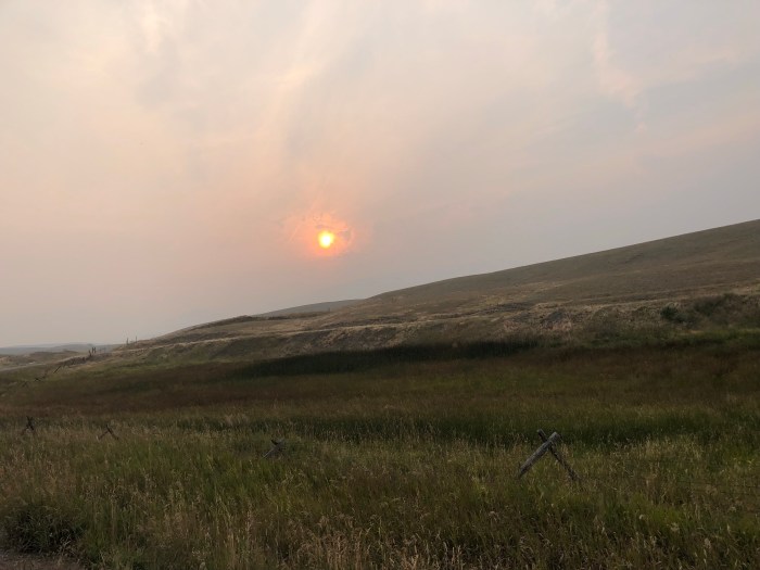
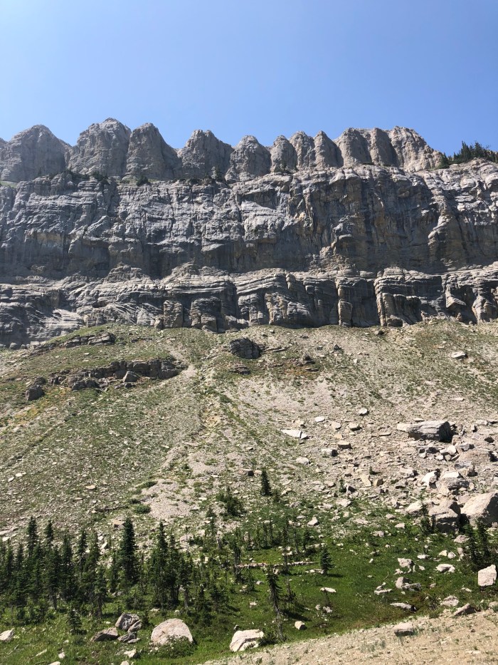
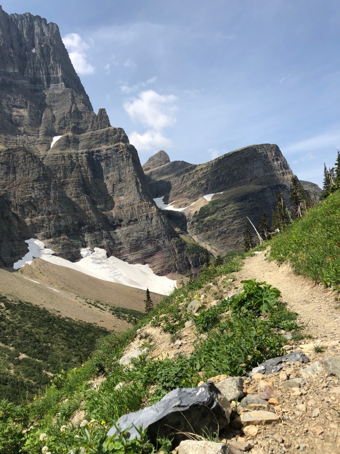
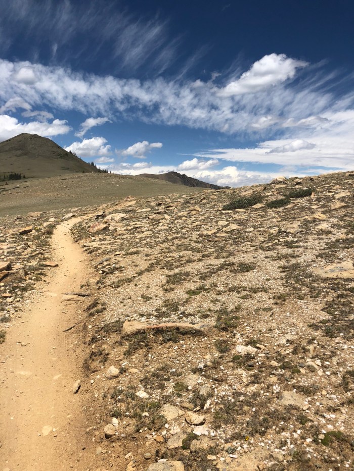
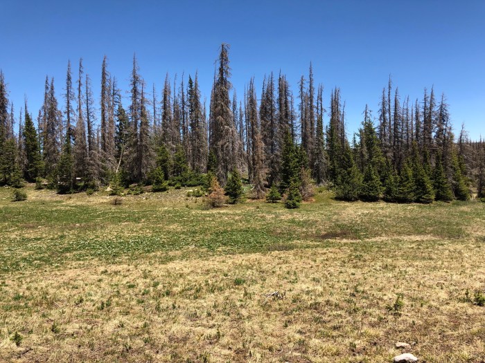
I got to the Pass and walked in past Brooks Lake under grey skies and thunder rumbles. About 3:30 there was a brief but intense rain, filling the trail ruts with water and slickery mud. The mosquitoes and flies were swarming. Since I jumped ahead from Colorado, it’s kind of a surprise how buggy it is in Wyoming, all the snowfall finally melting I guess, and flowers everywhere! And now I’m supposedly in grizzly country so I found a campsite away from water and with my back to a wall of downed trees and crunchy sticks. And then the zipper on the backup tent I’ve been using while waiting for my primary tent, failed. Ever try to sleep in a headnet? I lay there with the whine of the little bloodsuckers and 10 more nights ahead of me before civilization big enough to find a new tent.

So the next morning I backtracked to the highway crossing I’d started from the day before. Sigh. I waited about 45″ and car #57 gave me a ride to Dubois. My options were (1) buy a tent from the outfitter there, (2) order and express ship a tent, or (3) determine if my repaired tent had made it yet to Jackson and figure out how to get there. FYI, one of the many reasons I like Dubois is that St Thomas Church has a summer mission to serve hikers and bikers with a free place to stay. Very cool.

No tent at the outfitters that weighed less than 12 pounds. I could order and wait 3 days. Behind the third door? Bingo, my tent at last made it to the hotel in Jackson where Zpacks said it would be days ago. Now how to get there, now 75 miles away. Google, google, U-Haul has rental vans in Dubois at Bull’s Mechanics Shop! I reserved what they said they had available, a 15′ moving van.

When I got to Bulls the next morning and said why I needed to get to Jackson, they said they’d just got back a rental car, a Ford Focus (or in my Dad’s parlance a F*ing Ford Focus, “Triple F” in my stepmom’s kinder, gentler terminology). Woohoo! I gave a hiker a ride to the Pass, continued to Jackson, got my tent, drive back to Dubois and turned in the Triple F by 4 pm, $80 well spent.

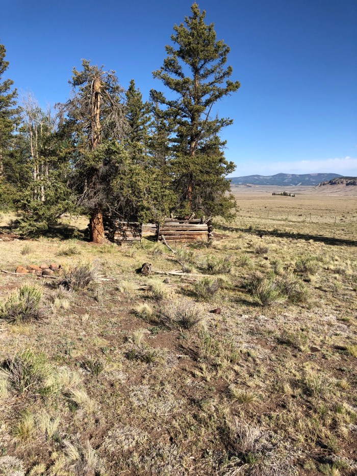
I tossed my old tent, bought 100% Deet and bug repellent leggings and walked out of town to try a hitch the next morning. Glenn Mason, 81, gave me a ride all the way in to Brooks Lake. “I’m gonna teach you something,” he announced a few minutes into the drive. I was hoping for more history of the area. “See those 2 yellow lines?” In the center of the highway. “That means you can’t pass.” Uh oh. “Now I’m going to show you something,” as he drove to the right on the rumble strip. “That means you’re driving off the road.” Then he told me about rolling his former vehicle several months ago. Fortunately we made it to the trail and I contributed rather more money to his car payment than I’d anticipated. It was worth it, I got a much earlier start on my day than the last time I’d hiked out of here, thanks Glenn!

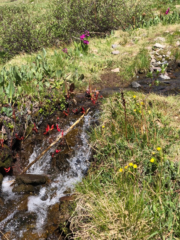
There was a river crossing about 15 miles in that I was warned about, so I was anxious to get past it. For sure it was a bit challenging, thigh deep with quite a strong current that had knocked several hikers over, but I crossed carefully. Several miles later I camped on a bluff with a view and a breeze that kept the bugs at bay. Pure contentment and quiet.

The next day was similar: warm, full of glorious wildflowers, not so glorious bugs, beautiful views and constant water crossings and wet feet. I found another breezy, viewy campsite.

Day 3 I made it to my first designated, permitted campsite in Yellowstone. Yuck. Hung my food bag from the provided cross bar and wondered if I’d ever see another hiker. I’d see not one human since Brooks Lake 3 days ago. And just weird to have to camp so early, 4 pm.

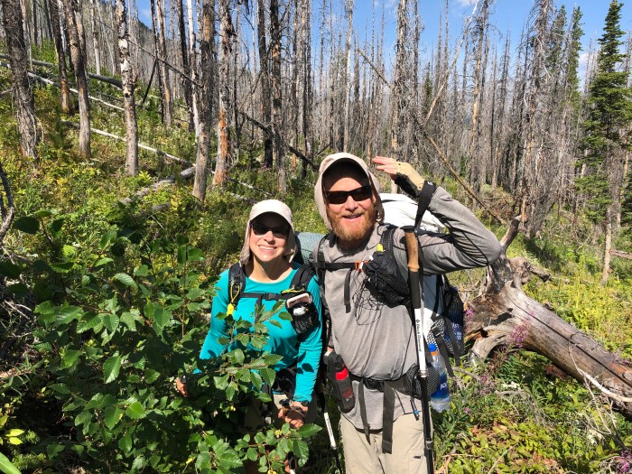
Yellowstone backcountry so far was unremarkable, the trail runs mostly on a historic logging road hemmed in by scrub trees, second growth, so there are few views and lots of bugs. It’s warm so I don’t mind the marshy meadows and stream crossings that keep my feet wet. Day 4 Jackrabbit(?) and Natural caught up to me, they have decided to camp once in the Park (permit for Heart Lake) then walk the 28 to Old Faithful Village, then the 15 or so out of Park boundaries. It was fun to camp with someone. As we sat cooking dinner, a thunderstorm burst with rain and hail and we scooted under a tree. Half an hour later, the sun burst out and as I lay in my tent escaping the bugs, they were swimming and whooping it up, making me laugh. They were gone by the time I got up at 5:45 am.

My designated campsite that night was disgusting, another dark, damp hole next to a creek hidden by thick, tall bushes where bears lurk. It smelled like pee, whether from the uncovered pit toilet or bear pee, I don’t know. I hiked on to another official campsite, pitching my tent just as another short thunderstorm broke to hatch millions and millions of buzzing baby mosquitoes.

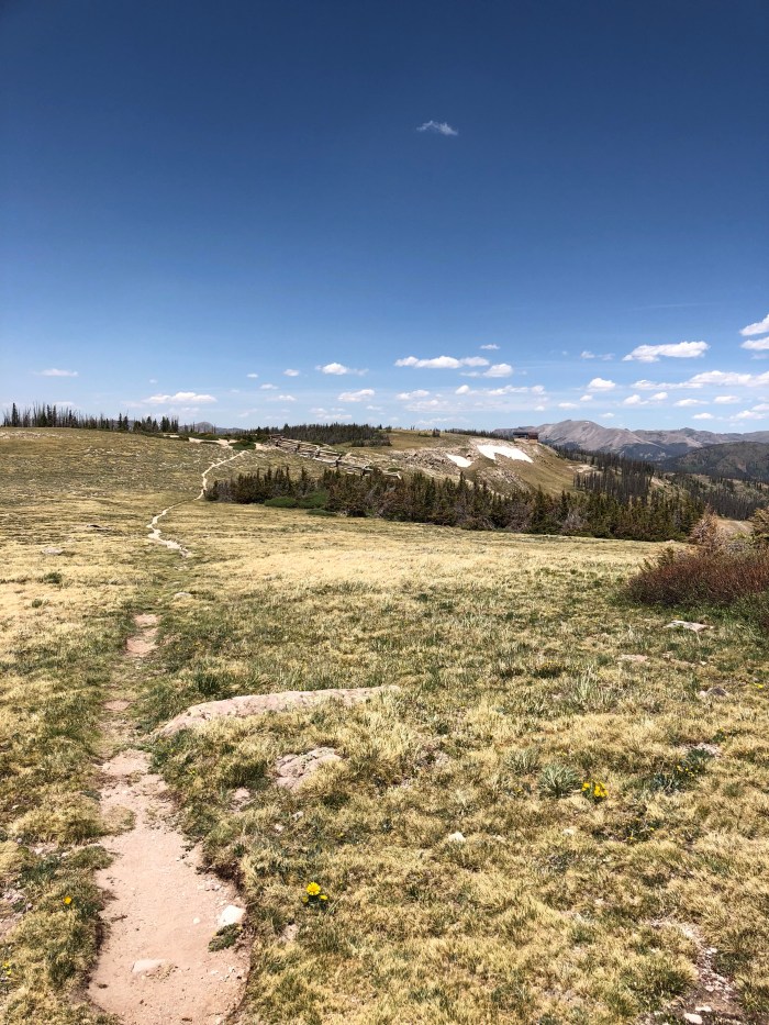
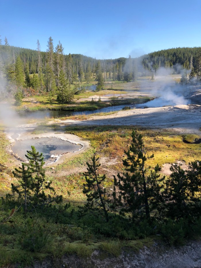
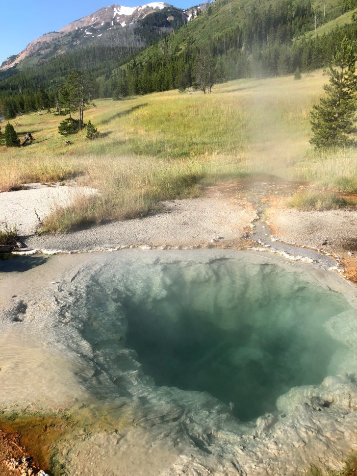
Day 6 and I was at my campsite by 11:30 am, the first one I actually like. It’s open and breezy right next to a thermic area with wafts of sulfur and steam drifting about. Just a few miles from Old Faithful Village, I can walk in, get my box, shower, launder, eat and walk back out. There is no campground in or near Old Faithful Village, a tough situation for hikers. My final permitted, designated site is north of the Village about 10 miles. Or I can camp here all day long, go in in the morning, hike out later in the day. I decide I’d go crazy hanging out here all day, so I’ll take my chances. It’s a more interesting few miles in Yellowstone than the days before. I meet a CDT SOBO section hiker who got encephalitis last year on the trail in Colorado, quite a scary tale. I got a cell signal at about 1pm, called Yellowstone reservations and got the last room available of the 3 hotels/lodges. Unbelievable!!

The culture shock got me pretty bad. The Village is absolutely crammed with cars and people walking around in clean shorts and pastel tank tops. Where are all the mosquitoes and flies that have plagued me the last 6 days? Run off by concrete and fresh scent laundry detergent I guess. My room was lovely, the shower refreshing and once I washed my clothes, I managed to feel I fit in better in this “#1 Destination in the US.” No WIFI anywhere though, outrageous.

Slackpacking

Shave Ice!

Smokey the Bear
Not shown, the burro

We took the free bus to Breckinridge and ate real food and drank real beer, all of us, safety in numbers, filthy, stinky and with our disgusting packs next to us on the outside deck. I Pricelined the most affordable hotel for 3 for 2 nights that I could find, so we took another free bus direct from Breck to Silverthorne. Showers, laundry and comfy, comfy beds.

I must confess that I’m not a big fan of the 4th of July celebrations, especially without fireworks. At home in Alaska, it’s not dark in July but New Year’s is, even if you have to wear all your arctic gear to watch the show. The parade in Petersburg, Alaska is my all time favorite-Viking boats! We got up on the 4th, ate free breakfast and went to REI of course. Then took the bus to Frisco and walked up Main St. Nuthatch and I kept telling BC that it really wasn’t a typical parade: the long gaps between paraders, the lack of marching bands and banners, the disorganization. But we got free hot dogs from a church, free lemonade and free ice cream, that made us all giddy. When the Republican politicians appeared with their obnoxious slogans I excused myself to my friends and turned my back to the parade, a quiet resistance.

To link miles on the CT and CDT, Burning Calves wanted to hike the CDT from Copper Mountain to where the trail crosses the road to Breck, where we got off trail. Nuthatch wanted to do the same but she intended to keep going, back to where we came from days earlier, where the CDT and CT diverged, and on north to keep hiking to Grand Lake. I’ve hiked all of the CDT through here, but on the Silverthorne Alternate which neither wanted to do, and so I was happy to slackpack (day hike) something I hadn’t done before. We got the bus to Copper and Nuthatch started out the trail with lightening threatening. I declined to hike up, so BC and I decided to hike low on the bike path to Frisco (me) and all the way to Silverthorne (BC). We heard thunder and pretty soon got a text from Nuthatch who decided to be safe and not hike up above tree line. She soon caught up to us. It rained, and cyclists thronged the path in both directions. BC continued to Dillon, we took the bus from Frisco and we all met for dinner eventually at the Dillon Dam Brewery.

The weather improved the next day and we all hiked the CDT from Copper to the road to Breck, about 15 miles.

July 7, I said goodbye as BC and Nuthatch hiked past our motel up the Silverthorne Alt to Winter Park and Grand Lake. They intend to hitch back to Copper and then go south to Monarch Pass on the CDT/ CT. We’ll always be the Tres Amigas. One of our little jokes is to stop using the word “stupid” and substitute a more precise description for that word. It’s amazingly hard not to say “stupid” a bunch of times a day. Especially if you’re in range of the latest political news. And now I have to monitor myself. No cheating, eh?

I took a bus to Denver, after another trip to REI to replace the rain pants that soaked through 2 days ago, and got a flight to Jackson Hole where I have a long hitch or Uber back to Togwotee Pass where I left the trail last August. I’ve never been to Jackson so I wanted to see it. Logistics are a hassle, and expensive, when you’re not thru hiking.

Tres Amigas

Catwater, Nuthatch, Burning Calves

6/26-7/3 104 miles

I walked a couple miles from the Greyhound station in downtown Denver to the 11th St Hostel, a fantastic old building with high ceilings, ancient radiators and modern fans installed and blasting in the hallways to help cool the building from Denver’s 100*F heat. I went out and ate lunch, then out again to eat dinner while I worried about flight delays for Burning Calves on her way from Frankfurt. About 9:30 there was a knock on my door. Reunion! And she brought me German beer!

We went out to dinner, it was something like 4 am to her. The next morning we took a bus to REI for gear and supplies, then light rail to the end of the line then Uber to the Waterton trailhead for the Colorado Trail (CT). And there was Nuthatch waiting for us after walking 40 miles just to turn around and walk it the other direction with us. The last time I saw Nuthatch was last year at Ghost Ranch before she broke her leg and had to be helicoptered out. She’s still working on healing. The last time I saw BC, she was hitching back to Rawlins from the Red Desert as the Ravens and I said goodbye.

Nuthatch had staked out a wonderful campsite 8 miles uphill from the beginning of the CT, perfect! Burning Calves (BC) was sleep deprived, jet lagged and more than aware of the elevation.

Day 2 and it was hot! There were lots of people on their first long hike, the Colorado Trail, with heavy packs and the dawning misery of water hauls and altitude sickness. We took a break at a river, but after an hour and looking at many miles of uphill and heat, I said I’d get going and see them on one of my many micro breaks. Long story short, hours and hours later, I got water at a tap at a firehouse and sat down to make my dinner, feeling like a jerk waiting for them to catch up. First Nuthatch then BC appeared and we decided to camp (after 16 miles) with a couple dozen other hikers. Tomorrow we’d hitch into Bailey where Nuthatch began her hike and had left resupply and it didn’t matter if we were a mile or two closer or not, we’d get there in the afternoon.

And so it happened. We debated whether we should hitch in, get food and showers and hitch out, but in the end we ran out of time and a weird little hostel had 3 beds, etc so we overnighted. Bailey is a hiker friendly town with a great food truck at the local brewery! We paid $35 each for a basement room with plywood bunks, an outdoor shower and a portapotty. Had to use our sleeping pads and bags but we did get showers and laundry done and got the late (8:30) ride back to the trail, so it worked out.

Day 4 we met more CT hikers, including TJ, a dad, hiking with his daughter Honey Bee (14) and her friend, Marnie (15) doing the CT as a homeschool trip, wow! Why don’t I have pictures of these competent, confident girls? We wound up camping together with along with two guys, early 20’s, longtime friends from Michigan. TJ never heard it, but based on an offhand and admiring comment from Marnie, “that’s some dad shit,” I told Nuthatch and BC that a good trail name would be SDS. Of course we all laughed.

Day 5 the same group gathered at a campground for snacks and water. We three kept going to a little meadow at the bottom of a hill. We passed an ominous wildfire near Fairplay. The smoke was blowing away from us, but it looked gnarly. We crossed Georgia Pass where the CDT and CT come together heading SOBO. At last, I’m home on the CDT. I posted the photo at the top of this blog and my friend Jim asked if we were like the 3 Amigos, a group of volunteer men we used to work with. Bingo! The Tres Amigas was born! We are having such a wonderful time together, I just have to live in the moment and laugh and share and listen and love these two strong women hiking life.

We camped by ourselves again but the next day there was quite a posse heading to where the trail crossed Summit County free bus line between Frisco and Breckinridge. July 3 and BC wants to experience the 4th of July in the US. Sans fireworks due to the high fire danger.

Gunnison to Monarch Pass

6/21-24 72 miles

It’s a sort of solitude when you’re holed up in a motel room with a Do Not Disturb sign hanging off the door but with all the human noise penetrating through the walls, people walking down the hall, doors slamming shut, the murmur of a TV, traffic noise. Solitude of a sort I guess.

And then there’s the quiet solitude when you’re in your little tent beneath a Douglas Fir, the only human in the quiet of a wild place. I lay in my tent the first night out after spending so many days sick in town, utterly giddy as the wind died down and the birds twittered their good nights to each other. I actually feel better, after a round of antibiotics, than I’ve felt in weeks.

I did manage to get information about shuttles out of Gunny to the trail. It cost some money and took nearly 2 hours, but Kenny got me back to Eddiesville Trailhead and I started hiking about noon on a perfect day, the cold and rain I’d been in a few days before, resolved. Summer Solstice! Hike Naked Day! I didn’t! I carried enough food for 3 or 4 nights in case I needed extra time to make the miles after being ill.

The second day the trail went from broad brown rangeland, spooking antelope as I walked, to lots of slow uphill and increasing wind. If I hike uphill for 20 miles, how come I never run out of ground? I saw 9 people hiking SOBO on the Colorado Trail (CT) including 1 guy pushing his bike uphill at about 7pm who greeted me with ” I need to sleep”. To get over the last of the climbs so I didn’t have to do them the next day I hiked about 24 miles and camped in a dumb, damp little tent site near a creek. My sleeping pad didn’t insulate me very well from the cold ground. Going to switch it out for my heavier, less comfortable, but always warm NeoAir Xtherm at the first opportunity.

The scenery was a tad tedious the third day, too much second growth, so I listened to an audiobook for a few hours. Today I saw 10 people including 3 dudes in assorted neon outfits on dirt bikes. Sigh. Colorado has a lot of multi-use sections on their National Scenic Trail, only authentic ” Wilderness Areas” are closed to wheels. The dirt bikes churn up the rocks and gouge the ruts deeper. A pain to walk on. But I had another perfect campsite.

Day 4 there wasn’t any reason not to make the 18 miles to Monarch Pass and the completion, at last, of the Colorado CDT. The day’s hiking was a mixed bag. Trail to dirt road with zillions of mountain bikers, then another dirt road and more mountain bikers and dirt bikers to single track. I KNOW I have the right-of-way, and posted signage at trailheads even has simple graphics illustrating that, but it doesn’t work out that way. If I don’t crawl out of the ruts to let the bikes go by, I will get run over. Annoying. The last few hours the trail ran high on the ridges and at altitude, it was gorgeous but the howling wind was cold. Sometime in the morning a hiker, trailname Sahib, caught up to me. French, my age, hiked the PCT in 2016. We got to Monarch Pass at the same time, witnessing the aftermath of a horrendous traffic accident with cars backed up for miles in both directions and a Medevac helicopter arriving after the ambulances. Not good. After a while, the helo left, the pilot masterfully wobbling in the high winds, and we got a ride the 20 miles to Salida from a couple returning home from the Telluride Bluegrass Festival.

Salida is a sweet little town and I’m staying at the same hostel as last year, Salida Hostel, a little away from town and clean, bright and spacious. Next phase of my hike is a bus ride to Denver and hiking the first 100 miles of the Colorado Trail (CT) with Burning Calves and Nuthatch (she was SOBO PCT 2016 when I was and on the CDT last year too!). Hopefully I can keep up with them.

Colorado Hates Me

6/15-16

I walked through the town of Creede and up through the historic mining district on a dirt road. There was a lot of road, a lot of elevation gain, a storm forming for tomorrow and I figured on a low mileage day, a campsite was listed on the far side of San Luis Peak for about 15 miles. It was a brutal day for me. There was no juice in my legs, my stomach hurt and I had no appetite. I climbed slowly from 8:30 to 3, had a brief respite, then climbed some more, getting to nearly 13,000′ more than once, stopping frequently and wondering if my problem was the altitude, the zero days, or what. But I was acclimated to altitude by now and in excellent trail shape.

Even though I intended to camp earlier than most thru hikers, I could see another tent in the not-so-flat little campsite near a creek. I just couldn’t go any further, so I asked the hiker, new to me, if he would mind sharing. Bark Eater was fine with it and we chatted a bit as I set up camp. I forced down my dinner. Two or three CDT alternates have kind of led to a bit of a traffic jam on this stretch. Because of the San Juan National Forest closure, there were hikers on the official longer CDT San Juan route already, there were hikers on the shorter Creede Route and there are hikers rerouted off both of those from Woof Creek Pass. Not to mention hikers rerouted from further behind from Cumbres Pass. Anyway a bunch of unknown hikers walked past as the evening wore on and 3 others crowded in with us in 2 more tents. Dark fell and all was quiet.

I woke the next morning and packed with the others. They headed out. I followed, unable to eat breakfast. I puked up my protein powder enriched morning coffee. My legs were weak. Not good. It was a beautiful gentle downhill as rain started spitting off and on. On my map, a trailhead was listed in a few miles. Here’s what I thought: “I’ll be goddamned if I’m going to call Search and Rescue. If I’m at a road access trailhead and I get sicker I can figure out how to call the Forest Service or someone with a truck. I’ll just pitch my tent and see if I feel better with a little rest first before I decide.” I satellite texted Dan telling him my situation and asking for input.

I got there, a wonderful clean vault toilet and a single car in the tiny dirt parking lot. I felt pretty puny and put on some layers against the cool and damp and leaned against my pack to think about things. A couple hikers went by. 20 minutes later a guy walked in from a slightly different direction. “Is that your car?” I asked. “Yes.” “Can you give me a ride to whatever town you’re going to?” “Yes.” I am so very lucky. So very lucky that Chris, hiking Colorado peaks on vacation from teaching Chemistry at a Kansas college, didn’t hesitate to help. He didn’t hesitate when I said I was not feeling well. He didn’t hesitate when I asked him to pull over and I got out and puked some more. It was an hour and a half to Gunnison where he was going. I’ll never be able to hitch back to that obscure trailhead. But I am so lucky to lay in a hotel bed for 18 hours, feverish but comfortable inside instead of in a tent in a rainstorm. Some people have the impression we spend 100% of our time camping, but it’s not true. For every 100 or so miles, you have to go to a town and resupply with more food. And I think towns are where you get your dose of germs too.

Cumbres Pass to Wolf Creek Pass

6/9-12 70 miles

The dumbest things get stuck in your brain when you’re walking 12 hours a day. How do you say wolf? People here say “woof” dropping any indication that there’s an L in the word. Since I never notice how we say it up north, we probably don’t say “woof.” I avoid saying this section’s destination out loud because I think it makes me look weird that I giggle every time someone says “Woof Creek Pass.”

Laura!

Laura gave me a ride back to Cumbres Pass, since she was going to hike out to meet Dave as he hiked in. I only hiked 16 miles the first day, 12 of them uphill and in the wind around 10,000′. For once the Guthook app called out a tent site by a lake, so when I got there I camped and left room for all the other hikers I just knew would be arriving after a later start. Nope, just me and the mosquitoes trying to get in around my binder clipped bug screen.

Miles and miles of beetle kill

On the morning of Day 2, Ripples and Clouds, a Brit couple I’d met in Cuba, passed me. I should have got a photo! They’re quicker but take longer breaks so we played tag. We figured out we had the same goal in mind, a listed tent site after a couple big climbs and drops, about 21 miles for me. It was a tiny flat spot and when I got there, they had scrunched their tent to one side so I could camp too, almost touching. Between the wind and the nearby stream, there was enough white noise to neutralize the squeakiness of my sleeping pad as I tossed and turned all night. And since the zipper is broken on my tent, no worries about that noise when I had to get up in the middle of the night.

Day 3 was challenging. I think I got to 13,000′ a couple times and never below 11,500′. Every uphill that is more than about 4% grade (treadmill stuff) at this elevation is killer. The air is so dry and so thin that my legs are just oxygen starved. I huff and puff while my heart rate ratchets up, breathing so loudly that chipmunks and birds pour off the trail as I approach. This is a very low snow year but the skinny little slanted tread traverses on extremely sloping mountain sides are sketchy, whether just gravelly or snowy. I have micro spikes which are fine for snow but not so much for gravel. Ripples and Clouds did use their ice axes on one terrifying pitch, the consequences of a slip and fall down 500′ made us all extra cautious. We found ourselves once again with the same goal, Bonito Pass just past a stream should maybe be flat enough to camp. We camped far enough part in the woods to have privacy. I turned off airplane mode and found I had a cell signal which led me to the FB CDT 18 page and the news that the San Juan National Forest was being closed for the safety of everyone due to fire and the extreme potential of more fires. We would get to Woof Creek Pass the next day, and I had to hitch to Pagosa Springs to get boxes. My plan had been to then hike the 45 miles on trail to Creede, then to Monarch Pass.

Day 4, I shared the news. Ripples and Clouds didn’t have a box in Pagosa, although they’d originally intended to hitch in for a night. Instead, they decided to hike the 12.7 to the Pass then continue hiking the highway to South Fork, etc. Maybe I’ll see them again, I really like them!

Snow Cat at Woof Creek Ski Resort

Even though it was less than 13 miles to the highway, it took me a long time to get there, 1:30. Definitely time for a day off.

I stuck out my thumb and got a ride to Pagosa Springs, checked in a motel and got my replacement tent and shoes at the PO. Jesus was there picking up his box. I just love that sentence. I had dinner and a beer at Riff Raff Brewing which uses spring-fed geothermal heating for its beers. How cool is that?

Decisions, decisions. The new alternate (cause the entire San Juan National Forest is closed and the trail cuts in and out of it) for the CDT is pretty straightforward. From Woof Creek Pass take the highway to South Fork, turn left and take another highway to Creede, a total of about 45 road miles. From Creede it’s about 10 miles on a county road to rejoin the CDT.

I woke up and got a ride to South Fork, a highway town with shuttered businesses, For Sale signs and at least 3 realty companies. The Wolf Creek Ski Lodge was clean, comfy and affordable. OK, OK, I’m going to have to come back and actually hike this section because once again I stuck out my thumb and got a ride to Creede. This is an interesting place with a bunch of mining history and famous figures from “The West” including Soapy Smith who finally got his due in Skagway, Alaska. I toured the mining museum and walked through town. The postal service has lost my box, the first time in 6 years of long hikes. Tracking shows it bouncing from Seattle to Denver to Seattle to Denver possibly for all eternity. So I went shopping, yum Idahoan Potatoes till Monarch Pass. And weather is coming in, I hope it rains and clears the air and helps the firefighters control all the fires. Meanwhile, another comfy bed indoors at the Snowshoe Inn where John Wayne used to stay. Plus Johnny Depp filmed The Lone Ranger here.