PNT Bonner’s Ferry to Metaline Falls

7/15-7/21

7/15 16.9 miles

As usual, 6 days of food is heavy, especially on the sun exposed switchbacks after the not unpleasant road walk along highway then through the flat farm valley gravel roads. A little girl came running out to the edge of her driveway, barefooted, to tell about her sore toe. She was maybe 5, wearing bright girl colors but told me her favorite color was black, that made me laugh. Her final comment was that her family was selling puppies—good thing I didn’t see them because a puppy would really weigh down my pack.

We got water at a spring on the uphill, needed enough for camping and quite a ways tomorrow. Our campsite was marginal but at least it was flattish and all the standing dead trees were cleared. Later, Brennan walked in and camped too, I had no idea he had zeroed in Bonner’s too, so that was nice. Plus, in the morning he makes real coffee, how cool is that? I’m pretty sick of instant Starbucks Via doctored with protein powder and Instamix. Yuck.

Osprey in her nest

7/16 12 miles

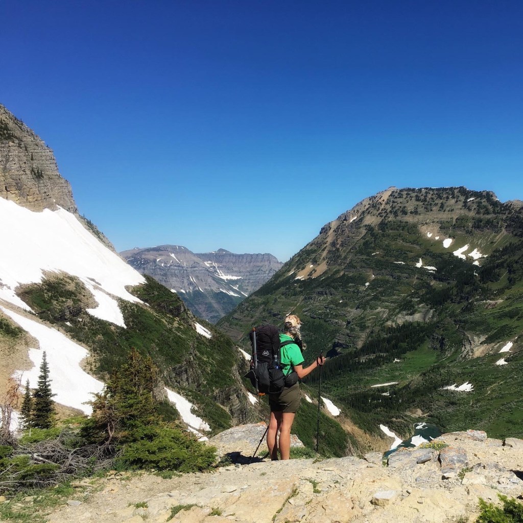
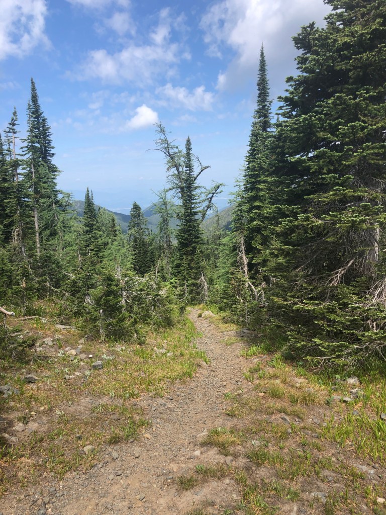
Positioning for the dreaded bushwhack tomorrow. It was a beautiful ridge walk most of the day, although it was quite the long haul to water. I was ecstatic to find pools of water after 9 miles this morning. There’s a trailhead that gives access to Pyramid Lake, then Upper and Lower Ball Lakes which all have campsites. Quite a few locals are camped nearby. Poppy was ahead and met a group of women on a girlfriends’ weekend. “We all hunt and fish,” said the friendly one. All 6 had sidearms “for people, not bears.” Guns don’t bother me, but stupid attitudes do so I did my best not to show my contempt for these chicken shits. At least their dogs will be an early warning system for bear when they enter the girlfriends’ messy camp.

7/17 8 miles or longer

End of the bushwhack

Brennan caught up to us in the morning so we all did the hellish bushwhack together. Turns out one of those women pulled her gun when he turned up at the lake, a totally not scary, harmless guy. I wish I could go all Mama Bear on them, I’m outraged. But I’m not hiking back!

Anyway after about 8 hours, we emerged on an actual trail, bleeding from scratches and punctures. I rolled my ankle, which I’ve done before too many times to count. It hurts for a few minutes, will swell and stabilize, and I’ll continue hiking. So it goes.

We three camped soon after, right near another trailhead that many families were using to hike a short ways to a waterfall.

All of a sudden a helicopter was circling overhead, obviously Search and Rescue (SAR). We all checked to make sure we hadn’t set off our inReach SOS by accident. Then there was another helo with a guy hanging outside on the skids outside looking. Pretty soon a volunteer SAR crew came down the trail from the parking lot with a stretcher. A minute later they came back. I went to talk to them.

After mobilizing 2 helicopters and 2 ambulance crews, it turned out the injured person (head injury in the Falls) was being carried out to the road by a parent.

The Bonner’s Ferry SAR woman told me they’d successfully lifted a PNT hiker with a broken leg the day before. We wondered who it was, just a day ahead of us.

Beans

7/18 12.7 miles for me, 20 for Poppy, LOL!

I started first and immediately made a mistake looking for the trail along the river. I backtracked and Poppy was gone, ahead of me. A few miles later on the road walk, I made another mistake. I missed a switchback 1.5 miles behind me. I checked my maps and stayed on the perfectly excellent gravel road that led downhill mostly to the Priest Lakes and the campsite location we’d talked about. I got there by noon and relaxed at a picnic table, watching the boaters and sunbathers. I went for a swim and rinsed out my clothes. Poppy arrived later and also swam after her much longer, arduous day and we settled in near the privies for a quiet night.

7/19 22 miles

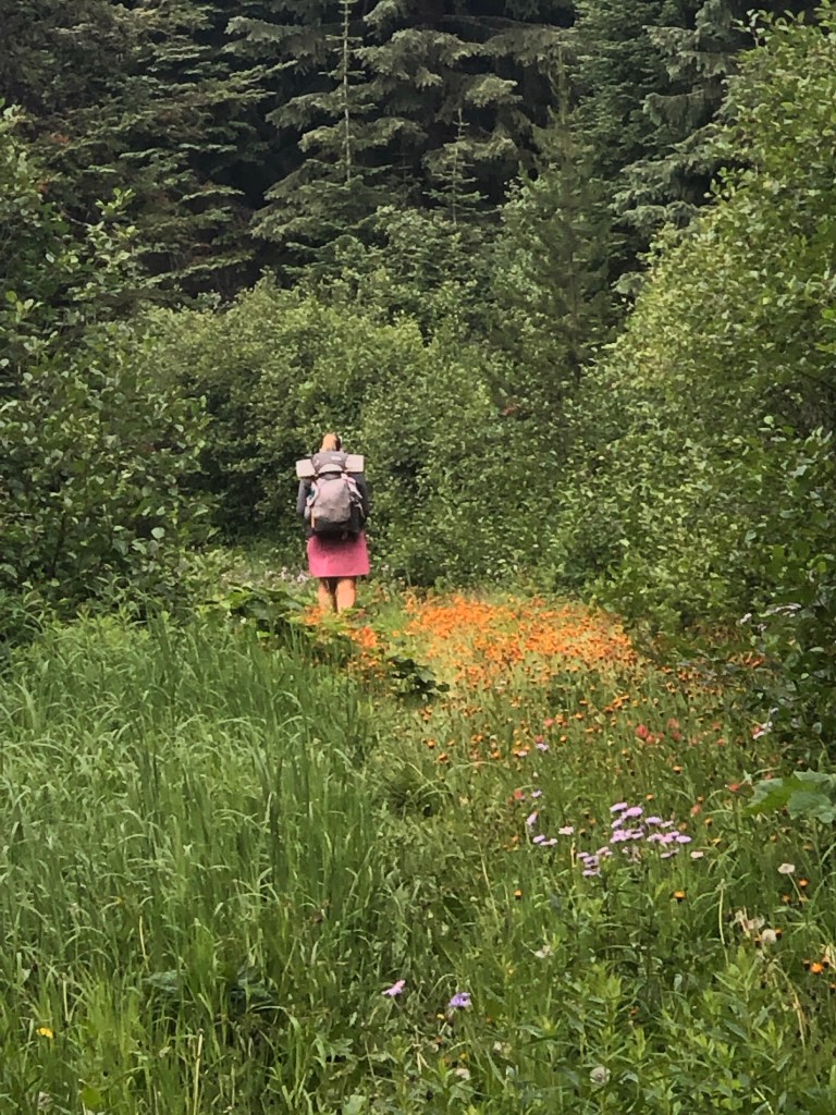
A lovely day! Walked from Upper Priest Lake into old growth cedar forest then onto gravel road.

I was dreading coming off the road and onto trail and the heat and smoke made me worry about having to evacuate possibly. Our Guthook app had recent comments about a very long road walk alternate that would put us into Metalline Falls on schedule, rather than having to spend an unplanned extra night on trail. I got ahold of Poppy, ahead, on the inReach, and we decided to do the road walk.

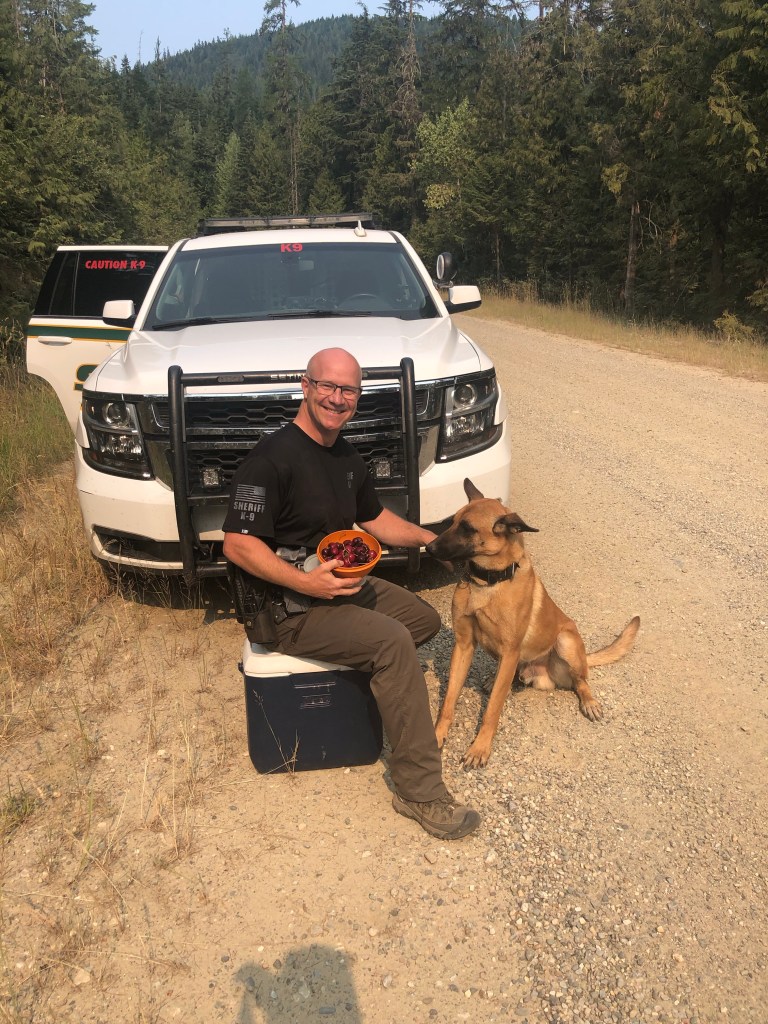
My day was made better when a Sheriff’s K-9 unit came screeching to a halt in front of me. Deputy Darren leaped out of the driver’s seat, grabbed a cooler snd offered me fresh cherries! And I got to pet K-9 Leo! We had a great conversation and I walked on. I knew Brennan was behind and hoped he got the same experience, but Poppy missed it, bummer.

We all 3 wound up camping on the road just downhill from the Pass

K-9 Unit Darren and Leo with trail magic!

7/20 18 miles

Pretty nice gravel road walk this morning turned into a quite painful paved downhill in the heat into Metalline Falls. Like my feet are killing me as I eat a fantastic meal at the Farmhouse Cafe with a tall glass of huckleberry lemonade. Life is great! Met Tix and Nick. The discussion was about Washington DNR closing all recreation on their lands to the west of us and east of North Cascades in 2 days due to worsening fires and heat.

Slide Rule rolled into town in our ‘97 4WD Ford Sportsmobile and took Poppy and I to a motel.

7/21 zero

We loaded the van with Ken, Honey Sticks, Best Western, Poppy, Beans (née Brennan) and drove to Spokane. We’re going to bounce a little ahead of what we’d planned, due to the threatening conditions. Brainstorming logistics, resupply, and routes for a few days. I think we’re going to get a ride to Chelan, take the ferry to Stehekin, walk up the PCT to Highway 20, and walk up that and rejoin the PNT on the west facing side of the North Cascades. Should be cooler and less smoky. I hope. Got to figure out resupply and send some boxes.

PNT Eureka to Bonner’s Ferry

7/8-7/14

7/8 14.5 miles

Another brutal day carrying 5 nights of food, steep ups. Mosquitoes, not too hot though. I’m sleep deprived, I don’t know why I couldn’t sleep in the comfortable, cool Silverado Motel in Eureka. I woke up with a sore throat which sometimes happens when I don’t sleep much or it can be the start of a cold. Really? A summer cold? I”ve never had one but nobody is wearing masks anymore so I guess it is possible. My pack weighs too much but my legs are strong and my breathing and heart are good, I’m just freaking slow on the uphills! And it’s always uphill with too much weight out of a town stop.

7/9 17.8 miles

We walked up to the Mt. Henry lookout. Wonderful views and I found a pair of sunglasses. It was a horrible, rocky steep 4 miles from the lookout down to the creek, then a tough 3 miles up again on one of those pieces of trail that really has never been constructed–so your feet are slanted with the contour of the hill. I finally got a second wind chasing down Poppy who needed water. We camped in another turnout on the gravel road just before you can hitch or walk into Yaak. We’re not going to.

7/10 19.9 miles

Easy 15 mile road walk to Garver Mountain Lookout. This view was kind of unimpressive to me, maybe because of smoke and wind. We continued on through rocks and second growth and hit another dirt road where we camped (again) in a turnout. There were deer everywhere but just a few cars that petered out before dark. A hot, thirsty day and it’s the third day with a sore throat. Smoky too.

7/11 17.8 miles

News of the day! I found the trowel I lost last year. This was my super secret mission of the day–to find the perfect campsite I’d used last year when the big winds and rain hit me on the ridge and I offered Petra and Retune the spot next to me but she rejected it as “unsuitable” and wound up camping a couple miles away and getting their tent flooded. Ha ha, good times.

I guess the sore throat is a cold, not hay fever. Sigh. Today was road to road to trail up through thick green, then rolling up and down ridges and sidehills except for the short rocky bit to Rock Candy Mountain, a lovely granite cirque. I’d love to spend a week there on a volunteer trail crew to build trail where there is none.

It’s just 12 miles to Fiest Resort tomorrow, I hope it’s open for food and drink. And it’s just 27 from our campsite tonight to where we will hitch to Bonner’s Ferry and the beautiful casino/Best Western right on the river–a respite I loved last year!

7/12 13 miles

With a stop at Fiest Resort. Hazel and Brennan were there too! The cold is not better, Advil helps so I got some food then hiked out to the base of tomorrow’s climb to pitch my tent and relax. Poppy was thinking about waiting till it cooled a bit at 4 pm and then walking uphill for 5 miles and camping. I just didn’t want to, plus it doesn’t really cool off at 4pm, it’s more like 8:30 when the sun gets low in the west.

7/1316 miles

Not bad, a well graded up (which is why I didn’t remember it I guess) and a continue down the other side to State Route 95. Just as short a day as last year. I caught Poppy on the road downhill and waited at the junction for about 20 minutes. She went blasting by me to the highway while I hurriedly threw on my pack and followed. No sooner did she get on the highway than a car came into view, she jumped up and down, waved her arms, made begging hands and they stopped!! I think I’ll keep her around, that was amazing. Nice people from Boise had never picked up hitchhikers before. And by 2:30 pm we were in AC washing clothes and ourselves, getting food and cold beverages, picking up her new shoes at the post office and generally utterly thrilled with ourselves.

7/14 zero

Slide Rule arrived and took us shopping. I found a rayon Aloha shirt at the thrift store for a buck! Then we went to visit with the bros, Doug and Dave, up at their fishing camp. We drove back to Bonner’s, picked up Poppy and went out to dinner. Also, Mucinex is helping the stupid cold resolve.

PNT Polebridge to Eureka

Hot Flash

7/2-7/8

7/2 18 miles

Now I’m on trail that’s a repeat of last year. We camped in a turnout where the “trail” (gravel road) has a junction with the Red Meadow Campground. We hauled water only 2 miles to make it possible. It’s been a hot day being pestered relentlessly by an assortment of mosquitoes, flies, and bees. Oh joy!

Hot Flash stopped by to say good bye–we’re going to miss him, but he’s doing 30’s and we’re not.

7/3 16 miles

I didn’t pick up enough water this morning at the last water source which was just a mile from our turnout camp. A couple miles on trail after the dirt road ended, I heard dirt bikes coming at me. They are absolutely forbidden on this trail and it is clearly marked. And the 3 of them were quite rude. The lead guy was barreling uphill at me, didn’t even attempt to cut his speed, give me the right-of-way, get off the bike or do anything. I had to leap off the trail so they could continue to tear up the tread. Not a nod, not a wave, nothing. Jerks. Real men walk on their own two feet.

There’s a few snow patches so I melted some to add to my water supply but there was a lot of climbing and descending until finally we headed up the last climb of the day to Mt. Locke. Poppy and I both found a big snow patch and got out our stoves to melt a couple of liters to get us through the heat of the day. I quickly downed a liter in the heat and bugs and continued down to our campsite. I found the trail I’d searched for last year, now marked by 3 cairns. Poppy didn’t believe the official PNT guide book was wrong so decided to follow the guide book directions. A while later I got her inReach text that she’d cliffed out and was coming back the way I’d gone. Fortunately, the worst blowdown section of all 2020 was cleared! Trail crew rules!

7/4 17 miles plus up to Mt Wam lookout and back to the trail

I was tired today. Started with 5 easy miles downhill to a paved uphill roadwalk, then trail to a miracle find campsite around Poppy’s desired 16 mile day. Bugs, heat, uphill. My big toes from Day 3 are actually blisters under the nail, painful but no way I should pop them–they’ll reabsorb the fluid hopefully. I need to figure out the water–drink more, carry more, it’s freaking hot!

At Mt Wam lookout I found my name in the trail register from last year, with One Gallon signing in after me. I found a plastic spoon for Poppy too since she lost hers and has been eating with a tent stake. The register claimed there was a rabbit living under the shelter but Poppy swore later she saw a kitty. However, she was almost delirious with the heat so I’m hoping there’s not a feral cat living on the top of a mountain all by herself.

7/5 15 miles

This was a beautiful day, walking the cirque, no snow, unlike last year, to the little lake that I blew my sleeping pad on last year. We’re now camped just 12 miles from town, Eureka, our next stop, right on the border. A previous hiker commented that a creature was yelping and growling right outside his tent at this spot so I’ve been yelling “Arf! Grr!” at frequent intervals.

Still incredibly hot, but the bugs are somewhat sparcer. These “low” mile days are actually pretty great. I’m thinking ahead and hoping Slide Rule can help us slack pack the walk between Eureka, along the rail-to-trail stretch and across 1972’s most beautiful bridge to the trailhead just off the road, a 19 mile stretch.

7/6 12 miles to town

Another easy quick day. I got turned around when the trail routed through a golf course (what??), but Poppy caught up and we made it to the Silverado Motel. Sadly, when she was ahead of me earlier, she came across a deer with a broken leg, suffering. She flagged down the next car. “It’s Montana, he was carrying a gun, and was able to put it out of it’s misery.”

We got to town, checked in early and dashed across the street for a wonderful breakfast, second breakfast! Slide Rule arrived later, so after showering and doing our laundry, we all went for dinner. Town days are good!

7/7 19 miles slackpack

I listened to Hamilton, “sang” along, danced and generally enjoyed the quick hike west to east (EABO) back to Eureka. And then super yummy pizza and beer at Fire and Slice in Eureka. So no zero for us but we got the miles done.

Poppy

Pacific Northwest Trail (PNT) 2021

In 2015, Poppy and I met at the San Diego airport while being picked up by Scout and Frodo’s volunteers for a stay at their trail angel home before starting north on the PCT. She met me and hiked the Glacier NP part of the CDT with me in 2018. In 2020 she’d intended to thru hike the PNT but since Glacier and Olympic NPS were closed she opted out but met me at Bonner’s Ferry for a visit. I told her if she hiked the PNT in 2021, I’d love to join her. And so we are hiking!

6/27-7/1 Glacier NP to Polebridge, MT

Poppy

Misinformation Creates Mistrust

We applied for and got GNP campsite permits months before. Arriving at the Wilderness Center in Apgar, the permit people had no current information about conditions in the park. Social media posts were few and incomplete. We were told to carry ice axes for Stoney Indian Pass and a bear canister for Waterton camp since there might be snow so high up the bear hang that our food wouldn’t be safe. We were told campsites were overbooked. None of this turned out to be true. On Day 4 in beautiful Glacier NP we reached the Polebridge ranger station on the west side of the park and I tried to update the ranger there as to conditions—the suspension bridge over Waterton had been hung and 3 miles of trail cleared of blowdown. She brushed me off and said, “we just came off winter status yesterday,” apparently having no idea, along with the permit office 5 days earlier, that trail crews had been organized and deployed. That doesn’t happen on the spur of a moment. Oliver at the Polebridge hostel commiserated with us and said there had been a massive loss of GNP experienced personnel and new people had inadequate familiarity with the system.

Anyway….

6/27 13.4 miles

Hot but good trail. Poppy and I got a good tip from a hiker coming at us crossing one of Glacier’s tippy suspension bridges. Walk one foot in front of another, not wide spaced like you do to stabilize. Light bulb moment! We camped as per our permit at MOJ (acronym for designated campsite Mojowanis on our permit) and met another PNT hiker—Tennesteve.

6/28 13.9 miles

Well we started at 7:30 am and camped at 7:30 pm but Poppy is being careful not to reinjure her knee and is making sure her feet stay healthy, so we took several “shoes off” breaks. We were worried about snow over Stoney Indian Pass, carried an ice axe and spikes. Then we worried about no bridge at Waterton (WAT), but it was put in! The problem was from the Pass down— dreadfully overgrown, couldn’t see my feet, then the blowdown, heat and bugs. Amazingly, the last 3 miles from campsite KOO ( campsite acronym for Kootenai on our permit) to WAT ( campsite acronym for Waterton river) were clear. We camped alone in the designated campground despite being told it was booked solid. I woke to slugs on my tent and in my shoes. A first.

6/29 15.8 miles

Somewhere up Brown Pass I caught my foot on a root and now have a bruised finger, a big old hematoma on my right shin and a black-and-blue elbow. In other words, normal Catwater. Beautiful views, great trail but the incredibly steep downhill to our third and last camp in Glacier Park, BOW (short for Upper Bowman Lake) destroyed my big toes—the usual black toenails will ensue and take approximately 1 year to grow out. Poppy and I are talking nail polish at a town in the future—she’s sporting baby blue polish at the moment, which is somewhat better than what my now red, blood blistered below the nail toes look like.

The best campsite so far, a breeze off the lake kept the temperature cool and the bugs down, yay! There are 6 or 7 other people here, a group who hiked in from the bottom of the lake. As I was relaxing in my tent, one of them asked if I had any antihistamine for an allergic reaction he was having. Oddly enough, I have been carrying a few prescription pills left over from ankle surgery in 2014 that were given to me to fight post-op nausea if necessary. I didn’t need it at the time so they’ve been in my first aid kit ever since. A nurse in his party vetted the meds and they worked to stop his reaction.

6/30 15 or so miles

A crazy easy hot day to Polebridge. We stopped at the Mercantile and got a free pastry just for being PNT hikers! Then we walked to the North Fork Hostel where we sent resupply boxes snd decided to stay in the dorm for 2 nights. We saw Tennesteve again and met Brennan snd Grant, all hiking the PNT, as well as some bike packers and regular people staying in hostel owner Oliver’s eclectic assortment of teepees, cabins and trailers. Grant had come in with heat exhaustion and Oliver took him down to the river and stayed with him while he got in the water and cooled down his body temperature. What a good man. We ate at the Saloon next to the Mercantile after showering and sitting in the shade. It’s so incredibly hot.

Oliver
Oliver

7/1 zero

Tennesteve and Brennan left today. I hung out with Poppy and Grant. It was now just the 3 of us upstairs in the dorm and it was cooler when we figured out the airflow. Oliver is the bomb and his cat Oliver is gorgeous and perfectly catlike.

As Poppy and Grant and I chatted we were exploring trail names for Grant. He has problems with his Sawyer water filter and Sawyer “Squeeze Breaker” came up but then I told the Beth and John (CDT) story, how she proposed Hot Flash for her name due to time-of-life issues and I told her “no.” All 3 of us shouted “Hot Flash” and it’s now Grant’s trail name—how perfect is that name for a super tall, mid-20’s, nerdy guy who has just recovered from heat illness? We all laughed.