Stevens Pass to Stehekin to the End

September 23

PCT Mile 2660

Washington has been really, really tough.  Here’s why:

  1. Cumulative fatigue and weight loss
  2. The weather sucks
  3. Lots of elevation gain in a day, and lots of downs
  4. There’s a bush that smells like stinky feet and it’s everywhere
  5. Friends have been getting off trail for various reasons
  6. When it’s not raining or snowing, the yellow jackets are out and stinging the back of my legs

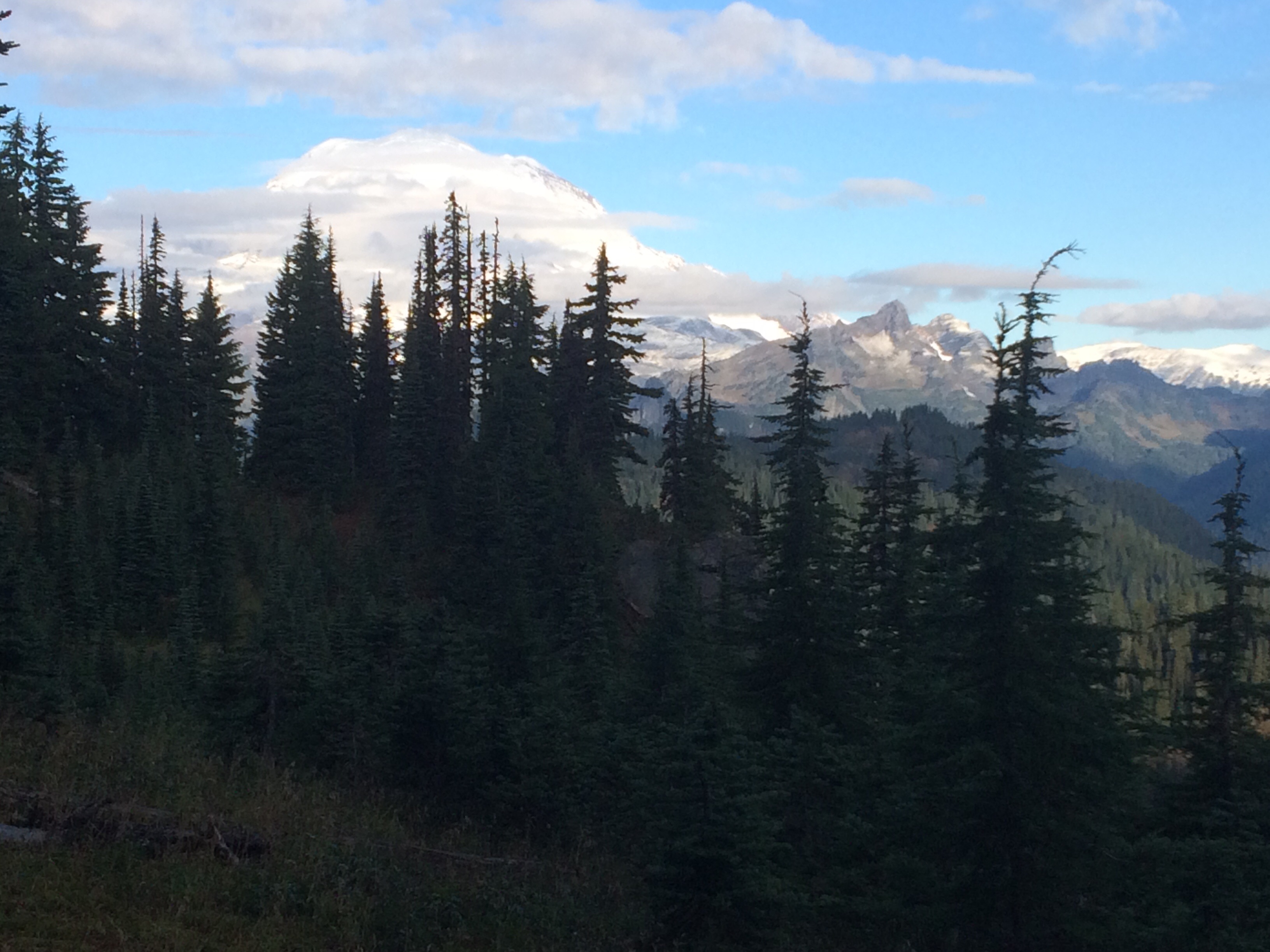
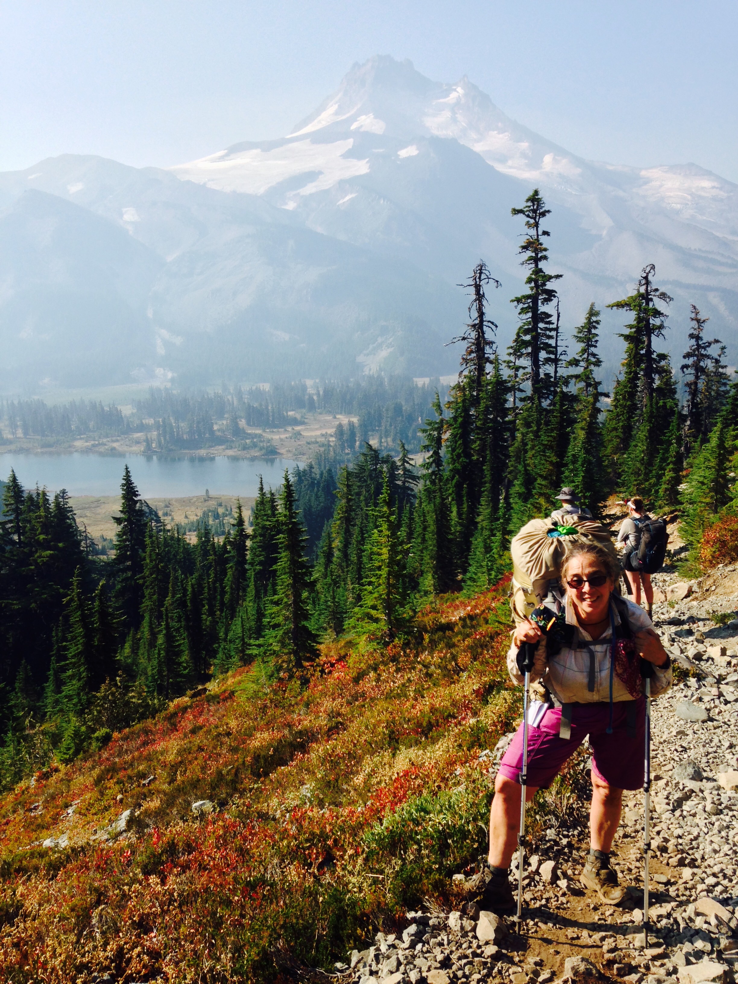
However, the Cascades are stunning!

image
Camped in the snow, walked in the snow
image
Fall colors
image
Beautiful pass
image
Log bridges all along this stretch
image
Reunited with Puff-Puff and Julien from the desert in Stehekin!

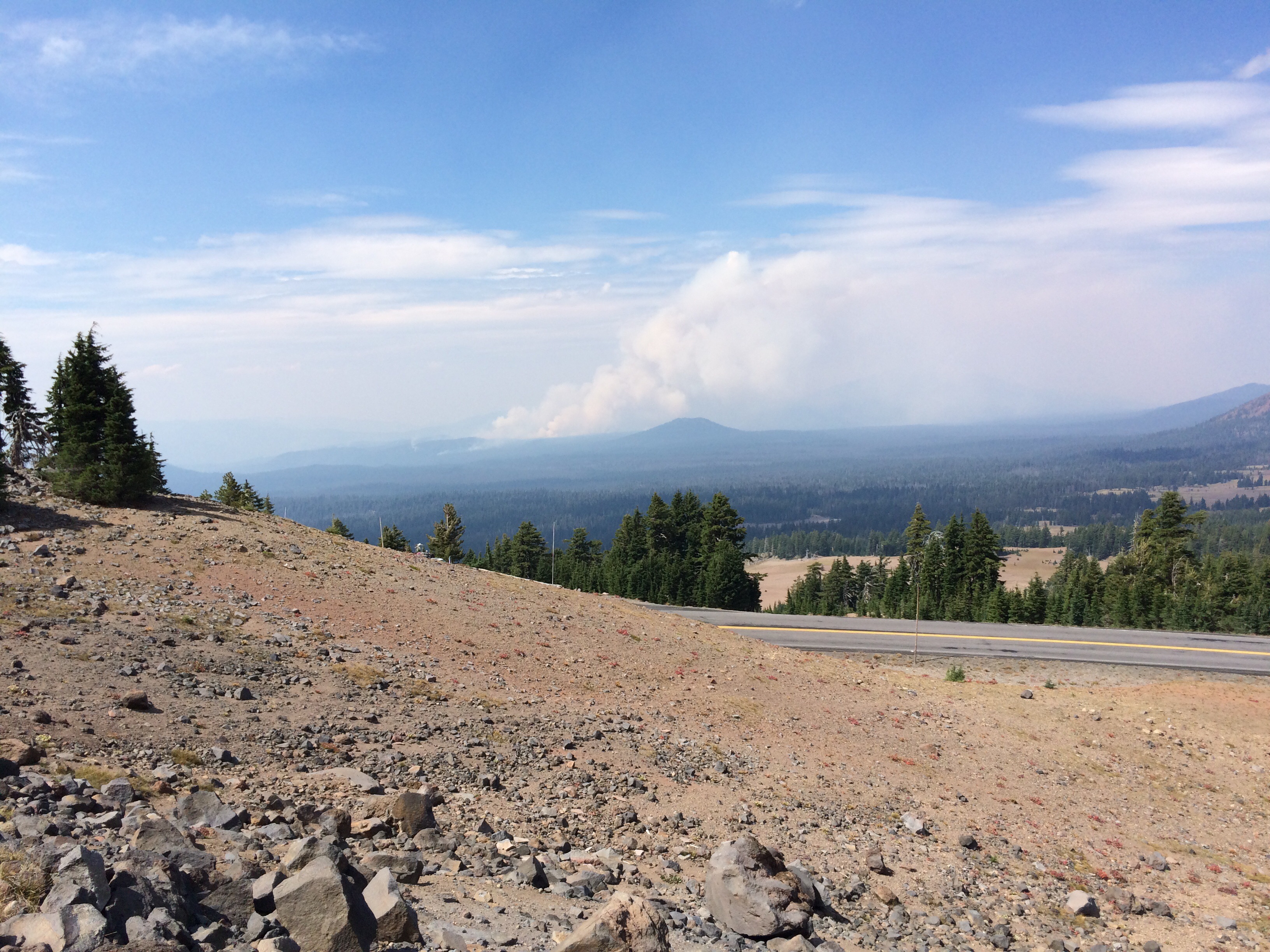
Hikers just a week or so ahead of me had to make a tough decision since there was a trail closure at the Suiattle River due to fire.  This closure had been in place for weeks and those of us hundreds of miles south had been stressing too.  The most popular choice was to get a ride from Stevens Pass to Chelan, take the ferry to Stehekin, and resume the PCT, but skipping 107 miles of PCT.  I figured that was what I would do and had lined up Sarah to drive me.  And then the closure was lifted!  All the crappy weather helped the firefighters.  I am impressed that in the midst of dealing with the devastating loss of life and property and the complexity of fire logistics deploying resources and personnel, that the PCT was reopened to the tiny population of hikers.  Who do I thank?  The US gets so many things right: we invented National Parks, the Forest Service and long distance National Scenic Trails.  Walking along I was thinking about this and humming “….land of the free, and home of the brave” guaranteed to choke me up like nothing else.  If I’m ever cast in a movie and have to cry on cue, I won’t be thinking about losing my favorite cat, I’ll be visualizing an Olympic award ceremony with the US flag in the gold medal position and some poor athlete stumbling over the words of the anthem, hand on heart.

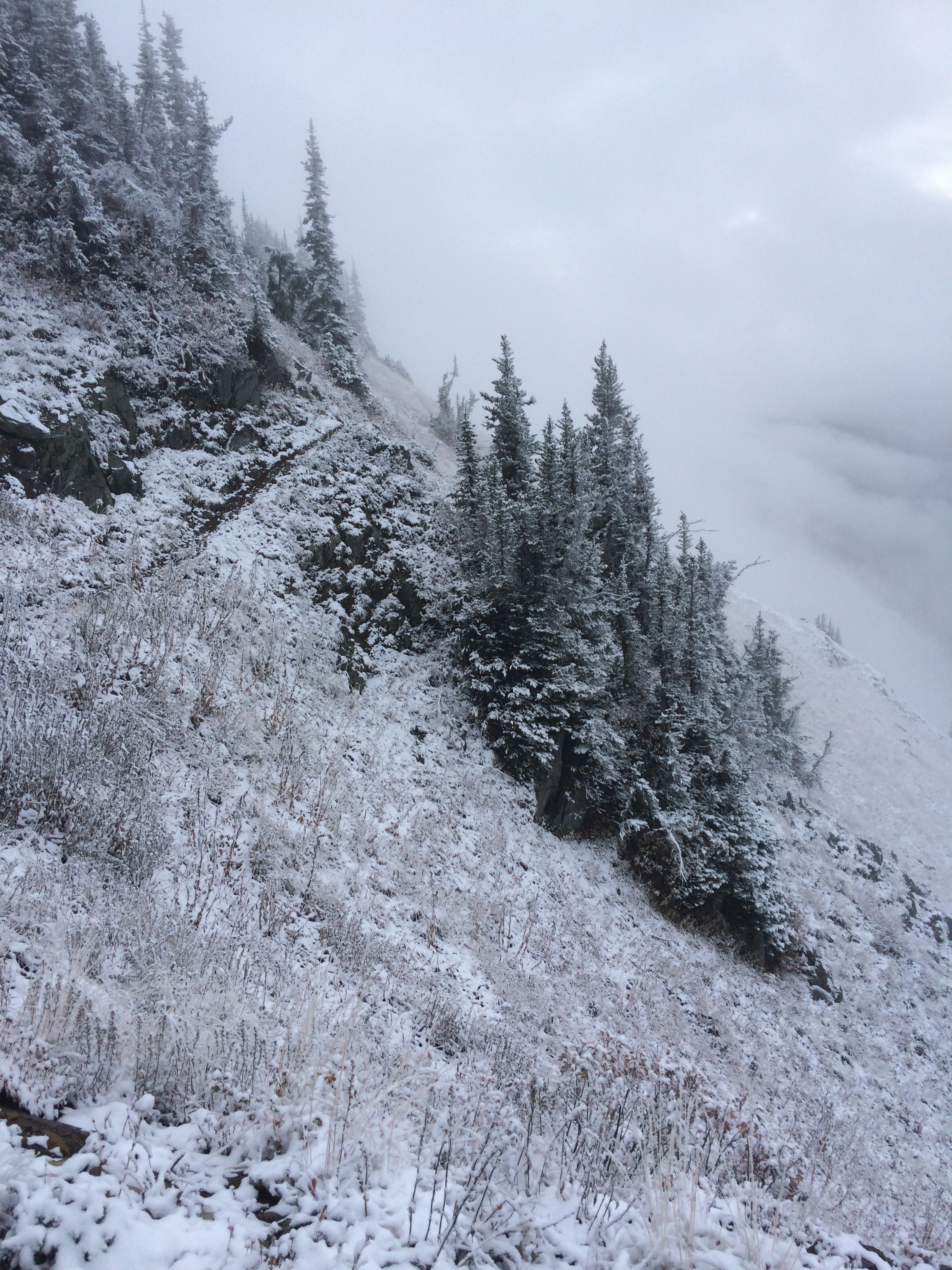
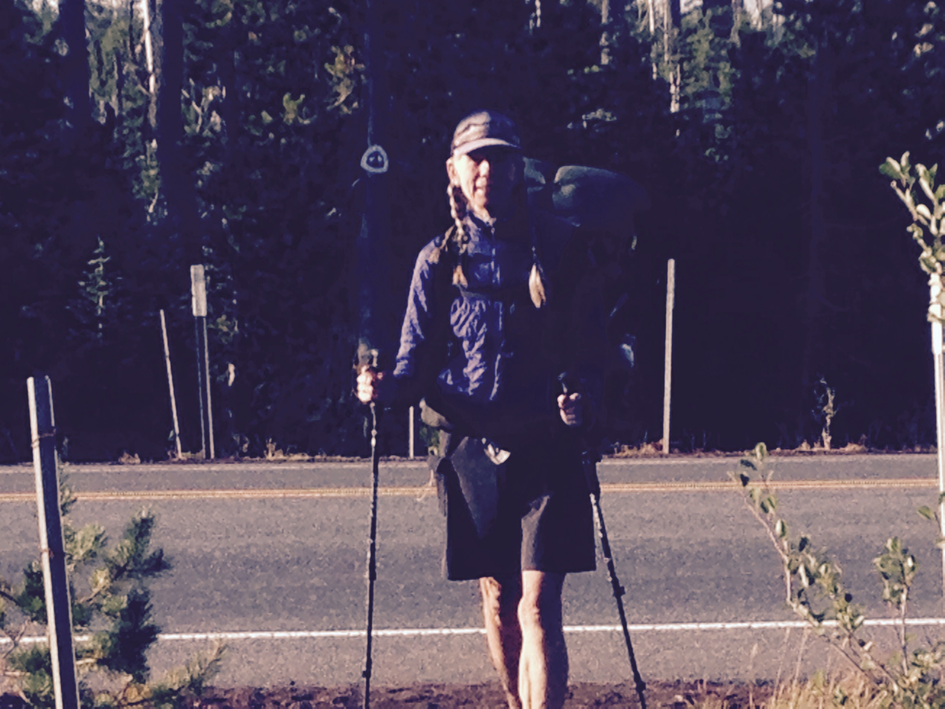
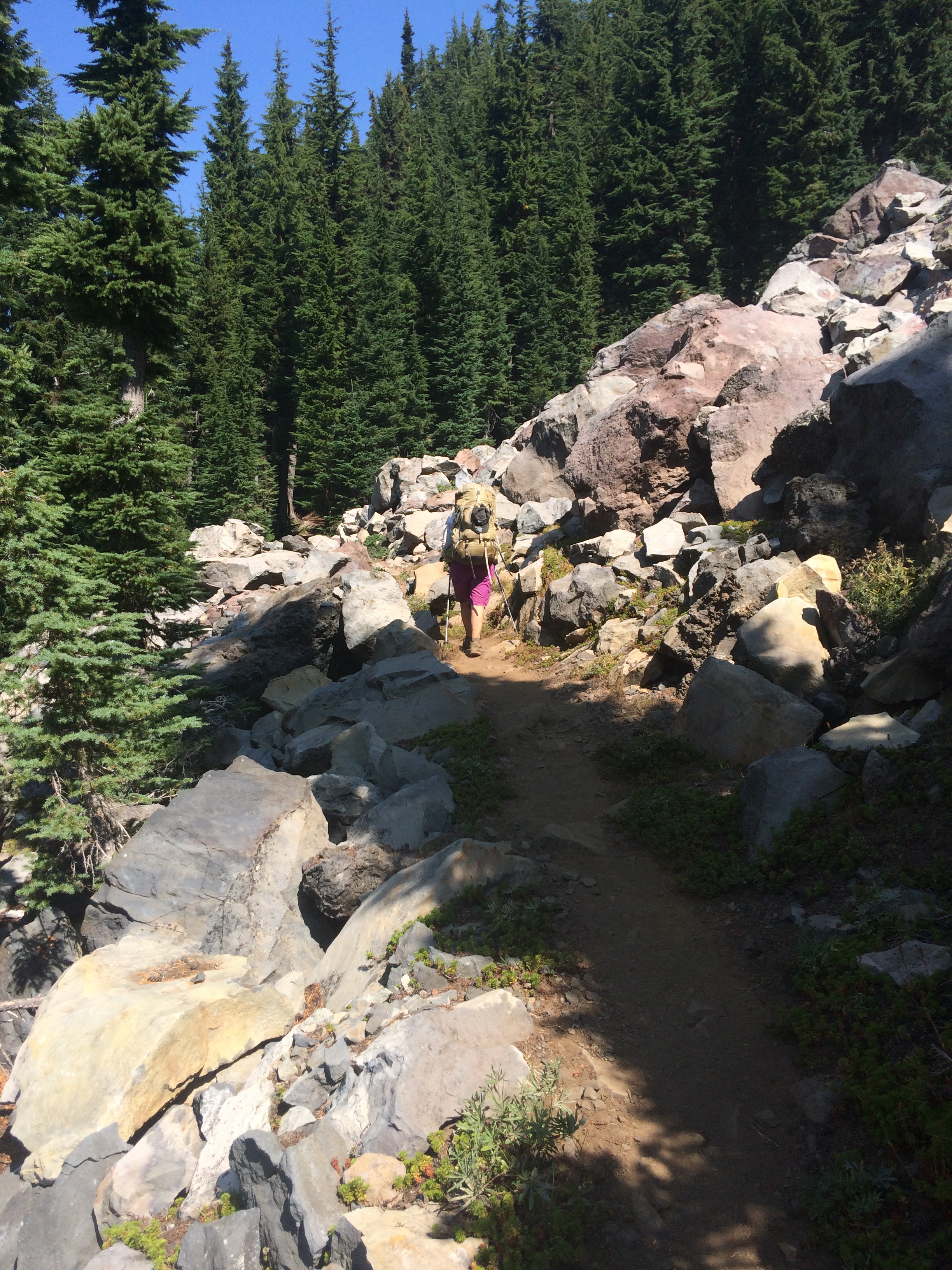
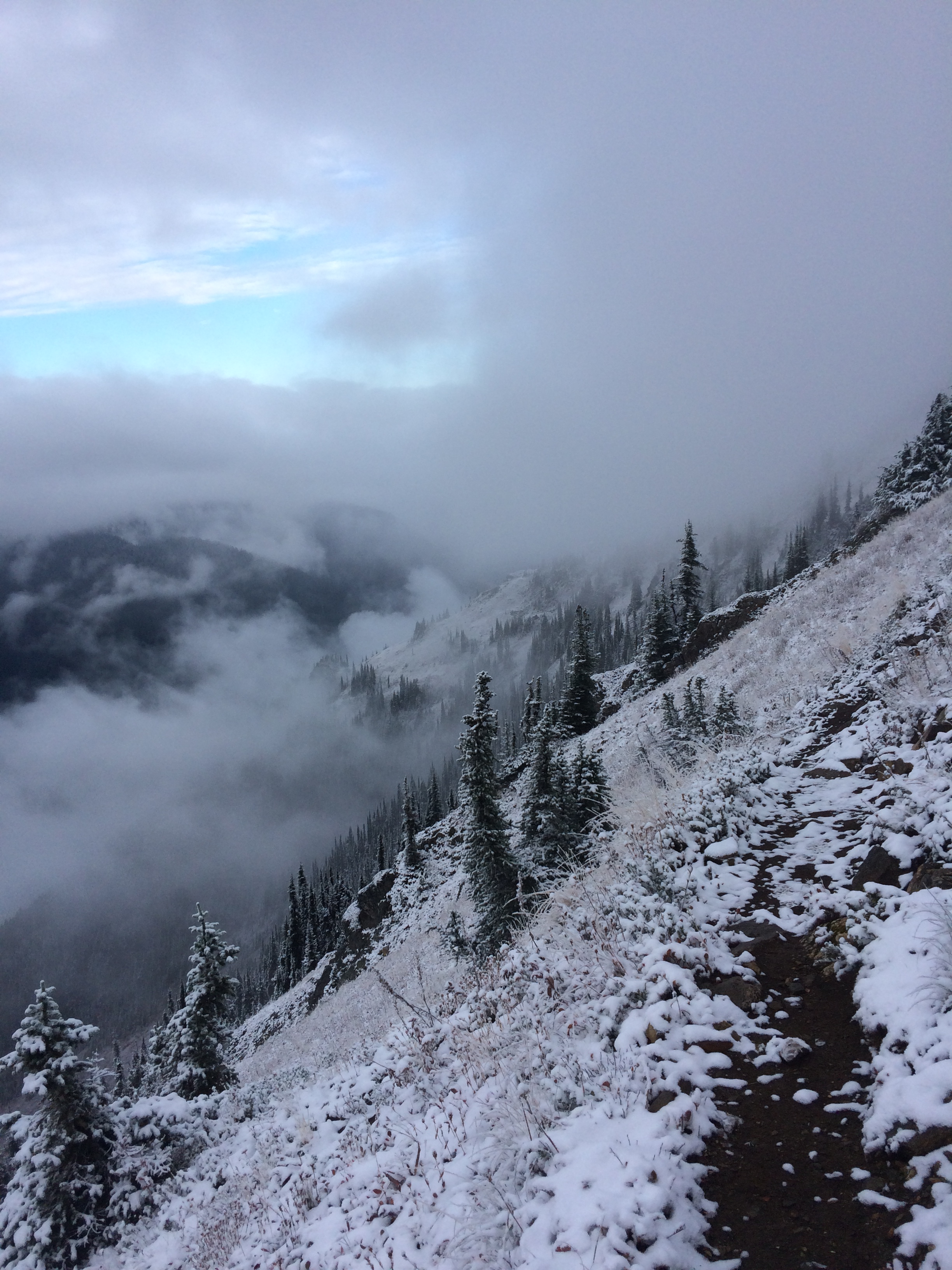
I got a slightly late start out of Stevens Pass, making just 16 miles till dark and a camp in the clouds.  Over the next few days I could not make up the miles, only getting 20-22 a day.  The trail was dreadfully unmaintained, brush overgrowing the trail pulling at my pack and drenching me with water. I couldn’t see my feet and was walking blind.  Trees were down, years and years of trees, that I had to scramble over, under, or around.  The trail was a rocky rut for miles and I picked my way slowly along, it would not be good to get injured so close to the end, plus how the f would Search and Rescue reach me?  So I was 5 nights out, instead if the 4 I’d hoped for.

A quick 7 mile walk to the Ranger Station where a bunch of us got the shuttle bus to Stehekin with a stop at the most incredible bakery of the entire trail.  All you who know my real life eating habits would laugh to see me eat a sandwich, a Dr Pepper, a slice of Quiche Lorraine and 2 blackberry cheese Danish.  And I was still hungry.

I got a room, and started all the usual chores: pick up the resupply box, inventory and make a list of what else to dig out of the hiker box (fuel, TP, more food) or buy at the little store, hang up and dry the tent and bag, shower, laundry, eat. And then I heard a voice I knew scream, “Catwater!” Just like a movie, Puff Puff and I ran to each other, arms wide.  And there was Julien too!  What a reunion!  I last saw Puff Puff in Mammoth but follow her blog alexandramason.wordpress.com and had lots of trail news drifting back to me.  Trail registers, where they exist, told me how far ahead she was, she just got faster and faster, and I didn’t.  Puff Puff, from England, is one of my heroes.  What strength and resilience this woman developed on the trail.  And although the trail closure was in effect when she reached the Northern Terminus, when it was reopened, she made her way back to Stevens Pass and hiked the 107 miles she’d been forced to skip.  Not many hikers have done that.

Julien I’ve been leapfrogging with since the desert.  This man, from Quebec, has unfailingly smiled through the entire trail, all the fatigue, pain, hunger, there he is, cheerful, gracious, amiable.

Waiting for the single washer/dryer in Stehekin, a bunch of us beautiful, scrawny, tattered, shaggy, tired hiker trash sat outside at a picnic table drinking beer and talking about making it to the final resupply before The Border.  I was happy to learn that a couple who met on the trail, that I met in Sierra City, will be a couple in post trail life!  And Sunshine recovered from a badly swollen shin in Crater Lake and will finish the PCT.  Oh I love trail life and all the interesting unique individuals who have walked this path.  Even though I am so ready to be done!

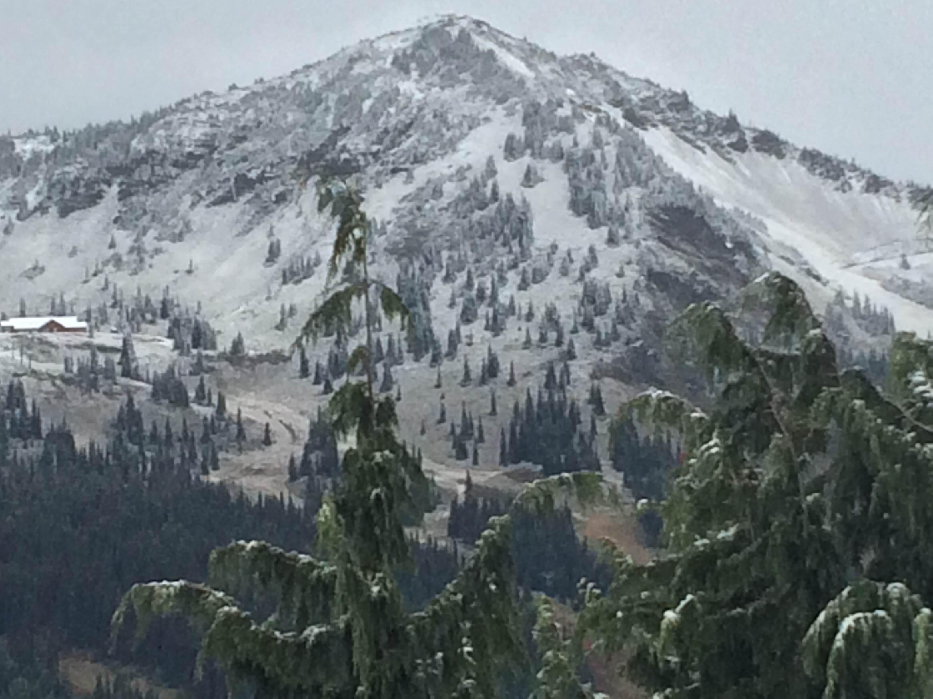
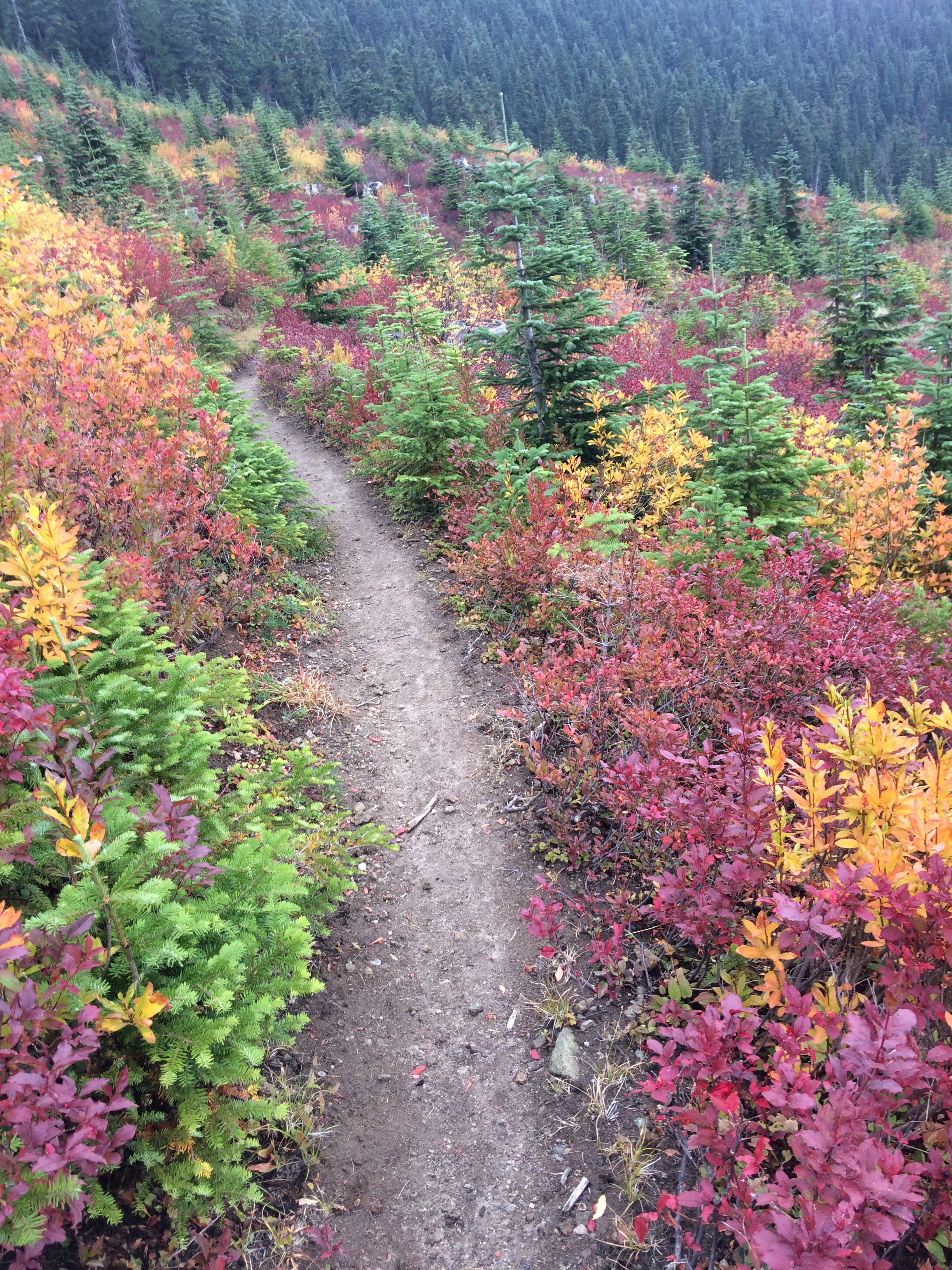
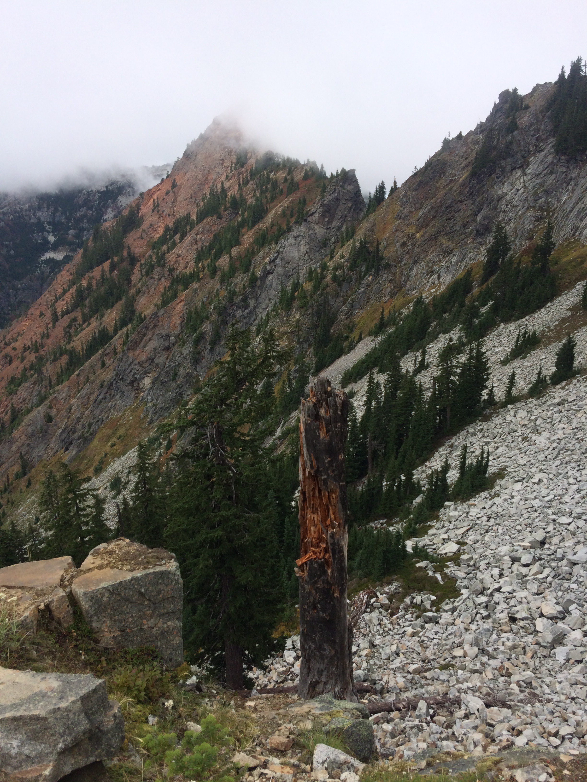
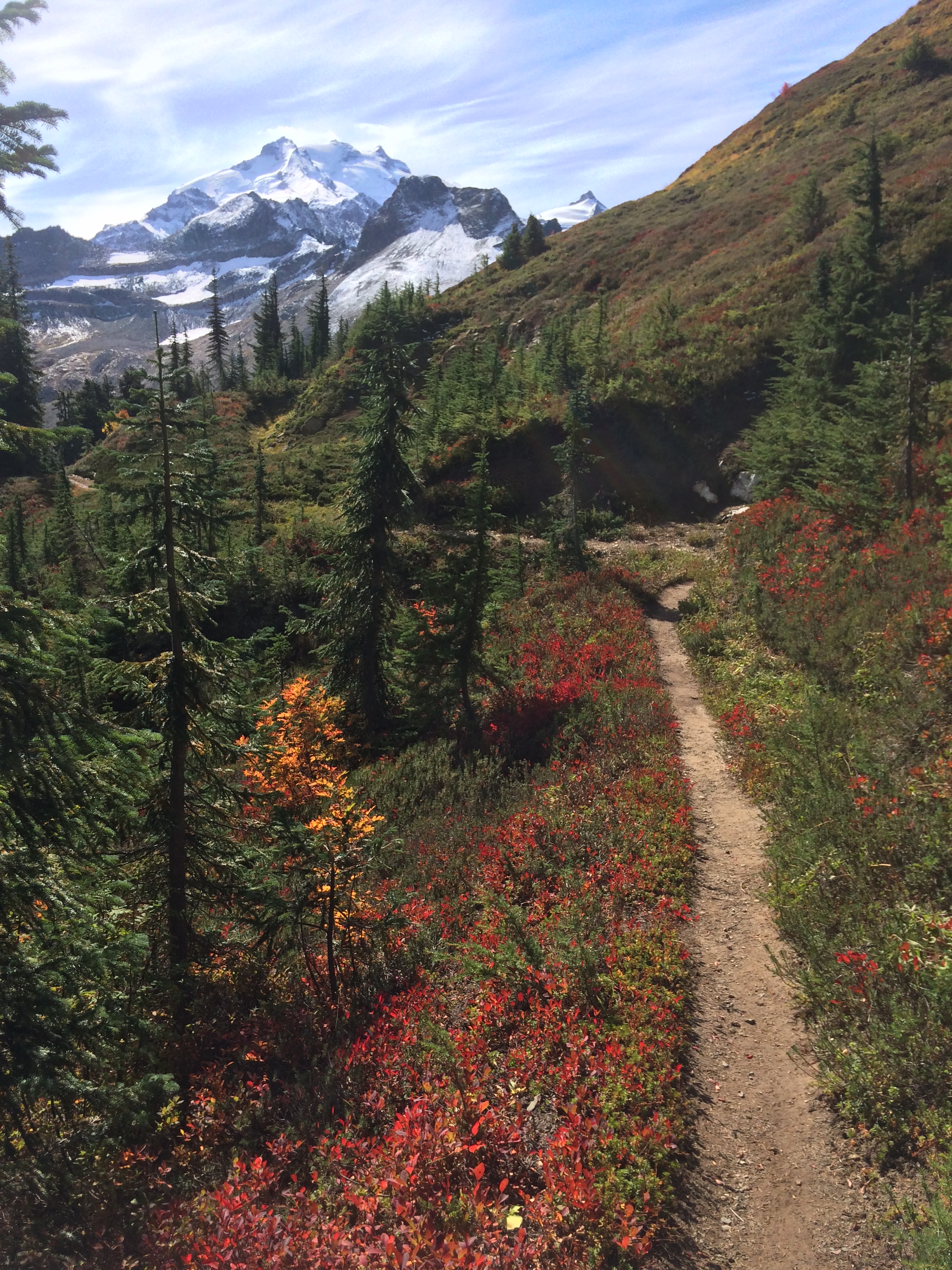
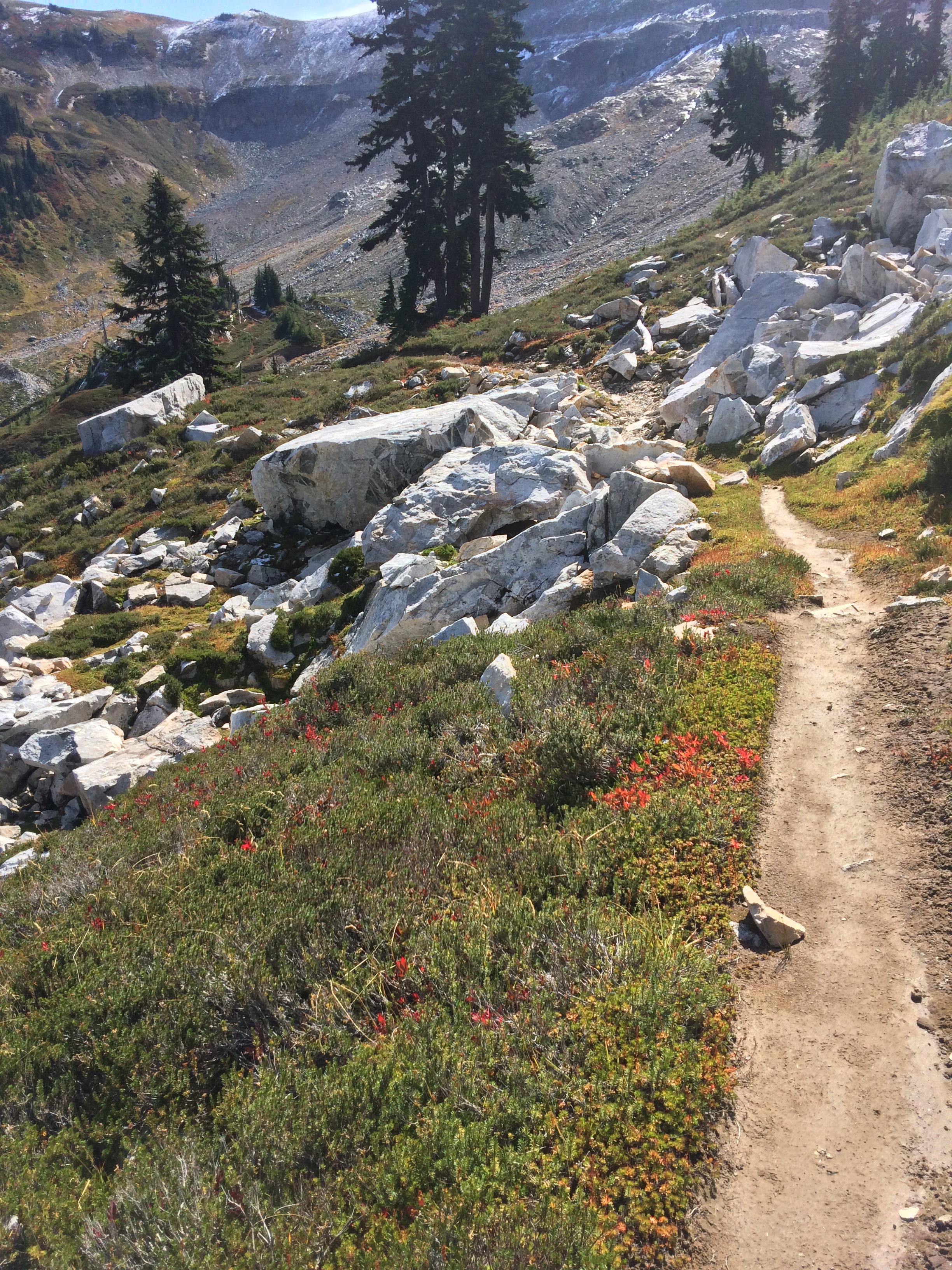
This final leg, I planned very carefully to climb high and sleep low, so as not to freeze at night. The first night the rain held off till 4pm and quit at 4 am, a long enough dry spell that my tent was dry when I packed it.  And then, miracle, the skies stayed entirely cloud free for the next 3 days, 2 nights to Manning Park.  The northern Cascades, all the Cascade Mountains really, are soul freeing.  In the alpine, the blue sky contrasts with the high white hanging glaciers, glacial moraines, and fall reds, oranges and yellows.  Below, the lush rain forest, Devil’s Club leaves as large as garbage can lids, ferns, maple, cedar, the stink of low bush cranberry and decaying plant life.  Winter is coming.

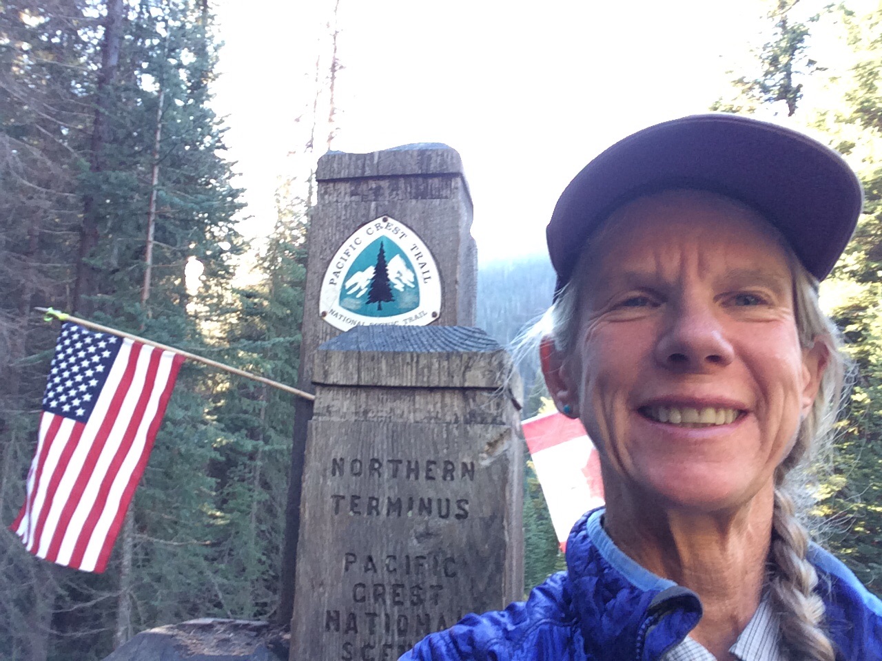
I passed the Doobie Brothers and 2 other thru hikers heading back to Harts Pass.  Not everybody enters Canada after making the Northern Terminus of the PCT at The Border.  Big grins, we all congratulated each other on thru hiking the Pacific Crest Trail from Mexico to Canada.

On my last day, less than a mile from Manning Park, Dan comes striding down the trail towards me, a little misty eyed behind the grin. I confess I was too.  I did it!

How is it possible I made it to the end?  So many did not.  I felt content when I got to Kennedy Meadows south, 700 miles of The Desert behind me, the portion of the trail I was most intimidated by.  All the miles and country I traveled through after that were bonus.  I saw my Dad, devastated by dementia in late June, and kept hiking.  I got off the trail in late July to gather with family in the wake of his release from a life he didn’t want, and got back on the trail a few days later. I sprained my ankle in Oregon and kept hiking.  I flirted with hypothermia in Washington and was fully miserable, stalled out in White Pass, but headed back out on the trail.  Velcro and I talked about what it took to hike the whole trail, he concluded it is 50% physical and 50% mental.  I think it gets more and more mental when the going is tough.  I know that I had to toughen up mentally and that what gave me strength was love.  You, my family and friends, old and new, gave me power through your love and belief in my ability to finish this long, long trail, you all are part of this journey.  Life is meant to be lived with people.  Life is meant to be lived with love.

Fun day, glad I have switched from trail runners to Gortex lined Keen boots

White Pass to Stevens Pass

September 12
PCT Mile 2461

I finally saw aountain in Washington! Rainier?
I finally saw a mountain in Washington! Rainier?
image
This place will be on the PCT Snowboard Trek

Fall colors light up the gloom hiking in clouds and overcast
I'm gonna freeze again
I’m gonna freeze again
Abandoned weather station with unlocked doors and electric still on = sanctuary
image
Drying my stuff out inside the abandoned weather station
image
I love the Cascades
image
Morning view looking north from my tent 15 miles south of Stevens Pass

Leaving White Pass Village Inn was difficult.  At least it wasn’t raining.  The first day went fine and I camped after about 21 miles.  The next day it rained, then hailed, then snowed, as I climbed and descended, climbed and descended.  I got to a campsite after a hard day, but kept going another hour to get below snow line where I pitched my tent in saturated ground under dripping trees.  It was a cold, uncomfortable night with condensation dripping off my single wall tent onto my down bag.  I packed up and hiked in the rain to the Urich Cabin where I hung all my wet stuff to dry over the wood stove stoked by several south bound hikers.  They told me about the abandoned weather station 27 miles north, which I reached the following day after another cold, windy, wet night.  Creepy by myself, “U.S. Government No Trespassing,” signs on the unlocked doors.  It took 2 hours but my stuff dried, then the rain stopped and I went on a few miles to camp on a long abandoned dirt road, a wonderful campsite.  As it was getting dark, I heard a solitary animal yip once about a 1/4 mile away, a yip with a low throaty bark undertone.  After a few seconds, the same voice yipping, no reply.  A coyote? Fox? Wolf?  After half an hour of this, it was completely dark and I yelled into the blackness, “Knock it off!  I’m trying to sleep!”  It didn’t work right away but eventually it turned into a beautiful completely quiet night.

My hiking buddy from Day 1 at Scout and Frodo’s up to Big Bear at mile 266, met me at the trailhead 5 miles before Snoqualmie with trail magic.  Poppy brought donuts, chocolate milk and IPA.  I have missed her company for so long, somehow we had found ourselves on the same general hiking program and had hiked in to Big Bear Hostel together where she woke up the next morning with a devastating infection in her foot and had to go home.  We chatted while I ate donuts, then she took my pack and I slack packed the final miles to Snoqualmie.  It was awesome to sleep in a bed, dry out everything thoroughly and catch up with hiker friends Captain ( who I’ve known since the desert), Rainbow, Splash, Risng Sun, Zackley, Rainbow, Trail Bride and Cope.

I hiked out in clear skies.  The first night I got up to pee in the middle of the night and got quite a shock. Stars!  The Big Dipper with just below, bands of white Aurora Borealis dancing from right to left.  I camped the second night near a little creek and it didn’t rain.  The third night was at high elevation and warm and I awoke to a beautiful view of Mt Baker (I think, our maps only show the narrow corridor the PCT travels through).  Velcro camped next to me.  The next day we caught up to Zackley and made it to Stevens Pass where trail angel, Chris, retired NPS, waited to give hikers rides to Skykomish and Baring.

I checked in to the Cascadia Inn and waited for my daughter Sarah to drive out from Seatle after work.  What a lovely, well kept old railroad town with friendly, helpful locals!  Sarah brought me the skookum gear I ordered: boots, new socks, waterproof mitts and an additional bag liner.  Also she brought IPA and a mini van to shuttle hikers.  Over the next day and a half she met or gave rides to Rising Sun, Velcro, Sodwinder, Not A Bear, The Doobie Brothers, Bender, Wall-eeand Snow White.  It made me so happy to share a bit of trail life with Sarah!  While I have been hiking, she has been busy bragging about me, recruiting trail magic and generally increasing PCT awareness.  And toward the end of our visit, she calmly and quietly said, “I’m thinking about hiking the PCT in 2 years.”

PCT Mexico to Canada: I did it!

image
Berry filled bear napping on a ledge above the trail out of Stehekin
image
One of the hundreds of Blue Grouse loitering around begging me to bean them with a rock and cook them on my Jetboil
image
At the Monument
image
Quick 5 mile hike into Msnning Park, woohoo!

I’ll catch up the blogs, but I reached the Northern Terminus of the PCT September 22 and hiked into Manning Park this morning. Woohoo!!!

Bridge of the Gods to White Pass

August 31
PCT Mile 2292

“All I have to do is get across the stinking bridge and I’ll be in Washington.” There seems to be another panic in Cascade Locks, OR. People are deciding this is the end of their hike, they’ll save Washington, in its entirety, for another time because of the smoke and fires and trail closures I guess. Having been through the panic at Kennedy Meadows where people skipped the Sierra when they suddenly realized that “low snow year,” did not mean “no snow year,” I surround myself with positive thinkers: the Ravens, GG, Zackley, Velcro, Rainbow, Milkshake, Sticky Buns and others resupplying in Cascade Locks. I think I’ll keep going as far as possible and hike what’s not closed. I won’t be disrespectful of communities who are dealing with fire though. But the conditions and hiker recommendations change daily and I’ve got hundreds of miles of Washington before the big fire complexes up north.

GG and I hiked across the bridge after she asked the toll booth attendant to take our picture. 11 miles of uphill and another 8 to camp and water where we were joined by Zackley, Velcro, Fish Out Of Water (a marine biologist!), and Apache. A tree fell in the night, right next to the lower tent sites, waking up everybody. Spooky.

Hiked the next day through trees and smoky gloom to a beautiful little pitch with a view to the south. Oh, and trail magic during the day just after I bitched that 85% of the trail magic caches were empty when I passed them (beer, soda, sweets, chips, conversation) with 2 guys who hiked the PCT in 2013. Trail Bride and Cope were there, maybe they still are, haven’t seen them since. Feeling the impending weather prediction for 5 days of rain, I pushed as far as I could the following day, camping again by myself next to the trail. It started raining that night and continued off and on through the day. Oh joy.

Zackley, Velcro and I reached Highway 23 mid afternoon, where a 24 mile stretch of trail is closed because of fire. The go-around is 11 miles of a paved highway walk followed by 16 miles of dirt roads. I headed out and within an hour the 4th car heading in the opposite direction stopped, backed up and gave me an orange  and an IPA. More trail magic! Made the rain seem less wet and the pavement less hard. A couple miles later, the first vehicle going my way stopped and offered me a ride. I hesitated until passenger Rising Sun leaned over and said, “He’s going all the way to the trailhead.” Done deal. Zackley and Velcro behind me had turned it down. 2 hikers ahead said no. The last 2 spots went to Apache and Fish Out Of Water. It was a really long drive and I was very grateful since I have been eating deep into my food bag and knew I’d be on short rations. Camped after a shortish 21-mile day in the rain.

The next day was a 6 on the miserable scale. Poured rain, the trail was ankle deep water, and uphill. Since all my socks were wet and it hadn’t been dry enough to dry anything, I put ziplock bags over my wet socks, which kept my feet from being completely numb. I met Blazing Star heading back down the trail. She attempted the pass and Knife Edge earlier but she said it was a white-out, couldn’t see the trail, she was completely soaked and that she would need to go to Trout Lake to dry out and get more food. She is an extremely competent and experienced hiker and I trust her judgement. Hmm, Rising Sun’s latest weather update was that it might clear a bit the following day. I would be cautious the next day and retreat if necessary.

I camped at Mile 2272 with Apache and Fish-etc. and headed out the next morning, telling them to call Search and Rescue if they saw my footprints going off the knife edge. I met up with Middle a bit later and together we navigated where the trail vanished into scree and a snowfield. A little sketch. We kept climbing and found the trail in a pretty big wind amongst the clouds. No view, wind chill, felt like hiking at home on top of the Chugach Mountains. I know how to do this. I was glad to get over and back down in the trees. For the first time, I used my inReach satellite text to ask Dan to get me a reservation at the White Pass Village Inn. I just needed to allay my anxiety that I would never be dry or warm again. My tent had been soaking wet for days, my down bag still kept me warm although it was damp. Western Mountaineering sleeping bags are the bomb! One of the toughest days I’ve had, call it a 7 on the miserable scale. That freaking hike down from San Jacinto to Cabazon is still my top miserable day. It’s too cold to stop and eat but you need the calories. You’re not thirsty but you need to hydrate for warmth. I’m pathetically skinny, I have no body fat left to help insulate me or burn for heat. My ankles and feet hurt and I’m out of Advil. It’s so dark under the trees and clouds you need a headlamp. The worst part? I’ve been out of Snickers for 3 days. And then I ate the last of my bacon jerky. Call in the heli’s, this is getting serious. I stumbled in after 6 to a warm welcome, guess I’ll live to hike another day.

I love the White Pass Village Inn. Hikers are everywhere! Saw Unbreakable for the 1st time since Idyllwild, they’ve done the flip flop. Saw the Doobie Brothers for the first time since Chester. Wall-ee and Snow White are here. Milkshake and Sticky Buns are hiking out. Zackley is here waiting for Velcro who had to hitch from Trout Lake to White Pass to pick up his replacement hiking Chacos since his current pair rotted off his feet and then go back and hike the trail. GG came in this morning and we’re eating dinner together.

If we ever get winter in the West again, I’m going to do a snowboard tour of all the snowboard resorts the PCT goes by from Washington way down to So Cal, including this place, White Pass. Hey, USASA Series Directors, watch for me at your contests. Catwater hikes, Catwater rides!

2000 Miles, A Thousand Words

August 21

PCT Mile 2096

image
Obsidian mountains
image
Obsidian everywhere
image
Back to braids and a jacket
image
Catwater and Tarcey
image
Tarcey in the Hood
image
Made my day finding this message in the dirt!
image
Tarcey on the trail

I loved the the stretch from Shelter Cove north. Tons of little lakes, flattish, not hot.  I walked into lava fields, which were hot and the footing stunk, but one night I had a perfect campsite on a bluff under trees with a view of the sunset, and also sunrise, both red and brilliant from all the forest fire smoke.  A small spring was nearby and I was utterly alone, perfectly quiet.

I know a picture is worth a thousand words, but  my phone photos of the special Obsidian Area do not capture the glitter of this place.  Black obsidian hills and hummocks on a rare sunny day sparkled like crystal shards in a giant garbage dump of volcanic activity.  Huge boulders of obsidian, rounded and matte black, were scattered on the landscape as if the old gods had spit out enormous wads of black licorice chewing gum.  I wondered about the first people discovering this treasure of tool making materials and what trade routes this stone has traveled.  I drank water bubbling from the ground, a spring with arrowhead and axe head sized obsidian rocks piled like scree all around.  Were some of the edges chipped and worked by human hands and then discarded, imperfect?

Hiked the following day uphill through massive fields of rotted black lava on a loose, slipping trail of red cinders.  As difficult as it was, the unknown trail engineer and construction crew did a stellar job with the alignment and grade.  The downhill was horrendous though, with chunks of lava sticking up through a bed of sand and dirt.

My friend Tarcey joined me at Big Lake Youth Camp, a 7th Day Adventist camp that has a hiker room, showers, laundry, etc. before mid-August. I got there the day after the last day of camp and it looked like a personnel bomb had gone off. Felt like The Walking Dead were imminent. Got my chores done and Tarcey and I camped a few miles up the trail by a pond.

The next days weren’t kind to Tarcey, heat, uphill and bad water tested her limits.  She made it though and returned to the area a day or two later to pick me up from the trail and to a motel: shower, laundry, food, beer and battery charging! And back to the trail so I could slack pack the last 5 1/2 miles to Timberline Lodge.

“0h goddammit,” I yelled as my good ankle rolled on a loose rock, the pain as ligaments or tendons or something wrenched out of place across the bone.  I could see my hike ending just as suddenly.  I nearly blacked out but really I’d hiked last year on a far more painful injury of my other ankle, maybe the inevitable swelling would allow me to keep walking. RICE is overrated in my personal experience.  “2000 miles is all I get?”  I limped 3 miles to Ollalie Lake, a mere 13 for the day and considered my options.  A day or two off to see how bad it was?  A 2 hour hitch to a doctor?  I went to the tiny store and bought an IPA, an Ace bandage, a bag of Fritos and 2 Hostess cherry pies.  Trail tranquilizers.  I took some Advil and camped there.  The next morning my ankle was puffy but I could walk without limping or much pain.  The trail was flat and soft, I camped after 25 miles, about 5:30 to rest the ankle.  It’s healing. I’m hiking on. Don’t try this at home. I’m an idiot.

I’ve talked about it before, how your perception of time changes on the trail. Time is how many days of food you carry, resupply to resupply, a 100 miles. I think about going from South Lake Tahoe to Sierra City or from Mazama Village to Shelter Cove.  On the trail, there’s a daily goal, where’s the next water? Will there be a tent site in 25 miles or should I stop earlier or go later? We ask each other, “Where’d you camp last night?” “Oh, around 1879.” The miles measure time, we hike 2.5 miles to the hour, or 3, we go 10 hours or 12 hours or longer, day after day. Some of us get up early, some get up late and walk till dark, or past. The 100’s just seem to tick by. A hiker will suddenly appear and I’ll have to place him by what mile I saw him last, what place, never what week or day, the weeks and days are anchorless, they don’t attach to miles or resupply locations. The people working in trail towns tease us for never knowing what day of the week it is. We know our start date, we know we’ll run out of trail someday and go back to real life, but for now there is the trail we walk every day, always different, time consuming yet timeless.

Ashland to mile 1950 Photos

Miles of burn areas
Miles of burn areas
Smoke near Crater Lake, they closed the trail shortly after I went through
Jackie and Catwater heading into the trail
image
A shadow of my former halibut shaped self
image
Crater Lake in the smoke
image
In the burning hot lava
We are here
We are here
Beautiful silver trees from an old burn
Silvery burn area
Silvery burn area
Not so high highest point
image
Crater Lake
Lots of smoky views
Lots of smoky views

Burning Hot Lava

August 14
PCT Mile 1950

Nice phrase, eh? Credit goes to my kids, who could never just say “lava,” it was always “burning hot lava.” So wherever I see the stuff that’s how I think of it. There was no burning hot lava on this stretch, just lots of the cooled down rock, and since I’m stil just writing this blog on my phone I’m not going to Wikipedia the proper terms for the massive fields of black scree lava, the trail built of red cinders and all the other manifestations of volcanic activity that Jackie and I walked through when we hit the trail out of Callahan’s near Ashland.

Jackie joined me for 3 days, doing 18 mile days right out of the blocks, pretty impressive! It was fun sharing the thru-hiking experience with a friend. She met Sparrow, and listened in as we shared trail news and gossip of hikers ahead, behind and off the trail. We got to know The Ravens, an extraordinary family of 4, who I last saw Day 3, Ann, Tim, 10-year old Little Crow, and 13-year-old Bling. Look for their daily blog on the PCTA website. We talked with Woodpecker, whose wife was also a guest-hiker for “3 weeks or 3 months.”

Jackie left the trail with a box of rocks to mail for the Ravens, and gave a ride to the trail angel who made us all breakfast burritos back at the Lake Isabella campground. Oh, and Keith and Nick brought me a burger and beer and their dogs!  I had to let the dogs get back in the car though, dang.

Back on the trail and a rather boring slog to Crater Lake National Park, enlivened by discovering Milkshake and Sticky Buns also took time off. I stayed in the backpackers section at Mazama Village, managing to do the usual chores (shower, laundry, resupply, drink beer, charge all the devices, eat real food) by 8:30 the following morning. I hiked up to the PCT alternate route, the Rim Trail, and soon picked up 6 liters of water for a 29 mile dry stretch, and I picked up an attitude.

So here I am, clean, silver haired, amiable, with a backpack and hiking sticks, walking along the Rim Trail which parallels a paved road with frequent tourist turnouts filled with frequent tourists venturing a yard or two down the trail to peer over the rim into the lake. As on the regular PCT, I greet everyone, but this bunch avoided eye contact, even the uniformed Rangers giving informative talks couldn’t say “hey”, a few tourists actually scuttled away when they saw me approaching. I suggest Crater Lake National Park institute a fundraiser to provide additional helpful signage along with the usual signage indicating bears are present and you will fall off the Rim if you get too close:

WARNING: PCT HIKERS IN THE PARK

May be identified by their lean, hungry, filthy appearance, possible odor, backpacks, rapid walking gait, and slightly blissful smiles.

Do not speak to them. They may bite. Do not try to walk past them, they’re faster than you.

Avoid eye contact. If one approaches you, quickly place whatever food or beverages, especially beer, that you have on the ground in front of you and slowly back away. Don’t watch what happens next.

OK, so I was tired, carrying a to of water and food and made it just 20 miles, camping by the side of the trail on lovely piles of duff in a tiny forest growing back through downed and rotting trees from an old burn. Slept great. And determined that if I hiked 29 miles the next day I wouldn’t have to haul water to camp. So I did, lovely soft, flat Oregon PCT, longest miles in a day so far and it took me less than 12 hours. Woot woot.

Sometimes it seems like you just pound miles to get to your next food box. Shelter Cove Resort is beautiful, I got there in the morning, stayed for 5 hours (gotta charge that battery charger, takes time) and ate 2 Costco poppyseed muffins, 1 Dr Pepper, 3 Gatorades, 1 tiny bottle Chardonnay and a large hot dog. Visited with other hikers including SOBO dog Echo and her man hiker. I love dogs, I love seeing them on the trail and in the towns. I love horses, mules, grouse, deer, naughty chipmunks and squirrels. I would love kitties on the trail but nobody brings them, so I’m holding out for a bobcat or mountain lion or Lynx or anything else sneaky and feline.

It has been smoky, and it’s getting cool at night. Sunrise is later.  Seasons changing.

Just when I didn’t think this trail could get any better, celebrity hiker Billy Goat appeared hiking south. Go watch the wonderful PCT documentary Go Tell It On The Mountain.

I’ve got some photos from this section but I’ll post them in a separate blog.  I’m writing this in my tent in the noisy Elk Lake Resort Campground. I had to eat some real food and this is the price I pay.  I’ll get up early and get back on the trail.  Meeting my buddy Tarcey on the trail in 2 days, got to get 45 miles in!  I love this life.

Oregon At Last

image

image
Filthy, I’m absolutely filthy.
image
Hiker register at CA/OR border. “…love you, Dad, hope your next life is even better than this one,”

image

August 3

PCT Mile 1715

As I promised myself, I got back on the trail Friday after leaving it Monday. Same scene, different hiker packs lined up in front of the cafe and store.

“You’re back!” said the locals. Guess I was the talk of the town. I saw Art, hugged him, gave him a card and introduced him to Dan, who shook his hand and thanked him for helping me. I saw Sparrow who I hadn’t seen since Tuolumne Meadows, he took time off for family too, also hugged him. Wow, I hope I don’t get sick from breaking the fist bump hiker greeting protocol.

I had to get out of there before I found myself wallowing in condolences so I headed up the 4500′ in 8 miles climb in heat so hot I had to stop every few minutes to let my heart rate ratchet down. Dry camped under a burnt tree just in time for the lightening storm, rain and wind to give my new tent a test drive. Z-Packs Solplex Hexamid weighs nearly nothing and uses my hiking sticks instead of tent poles. It worked perfectly!

I hiked a proper stretch the next day, packing water to camp which I hate but didn’t want to hike the 3 additional miles uphill to the next water in hopes of finding a flat spot. Similar situation the next day but I hiked a few more miles, 24 I think.

We made it to the California/Oregon border at lunchtime: me, Velcro and Zackly, joined in a bit by SOBO Green Mile (for weed, not the death row movie!). I’m done with California, done! Also I’m past PCT mile 1700. How cool is that?

I was joined in camp by another SOBO, Sailor, he left the Canadian border June 23, those guys are fast!

So what are some of the differences in Oregon from California? Can’t pump your own gas, right-to-die, no sales tax, weed is legal not just medical, what else? Got a few hundred miles to figure it out.

Grief got me yesterday when I signed the trail register at the border, saying goodbye to California and life long Californian my Dad. I could barely sleep because it turned to physical pain and I hiked half of today sluggish and lonely, feeling sorry for myself.  I’ve never done this, but I reached out with a Facebook post.  Thank you for all the encouragement and belief!  That and a package of Clif Shotblox with caffeine got me down this beautiful, healing, arduous path a few more miles.

Rattlesnakes and Cowbells

July 27

PCT Mile 1653

The rain stopped and I got a quick hitch out of Chester to the trail. Within seconds I met a hiker new to me, Raven, who was doing the second half of the PCT this year, and we discovered we lived 3 miles from each other in Anchorage. Lassen National Park, with steam vents and hot springs was a short stretch but unlike anything else so far. Burn areas, old and new, were deadly quiet and gloomy. I listened to a James Lee Burke book, Wayfaring Stranger, the part where 2 soldiers discover a survivor in a burnt out death camp towards the end of WWII, so somehow the scenery I was walking through and the words I was hearing sharpened the miles.

I hiked 25 miles the next day, arriving at Old Station where I would have to wait till 11 am the next day to pick up my resupply from the tiny post office with its limited part-time hours. I used the down time to shower, do laundry, visit with other hikers and contemplate the upcoming 29 mile waterless stretch along the Hat Creek Rim. Got my food package and walked a few miles to JJ’s where I eat an enormous burger and encountered a dad and his 4 young kids.

“How far you hiking?”

Grinning while stuffing 4 Snickers bars into my pack, I said, “um, Canada.”

“Where’d you start?”

“Well, Mexico.” I turned to the big eyed kids and told them, “If you hike, you can eat 4 candy bars every day!” He laughed back and said, “We’re on the way to Oregon. Want a ride?”

I picked up 7 liters of water and walked 8 or so miles up to a campsite on the Rim. Sticky Buns and Milkshake and another hiker shared the space with me. It was so hot we all just set up our screen tents, leaving the rain flies off. Right on the edge of the escarpment we looked across the deep broad valley to the sunset beyond the next mountain range. All night, far off near Mt Shasta soundless, I saw heat lightning.

I finished the waterless stretch the next day, hiking about 12 hours. I stopped at Burney Falls State Park the next day to pick up more food and shower. The next few days through Shasta Trinity were beautiful, walking on the sides of ridges, crossing back and forth, dropping down off the trail to gather water at little springs. Big old cows (steers? beeves?) with tinny cowbells littered the meadows below the trail. I remember the music, gamelan like, the cowbells in Switzerland make, the bigger the cow, the bigger the bell, with tiny little tinkling chimes for the calves.

The miles and days and glory of this country just seem to tick by, time feels different on the trail, suddenly I’ve gone another 200 past half-way and find myself waiting once again on a minute post office to open at 11am. I used my time in great conversation with Scooby and Cougar who were waiting for relatives to pick them up for dome down time. Hot.

Me and a rattlesnake scared the shit out of each other. He was hanging out next to the trail and I was mid-stride, hauling ass, with my hiking stick about to come down on him. I paused but my momentum was taking me forward as he jetted across the trail, his rattles shivering in fear. As my foot came down on the spot he’d just been, I yelled at the top of my lungs, thinking how I’d have had to hit the SOS button on my satellite tracker before passing out from fang bites on my leg.

Camped at Porcupine Lake, 0.2 off the trail, the best campsite since the granite shelf heading into Belden. The next morning was the first I’ve awoken to smoke, forest fire, the valleys and vistas filled with it. Makes you kind of nervous, no flames, but wondering where it’s coming from.

I resupplied in Etna, a lovely little town, but had my first 2 bad experiences in trail towns. Eating dinner at the brewery with a couple of hikers I’d just met, an old guy in a straw cowboy hat and the ugliest bushy gray Fu Manchu moustache I’ve ever seen, walked from the table he shared with his wife and another couple to ask me, “Did you know that your voice sounds like it had a mic attached to it?” Whoa. I looked up and said, “Sorry, I’ll shut up.” He kind of backpedalled and said, “I wasn’t saying that, I was just commenting.” I repeated my statement and after a long while he finally went away. I changed seats so my back was to him, and asked my companions if I should just comment on the hideousness of his hat and facial hair, and comment “Did you know that your wife is fat?” I was glad to get out of Etna the next morning after a server at the other restaurant tried to shortchange me $5. Nobody else I’ve talked to had a problem here. Guess I’m just loud and look math challenged or something.

Two more days of walking and I dropped into Seiad Valley. This place I like. State of Jefferson. No Siskiyou Monument signs. Coming from a state where less than 1% of the land is private property, I have some sympathy. Of course the State of Jefferson is probably even less likely to secede than Alaska (rest in peace Joe Vogler).

I got bad news through the cafe wifi but had no cell service and the pay phone static made it useless. I was walking back to the RV park feeling shell shocked and there was a large man on a 4-wheeler. I told him the bad news and he said, “Follow me, I live in that trailer and have a phone.” Art, 74, retired long haul truck driver, lost his wife a year ago. I made my call, he handed me a silver bracelet, “I see you like silver. I was going to have this engraved for my wife but she died. Take it.” He kept talking and showing me the pots and baskets and turquoise jewelry in his house while I waited for friends to drive 2 hours to pick me up and take me to their home in Oregon where my husband would fly in from Alaska to help me deal with the detritus of death.

My father is gone. I’ll be off the trail for a few days and will get back on where I left it, in Seiad Valley. Thank you kind stranger Art. Thank you Nick and Jackie. I walk this trail and am embraced.  I am heartened and happy and glad to scatter my father’s ashes in Yosemite in the Fall, the place where his parents love of the mountains was passed to him and from him to me and my sisters.  This is how I came to hike the PCT, my Dad took me hiking as soon as I learned to walk.

PCT Miles 1092-1325

Catwater hugging the dolphin at the Pacific Crest Trail 1/2-Way monument at mile 1325
Catwater, Adam, Zippy, Marshall
Pepper!
Pepper!
I've snowboarded Alpine Meadows and Squaw Valley, but had no idea the PCT runs just below the top of the highest lifts, just on the bsckdide
I’ve snowboarded Alpine Meadows and Squaw Valley, but had no idea the PCT runs just below the top of the highest lifts, just on the backside.
Mile Ears in bloom, huge meadows of them along the west side of Lake Tahoe
image
Out of Bounds
Perfect little flowers
image
I lost so much weight my hiking panty hose are bagged out?
image
My Fourth of July had red, white and blue somewhere between Sierra City and Belden.
Catwater and Travis, give this SOBO guy a hug if you see him

July 10

I took a triple-zero when I got to South Lake Tahoe.  Dan flew in to Reno and we drove to visit my Dad and Merry.  Got back to Stateline and Dan handed me off to Zippy, the heart of my USASA snowboarding universe.  Got to say “hey” to her Adam and Marshall, and got dog kisses from Pepper.  Since I was anxious about those zeroes, Zippy put me back on the trail at Echo Lake that afternoon.  Camped at Aloha Lake that night.

It’s hard to shake real life when all you do is hike and think all day:  my Dad, slow death by dementia. The next few days from along the west side of Lake Tahoe helped though.  I walked the backside of Alpine Meadows, one of my favorite places to snowboard.  I had no idea the PCT ran just the other side, out of bounds.  Huge meadows of Mule Ears in full yellow bloom.  I was hot, thirsty, and tired as the trail continued past Squaw Valley, Sugar Bowl and Donner Mountain.  After several days I was totally sick of Mule Ears, they host hordes of nasty biting flies which had managed to turn the backs of my legs into itchy red ugliness.

Made it into Sierra City and joined a throng of hikers hanging in front of the store charging phones.  “The Internet is broken,” said a local.  Also no cell signal. But I got a room at Herrington’s, got clean and had a great meal, killing time till the post office opened for its daily 10-2 hours the next day.  About the only time we stop long enough to have real conversations is in town.  Great to see Wiki (age 17),  Dana now Roadside Attraction, the Doobie Bros, Thor, Dan (Throbbing Thrillhammer), etc.  I hiked out of town into a thunderstorm at 11:30 once I got my resupply package.  Looked like a  drunkfest was developing for the Fourth and I’d rather be in the woods.

In this area of multiple dirt road crossings and trailheads, like similar stretches, regular hikers, section hikers and day hikers join the trail for a day or days, a week, or more.  Generally easy to tell the difference between thrus and others: their clothes don’t have ground in grime, the colors are still bright; they tend to look nourished as opposed to lean and stripped down; and they use city voices in the quiet and stillness.  You know where this is going.  I loved this stretch with its little piped springs of clear water, the lush, shady downhills, deer, rabbits, squirrels, and birds, so I shouldn’t be annoyed when just one campsite was ruined by a couple nearby who talked as if they were sitting across the table from each other in a crowded, noisy restaurant.  I had to put in earplugs as I lay reading in my tent.  In contrast, the next day I swam in the Feather River and camped with 6 or 7 other PCTers in perfect harmony.

I saw Travis as he was heading south and he wanted a selfie with me.  We had met 2 weeks before in South Lake and had a great time at dinner talking about life with Cool Breeze.  The life stories I hear out here are stunning.  Travis grew up in and out of Juvie and foster homes but was saved by strong male role models and Christian faith.  At 22, he has been hiking and working and finding himself.  He radiates calm and goodness. It was cool to see him again on the trail filtering water.

Belden Town, midweek after a Fourth music festival was lovely, although another hiker described the locals as a little Twin Peaks.  There were just a few hikers eating, drinking and staying in the lodge.  Quiet.  I shared my room with a remarkable young woman from Ireland, Roadrunner, who completed the AT last year, and who I’ll never catch again as she’s doing the PCT with 30 mile minimum days and no zeroes.  Another human being tugging at my heart strings, like Travis.  Legend cooked up pancakes and coffee across the river for hikers and helped us pick up our resupply from the trail angels.  Second time, Legend, himself a roving trail angel, has helped me out.  Thanks Legend!

It’s  rained the last 3 days, but I passed the 1/2 way monument, and the storm is supposed to lift today, so I’m off!