6/9-12 70 miles
The dumbest things get stuck in your brain when you’re walking 12 hours a day. How do you say wolf? People here say “woof” dropping any indication that there’s an L in the word. Since I never notice how we say it up north, we probably don’t say “woof.” I avoid saying this section’s destination out loud because I think it makes me look weird that I giggle every time someone says “Woof Creek Pass.”

Laura gave me a ride back to Cumbres Pass, since she was going to hike out to meet Dave as he hiked in. I only hiked 16 miles the first day, 12 of them uphill and in the wind around 10,000′. For once the Guthook app called out a tent site by a lake, so when I got there I camped and left room for all the other hikers I just knew would be arriving after a later start. Nope, just me and the mosquitoes trying to get in around my binder clipped bug screen.
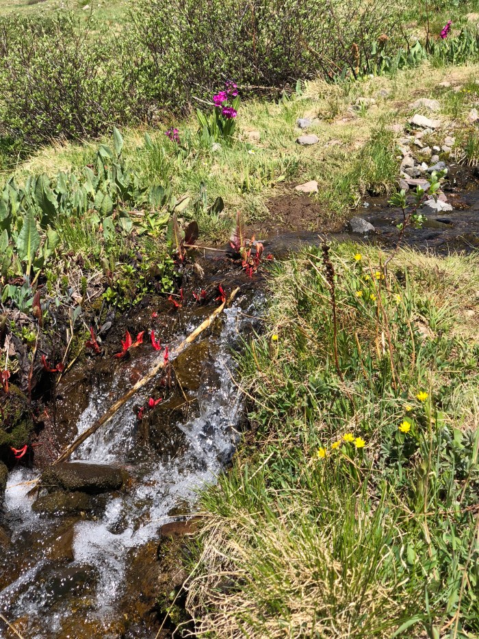
On the morning of Day 2, Ripples and Clouds, a Brit couple I’d met in Cuba, passed me. I should have got a photo! They’re quicker but take longer breaks so we played tag. We figured out we had the same goal in mind, a listed tent site after a couple big climbs and drops, about 21 miles for me. It was a tiny flat spot and when I got there, they had scrunched their tent to one side so I could camp too, almost touching. Between the wind and the nearby stream, there was enough white noise to neutralize the squeakiness of my sleeping pad as I tossed and turned all night. And since the zipper is broken on my tent, no worries about that noise when I had to get up in the middle of the night.


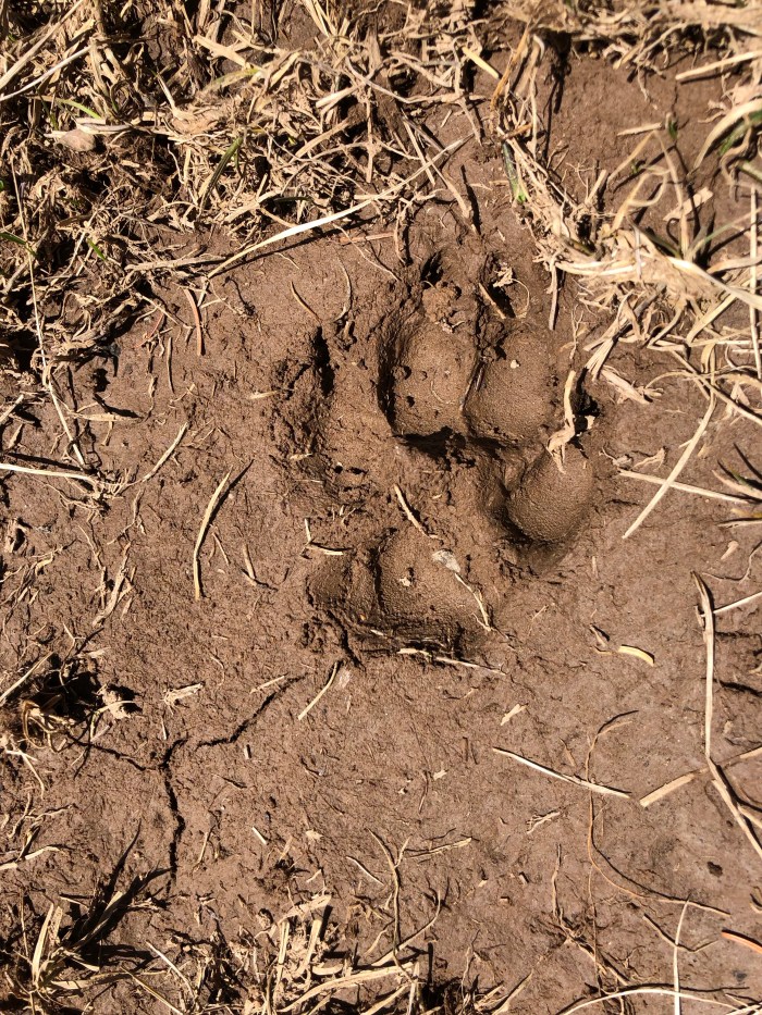
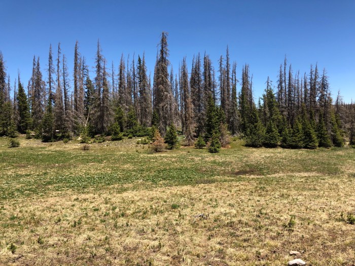
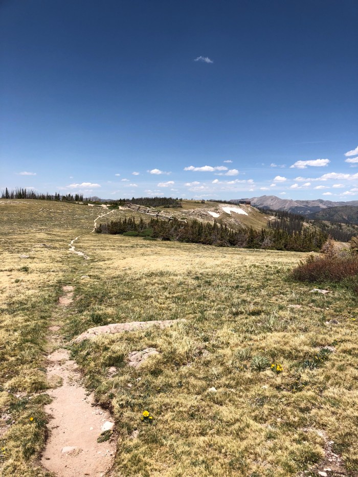
Day 3 was challenging. I think I got to 13,000′ a couple times and never below 11,500′. Every uphill that is more than about 4% grade (treadmill stuff) at this elevation is killer. The air is so dry and so thin that my legs are just oxygen starved. I huff and puff while my heart rate ratchets up, breathing so loudly that chipmunks and birds pour off the trail as I approach. This is a very low snow year but the skinny little slanted tread traverses on extremely sloping mountain sides are sketchy, whether just gravelly or snowy. I have micro spikes which are fine for snow but not so much for gravel. Ripples and Clouds did use their ice axes on one terrifying pitch, the consequences of a slip and fall down 500′ made us all extra cautious. We found ourselves once again with the same goal, Bonito Pass just past a stream should maybe be flat enough to camp. We camped far enough part in the woods to have privacy. I turned off airplane mode and found I had a cell signal which led me to the FB CDT 18 page and the news that the San Juan National Forest was being closed for the safety of everyone due to fire and the extreme potential of more fires. We would get to Woof Creek Pass the next day, and I had to hitch to Pagosa Springs to get boxes. My plan had been to then hike the 45 miles on trail to Creede, then to Monarch Pass.
Day 4, I shared the news. Ripples and Clouds didn’t have a box in Pagosa, although they’d originally intended to hitch in for a night. Instead, they decided to hike the 12.7 to the Pass then continue hiking the highway to South Fork, etc. Maybe I’ll see them again, I really like them!

Even though it was less than 13 miles to the highway, it took me a long time to get there, 1:30. Definitely time for a day off.
I stuck out my thumb and got a ride to Pagosa Springs, checked in a motel and got my replacement tent and shoes at the PO. Jesus was there picking up his box. I just love that sentence. I had dinner and a beer at Riff Raff Brewing which uses spring-fed geothermal heating for its beers. How cool is that?
Decisions, decisions. The new alternate (cause the entire San Juan National Forest is closed and the trail cuts in and out of it) for the CDT is pretty straightforward. From Woof Creek Pass take the highway to South Fork, turn left and take another highway to Creede, a total of about 45 road miles. From Creede it’s about 10 miles on a county road to rejoin the CDT.
I woke up and got a ride to South Fork, a highway town with shuttered businesses, For Sale signs and at least 3 realty companies. The Wolf Creek Ski Lodge was clean, comfy and affordable. OK, OK, I’m going to have to come back and actually hike this section because once again I stuck out my thumb and got a ride to Creede. This is an interesting place with a bunch of mining history and famous figures from “The West” including Soapy Smith who finally got his due in Skagway, Alaska. I toured the mining museum and walked through town. The postal service has lost my box, the first time in 6 years of long hikes. Tracking shows it bouncing from Seattle to Denver to Seattle to Denver possibly for all eternity. So I went shopping, yum Idahoan Potatoes till Monarch Pass. And weather is coming in, I hope it rains and clears the air and helps the firefighters control all the fires. Meanwhile, another comfy bed indoors at the Snowshoe Inn where John Wayne used to stay. Plus Johnny Depp filmed The Lone Ranger here.

Really, really like the photos. And it’s funny how folks say woof for wolf. Where I grew up many people said Warshington instead or Washington, and now I often hear Artic instead or Arctic. Language evolves!
LikeLike
Woof! Woof!
LikeLike