Silverthorne Alternate: Copper to CDT via Jones Pass

I hit the trail, the paved road actually, at 8 am, July 4th, out of Copper. I remember strategically avoiding the holiday in 2015 on the PCT and how pleased I was to miss the loud, drunken festivities in Sierra City. The trail was fine to the top of a pass, then blowdown, muck, and dim scrubby forest. The next pass had a nearby trailhead and better trail. Going over, there were a few snowfields left and I ran into a couple of guys with daypacks and fishing rods, who looked at me with incomprehension as I walked down towards them, it was weird. Weed is legal in Colorado, weird is legal everywhere.  Plus there weren’t any fish in the half frozen lake, or in any of the lakes or streams I’d walked by. Although I had thought about slack packing the 22 or so miles to Silverthorne, the unknown conditions of the passes made me worry about being caught on a dayhike without shelter, so I camped just a few miles from Silverthorne.

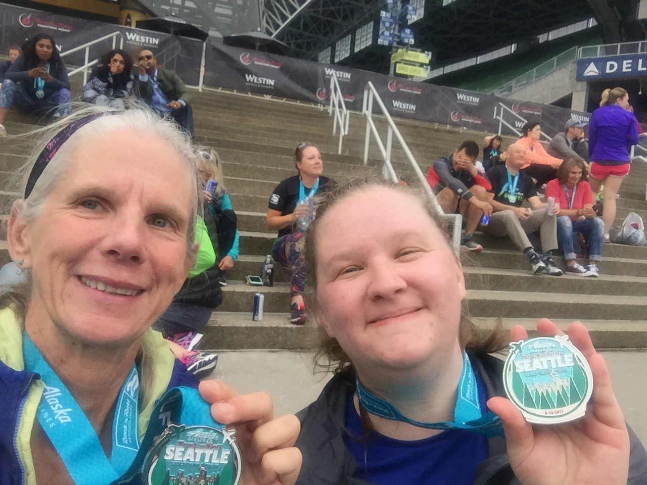
7/5 A short walk into Silverthorne, the trail went from blowdown to clear trail with a few runners to a trailhead and paved subdivision roads down to very busy streets, a highway and a freeway.  I met and talked with a USFS volunteer who just moved to Summit County in the Fall after retiring in Chicago.  I learned all kinds of interesting stuff about the area, thanks Bob! I marched my way past the outlet stores and booked a room.  Then since it was the morning, and they needed to clean the rooms, I got second breakfast, bought some replacement tent stakes and freeze dried dinners at the brand new REI, and finished the rest of my food shopping at the next door City Market. Turns out fireworks started a fire near Breckinridge which means almost everybody will have to take the shorter but less scenic Alternate.

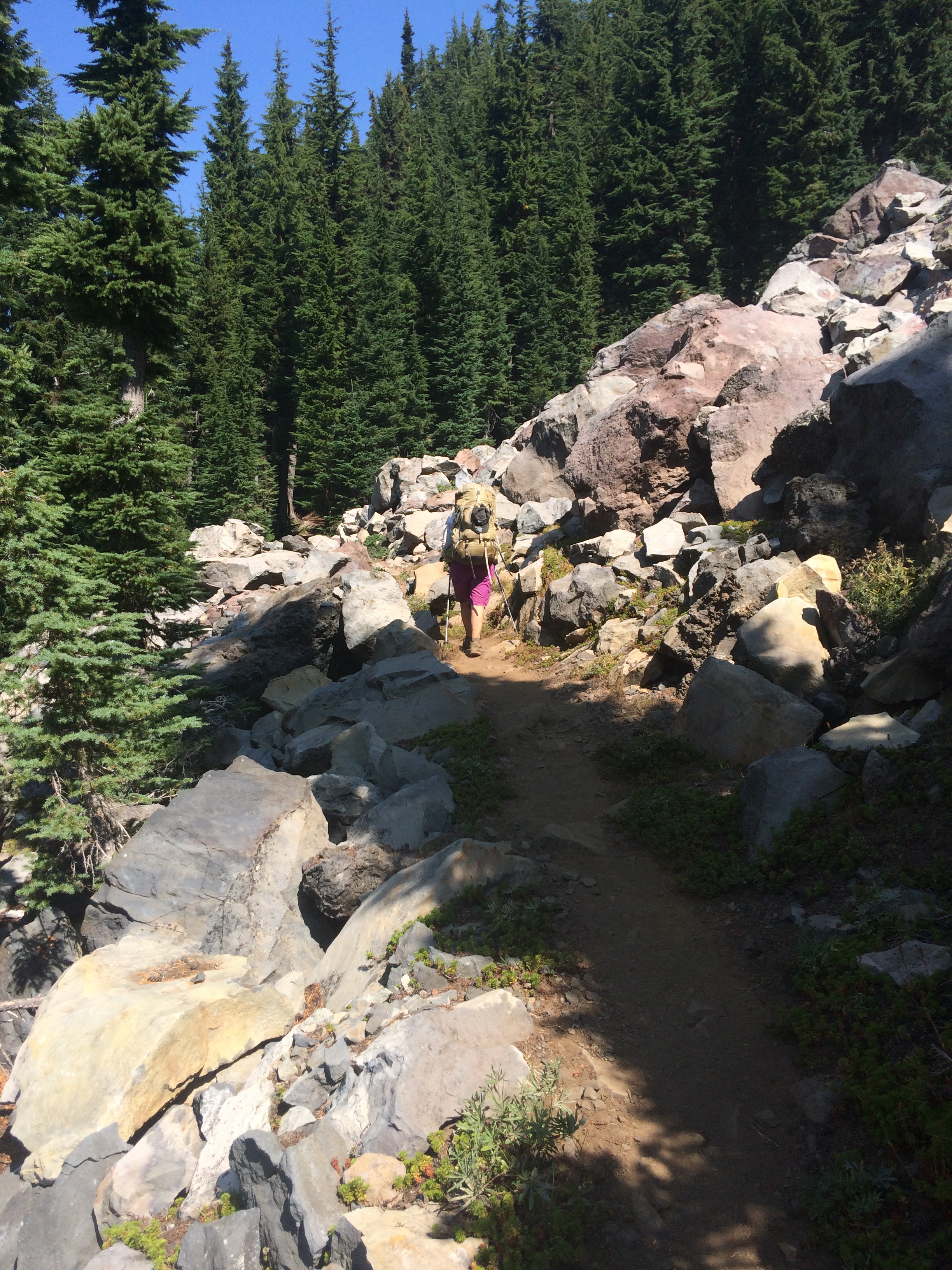
7/6 A slow, miserable day to a campsite where the trail teed into another crappy trail. The trail was fine to the pass, there were gobs of day trippers, where the maps showed a junction.  If there was a junction, I couldn’t tell.  So I navigated cross country on a tussocked side hill, and through bogs and wind, finding a cairn here and there, and towards late afternoon a switchbacked downhill with rocks and side slope, dwindling to nothing here and there. Slow, treacherous.

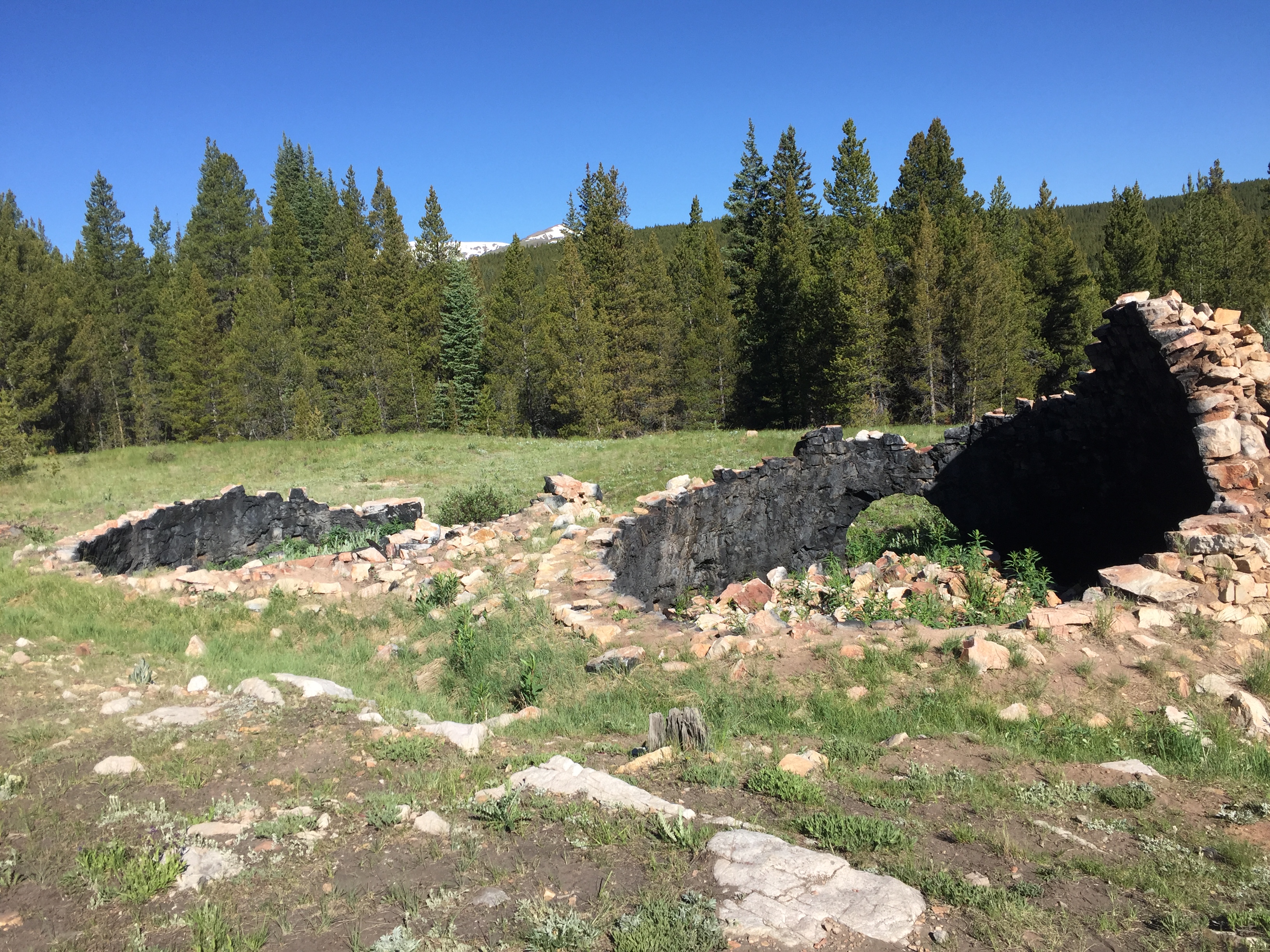
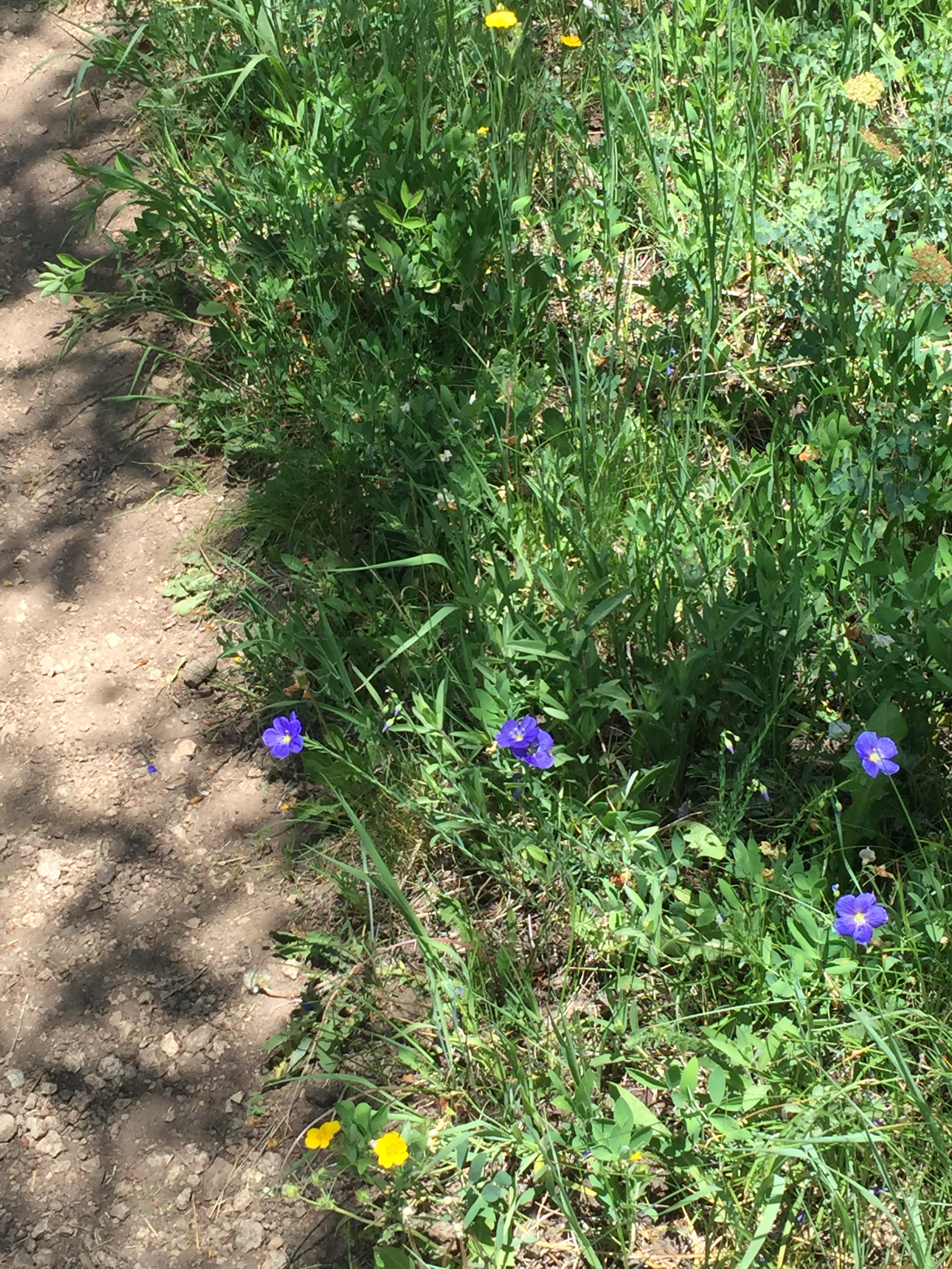
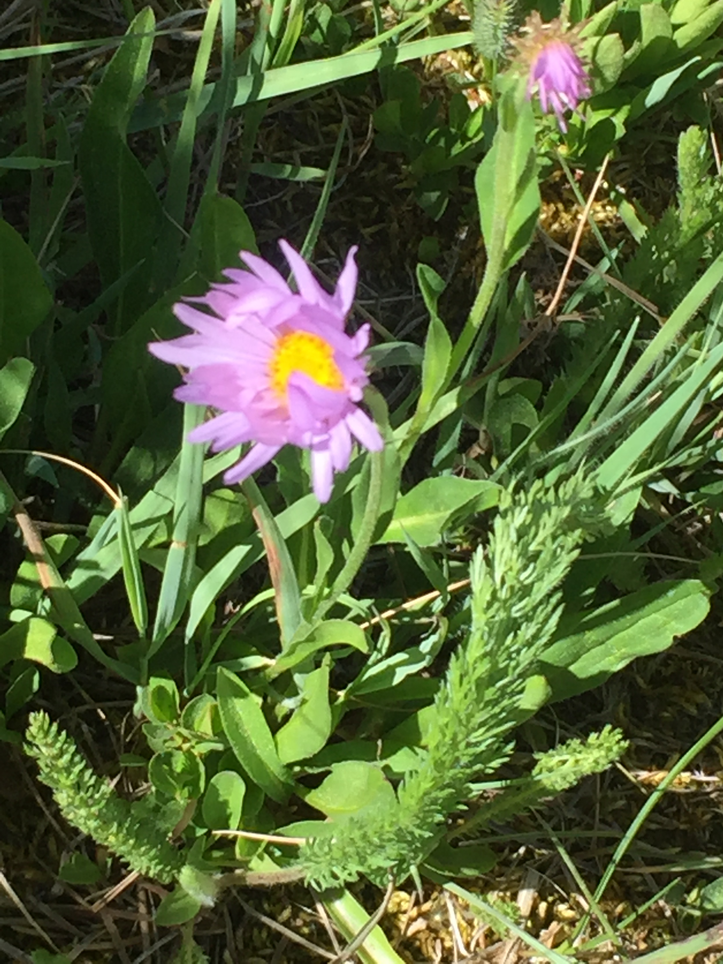
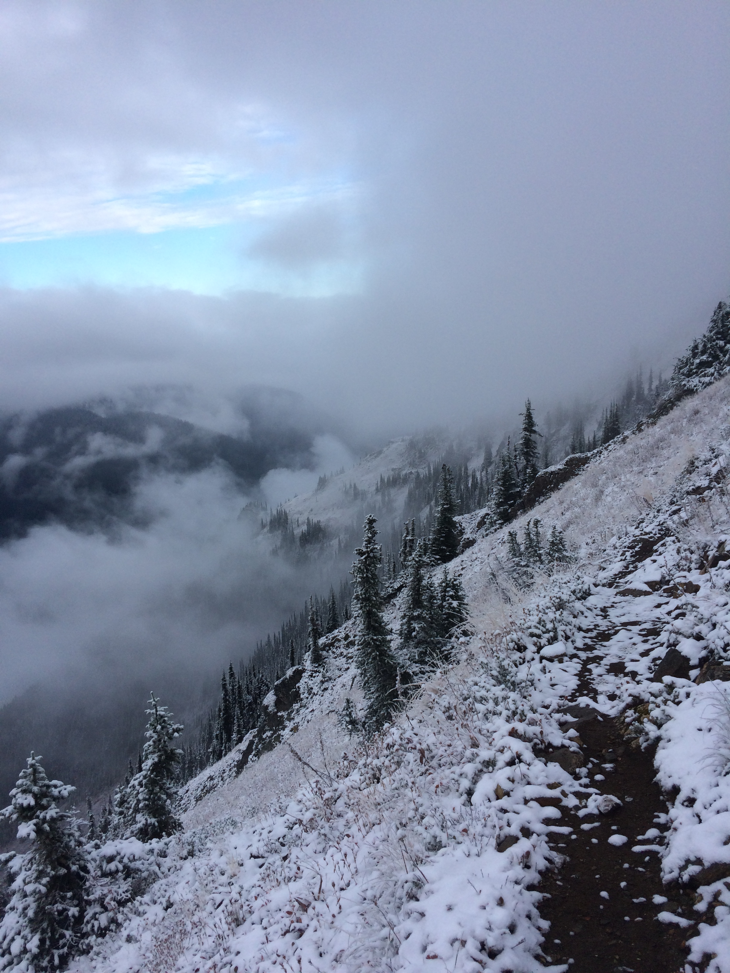
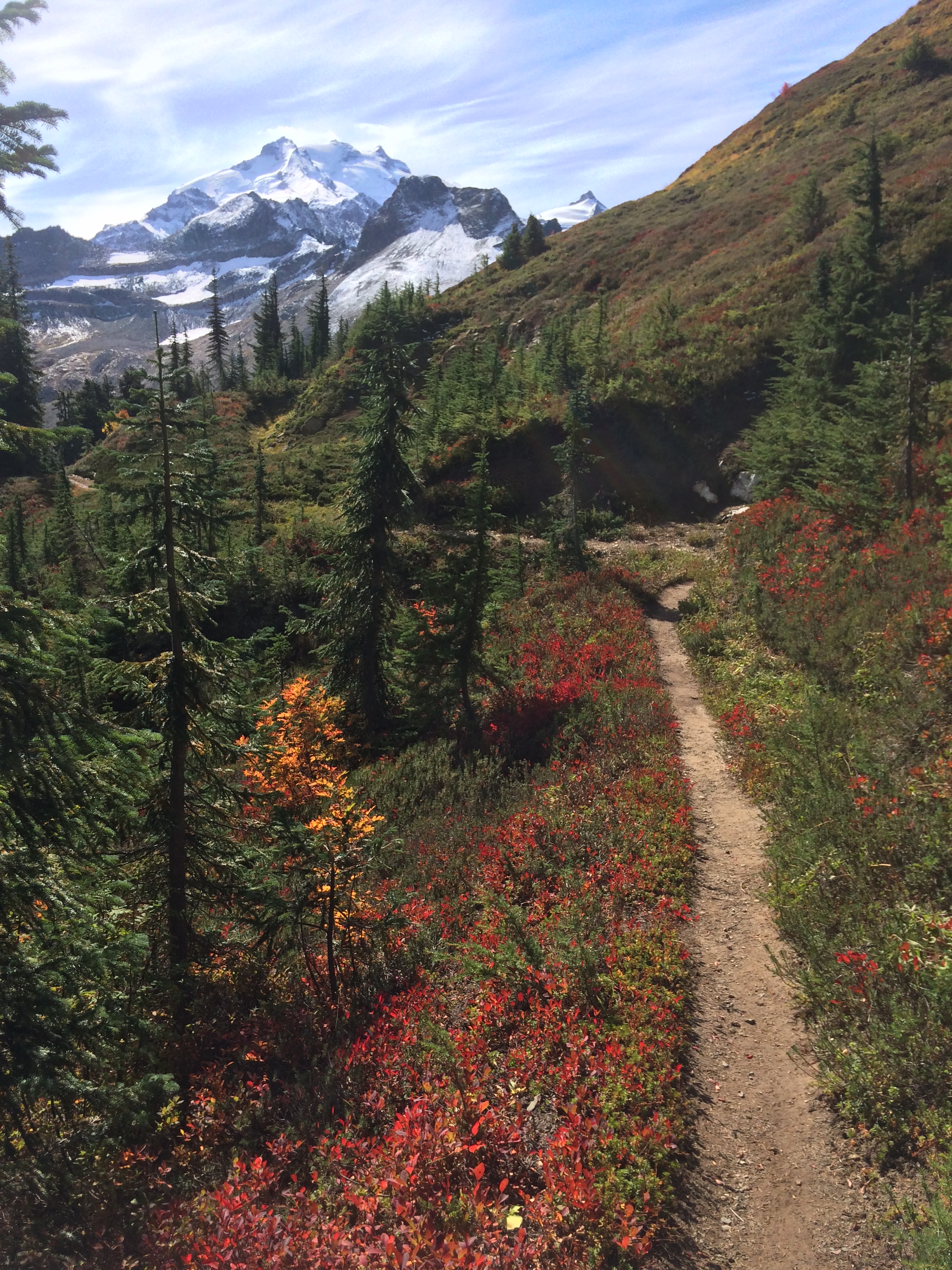
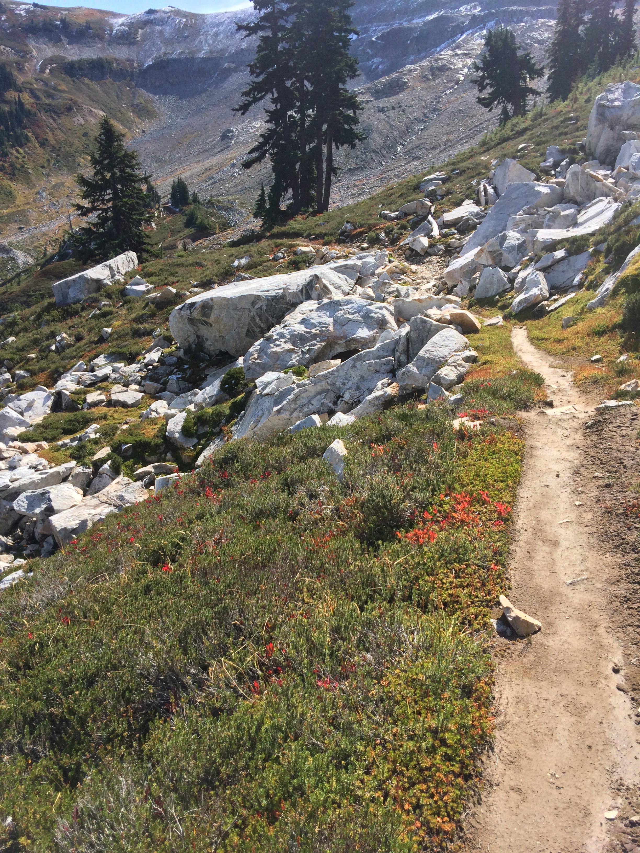
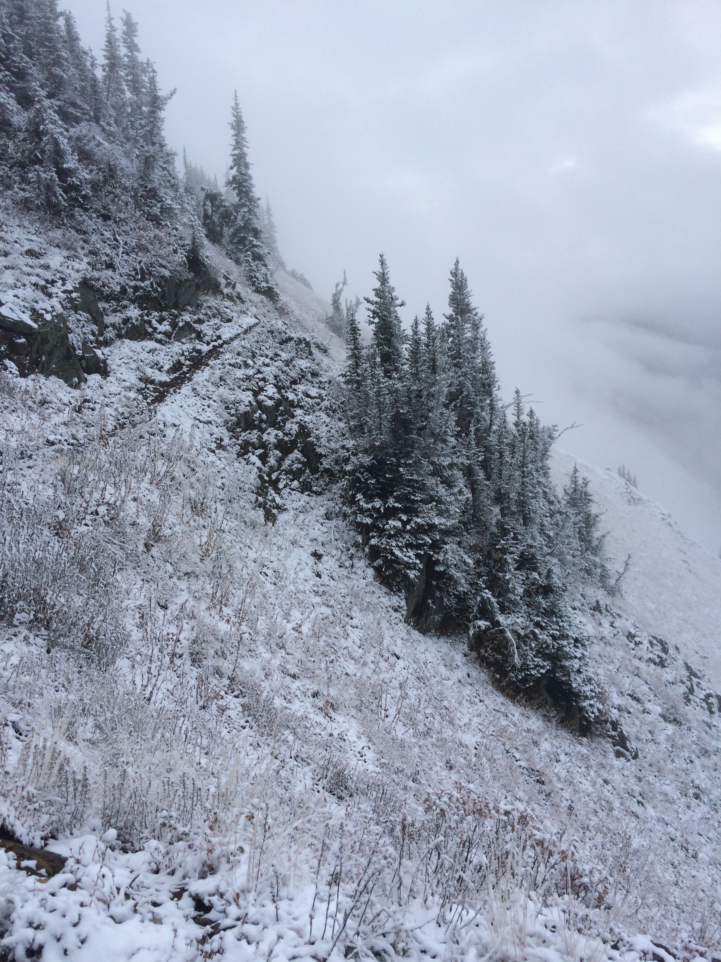
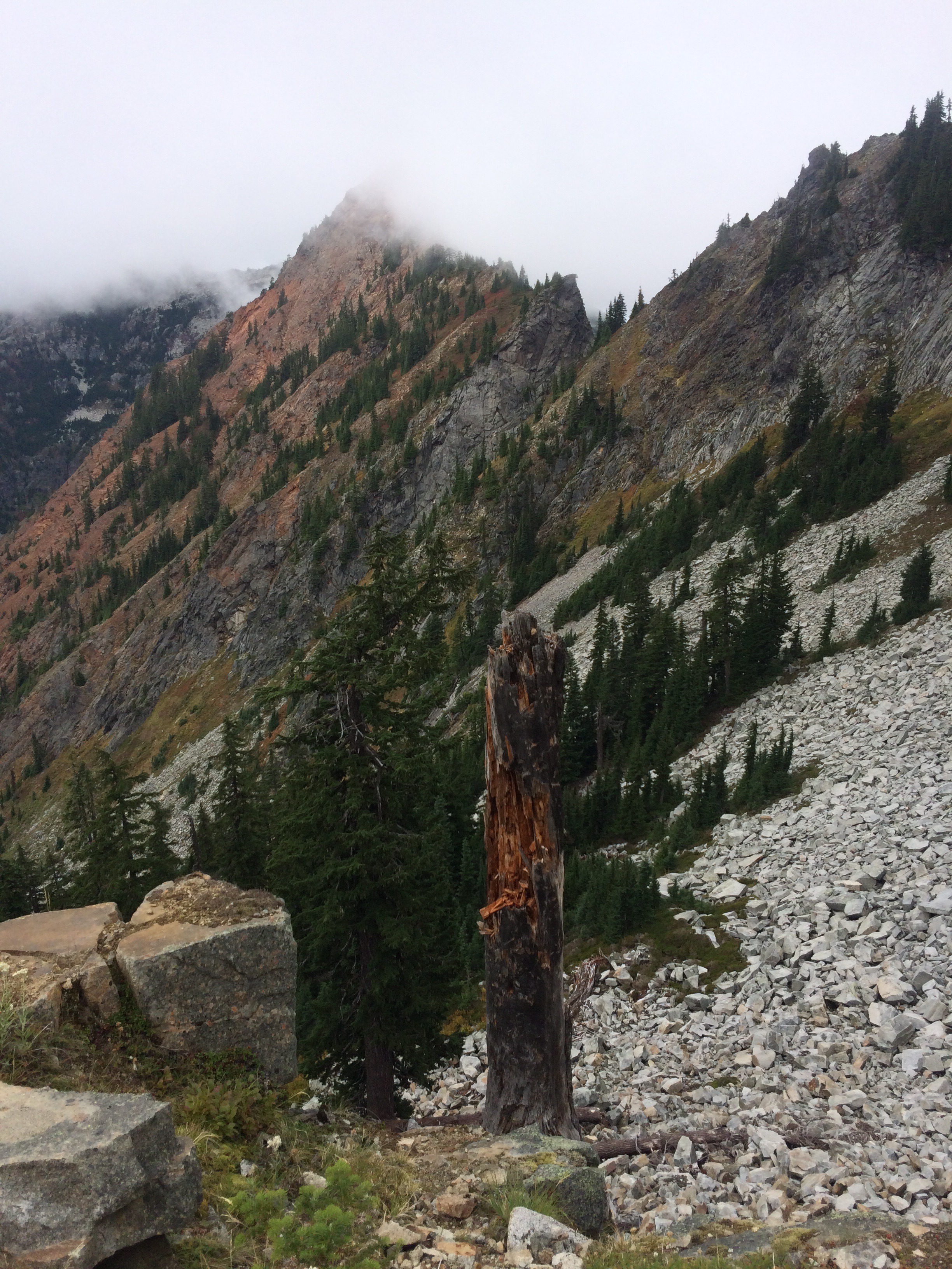
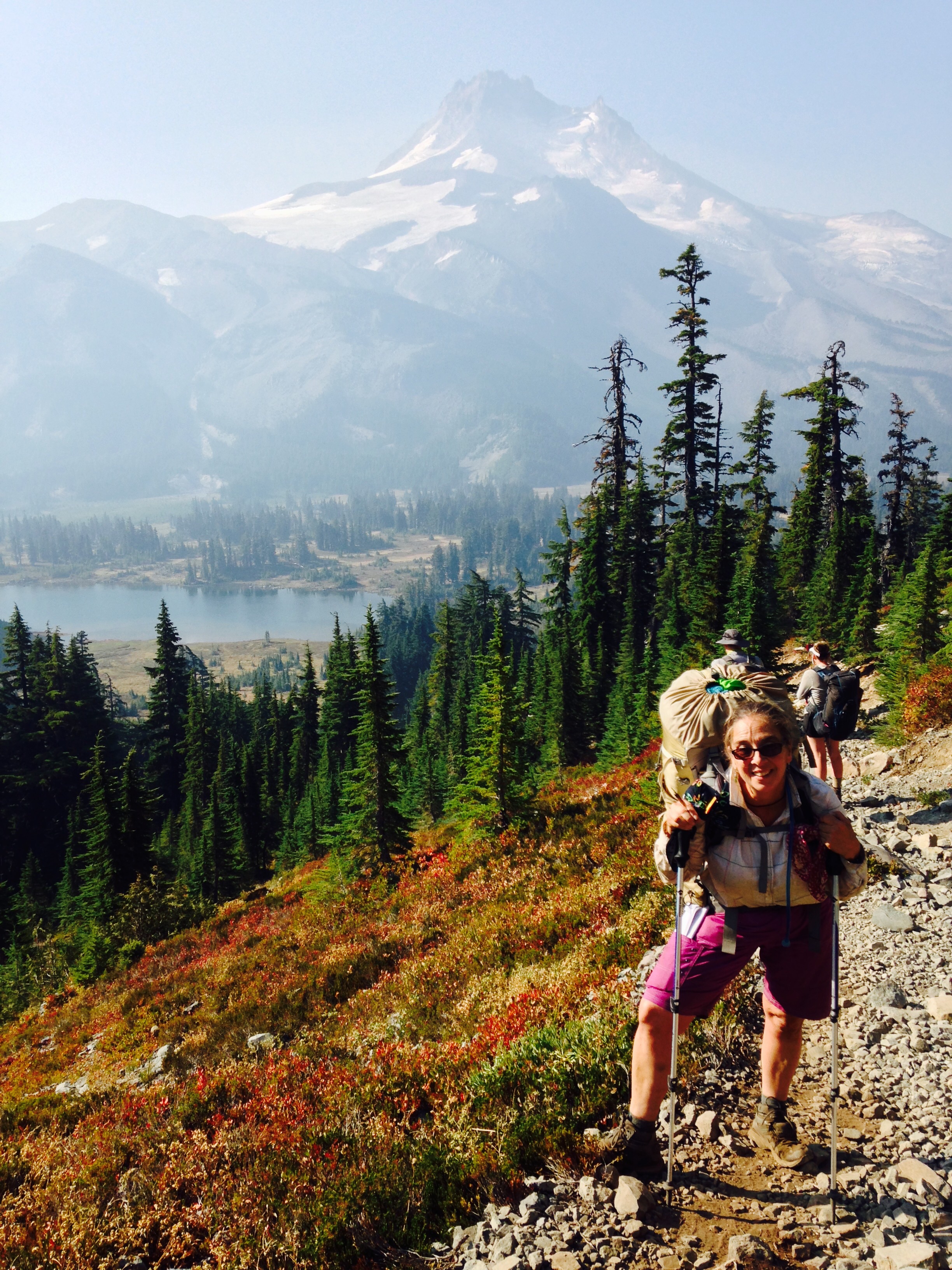
7/7 An even slower day. There is not much trail or tread to follow, so I pick my route through eroded side slopes and snow patches. Eventually I dropped into a super lush valley, where an occasional hint of a trail followed the stream. I saw moose tracks, then 2 people, Laura and Winter drying their gear in a clearing. “How do you like the CDT?” Laura, section hiking, asked.  “I hate it, it’s so slow, I can’t make any miles.  But, it’s so great to see people out here,” I added lamely.  Just after I passed them I saw a handsome young bull moose, his little antlers all fuzzy. Next to him a cow, sister? These moose are not Alaska-Yukon moose Alces alces gigas (“gigantic moose”) but reintroduced moose from Utah and Wyoming Alces alces shirasi (“mini moose”), I talked to them, they stared back and finally trotted away, good moose. I continued down the valley, and saw a third moose across the creek. These guys take their reintroduction to Colorado seriously and as I saw, they are thriving. I finally crossed the stream and continued up steeply on a beautiful, smooth, blessed dirt road. After all the roads in New Mexico, I have developed a true appreciation for the ease of walking and the faster pace I can summon up on decent tread. Thunder rumbled, lightning flashed and I was going to soon be above treeline for many miles. It started raining, then pouring. I debated with myself what to do. So few miles, so early in the day, such a wimp. I pitched my tent on a lovely flat spot at the notch of the last switchback that was still in the tree line. I crawled in as the rain pounded and the wind howled. Winter and Laura called out as they trudged uphill past me during a lull in the rain. The rain let up for a few minutes and I thought I would continue but the skies clouded and more rain started. Another hiker went by, Acorn. I decided to stay put. Inbar, the Israeli I last saw at Pie Town, stopped and talked. He’s doing great although his new backpack blew out after 3 days so he’s got to get to Grand Lake to remedy that. It got dark, the rain let up, the wind died, and it was the flattest, warmest, most comfortable night I’d had on the trail in a long time.

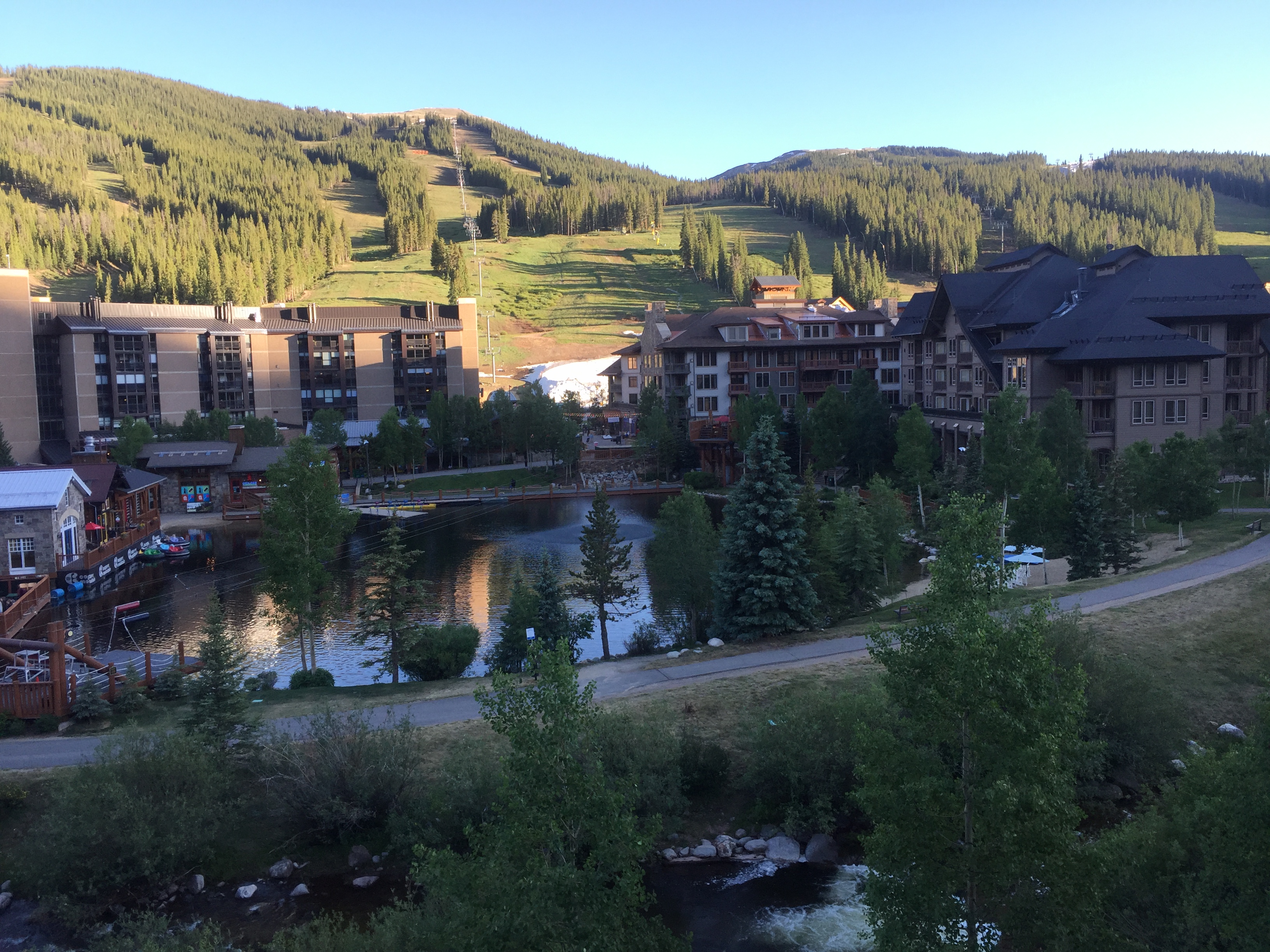
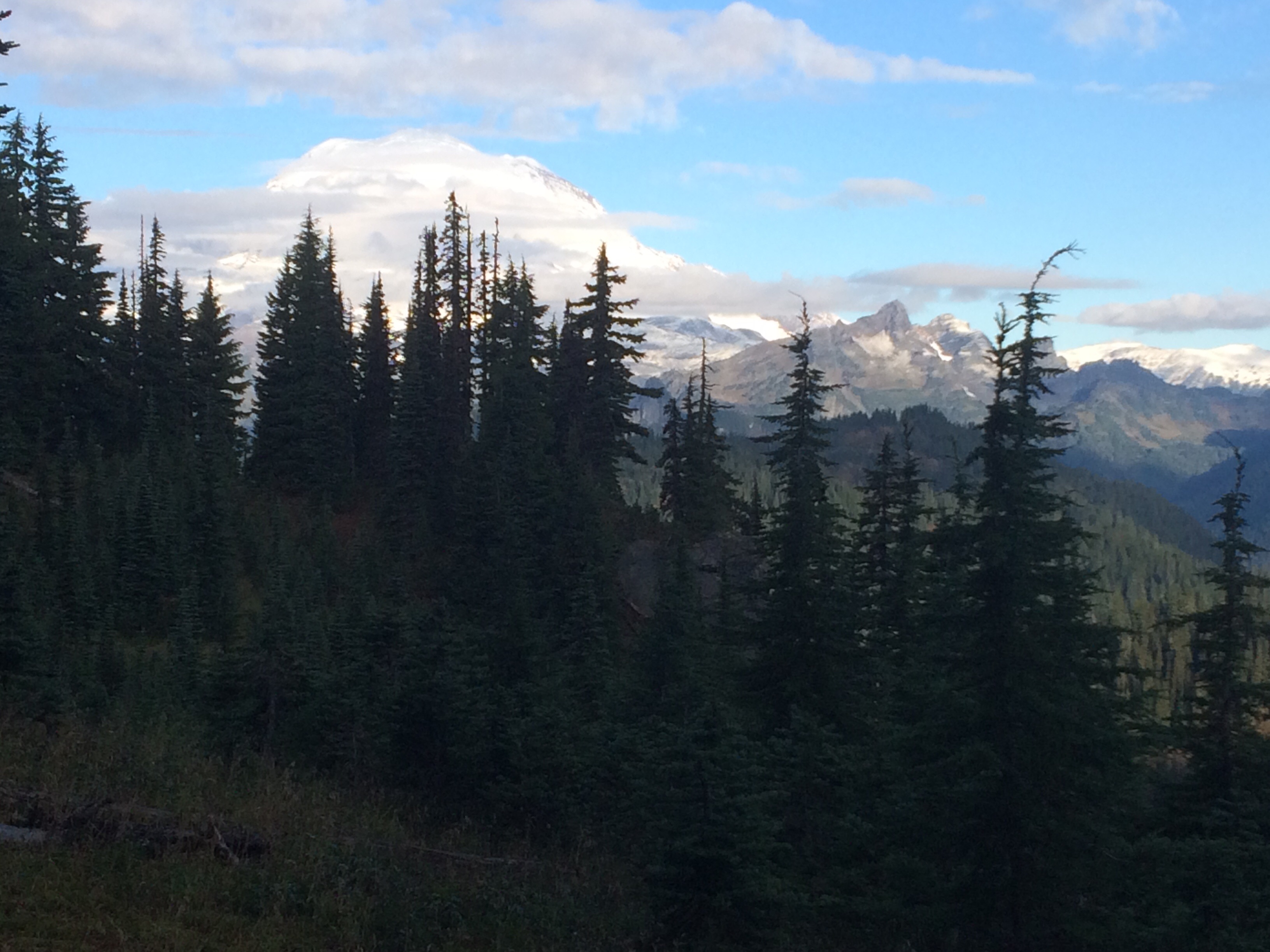
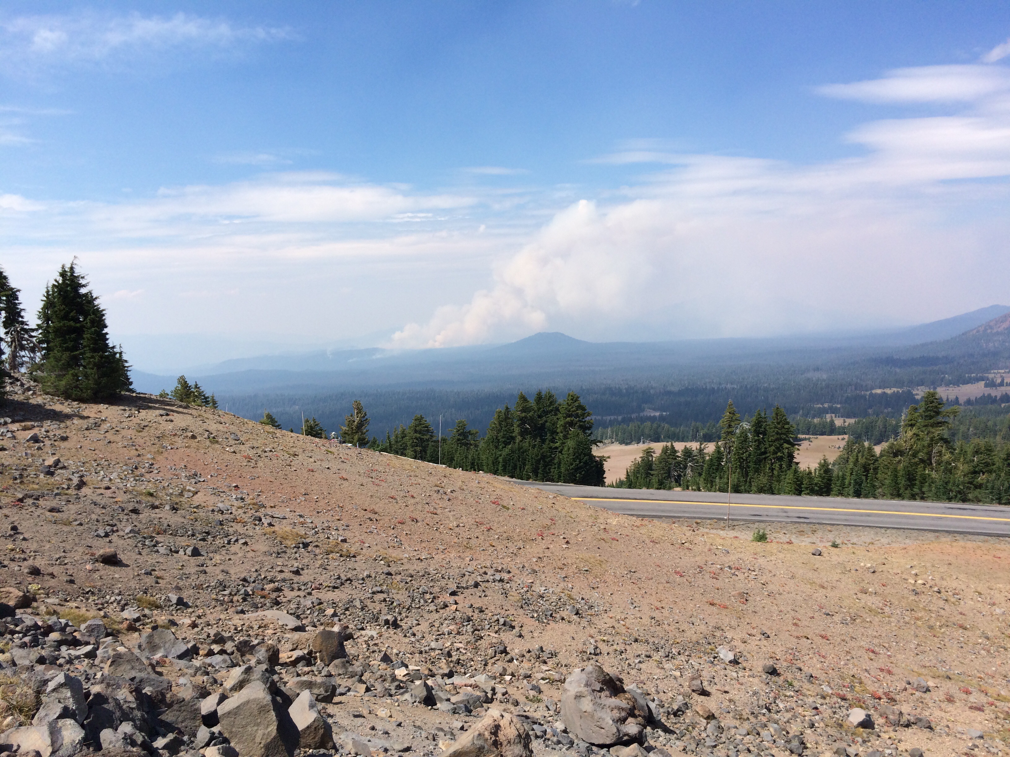
7/8 I congratulated myself on an excellent decision. I would have been grabby and anxious if I’d hiked up Jones Pass, and along a cirque yesterday and would have missed the beauty and views and joy of the mountains today. At the top of the dirt road, the Alternate rejoined the much better kept official CDT. When you start seeing day hikers, you know you’re near a trailhead and because there’s easy access, I envision all the volunteers who come out and work hard to give hikers of all stripes, good trails. Thank you!  On an impulse, when I reached Berthoud Pass, facing another climb into thunderclouds, I hitched to Winter Park, rather than camp a mile from the highway.  Within 12 seconds, Bambi and John picked me up.  I felt way less chicken when they told me they were coming from a talk about thunderstorms, over 300 people per year get struck by lightning in Colorado. 10% are fatal, but the remaining 90% experience permanent affects, mostly invisible mental processing problems, just what I don’t need more of.  Also you can apparently be struck from a storm more than 6 miles away.

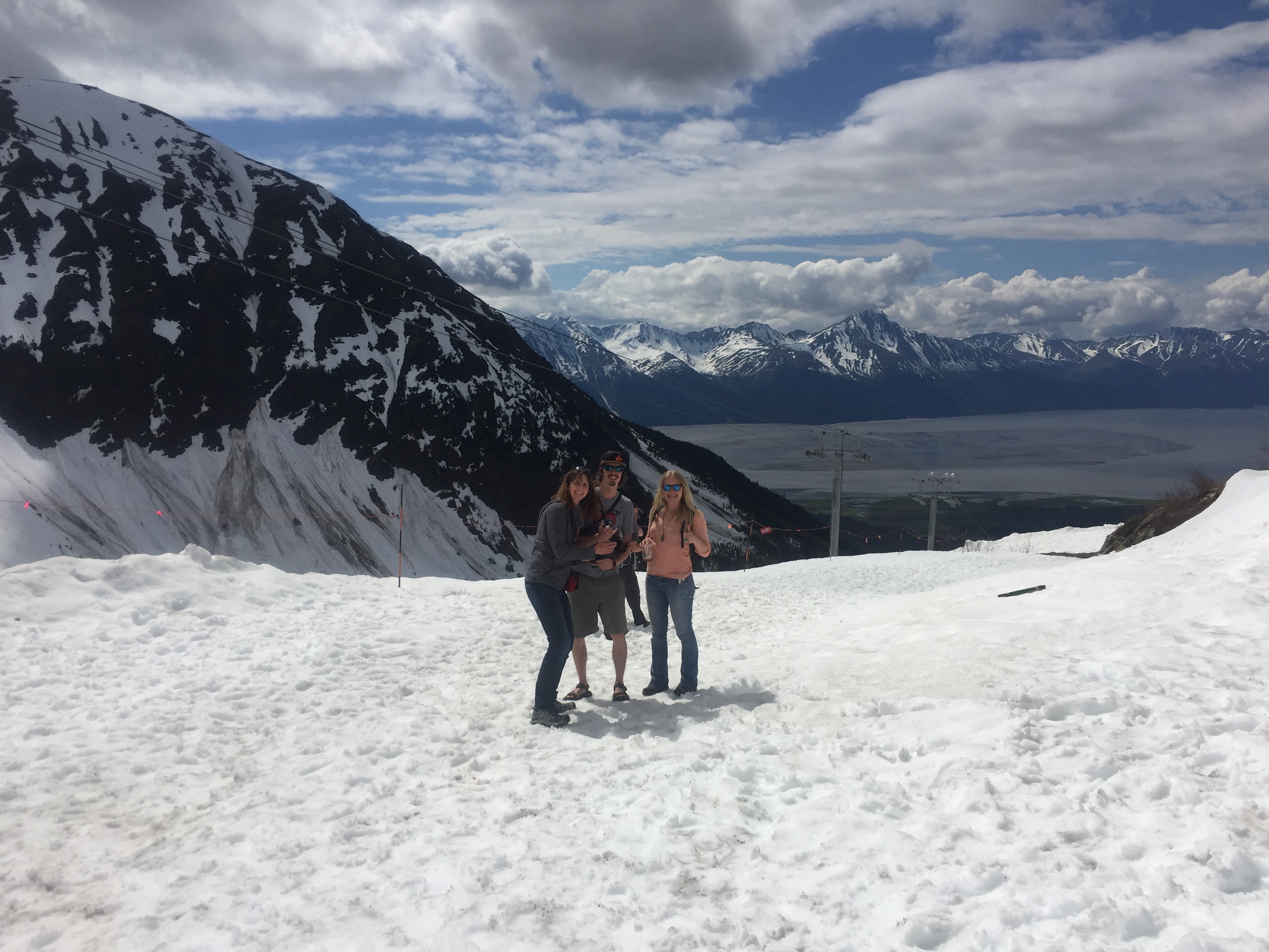
So this is how it’s going to be, eh?  A motel at every opportunity, slow, slow hiking in between.  This trail ain’t your mama’s PCT.

Twin Lakes to Copper Mountain

10th Mountain Division huts, bunkers, ordinance, etc are everywhere, I need to read more about their remarkable history.
Not sure what this was, anybody know?

6/28 I was reluctant to go, but finally hiked out at 9:45, with an ankle wrap on the right foot and duct tape on the left heel blister earned by wearing micro spikes on light-weight trail runners. The spikes smooshed the shoe structure too, so until I get new shoes, there’s a crumpled ridge of shoe rubbing my heel.

I was really pleased to find great trail, no snow, no blowdown, chock full of day hikers, Colorado Trail (CT) hikers SOBO from Denver to Durango, mountain bikers and a cheery guy, Dr Bob, finishing the CDT and the Triple Crown. Even though I won’t see any of these hikers again since they’re going the opposite direction, I am gladdened by the human contact.

6/29. What a day! 21 people, 4 tail wagers with dog food panniers, and 3 large youth-ish groups. At the end of the day I was overtaken by JPEG, the guy I met briefly on the PCT 2015–he took my photo at the 1/2 way monument outside Chester, and I found out months later–he’s somehow related to USASA former-President John Schaal from Michigan. JPEG and Gutpunch were on about their 30th mile for the day, trying to reach the highway a few miles further for a hitch to Leadville. I didn’t hold them up long, and found a perfect campsite near a creek. It’s a bit buggy out here and during the night I got a few splatters of rain.

I do not usually talk about gear, but I got a replacement tent in Salida after much thought. I’ve been using the Zpacks Solplex that I used for a 1000 miles through Oregon and Washington in 2015. A great tent, single wall with bug netting, very light. I had to manage condensation in the snow and rain of Washington and eventually the zipper needed fixing which Zpacks did for free. But gear wears out, and gradually there were more screen patches than I liked, the zipper was going again, and honestly I was sick of not being able to sit up without touching the walls, the condensation issue. So I upgraded to the Zpacks Altaplex, a taller version of the Solplex for not much more weight, 2 ozs.  I got the camo color, it’s a little less see-through, and I think camo signals to other people that I’m packing a gun or hunting gear, just adding to the all-around badassery image I project. Uh huh, I’m joking!  I’m not carrying a gun! I love this tent, it sets up with a single hiking stick and I have to fiddle around to get all the lines right but it stands up to wind and weird pitches surprisingly well.

There was a lot of uphill today, the first stretch was steep and I dreaded the second, but it wasn’t so bad.   I think a lot of trail here is like in my mountains, the Chugach, trail is created, not engineered, when people or vehicles take the shortest way up or down, as straight a line as possible.  Not great, but designing and constructing graded trail is expensive and labor intensive so meanwhile we walk on what’s already there, whether ancient wagon roads, social footpaths, jeep ruts or old mining routes.

I hit snow at about 3 and was out of it by 4:30. Melting snow means bugs so I broke out the Deet, just 30% strength, this isn’t Interior Alaska.  The flowers today have been incredible, I tried to get photos of all the colors–yellow, pink, butter, white, purple, lavender–but nothing can capture the fragrance, and I am a truly bad iPhone photographer.

Yellow
Red and yellow
White and purple
Blue and gold
Lavender and marigold

6/30 CDT miles 1214.4-1234.4. Way more miles than I wanted to do.  I couldn’t find a flat spot for my tent, so I’m in the worst pitch ever, or to put a positive spin on it, I’ll call it a creative pitch. I saw jillions of people today on the CT and the trail tripped through varied terrain as it went, paralleling and crossing the highway to Leadville, then through more abandoned  10th Mountain Division territory and up into the alpine and finally down through Searle Pass.  An absolutely clear day but I was still nervous about the high elevation exposure past 3pm in the Rockies.  Silly rabbit, no thunderclouds were developing but still I galloped as fast as I could for miles of alpine traverse until finally I saw the route heading down to tree line and I set up my crappy pitch.

7/1 The terrible tent site turned out not to be too bad.  I piled my pack, clothes bag, etc at the foot of the tent with my slippery sleeping bag on my slippery sleeping pad on the slippery tent floor and slipped throughout the night, waking up periodically to scootch back up to the head of the tent. I woke at 4:45, then again at 6:45, whoo!  It felt great to start a short downhill day to Copper Mountain at a late 7:30!  Lots of hikers coming at me, lots.  Then I saw chair lifts and soon I was descending on the road I used to board down from the USASA Boardercross course in April.  Another warp in the space-time continuum.  I continued across where the bottom of the half pipe is supposed to be. Just below was a huge pile of snow for Woodward Camp with rails and boarders and skiers and in the grass all kinds of summer toys and kids and families.  This place is fun!  Paddle boats, zip line, big bouncy balls, mountain bikes, crazy positive energy.  Rooms are cheaper here than Frisco or Dillon so I’m going to rest my ankle, eat and enjoy the hustle and bustle.

Saw this nest in the alpine, no trees nearby. I know there are ground-dwelling Ptarmigan?
View from my room towards the ephemeral Boardercross and Half Pipe


Alaska Really Is My Home

5/30-6/19 0 CDT Miles

Dan and I flew from Albuquerque home to Anchorage.  The next 10 days we got to play tour guide for Ashlee’s first trip to Alaska.  She and Chris packed a lot of vacation into a short period of time.  Because it never gets dark this time of year, they played frisbee golf until 2 am more than once, and Ashlee saw her first Alaska moose, a little guy on bended front knees nibbling grass on the course. We hiked Flat Top, went to Girdwood’s Fiddlehead Festival, visited numerous Alaska microbreweries, and hung out in Seward for a few days.  A friend took them to Talkeetna.  They biked the Tony Knowles Coastal Trail.  Ashlee was amazed by the mountain ranges surrounding our city on Cook Inlet, fortunately there were a few clear days in Anchorage so she could see them.  We all had fun, including their dog Grimm who made friends with our older son Glen’s dog Tindy.  The three cats were less stoked, Shred taunted Grimm from his perch on the moose rack.

The day they left, I ran the Alaska Run For Women, a 5-miler celebrating its 25th year.  I don’t know how many times I’ve run it, but it’s a great event raising funds for breast cancer totally by donation.  I pinned a card to my back, “I’m running in honor of Noreen” and joined the parade of pink.  I don’t own anything pink but they let me run anyway.  I got a pretty good time too!  And I did Zumba, in public, with the post-race class. Later that evening, friend Tarcey and I went to an outdoor solstice show with The Shins at Moose’s Tooth Brewery.

Having seen both my boys, I wanted to see my daughter Sarah in Seattle on my way back to the CDT and somehow found myself running in a half marathon with her from UW to the Seahawks stadium downtown.

Meanwhile I’ve been watching CDT NOBO progress on social media and trying to figure out the logistics of getting back to the trail.  I am going to fly to Denver and take a Greyhound south.  I will skip (temporarily) a chunk of trail rather than try to get all the expensive way back to New Mexico.  There’s still a bunch of snow, but reportedly most of the south faces have melted so hopefully my microspikes, Whippet (combo hiking stick and light duty ice axe) and neoprene  socks will be good enough.  We’ll see. I’ve got a bounce box to mail up the trail with other clothing and gear I may want to switch out with.

Seward Sealife Center, AK: me, my sis Annie, Ashlee, son Chris, Dan
Chris on Flat Top, Chugach Range, AK
My sister Dogwater, son Chris, and his partner Ashlee top of the tram, Alyeska Ski Resort, AK
Winner Creek Trail, Girdwood, AK
Ashlee, Dogwater, Chris
Chris, friend Trevor, Ashlee at the Girdwood Brewery
Shredder on the moose horns
Bear at Portage Wildlife Center, AK
Grimm, Ashlee, Chris, me, Dogwater on the trail to Fort McGilvray
Resurrection Bat, AK
Grimm and Chris in the water taxi, Resurrection Bay
Resurrection Bay
Resurrection Bay


Next Up: The CDT

Well my feet stopped hurting, almost anyway.  All of my toenails have grown back except for the one I lost somewhere on the JMT in October.   The plantar fasciitis that has plagued me for 18 months, including every single day on the SOBO is kaput.  So I’m back to running, in the freaking snow and cold of Anchorage.  But hey I got third in my age group in the Frostbite Footrace 5K during Fur Rondy which I never do, and snowboarding has been awesome since Alaska finally has snow after three winters of drought.

Since finishing the PCT SOBO November 25, I’ve thought a lot about the differences between hiking north and hiking south from border to border in the Lower 48 (continental US).  And I’ve come to some useful conclusions for the next long hike.

Living in the North, my entire adult life in Alaska, you mark special times of the year–Summer Solstice, Fall Equinox, Winter Solstice, Breakup, and Freezeup. The longest day of the year June 21 or 22, Summer Solstice, is accompanied by manic celebrations all over–people hike all night or throw parties, have soccer tournaments or drink Midnight Sun Brewing Company beer. A celebration certainly but also a wake–a celebration of a life passed, because Summer Solstice is the beginning of the dying of the light and the all too quick slide to winter, cold, aurora borealis and dark. Up here, Summer Solstice weather wise isn’t even the warmest weather, there’s still snowfields, gardens are barely greening up and the first hatch of mosquitoes are rapidly being replaced by gazillions of their quicker, itchier progeny. And it’s starting to get dark again.

The Continental Divide Trail Coalition (CDTC) offers a shuttle service from Lordsburg, NM to the Crazy Cook start on the border with Mexico.  I want to start the CDT in the last half of April or early May in order to beat some of the desert heat, but looking at weather maps, New Mexico is having an early spring, while snow in southern Colorado is at record highs.  Hopefully, the early spring will sweep massive heat north and melt some of the snowpack before I get there.  I’m glad I’m not hiking the PCT north this year as the Sierra snowpack is super high (some ski resorts are planning on continuing operations to July 4) which means there will be a lot more snow slogging in the High Sierra this year than 2016 which was way more than I had on the PCT NOBO 2015.  The thing about the Sierra though is that you mostly go up over passes and then down to lower elevations.  I never had to pitch my tent on snow even if I spent all day hiking through it. In 2015 the only pass socked in on both sides was Muir, but since I’d hiked that route three previous times, my memory combined with my maps and I navigated through snow without major incidents–I broke through a minor ice bridge and got my feet wet but only postholed up to my knees and I was able to camp on dry ground at the end of the day.  The most treacherous pass was Glen because of its pitch, but I knew where the trail was supposed to go and there were plenty of tracks ahead of me.

The CDT apparently climbs high and stays on the Divide so once you’re in the snow, you stay in the snow–other than when you hitch down a highway to pick up more food and stay in a motel.  That’s the impression I get anyway and that’s what I need to be prepared for.  Reading hiker stories from past years (and there’s not a lot of them), this is normal if you’re going NOBO:  walk through the desert for hundreds of miles, hot during the day, freezing at night, then climb into snowfields and continue hiking for hundreds of miles more.  Snowshoes, an ice ax and proper avalanche training and practice are nearly universal recommendations.  The other option for the CDT is, of course, to hike south from Canada.  I have experience with this on the PCT as well since I hiked SOBO in 2016.  Hikers going south on either the PCT or the CDT generally pick a later start date to give the snow a chance to melt up north, then run like hell to get through the High Sierra (PCT) or Colorado (CDT) before it starts snowing the Fall.  A later date means June or July.

My CDT hiking strategy is based on my experiences hiking the PCT NOBO in 2015 and SOBO in 2016.  I liked both hikes, but I tell people that if they’ve never done the PCT before, I think hiking north is the better choice.

To me, it comes down to this:  daylight hours.  If you’re going to be hiking for 4 or 5 months, and you’re relatively slow, or would rather hike without a headlamp, starting in the spring means you’ve got 2 months of gradually increasing daylight hours till Summer Solstice, then 2 months of gradually dwindling daylight hours through the rest of the summer months.  It doesn’t mean you won’t be cold or get snowed on or won’t have to walk through snow, it just means that you’ll have more daylight hours to get it done.

Hiking in snow or snowfields, no matter the daylight hours is just slower.  SOBO hikers on the PCT and CDT generally begin at the border with Canada in the later part of June or early July.  NOBO hikers generally begin at the border with Mexico in April or early May.  Another option on the CDT where there is less peer pressure to do a “true thru” is to flip around–hike as far as you want in one direction then catch a ride to a different location, hike that stretch and so forth, eventually completing the entire trail, linking footsteps, rather than walking continuous footsteps.  I might do this.  I get to do whatever I feel like doing, so there.

I really loved hiking with other people on the NOBO, I met and got to know so many interesting, wonderful, kind folks.  On the other hand, I loved the relative solitude of going SOBO.  My hiking partner for 1600 miles, Puff Puff, and I would go days without seeing other people all the way through California and were (mostly) stoked that we had each other’s company for a part of each day and could camp together and hang out in towns together.  The Sierra in October was nothing like the Sierra in June–we could truly be in the wilderness without the hordes (human and mosquito) of summer.  We had to discipline ourselves to get up and go at first light and often camped just as the light was going.  In the last month of the SOBO we had about 11 hours of daylight.  The final 700 miles of So Cal desert were cool, rarely cold, but increasingly dark, by the very end, we were in our tents by 5 pm, full on dark.

I don’t know how the CDT hike will go, but I’m going.  I’ll begin hiking at Crazy Cook on April 21.  I will probably take a week or two off the trail the beginning of June to let the snow melt in Colorado and to go home to Alaska to get bit by mosquitoes and because my youngest is bring his beloved for her first visit to Alaska and they want to do some hiking in my home mountains.  One way or another I want to be in Wyoming August 21 wearing special solar eclipse glasses.

I’ll blog the CDT hike and will try to do a better job of it than I did in 2016.  I seem to do more writing when I have fewer people to talk to, and when a trail is all new to me.


Stevens Pass to Stehekin to the End

September 23

PCT Mile 2660

Washington has been really, really tough.  Here’s why:

  1. Cumulative fatigue and weight loss
  2. The weather sucks
  3. Lots of elevation gain in a day, and lots of downs
  4. There’s a bush that smells like stinky feet and it’s everywhere
  5. Friends have been getting off trail for various reasons
  6. When it’s not raining or snowing, the yellow jackets are out and stinging the back of my legs

However, the Cascades are stunning!

image
Camped in the snow, walked in the snow
image
Fall colors
image
Beautiful pass
image
Log bridges all along this stretch
image
Reunited with Puff-Puff and Julien from the desert in Stehekin!

Hikers just a week or so ahead of me had to make a tough decision since there was a trail closure at the Suiattle River due to fire.  This closure had been in place for weeks and those of us hundreds of miles south had been stressing too.  The most popular choice was to get a ride from Stevens Pass to Chelan, take the ferry to Stehekin, and resume the PCT, but skipping 107 miles of PCT.  I figured that was what I would do and had lined up Sarah to drive me.  And then the closure was lifted!  All the crappy weather helped the firefighters.  I am impressed that in the midst of dealing with the devastating loss of life and property and the complexity of fire logistics deploying resources and personnel, that the PCT was reopened to the tiny population of hikers.  Who do I thank?  The US gets so many things right: we invented National Parks, the Forest Service and long distance National Scenic Trails.  Walking along I was thinking about this and humming “….land of the free, and home of the brave” guaranteed to choke me up like nothing else.  If I’m ever cast in a movie and have to cry on cue, I won’t be thinking about losing my favorite cat, I’ll be visualizing an Olympic award ceremony with the US flag in the gold medal position and some poor athlete stumbling over the words of the anthem, hand on heart.

I got a slightly late start out of Stevens Pass, making just 16 miles till dark and a camp in the clouds.  Over the next few days I could not make up the miles, only getting 20-22 a day.  The trail was dreadfully unmaintained, brush overgrowing the trail pulling at my pack and drenching me with water. I couldn’t see my feet and was walking blind.  Trees were down, years and years of trees, that I had to scramble over, under, or around.  The trail was a rocky rut for miles and I picked my way slowly along, it would not be good to get injured so close to the end, plus how the f would Search and Rescue reach me?  So I was 5 nights out, instead if the 4 I’d hoped for.

A quick 7 mile walk to the Ranger Station where a bunch of us got the shuttle bus to Stehekin with a stop at the most incredible bakery of the entire trail.  All you who know my real life eating habits would laugh to see me eat a sandwich, a Dr Pepper, a slice of Quiche Lorraine and 2 blackberry cheese Danish.  And I was still hungry.

I got a room, and started all the usual chores: pick up the resupply box, inventory and make a list of what else to dig out of the hiker box (fuel, TP, more food) or buy at the little store, hang up and dry the tent and bag, shower, laundry, eat. And then I heard a voice I knew scream, “Catwater!” Just like a movie, Puff Puff and I ran to each other, arms wide.  And there was Julien too!  What a reunion!  I last saw Puff Puff in Mammoth but follow her blog alexandramason.wordpress.com and had lots of trail news drifting back to me.  Trail registers, where they exist, told me how far ahead she was, she just got faster and faster, and I didn’t.  Puff Puff, from England, is one of my heroes.  What strength and resilience this woman developed on the trail.  And although the trail closure was in effect when she reached the Northern Terminus, when it was reopened, she made her way back to Stevens Pass and hiked the 107 miles she’d been forced to skip.  Not many hikers have done that.

Julien I’ve been leapfrogging with since the desert.  This man, from Quebec, has unfailingly smiled through the entire trail, all the fatigue, pain, hunger, there he is, cheerful, gracious, amiable.

Waiting for the single washer/dryer in Stehekin, a bunch of us beautiful, scrawny, tattered, shaggy, tired hiker trash sat outside at a picnic table drinking beer and talking about making it to the final resupply before The Border.  I was happy to learn that a couple who met on the trail, that I met in Sierra City, will be a couple in post trail life!  And Sunshine recovered from a badly swollen shin in Crater Lake and will finish the PCT.  Oh I love trail life and all the interesting unique individuals who have walked this path.  Even though I am so ready to be done!

This final leg, I planned very carefully to climb high and sleep low, so as not to freeze at night. The first night the rain held off till 4pm and quit at 4 am, a long enough dry spell that my tent was dry when I packed it.  And then, miracle, the skies stayed entirely cloud free for the next 3 days, 2 nights to Manning Park.  The northern Cascades, all the Cascade Mountains really, are soul freeing.  In the alpine, the blue sky contrasts with the high white hanging glaciers, glacial moraines, and fall reds, oranges and yellows.  Below, the lush rain forest, Devil’s Club leaves as large as garbage can lids, ferns, maple, cedar, the stink of low bush cranberry and decaying plant life.  Winter is coming.

I passed the Doobie Brothers and 2 other thru hikers heading back to Harts Pass.  Not everybody enters Canada after making the Northern Terminus of the PCT at The Border.  Big grins, we all congratulated each other on thru hiking the Pacific Crest Trail from Mexico to Canada.

On my last day, less than a mile from Manning Park, Dan comes striding down the trail towards me, a little misty eyed behind the grin. I confess I was too.  I did it!

How is it possible I made it to the end?  So many did not.  I felt content when I got to Kennedy Meadows south, 700 miles of The Desert behind me, the portion of the trail I was most intimidated by.  All the miles and country I traveled through after that were bonus.  I saw my Dad, devastated by dementia in late June, and kept hiking.  I got off the trail in late July to gather with family in the wake of his release from a life he didn’t want, and got back on the trail a few days later. I sprained my ankle in Oregon and kept hiking.  I flirted with hypothermia in Washington and was fully miserable, stalled out in White Pass, but headed back out on the trail.  Velcro and I talked about what it took to hike the whole trail, he concluded it is 50% physical and 50% mental.  I think it gets more and more mental when the going is tough.  I know that I had to toughen up mentally and that what gave me strength was love.  You, my family and friends, old and new, gave me power through your love and belief in my ability to finish this long, long trail, you all are part of this journey.  Life is meant to be lived with people.  Life is meant to be lived with love.

Fun day, glad I have switched from trail runners to Gortex lined Keen boots

White Pass to Stevens Pass

September 12
PCT Mile 2461

I finally saw aountain in Washington! Rainier?
I finally saw a mountain in Washington! Rainier?
image
This place will be on the PCT Snowboard Trek

Fall colors light up the gloom hiking in clouds and overcast
I'm gonna freeze again
I’m gonna freeze again
Abandoned weather station with unlocked doors and electric still on = sanctuary
image
Drying my stuff out inside the abandoned weather station
image
I love the Cascades
image
Morning view looking north from my tent 15 miles south of Stevens Pass

Leaving White Pass Village Inn was difficult.  At least it wasn’t raining.  The first day went fine and I camped after about 21 miles.  The next day it rained, then hailed, then snowed, as I climbed and descended, climbed and descended.  I got to a campsite after a hard day, but kept going another hour to get below snow line where I pitched my tent in saturated ground under dripping trees.  It was a cold, uncomfortable night with condensation dripping off my single wall tent onto my down bag.  I packed up and hiked in the rain to the Urich Cabin where I hung all my wet stuff to dry over the wood stove stoked by several south bound hikers.  They told me about the abandoned weather station 27 miles north, which I reached the following day after another cold, windy, wet night.  Creepy by myself, “U.S. Government No Trespassing,” signs on the unlocked doors.  It took 2 hours but my stuff dried, then the rain stopped and I went on a few miles to camp on a long abandoned dirt road, a wonderful campsite.  As it was getting dark, I heard a solitary animal yip once about a 1/4 mile away, a yip with a low throaty bark undertone.  After a few seconds, the same voice yipping, no reply.  A coyote? Fox? Wolf?  After half an hour of this, it was completely dark and I yelled into the blackness, “Knock it off!  I’m trying to sleep!”  It didn’t work right away but eventually it turned into a beautiful completely quiet night.

My hiking buddy from Day 1 at Scout and Frodo’s up to Big Bear at mile 266, met me at the trailhead 5 miles before Snoqualmie with trail magic.  Poppy brought donuts, chocolate milk and IPA.  I have missed her company for so long, somehow we had found ourselves on the same general hiking program and had hiked in to Big Bear Hostel together where she woke up the next morning with a devastating infection in her foot and had to go home.  We chatted while I ate donuts, then she took my pack and I slack packed the final miles to Snoqualmie.  It was awesome to sleep in a bed, dry out everything thoroughly and catch up with hiker friends Captain ( who I’ve known since the desert), Rainbow, Splash, Risng Sun, Zackley, Rainbow, Trail Bride and Cope.

I hiked out in clear skies.  The first night I got up to pee in the middle of the night and got quite a shock. Stars!  The Big Dipper with just below, bands of white Aurora Borealis dancing from right to left.  I camped the second night near a little creek and it didn’t rain.  The third night was at high elevation and warm and I awoke to a beautiful view of Mt Baker (I think, our maps only show the narrow corridor the PCT travels through).  Velcro camped next to me.  The next day we caught up to Zackley and made it to Stevens Pass where trail angel, Chris, retired NPS, waited to give hikers rides to Skykomish and Baring.

I checked in to the Cascadia Inn and waited for my daughter Sarah to drive out from Seatle after work.  What a lovely, well kept old railroad town with friendly, helpful locals!  Sarah brought me the skookum gear I ordered: boots, new socks, waterproof mitts and an additional bag liner.  Also she brought IPA and a mini van to shuttle hikers.  Over the next day and a half she met or gave rides to Rising Sun, Velcro, Sodwinder, Not A Bear, The Doobie Brothers, Bender, Wall-eeand Snow White.  It made me so happy to share a bit of trail life with Sarah!  While I have been hiking, she has been busy bragging about me, recruiting trail magic and generally increasing PCT awareness.  And toward the end of our visit, she calmly and quietly said, “I’m thinking about hiking the PCT in 2 years.”

PCT Mexico to Canada: I did it!

image
Berry filled bear napping on a ledge above the trail out of Stehekin
image
One of the hundreds of Blue Grouse loitering around begging me to bean them with a rock and cook them on my Jetboil
image
At the Monument
image
Quick 5 mile hike into Msnning Park, woohoo!

I’ll catch up the blogs, but I reached the Northern Terminus of the PCT September 22 and hiked into Manning Park this morning. Woohoo!!!

Bridge of the Gods to White Pass

August 31
PCT Mile 2292

“All I have to do is get across the stinking bridge and I’ll be in Washington.” There seems to be another panic in Cascade Locks, OR. People are deciding this is the end of their hike, they’ll save Washington, in its entirety, for another time because of the smoke and fires and trail closures I guess. Having been through the panic at Kennedy Meadows where people skipped the Sierra when they suddenly realized that “low snow year,” did not mean “no snow year,” I surround myself with positive thinkers: the Ravens, GG, Zackley, Velcro, Rainbow, Milkshake, Sticky Buns and others resupplying in Cascade Locks. I think I’ll keep going as far as possible and hike what’s not closed. I won’t be disrespectful of communities who are dealing with fire though. But the conditions and hiker recommendations change daily and I’ve got hundreds of miles of Washington before the big fire complexes up north.

GG and I hiked across the bridge after she asked the toll booth attendant to take our picture. 11 miles of uphill and another 8 to camp and water where we were joined by Zackley, Velcro, Fish Out Of Water (a marine biologist!), and Apache. A tree fell in the night, right next to the lower tent sites, waking up everybody. Spooky.

Hiked the next day through trees and smoky gloom to a beautiful little pitch with a view to the south. Oh, and trail magic during the day just after I bitched that 85% of the trail magic caches were empty when I passed them (beer, soda, sweets, chips, conversation) with 2 guys who hiked the PCT in 2013. Trail Bride and Cope were there, maybe they still are, haven’t seen them since. Feeling the impending weather prediction for 5 days of rain, I pushed as far as I could the following day, camping again by myself next to the trail. It started raining that night and continued off and on through the day. Oh joy.

Zackley, Velcro and I reached Highway 23 mid afternoon, where a 24 mile stretch of trail is closed because of fire. The go-around is 11 miles of a paved highway walk followed by 16 miles of dirt roads. I headed out and within an hour the 4th car heading in the opposite direction stopped, backed up and gave me an orange  and an IPA. More trail magic! Made the rain seem less wet and the pavement less hard. A couple miles later, the first vehicle going my way stopped and offered me a ride. I hesitated until passenger Rising Sun leaned over and said, “He’s going all the way to the trailhead.” Done deal. Zackley and Velcro behind me had turned it down. 2 hikers ahead said no. The last 2 spots went to Apache and Fish Out Of Water. It was a really long drive and I was very grateful since I have been eating deep into my food bag and knew I’d be on short rations. Camped after a shortish 21-mile day in the rain.

The next day was a 6 on the miserable scale. Poured rain, the trail was ankle deep water, and uphill. Since all my socks were wet and it hadn’t been dry enough to dry anything, I put ziplock bags over my wet socks, which kept my feet from being completely numb. I met Blazing Star heading back down the trail. She attempted the pass and Knife Edge earlier but she said it was a white-out, couldn’t see the trail, she was completely soaked and that she would need to go to Trout Lake to dry out and get more food. She is an extremely competent and experienced hiker and I trust her judgement. Hmm, Rising Sun’s latest weather update was that it might clear a bit the following day. I would be cautious the next day and retreat if necessary.

I camped at Mile 2272 with Apache and Fish-etc. and headed out the next morning, telling them to call Search and Rescue if they saw my footprints going off the knife edge. I met up with Middle a bit later and together we navigated where the trail vanished into scree and a snowfield. A little sketch. We kept climbing and found the trail in a pretty big wind amongst the clouds. No view, wind chill, felt like hiking at home on top of the Chugach Mountains. I know how to do this. I was glad to get over and back down in the trees. For the first time, I used my inReach satellite text to ask Dan to get me a reservation at the White Pass Village Inn. I just needed to allay my anxiety that I would never be dry or warm again. My tent had been soaking wet for days, my down bag still kept me warm although it was damp. Western Mountaineering sleeping bags are the bomb! One of the toughest days I’ve had, call it a 7 on the miserable scale. That freaking hike down from San Jacinto to Cabazon is still my top miserable day. It’s too cold to stop and eat but you need the calories. You’re not thirsty but you need to hydrate for warmth. I’m pathetically skinny, I have no body fat left to help insulate me or burn for heat. My ankles and feet hurt and I’m out of Advil. It’s so dark under the trees and clouds you need a headlamp. The worst part? I’ve been out of Snickers for 3 days. And then I ate the last of my bacon jerky. Call in the heli’s, this is getting serious. I stumbled in after 6 to a warm welcome, guess I’ll live to hike another day.

I love the White Pass Village Inn. Hikers are everywhere! Saw Unbreakable for the 1st time since Idyllwild, they’ve done the flip flop. Saw the Doobie Brothers for the first time since Chester. Wall-ee and Snow White are here. Milkshake and Sticky Buns are hiking out. Zackley is here waiting for Velcro who had to hitch from Trout Lake to White Pass to pick up his replacement hiking Chacos since his current pair rotted off his feet and then go back and hike the trail. GG came in this morning and we’re eating dinner together.

If we ever get winter in the West again, I’m going to do a snowboard tour of all the snowboard resorts the PCT goes by from Washington way down to So Cal, including this place, White Pass. Hey, USASA Series Directors, watch for me at your contests. Catwater hikes, Catwater rides!

2000 Miles, A Thousand Words

August 21

PCT Mile 2096

image
Obsidian mountains
image
Obsidian everywhere
image
Back to braids and a jacket
image
Catwater and Tarcey
image
Tarcey in the Hood
image
Made my day finding this message in the dirt!
image
Tarcey on the trail

I loved the the stretch from Shelter Cove north. Tons of little lakes, flattish, not hot.  I walked into lava fields, which were hot and the footing stunk, but one night I had a perfect campsite on a bluff under trees with a view of the sunset, and also sunrise, both red and brilliant from all the forest fire smoke.  A small spring was nearby and I was utterly alone, perfectly quiet.

I know a picture is worth a thousand words, but  my phone photos of the special Obsidian Area do not capture the glitter of this place.  Black obsidian hills and hummocks on a rare sunny day sparkled like crystal shards in a giant garbage dump of volcanic activity.  Huge boulders of obsidian, rounded and matte black, were scattered on the landscape as if the old gods had spit out enormous wads of black licorice chewing gum.  I wondered about the first people discovering this treasure of tool making materials and what trade routes this stone has traveled.  I drank water bubbling from the ground, a spring with arrowhead and axe head sized obsidian rocks piled like scree all around.  Were some of the edges chipped and worked by human hands and then discarded, imperfect?

Hiked the following day uphill through massive fields of rotted black lava on a loose, slipping trail of red cinders.  As difficult as it was, the unknown trail engineer and construction crew did a stellar job with the alignment and grade.  The downhill was horrendous though, with chunks of lava sticking up through a bed of sand and dirt.

My friend Tarcey joined me at Big Lake Youth Camp, a 7th Day Adventist camp that has a hiker room, showers, laundry, etc. before mid-August. I got there the day after the last day of camp and it looked like a personnel bomb had gone off. Felt like The Walking Dead were imminent. Got my chores done and Tarcey and I camped a few miles up the trail by a pond.

The next days weren’t kind to Tarcey, heat, uphill and bad water tested her limits.  She made it though and returned to the area a day or two later to pick me up from the trail and to a motel: shower, laundry, food, beer and battery charging! And back to the trail so I could slack pack the last 5 1/2 miles to Timberline Lodge.

“0h goddammit,” I yelled as my good ankle rolled on a loose rock, the pain as ligaments or tendons or something wrenched out of place across the bone.  I could see my hike ending just as suddenly.  I nearly blacked out but really I’d hiked last year on a far more painful injury of my other ankle, maybe the inevitable swelling would allow me to keep walking. RICE is overrated in my personal experience.  “2000 miles is all I get?”  I limped 3 miles to Ollalie Lake, a mere 13 for the day and considered my options.  A day or two off to see how bad it was?  A 2 hour hitch to a doctor?  I went to the tiny store and bought an IPA, an Ace bandage, a bag of Fritos and 2 Hostess cherry pies.  Trail tranquilizers.  I took some Advil and camped there.  The next morning my ankle was puffy but I could walk without limping or much pain.  The trail was flat and soft, I camped after 25 miles, about 5:30 to rest the ankle.  It’s healing. I’m hiking on. Don’t try this at home. I’m an idiot.

I’ve talked about it before, how your perception of time changes on the trail. Time is how many days of food you carry, resupply to resupply, a 100 miles. I think about going from South Lake Tahoe to Sierra City or from Mazama Village to Shelter Cove.  On the trail, there’s a daily goal, where’s the next water? Will there be a tent site in 25 miles or should I stop earlier or go later? We ask each other, “Where’d you camp last night?” “Oh, around 1879.” The miles measure time, we hike 2.5 miles to the hour, or 3, we go 10 hours or 12 hours or longer, day after day. Some of us get up early, some get up late and walk till dark, or past. The 100’s just seem to tick by. A hiker will suddenly appear and I’ll have to place him by what mile I saw him last, what place, never what week or day, the weeks and days are anchorless, they don’t attach to miles or resupply locations. The people working in trail towns tease us for never knowing what day of the week it is. We know our start date, we know we’ll run out of trail someday and go back to real life, but for now there is the trail we walk every day, always different, time consuming yet timeless.

Ashland to mile 1950 Photos

Miles of burn areas
Miles of burn areas
Smoke near Crater Lake, they closed the trail shortly after I went through
Jackie and Catwater heading into the trail
image
A shadow of my former halibut shaped self
image
Crater Lake in the smoke
image
In the burning hot lava
We are here
We are here
Beautiful silver trees from an old burn
Silvery burn area
Silvery burn area
Not so high highest point
image
Crater Lake
Lots of smoky views
Lots of smoky views