Turned out to be a surprisingly short section, one less night than when I’ve hiked it before because there is a four mile trail closure for a prescribed burn. There were two suggested alternates on Guthook, one of which required a 35 mile water carry if the not-to-be-counted- on water caches weren’t adequate. Since there are so many more hikers than anticipated (I surmise), I was worried about water caches being depleted. But Tin Man roomed with Radar at the Econolodge in Lordsburg and Radar gave him a better plan. Tin Man passed the word on to other hikers: stay on the CDT to Burro Mountain Homestead RV Park (a mile off trail but known to be hiker friendly offering free water, showers and camping) where the Ravens and I stayed in 2017. Then hike 7 miles to Highway 90 for 11 more to Silver City.
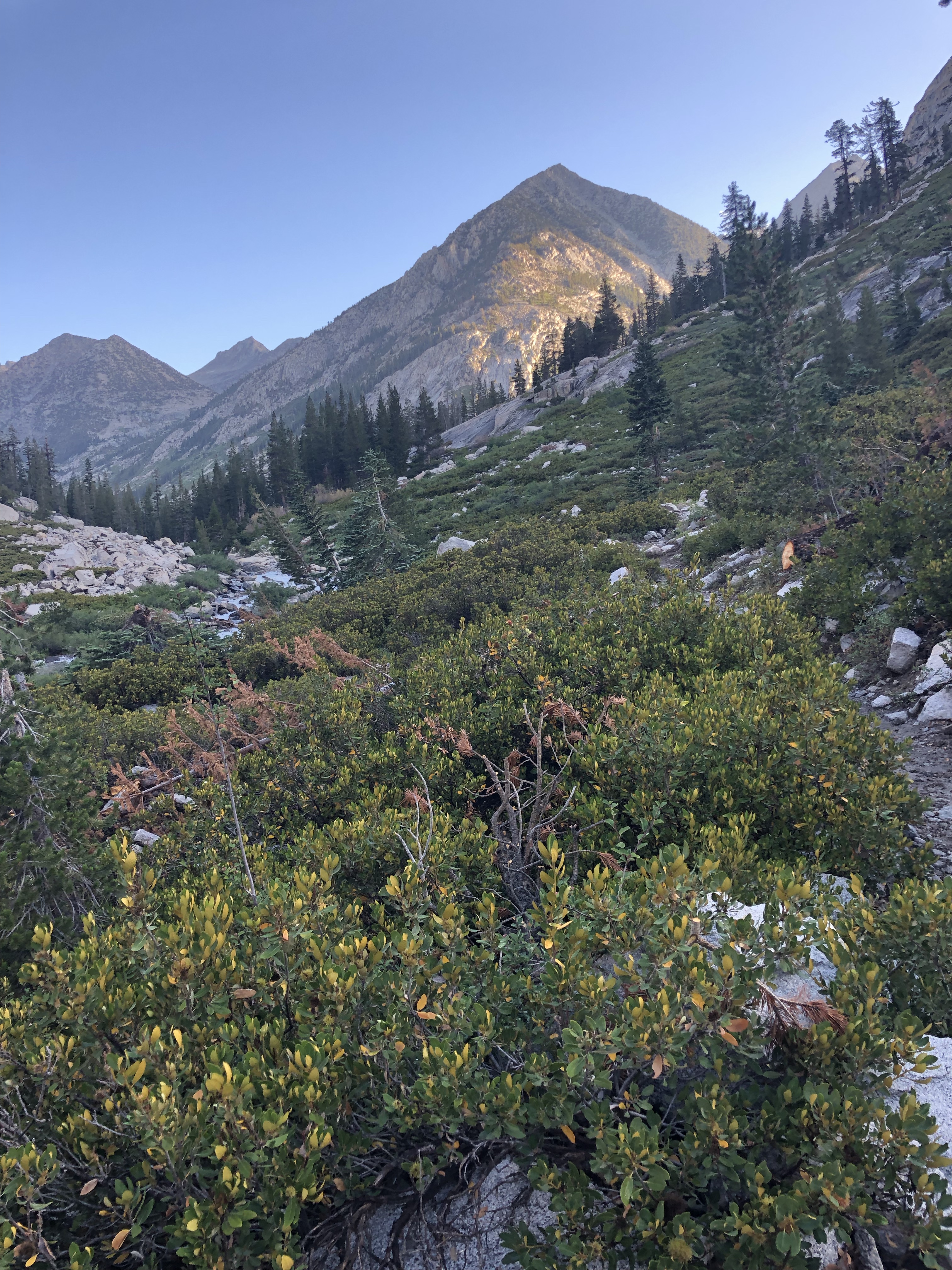
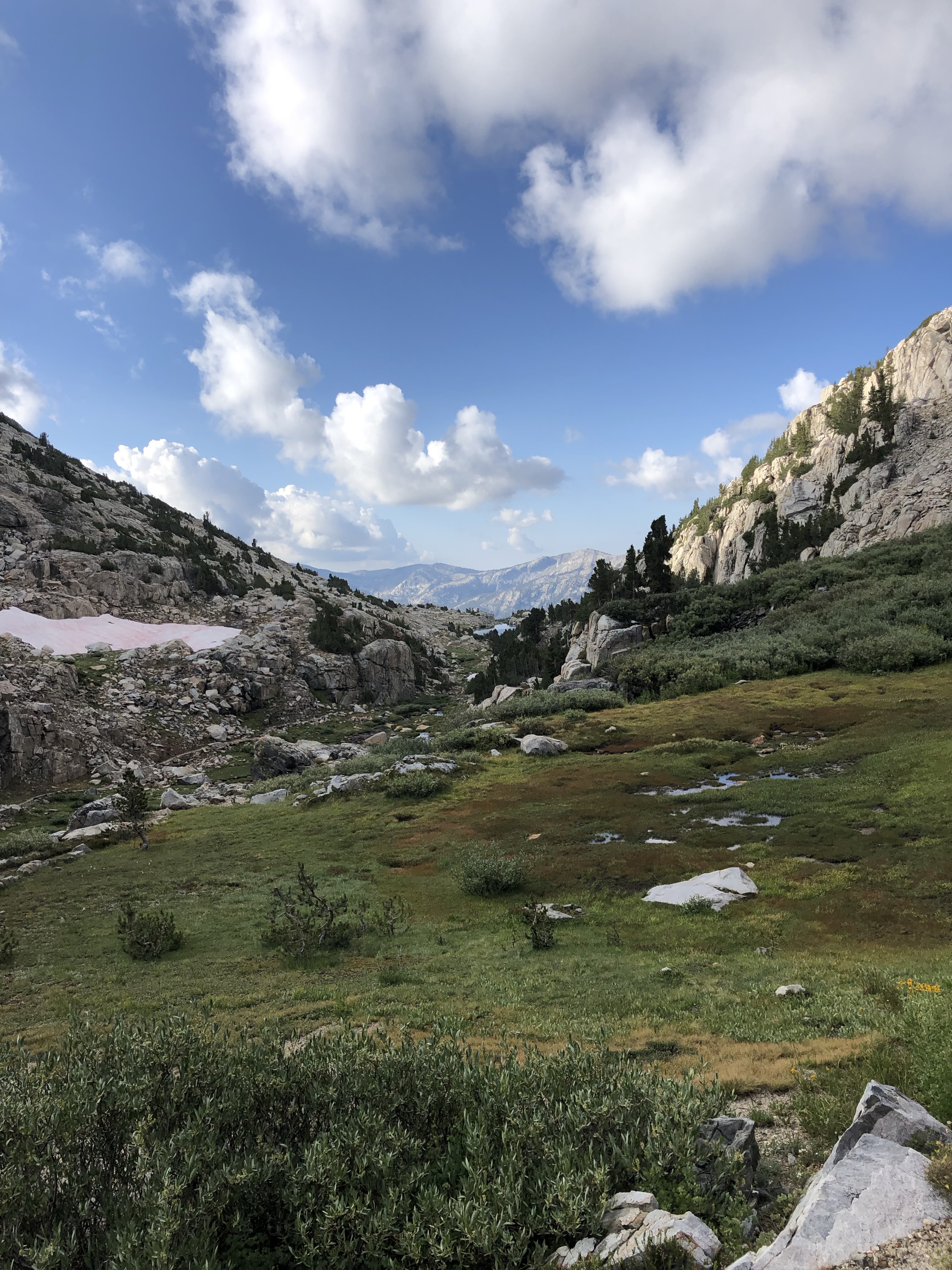
I’d been telling hikers in the first stretch that half a day out of Lordsburg, we’d finally get into trees. And so it was.
After getting to Lordsburg the day before at noon after walking 15 miles, I showered, laundered, ate a burger, drank a couple of beers, and got ready to hike out after a prepackaged Covid breakfast at the Comfort Inn. Love that place! They held a resupply bag for me while I hiked from the border and had a room ready when I asked at noon after walking into town. Right on. Rode the elevator up with a couple of youngish unmasked (against hotel requirements) guys from El Paso. I hesitated when I saw them as they held the door for me. Then said, “The hell with it, I’m vaxed,” One laughed and said, “So are we!” All of us joyful. I asked where they were working, they asked where I was from. The usual reaction that Puff Puff imitates so well, “ Alaska?!”
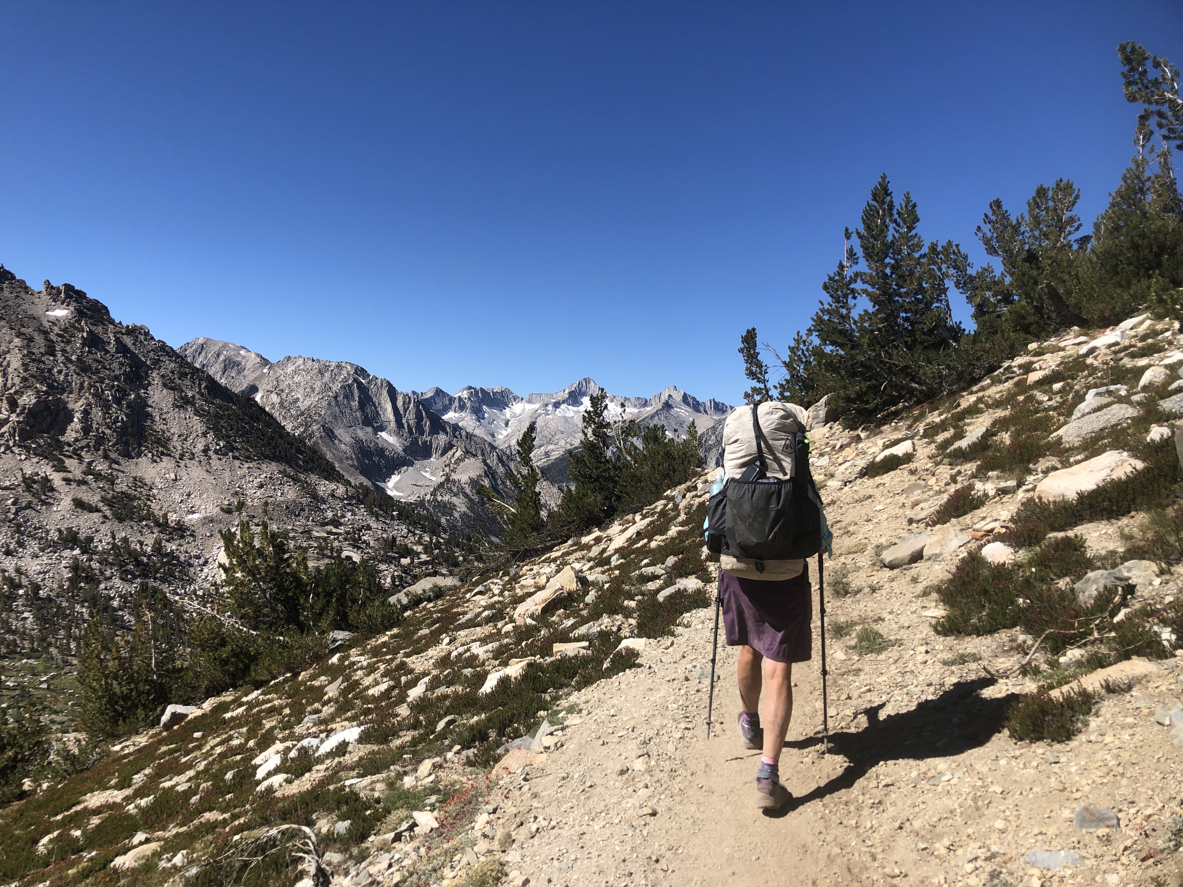
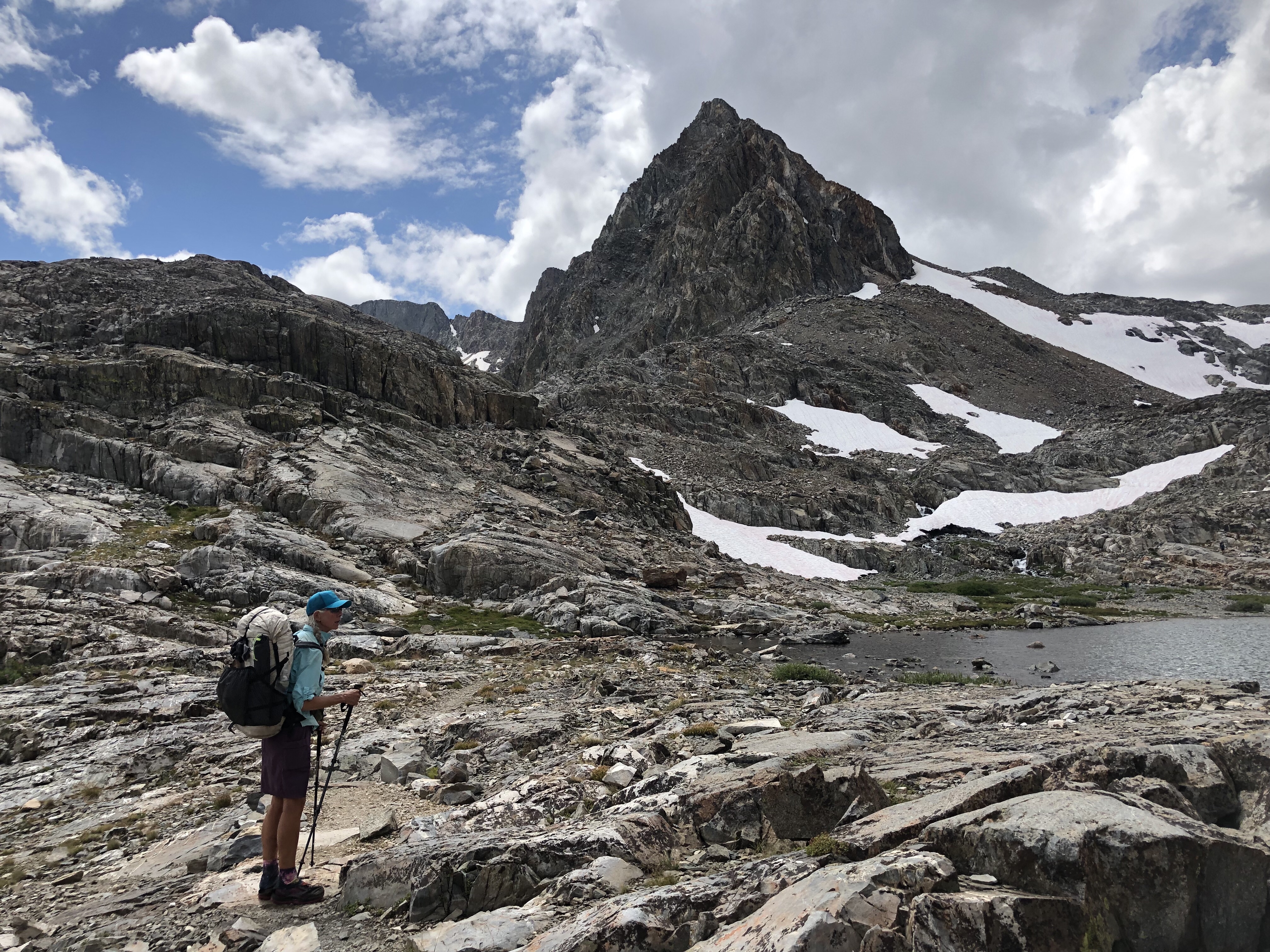
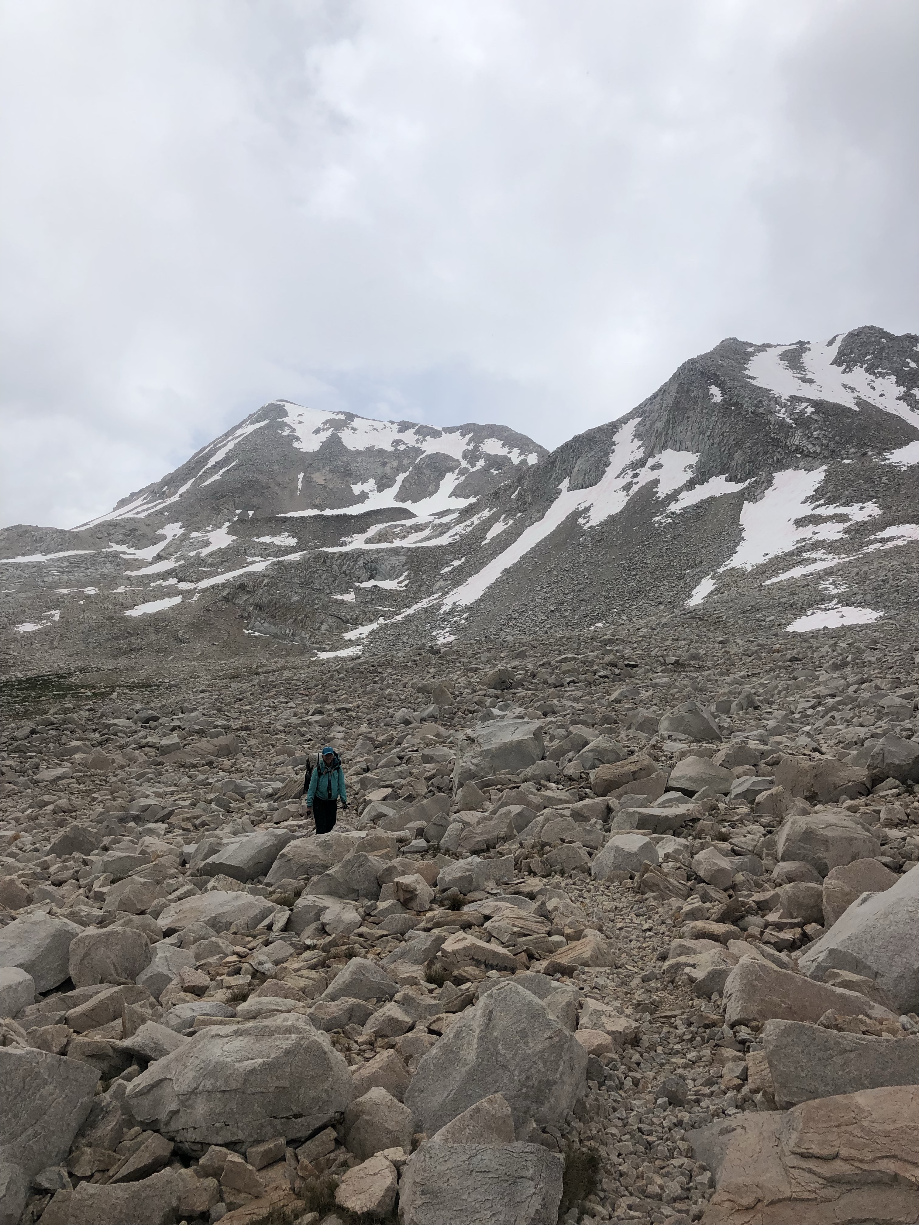
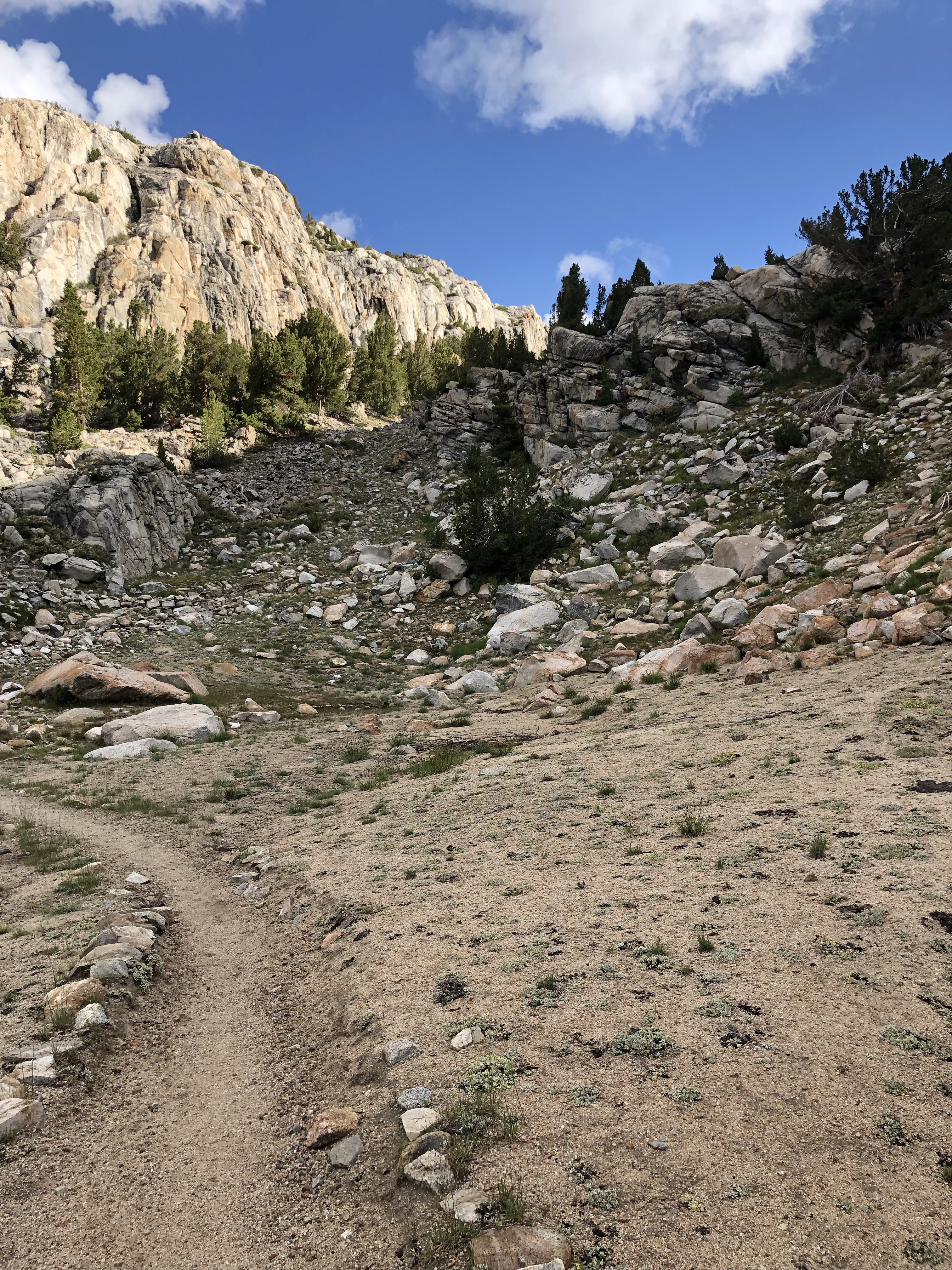
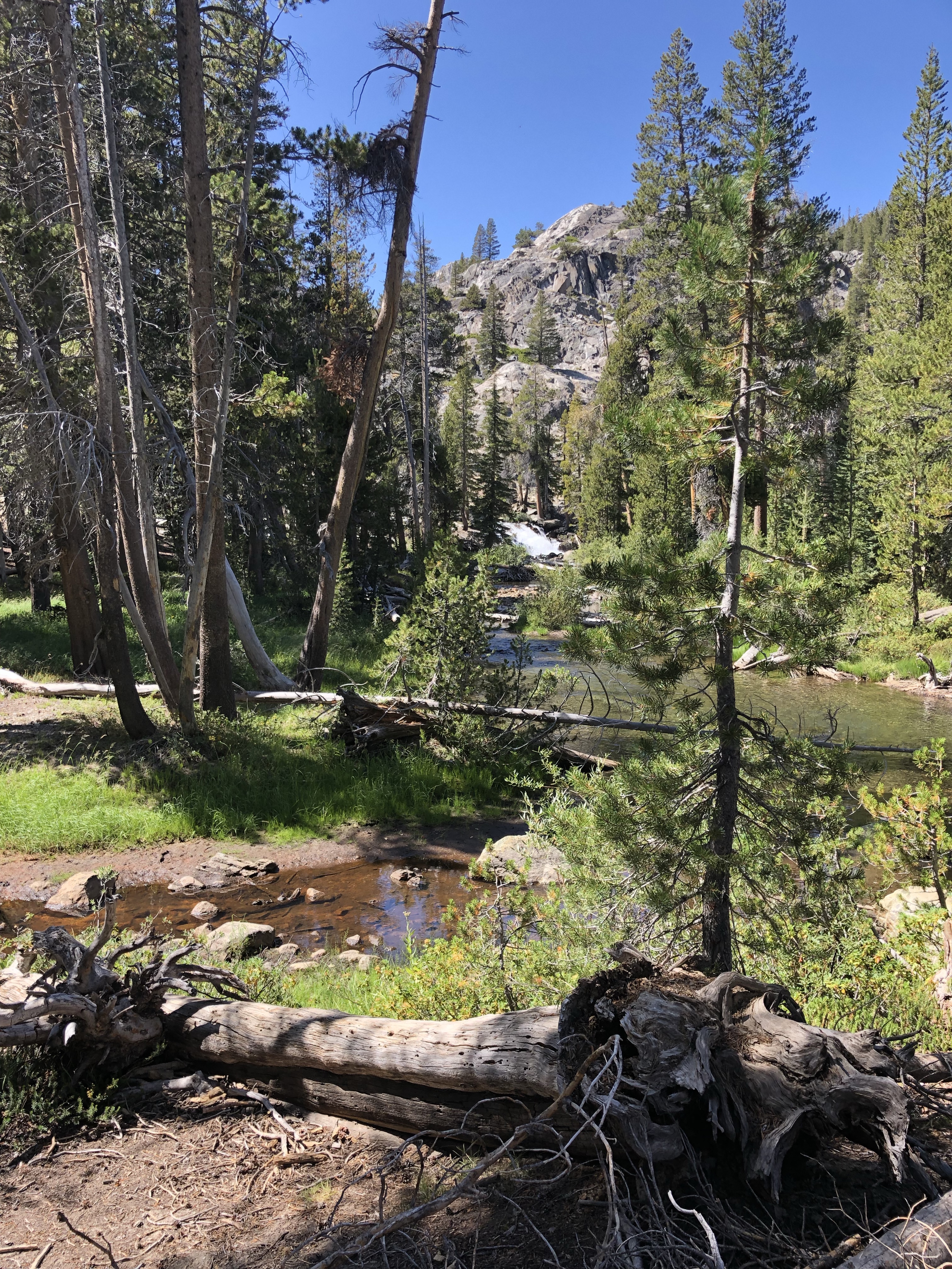
It was a good day out of Lordsburg into the trees. Tons of hikers: Tex and No Keys, OT (Old Timer, a Viet Nam vet and straight up believer in the Lord) and Jacobi, Cake and So Good, Bedbug, IBTAT (I think, guy with a camera I’ve been leapfrogging with—amazing photos and I’m now following him on Instagram), Gray Goose and my now buddy and fellow OG Tin Man. As I remembered from the two times I’ve done it before, it’s basically all uphill for 16-17 miles.
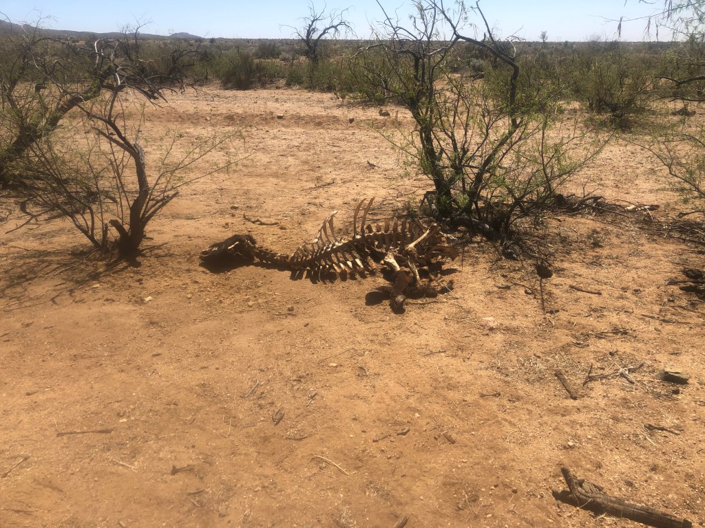
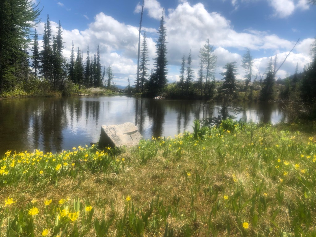
Dead cowResting in the shadeCow pie cairn
We all gathered like Water Buffalo at the first and only water source, the Engineer’s Windmill, getting water out of the cow trough and sitting in the shade, the first big shade since the beginning of the CDT. As we sat, a cow and calf began lapping up water. As I walked on, I saw a herd of cows and calves near the trough. The next day I heard that hikers just a couple of hours behind us found the trough empty, the pump broken and no water at all in the tall water tank. Some hikers posted comments on the Guthook App. The CDTC follows and uses the comments for their water report so I’m hopeful they were able to contact the rancher so he could get water to the herd. Poor mamas, poor babies.
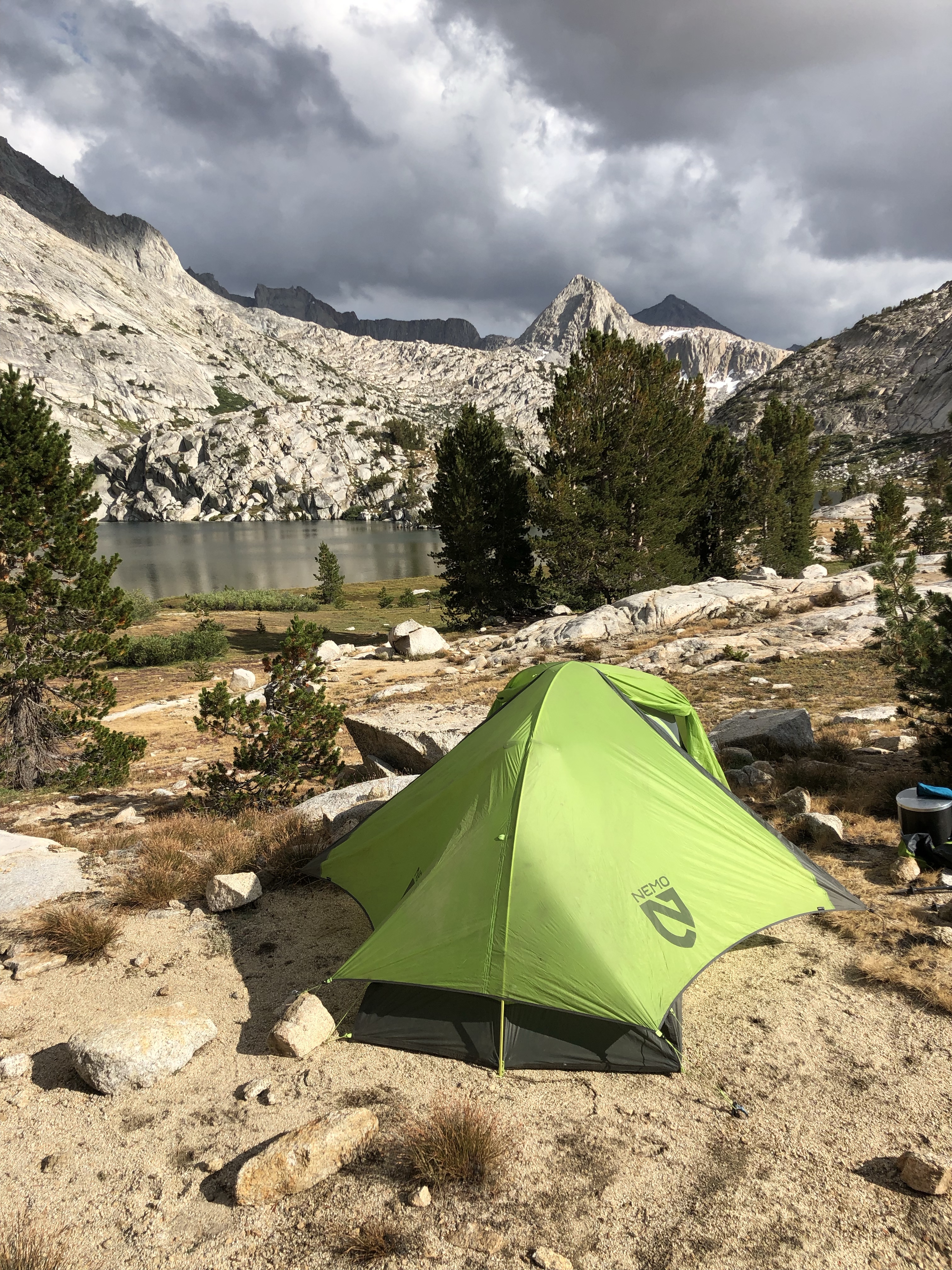
At about 5:30, Gray Goose, Tin Man and I pitched our tents in a shaded, wind protected, sandy bottomed little campsite.
The next day I caught up to them at a trail angel set up after 11 miles or so, around noon. Solo cooked hot dogs, had fresh fruit and cold sodas. She was camped in her van and was so happy to help us all out. Outstanding day brightener! I knew there was going to be quite some climbing and elevation gain up to Burro Mountain and it was getting hot.
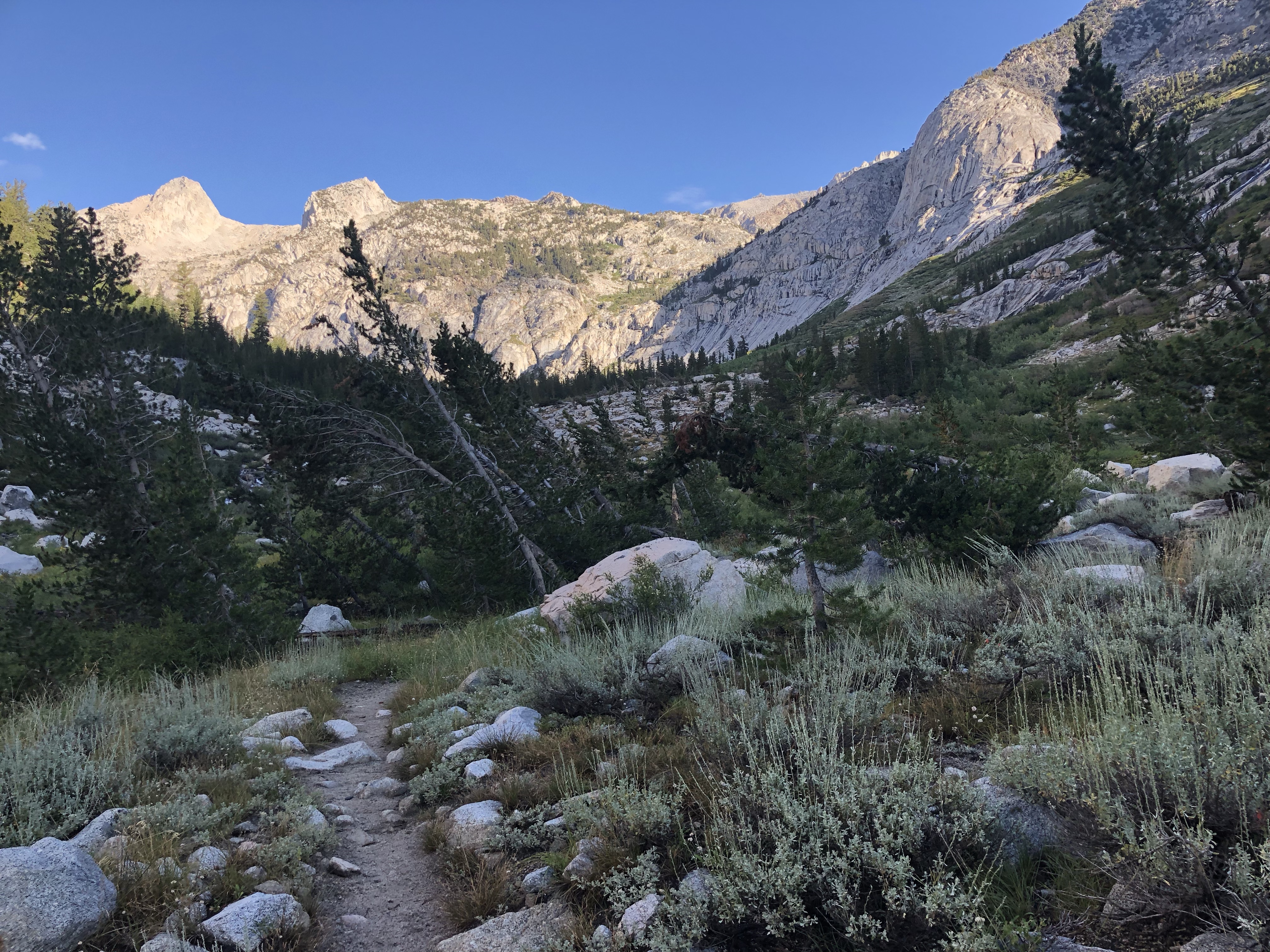
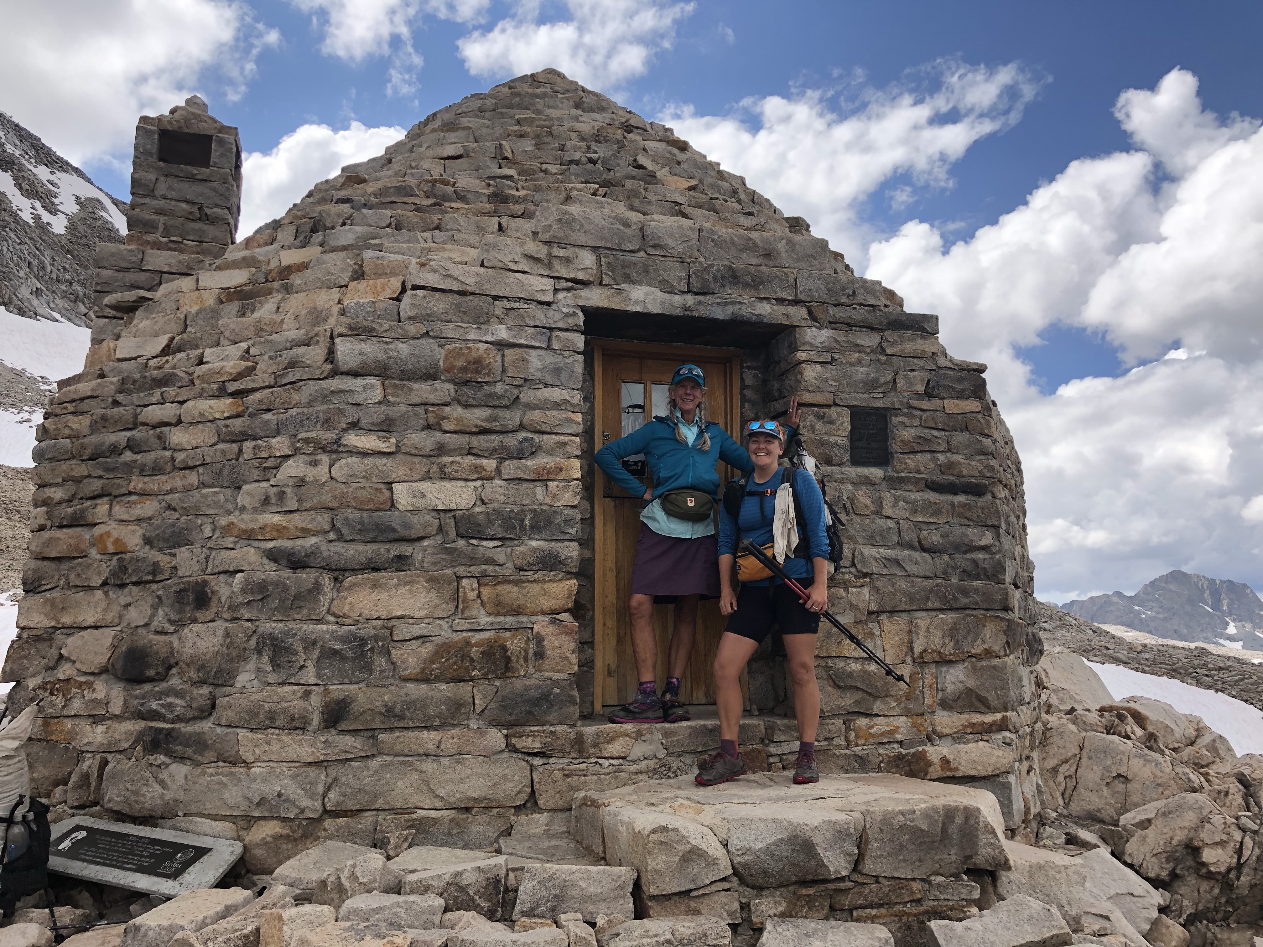
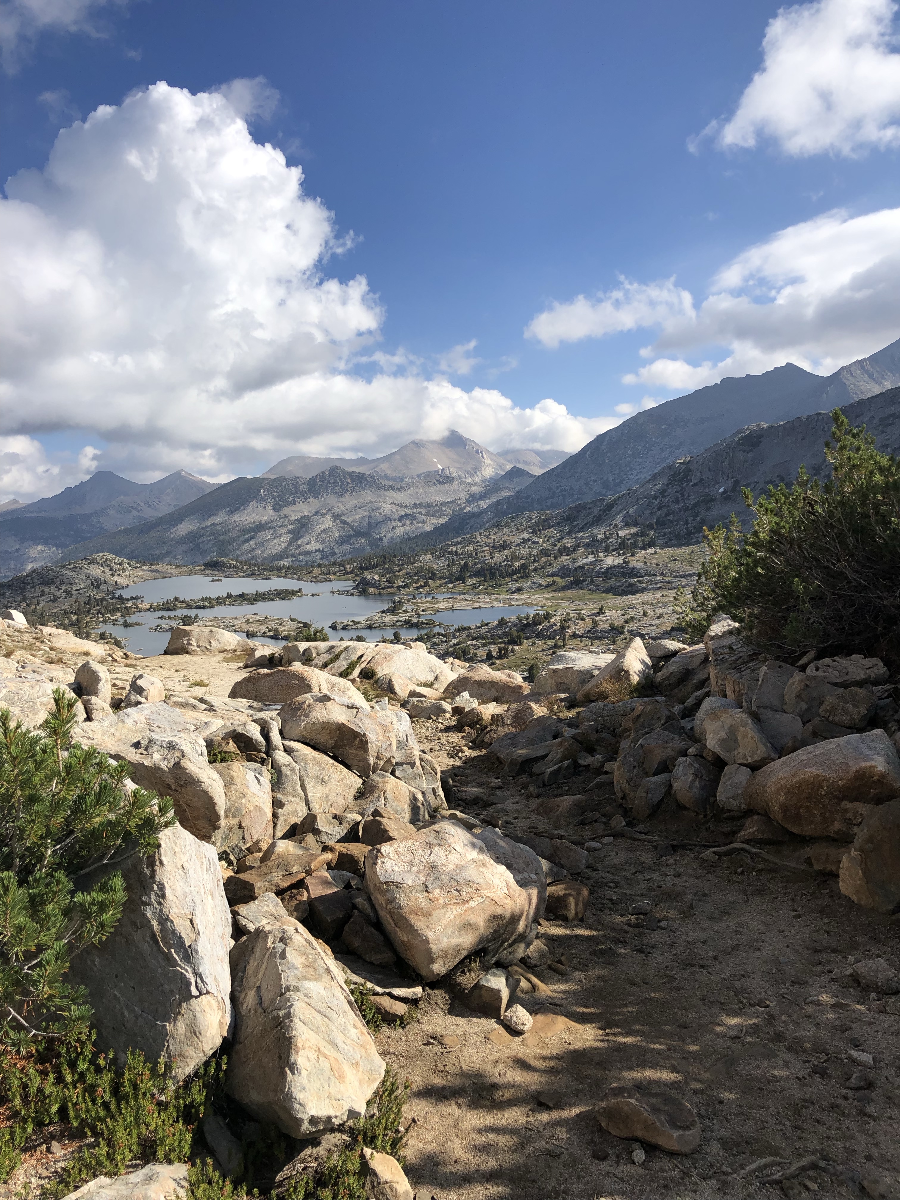
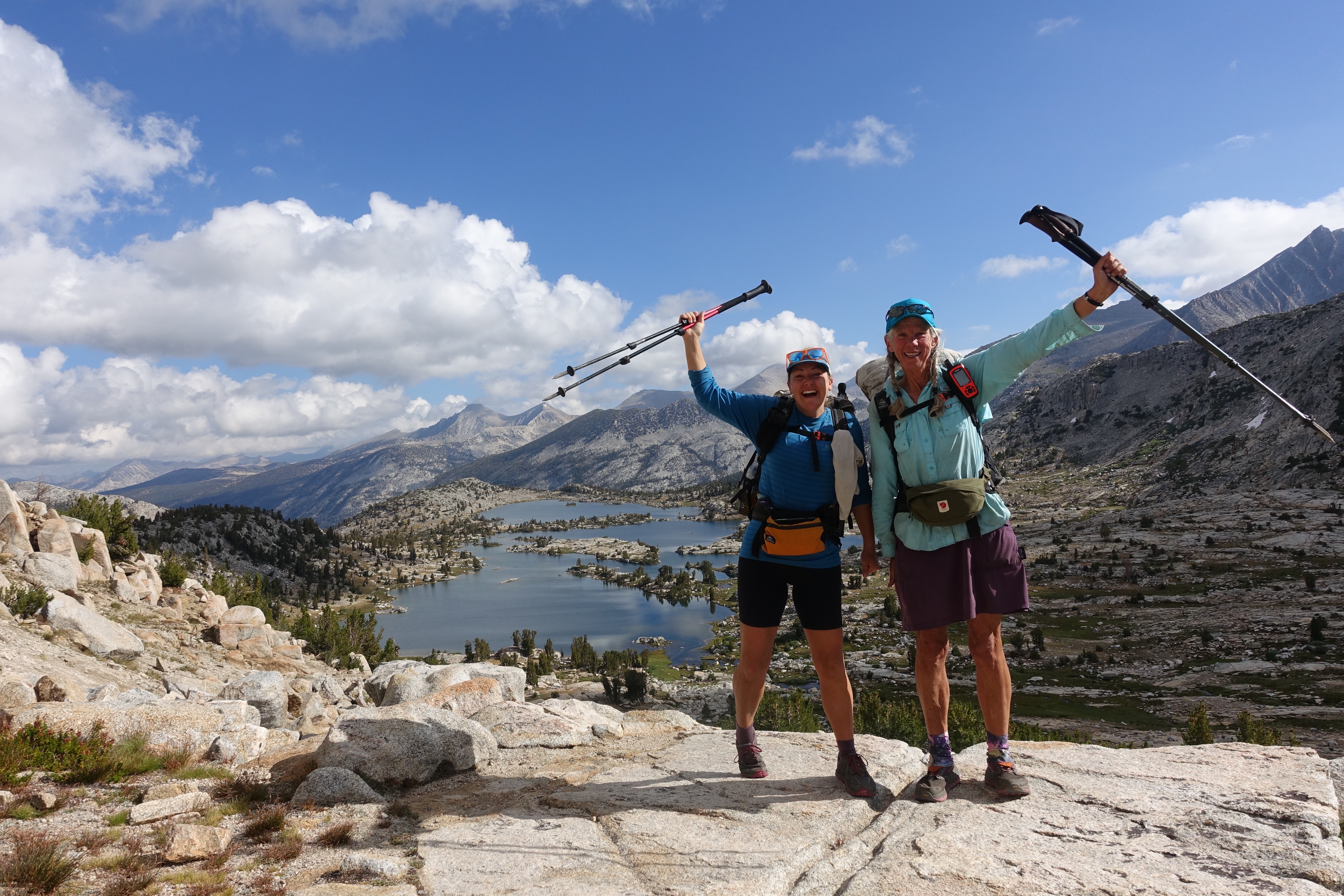
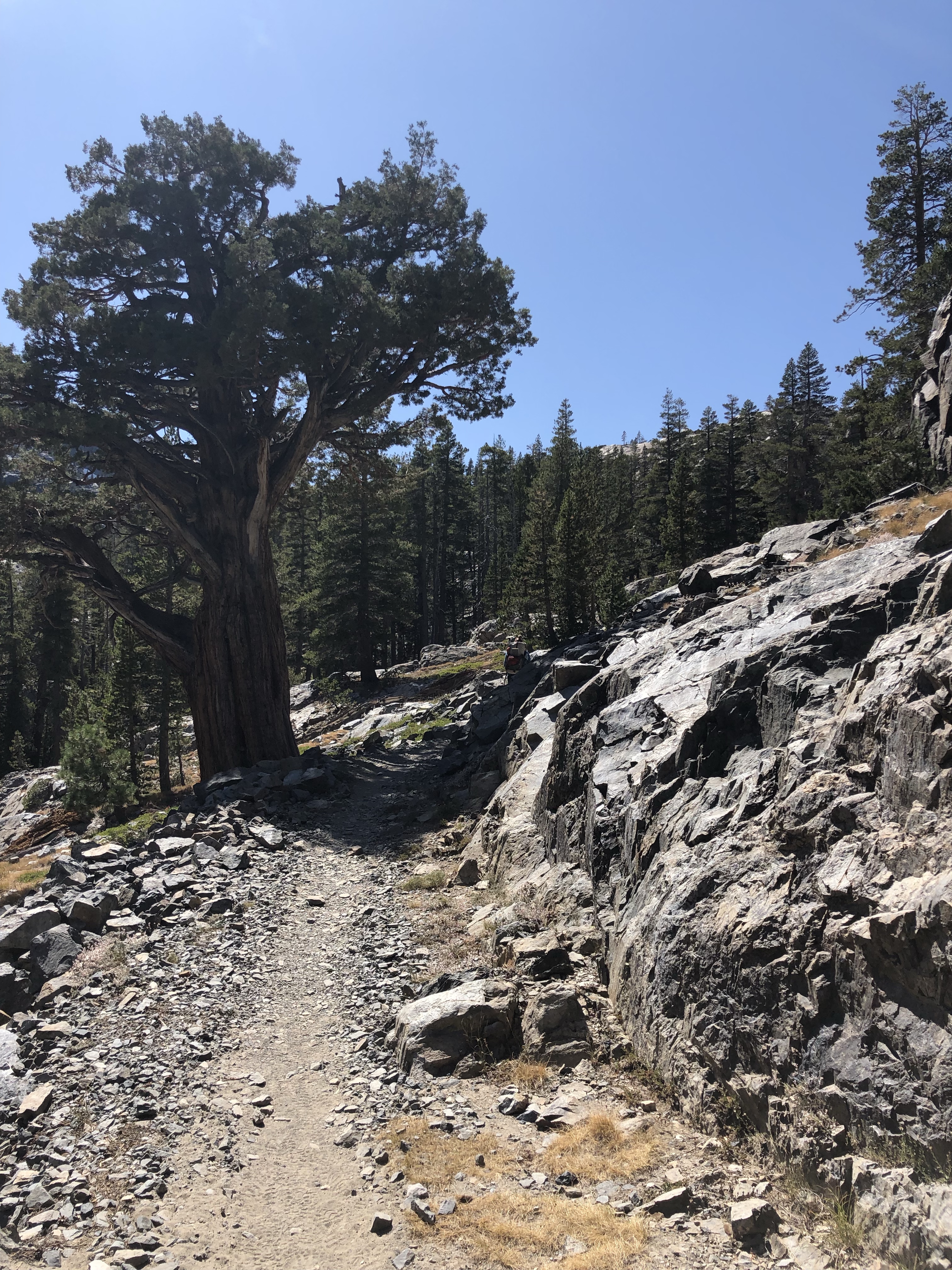
Since the last time I was here, a new section of trail has been built, something the Guthook guide has not incorporated into the map, but it was well built and well blazed and eventually hooked into the trail I knew. At the top I found OT, Jacobi and Tin Man! I followed them downhill on slippery, sandy and gravelly trail, taking my time so I didn’t go ass over teakettle as is my wont. At the junction off trail to Burro Mountain Homestead RV Park, they waited so I wouldn’t miss the turn off. Of course I wouldn’t, and was probably kind of overly sensitive about that. I thanked them and on the way down felt I should explain or apologize, something. Why can’t I just assume men would do the same for another guy hiker, that it has nothing to do with me being a long lived female?
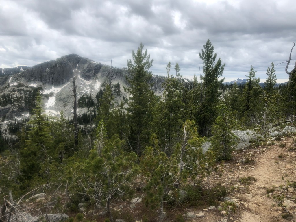
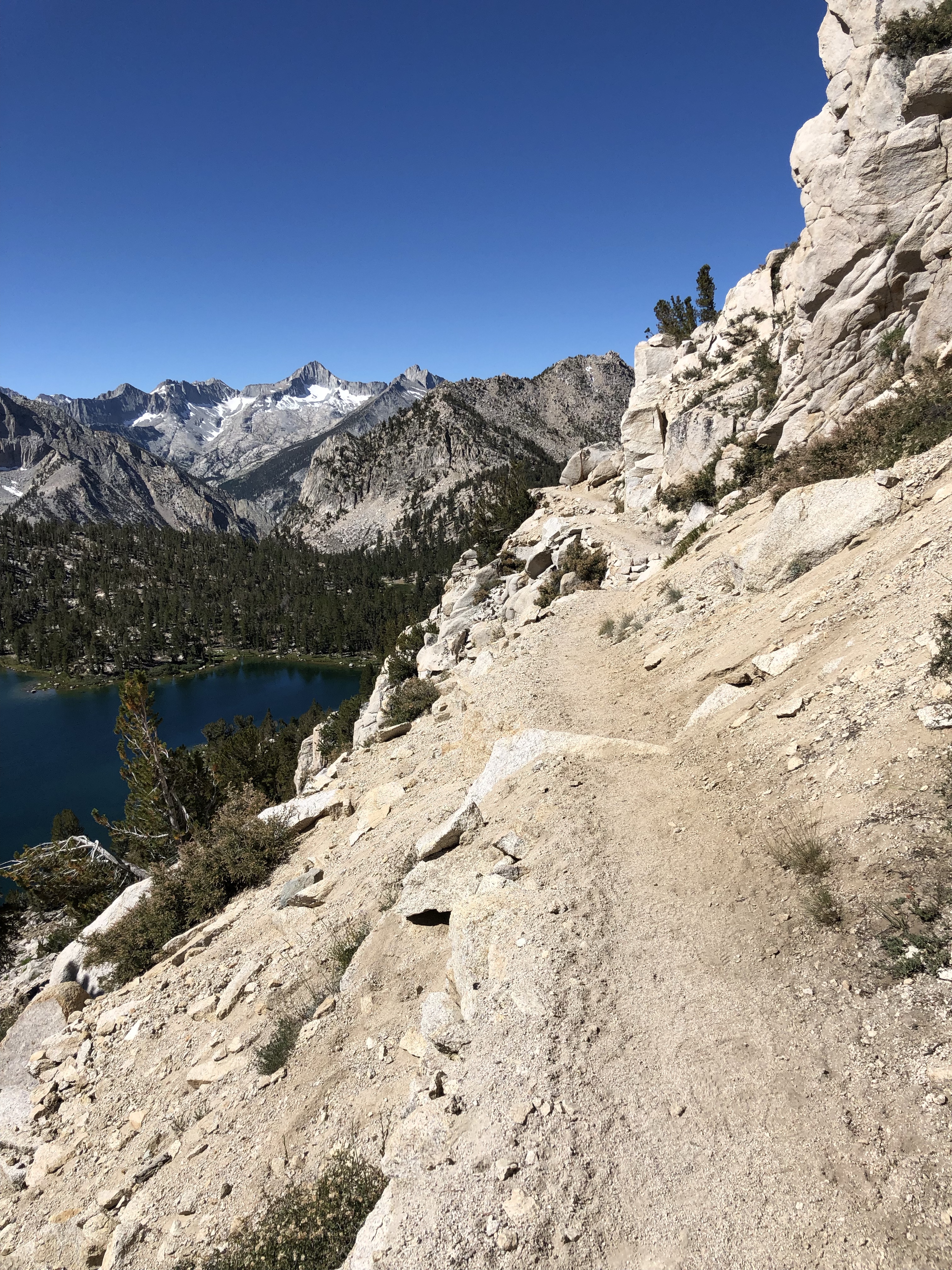
Burro Peak view
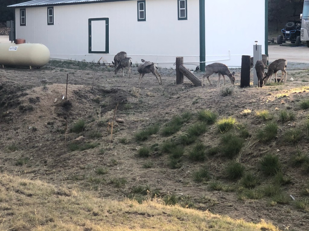
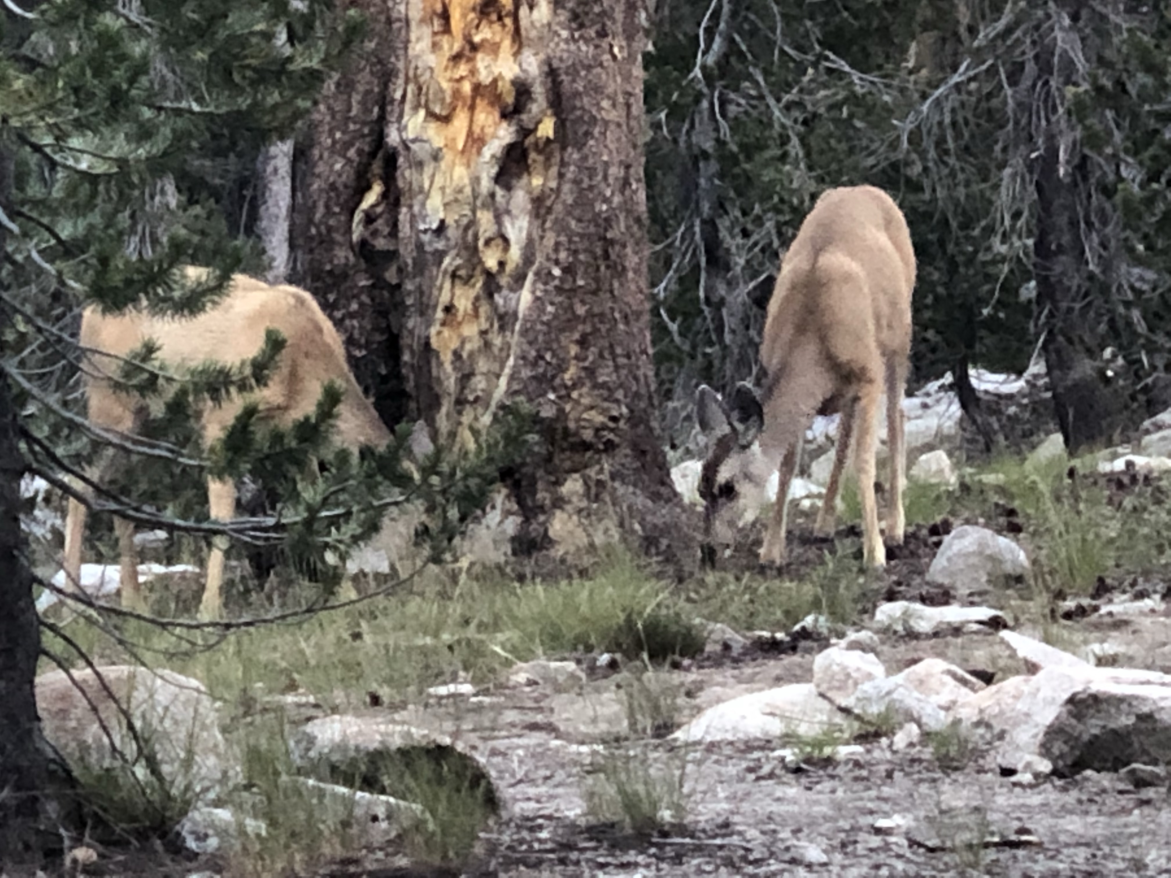
Anyhow, on the deck was a wonderful pile of hiker trash. I’m so happy to be out here! Tex, No Keys, Cave Man. Gray Goose greeted me, Tin Man, OT and Jacobi. Already pitched behind the bathhouse was Beth and John. It was quiet before dark, even though No No and another hiker came in just before. Free showers, close camping, deer browsing amongst our tents. A beautiful restful night.
Day 3 we trickled up and out on dirt roads towards the highway. At the junction we started the trudge on paved highway. About 4 miles before town, most of us stopped at a burrito place. I had a bacon, egg and red sauce burrito—absolutely divine. We had to stand in the drive thru lane behind cars, then eat in the dirt and shade of a tree across the lane.
There are so many hikers that when I called the Triple Crown Hostel, they were full. I had a reservation for the next night, but was getting to town a day early because of the fire closure and reroute. No problem, my favorite cheap motel, Copper Manor, had room. But I’ve been traipsing along with Warriors and a former Warrior and current adhoc Warrior supporter. They’re staying at an in town RV park with a few cabins or trailers for rent. So I’m sharing a trailer with another hiker for a zero and got to eat dinner with vet and Warrior Expedition on the ground coordinator Michele and her totally delightful daughter Payton. Oh also some guys, Gray Goose, Caveman, Tin Man.
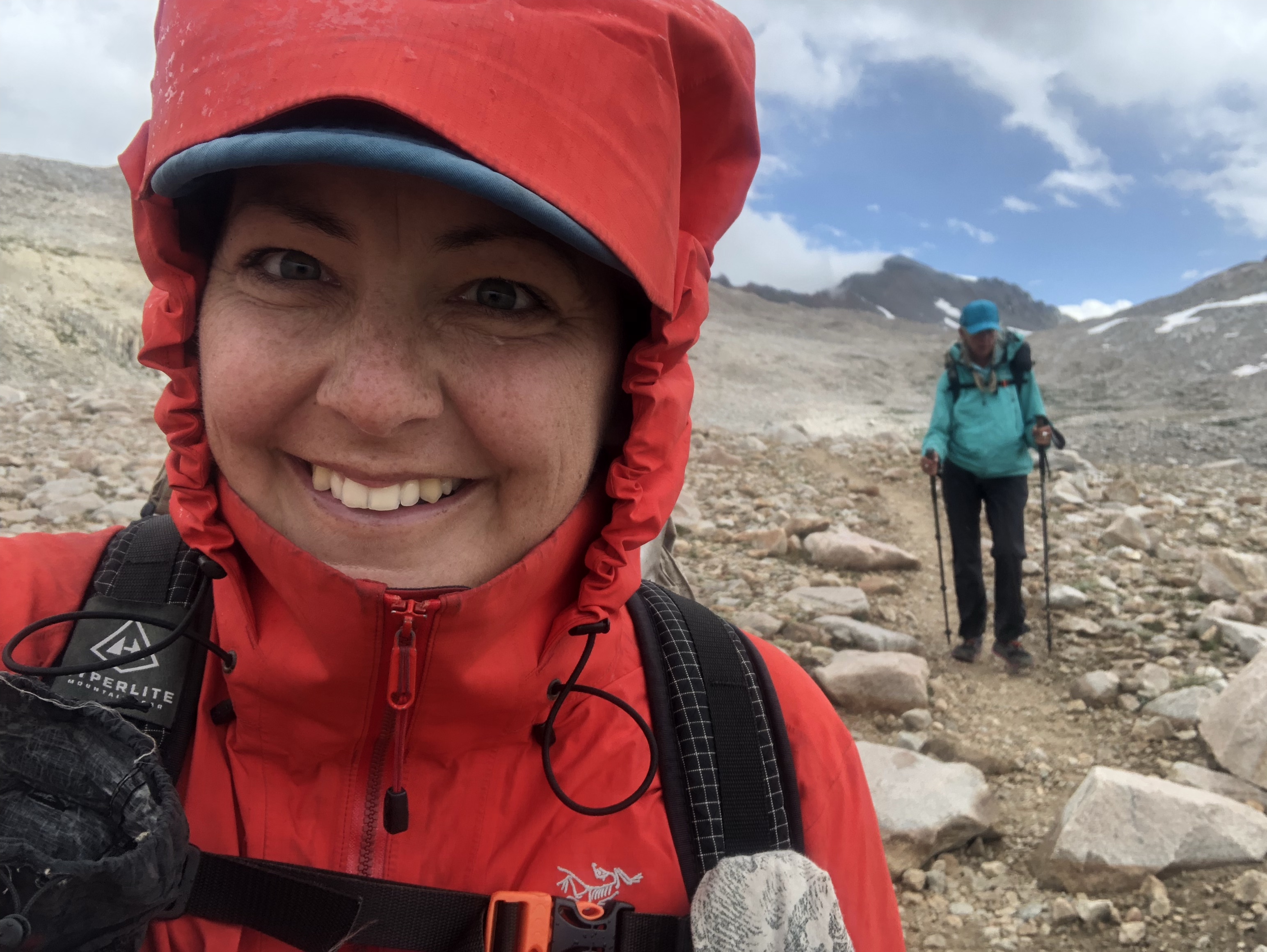
Getting ready to hike Hwy 90
It’s been a unique experience, not just on the trail, but in life, to spend quality time with vets. I love our discussions about military history. I listen in to their detailed and technical discussions about guns and other weaponry. I am taken by their honesty, why they joined, what they have done after getting out.
Where else but at a brewery?Silver City Visitor Center
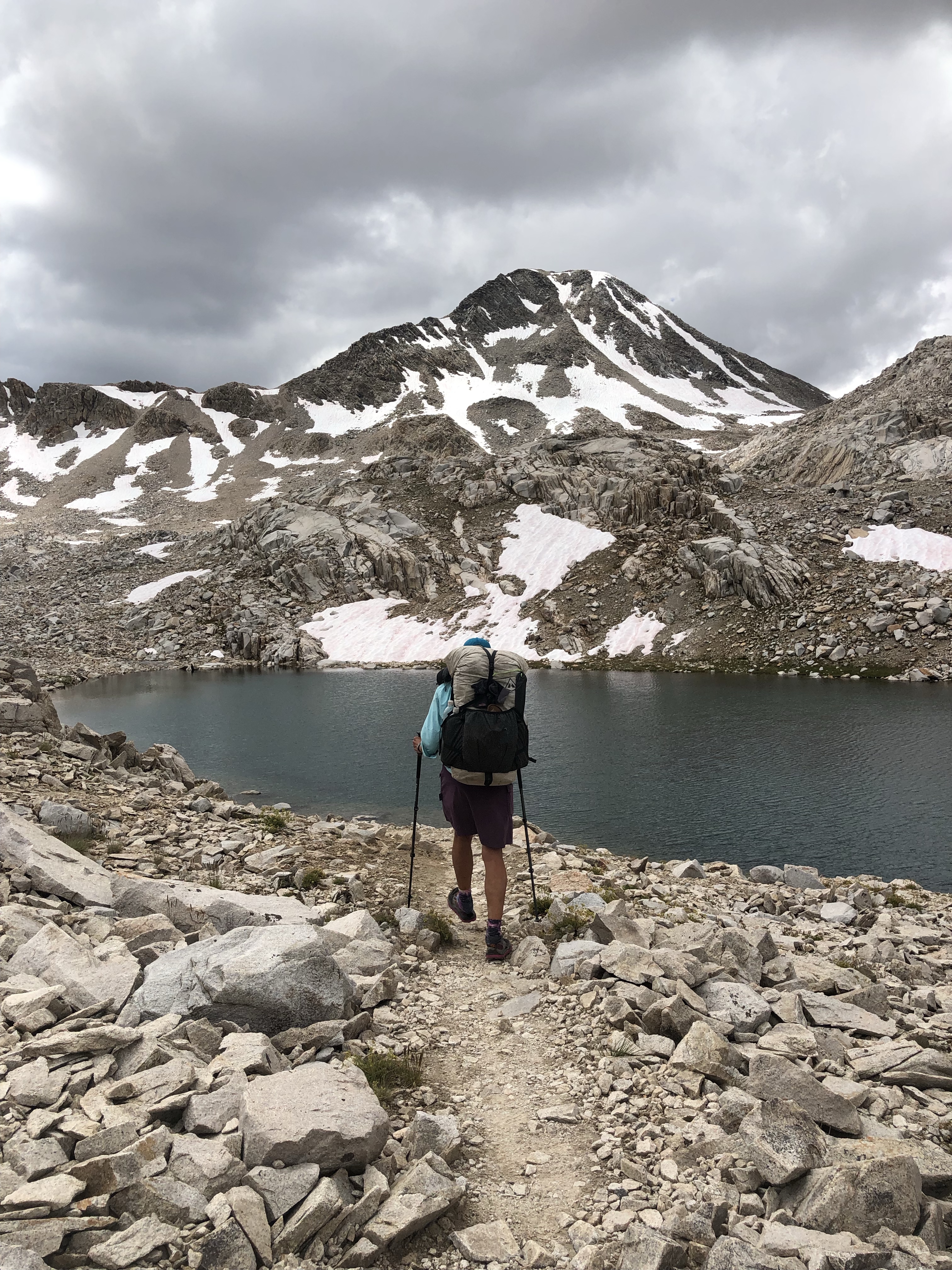
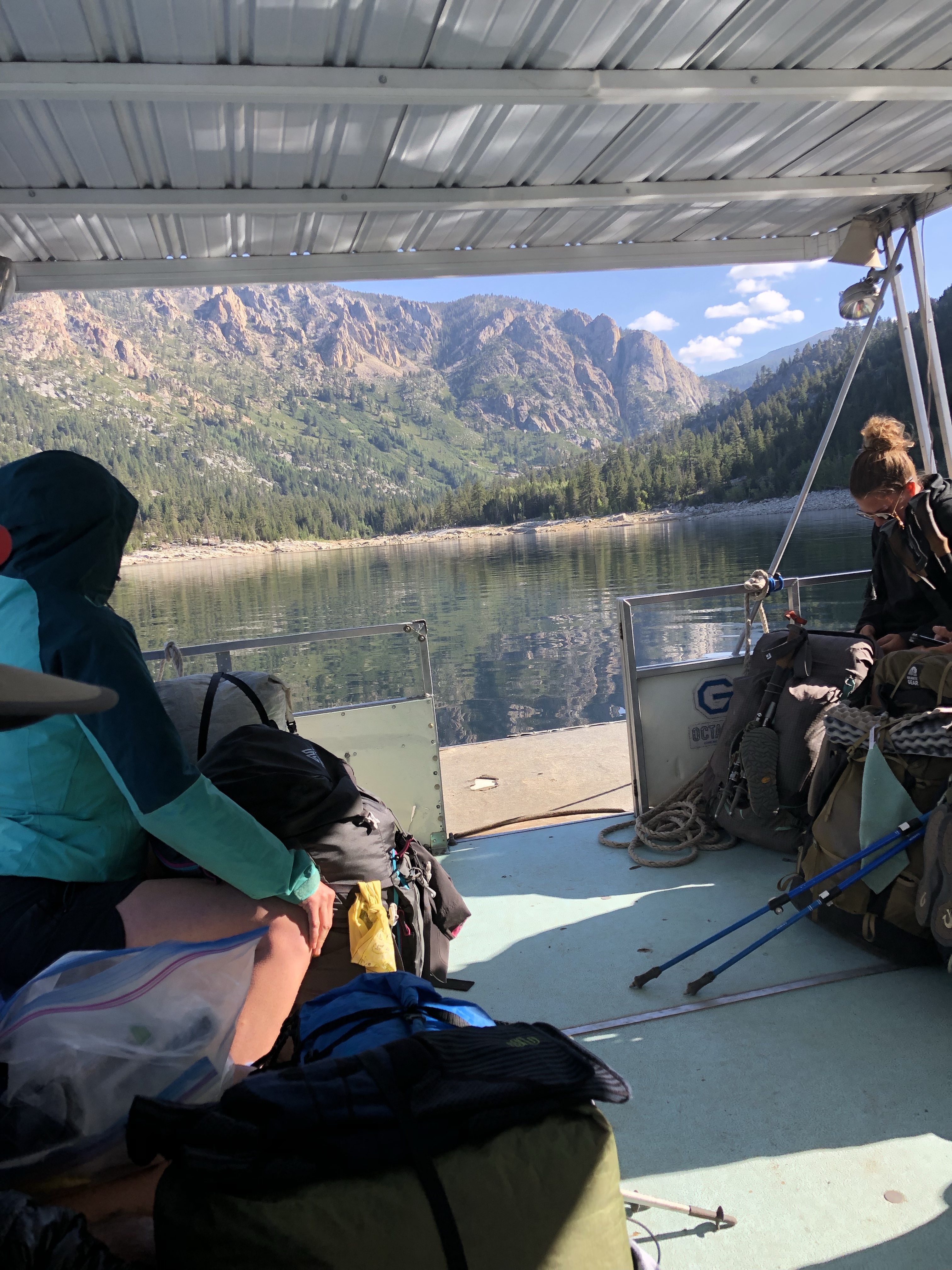
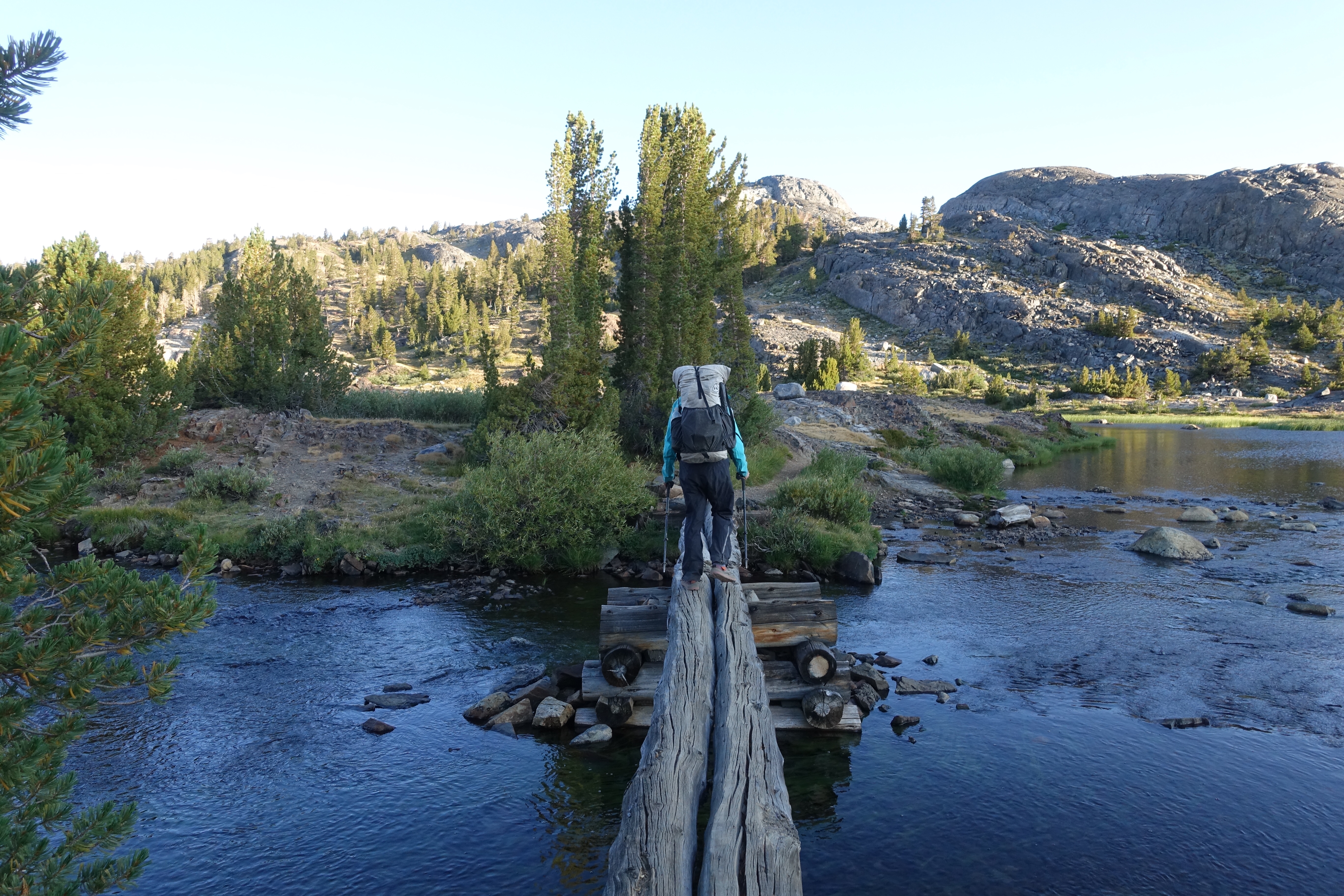
The road to the CDT monument at the border is much improved from 2017 when I rode out with the Ravens. Dion (Buddy Backpacker’s dad) of Crazy Cook Shuttles picked up me and 2 other hikers at 6 am. I think I was hiking by 9 am, planning to camp at Water Cache #1, like we did last time, after about 14 miles.
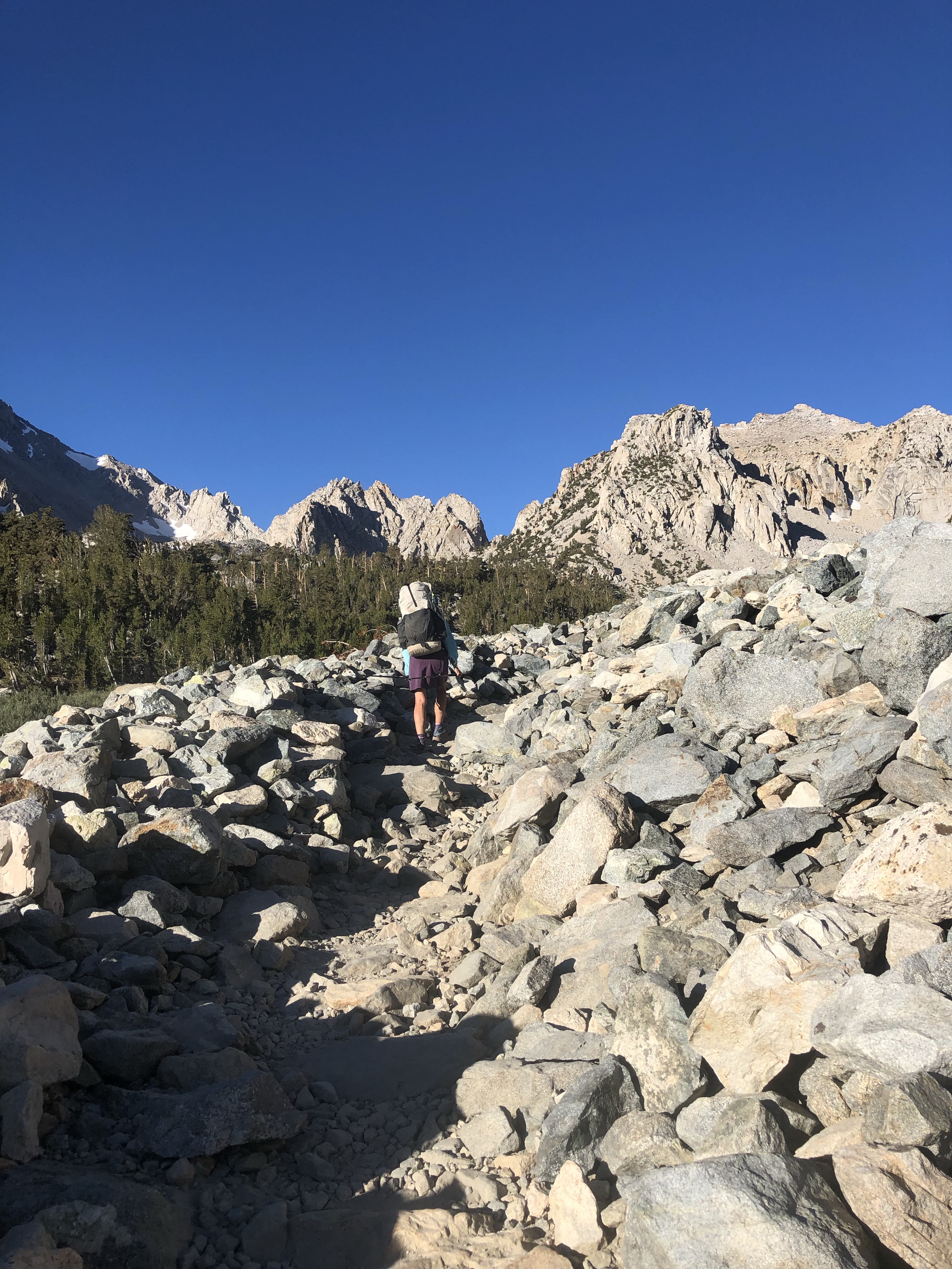
One of my goals in hiking this hellish stretch again was to learn from my mistakes. Day 1, I made three mistakes, but one I fixed, and another was kind of fortuitous. The first mistake was leaving my sandwich in the motel refer. The second was forgetting to test my Guthook map app. Duh. Couldn’t find my little GOS arrow on the map. Asked another hiker, problem solved. The third was when I set up camp and realized I’d packed the wrong sleeping pad, a Big Agnes that is divinely comfortable but heavy and bulky. But I hydrated like crazy all day and felt fine. Way different than 2017.
Super windy camping at Water Cache #1, with a bunch of people including a group from Warrior Expeditions, combat vets. Way more hikers this year but still fewer than the 50 that start the PCT each day.
From Water Cache #1, I took the gravel road rather than climbing back up to the “red route” in Guthook that goes post to post. It was simple, tedious, but reasonably quick walking. I felt better today—exhausted from carrying 5L of water from MP 25.2 to a beautiful, sandy dry campsite.
Day 3 I felt even better, walked a ways with retirees Beth and John that I met the first day. They’ve biked the trail and Baja and other cool places, this is their first long distance hike though. It’s especially nice to have another woman in my general age range out here, women are definitely in the minority in the wave of hikers I find myself in. It’s easier walking today, but that means monotonous. So people at water sources are a big excitement: Kyle, Tinman, Grey Goose, Jazz Hands and trail angel Cheshire Cat and his dog Stella Blue (I got a banana!). After yesterday’s water haul to camp, I decided to call it a day at a water source after 18.5 miles, another short day of walking just 7 am to 4 pm. It’s more or less dark at 8:30 pm.
The last night I camped with 15 miles left to Lordsburg as planned. What I didn’t anticipate was how quickly those miles went when you’re not suffering from heat exhaustion and have another hiker to chat with! Made it to my hotel by noon and got early check in, sweet!
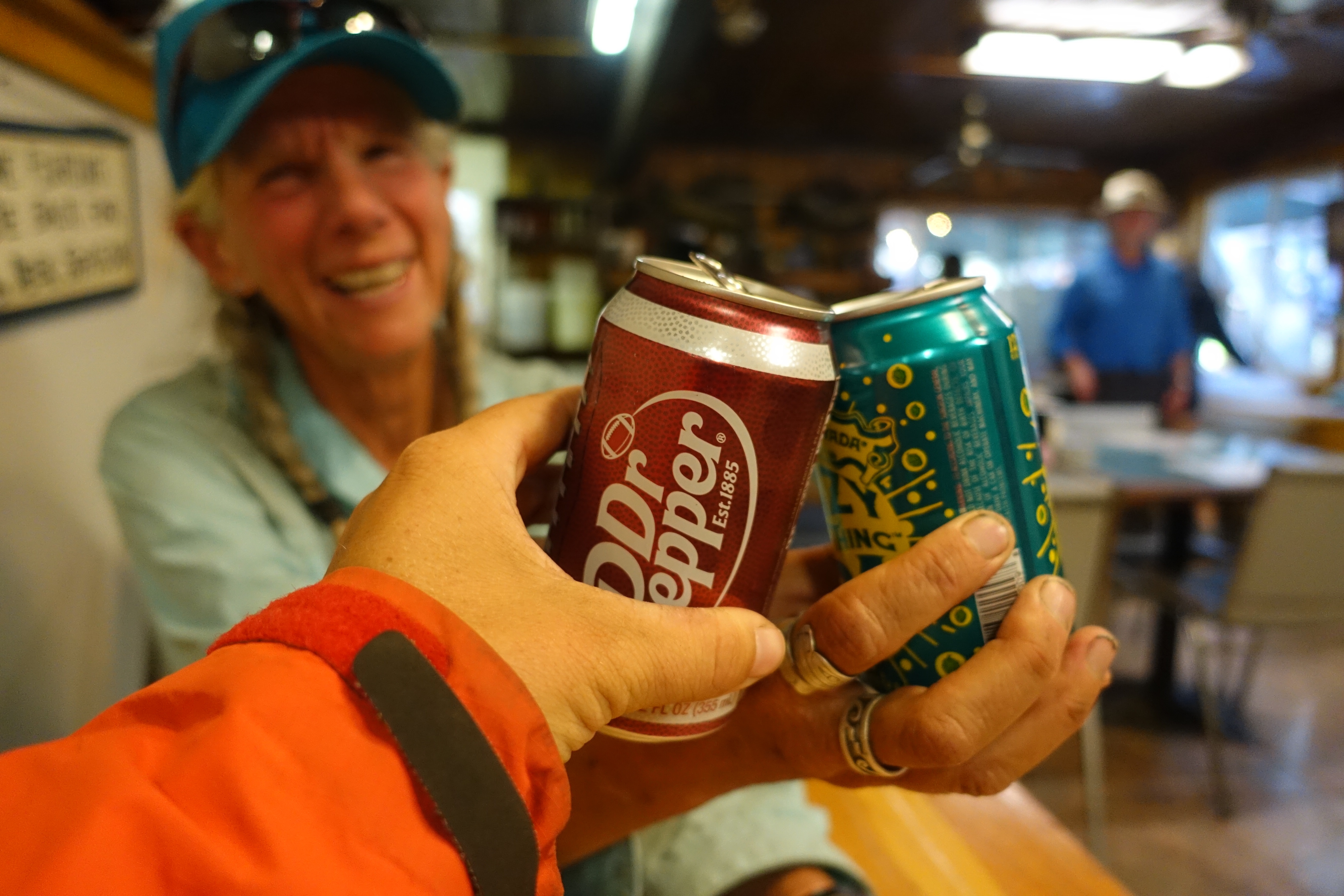
The whole stretch has been so much cooler than last time, breezy and just lower temperatures. I’ve used my sun reflecting umbrella for shade several times but not constantly. So glad I made this section in good shape! I won’t need to zero, I’ll just get my burger and beer and head out in the morning.
Wow, what? So I was planning the Arizona Trail (AZT) starting mid March, 800 miles or 2 months but then the wonderful USASA Series Directors in Mt Hood, Ali and Leslee, decided to host a Regional championship for Alaska, Oregon, Idaho, Montana, and Washington in early April, so after going to that, I’ve got a month to hike till I have to be back in AK. Watching my Facebook feeds, I jumped on a shuttle reservation to the CDT start at the border of Mexico and New Mexico April 15. It’s a few hours on bumpy dirt roads from Lordsburg. Not only am I pandemic crazy, I’m masochistic. I’ve done the CDT from the border. The first 85 miles to Lordsburg sucks! No shade, reliant on water caches, I got heat exhaustion but didn’t realize it. But, maybe I can learn from my mistakes and do it better. And, maybe getting on the trail for a month will help heal me. I’m vaxed, but traumatized as we all are from the pandemic isolation and paranoia and anxiety. Combined with being ancient, I hyperventilate over every weird new physical, emotional, or psychic symptom. Is it aging or illness or anxiety?
Team Big AK at Mt Hood (I’m in there)
4/14/21
The USASA Pacific Northwest Regional Championship was a blast!
Flew back to Alaska to change out my snowboard gear for my hiking stuff, then flew to El Paso for a night. Uber to the Greyhound, 3 hour bus ride to Lordsburg, NM, and I have a bumpy shuttle plus water cache lined up for tomorrow. Last time I did this, the Ravens and I were together and met the other 5 hikers who started that day in including Dassie (read her book!), Burning Calves, and Johnny who became German Mormon up the trail. I hope to meet and hike with more great characters this year. Yeah I solo happily but I actually really love company on the trail. For it to work, we have to compromise and adapt to other people’s hiking style, a satisfying challenge. Hiking friendships and partnerships that form on the trail are fascinating too. Me and Puff Puff, Trooper and German Mormon, Nuthatch and Party Saver, AJ and Dassie (buy her book!), and many others.
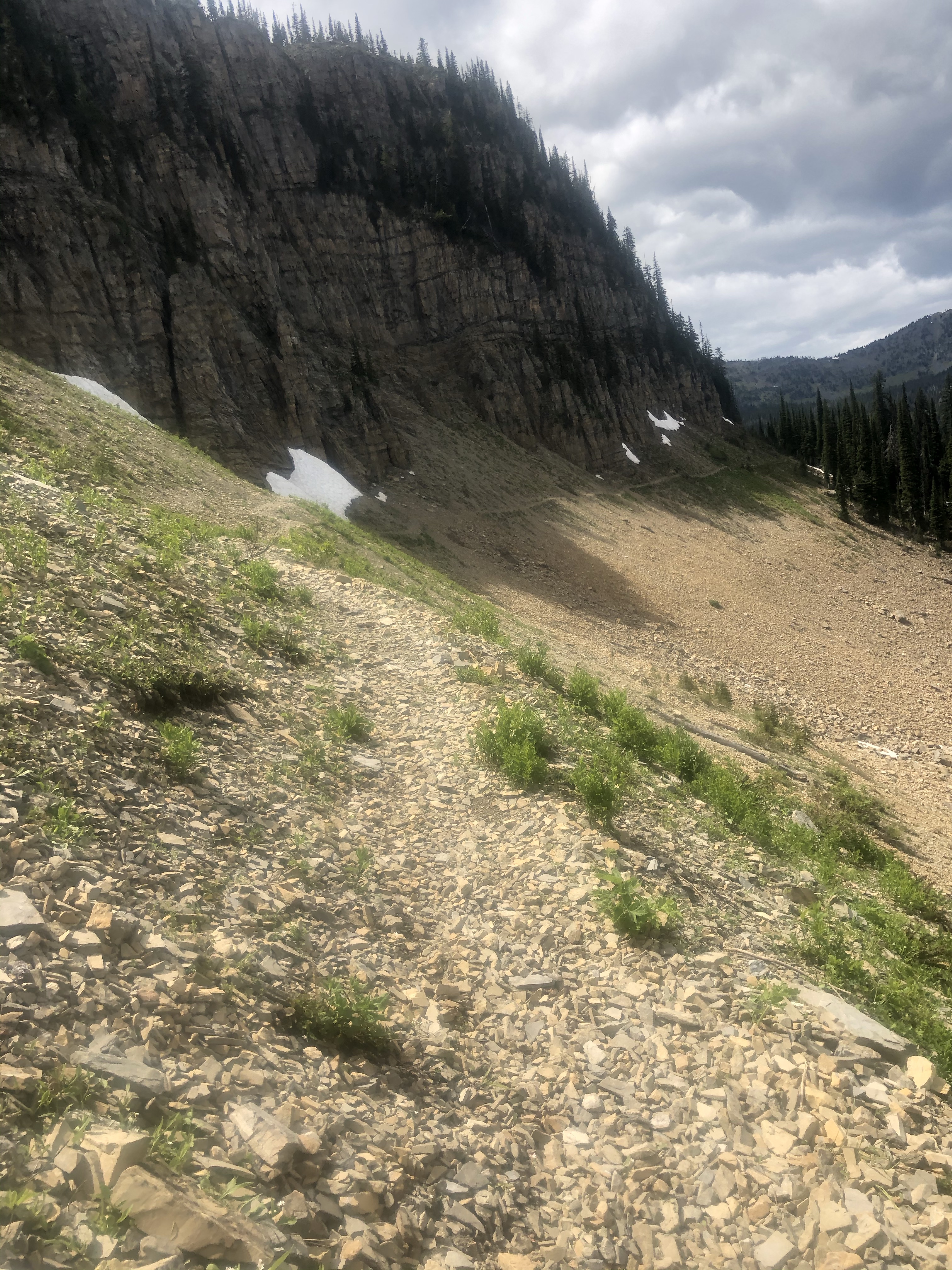
8/5 Skipped a ton of road walking out of Oroville. Dan drove me to 6200’ so it’s a bit of a shock to the system, from blazing hot to pleasantly cool, from low to high(er), from bugless to voracious and noisy mosquitoes and flies. Lots of short haul backpackers out here, nice to see them.
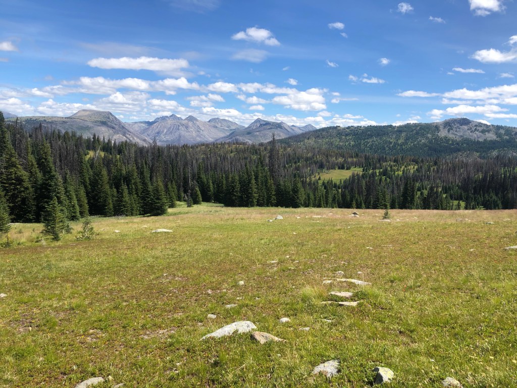
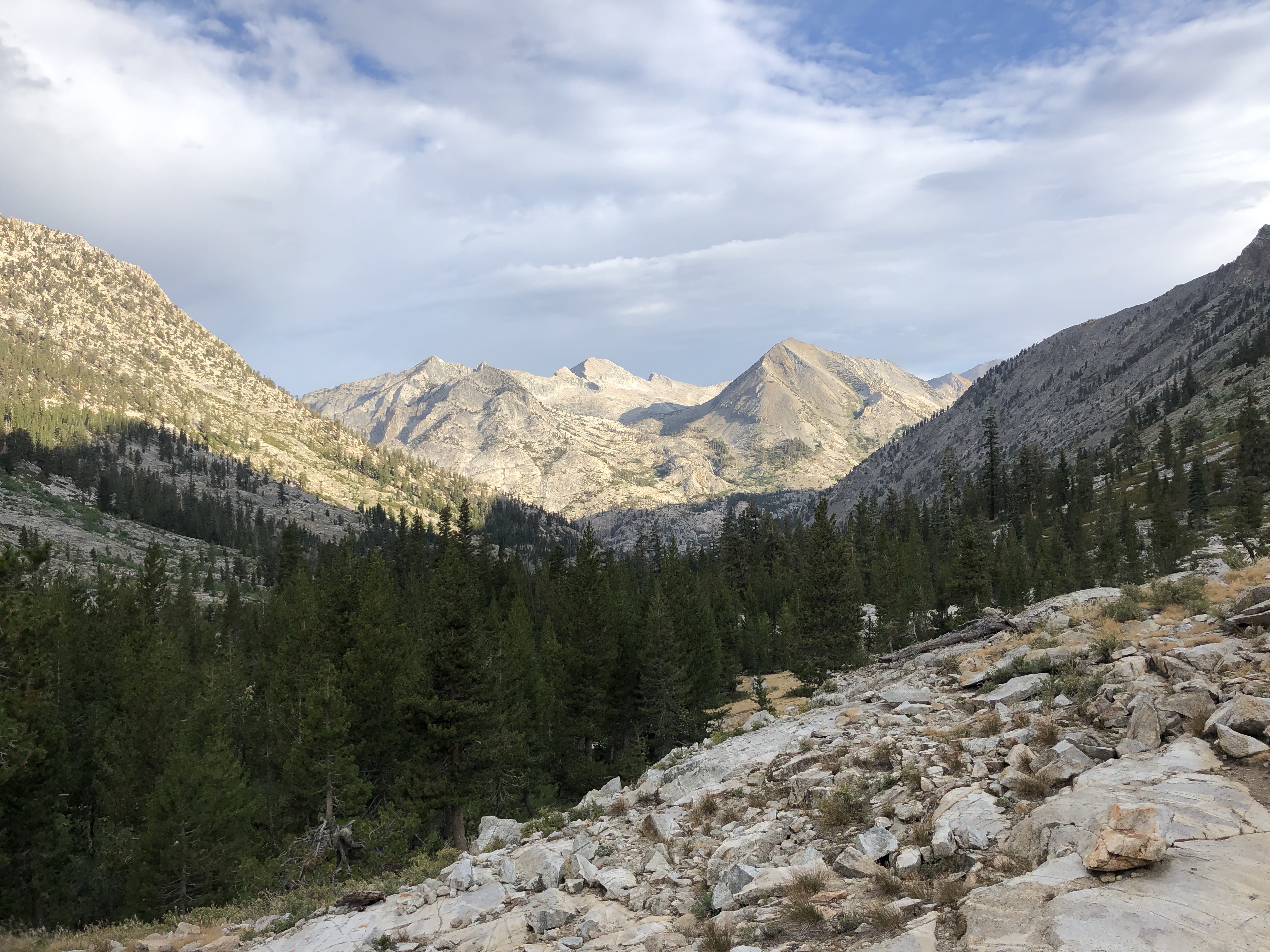
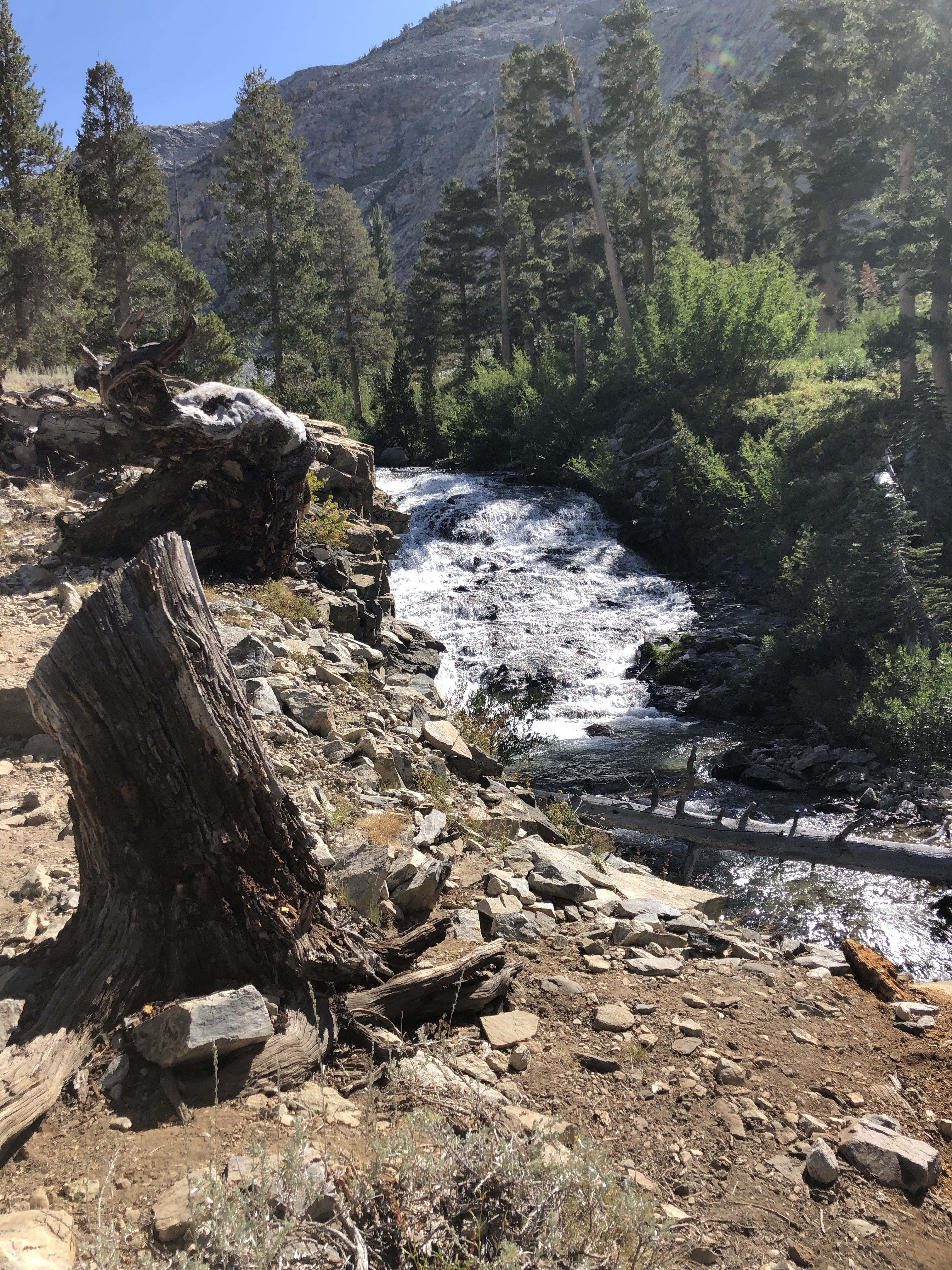
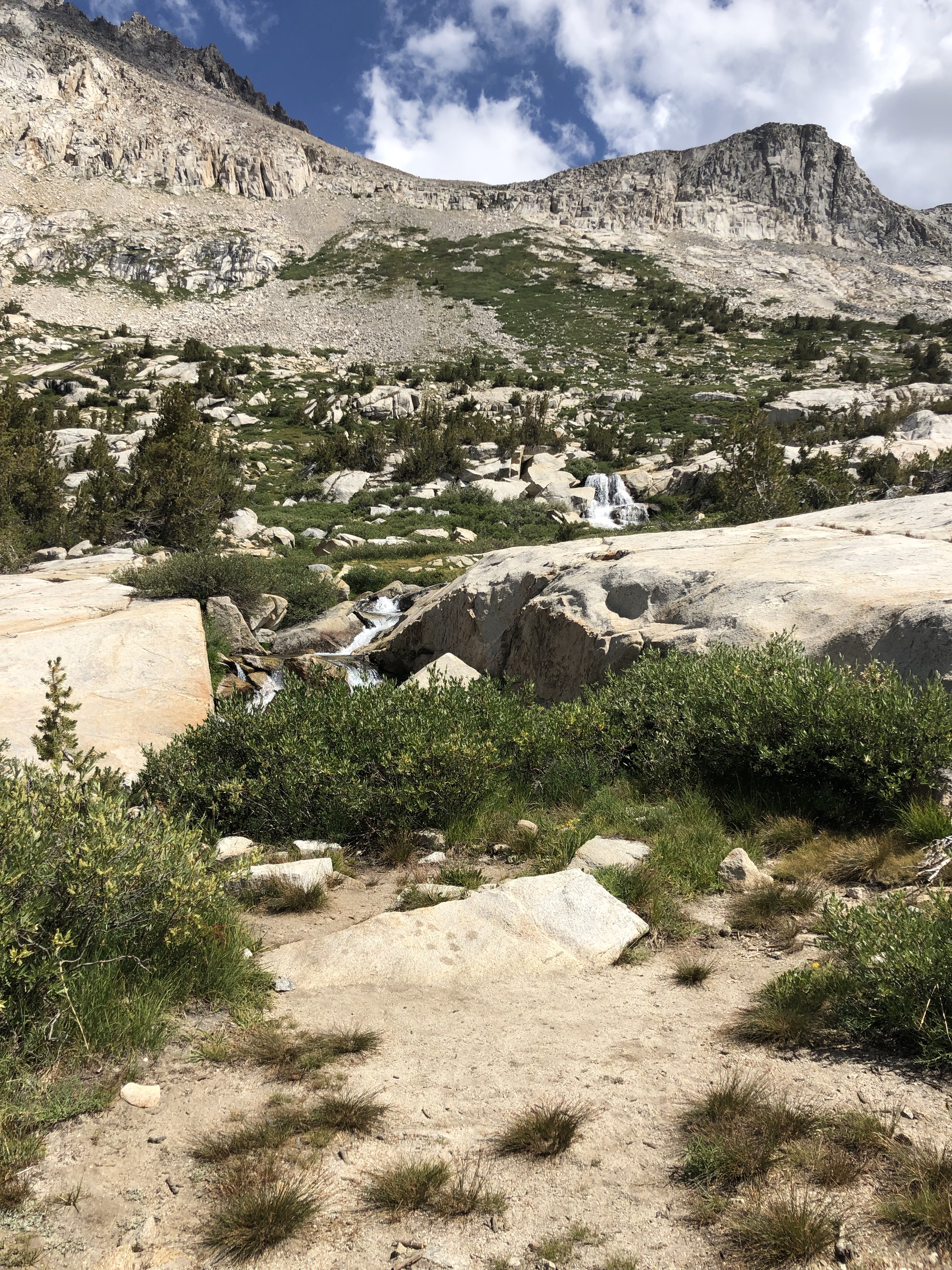
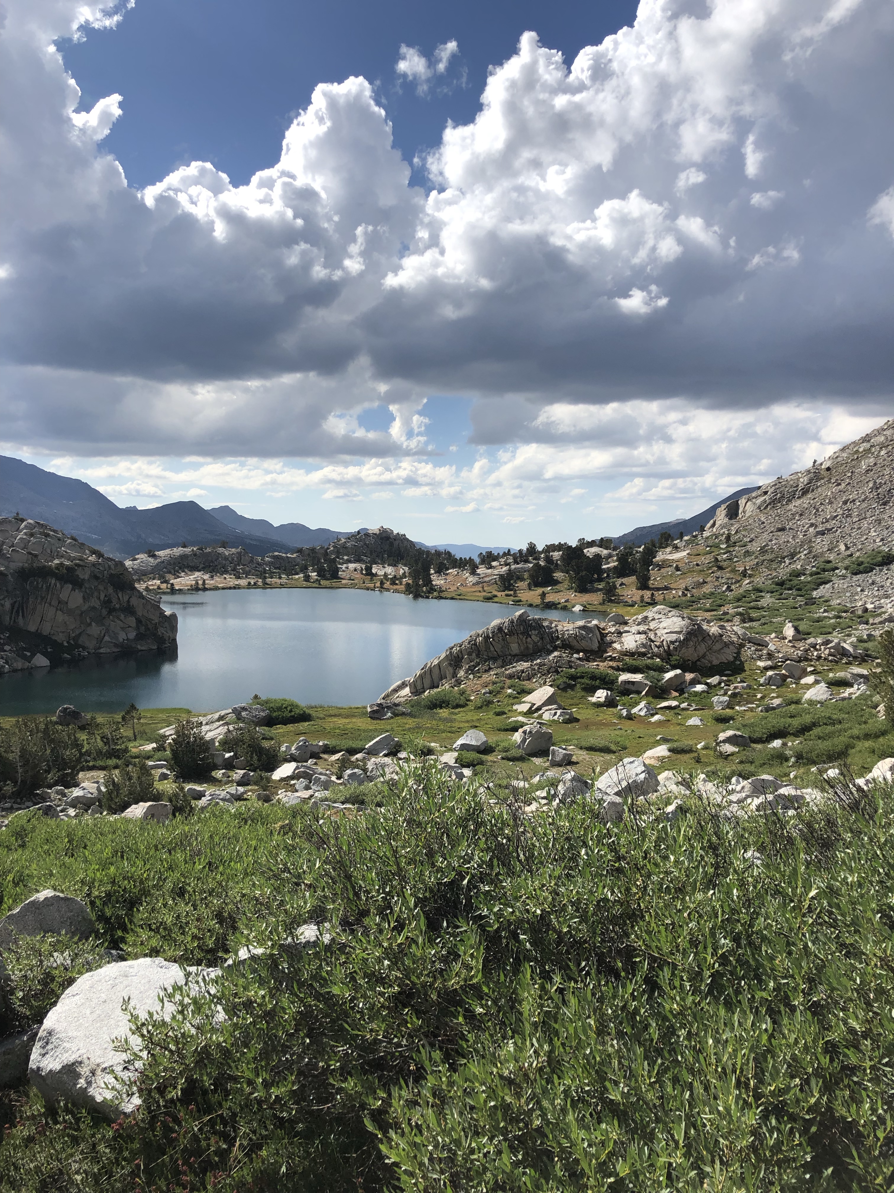
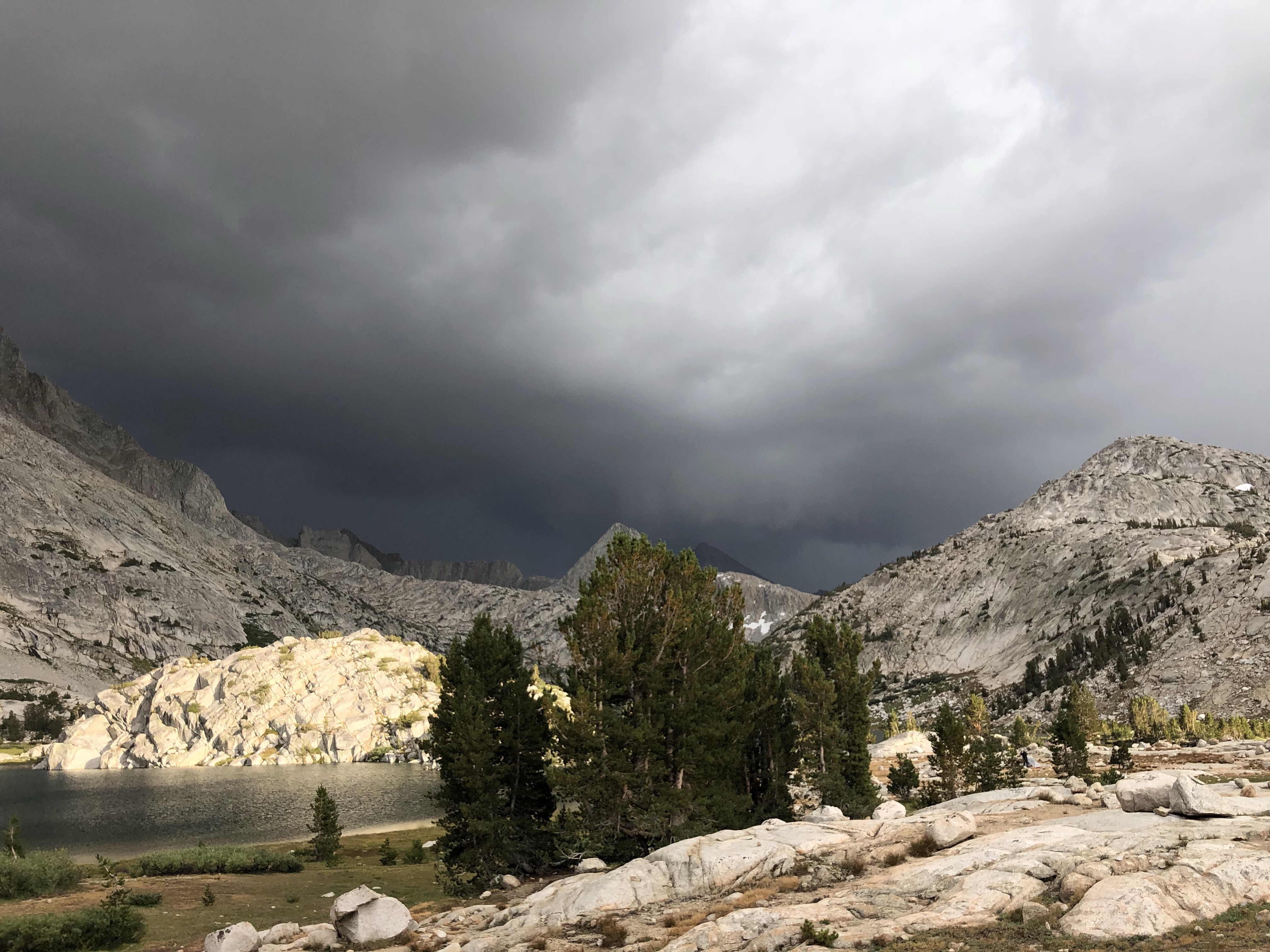
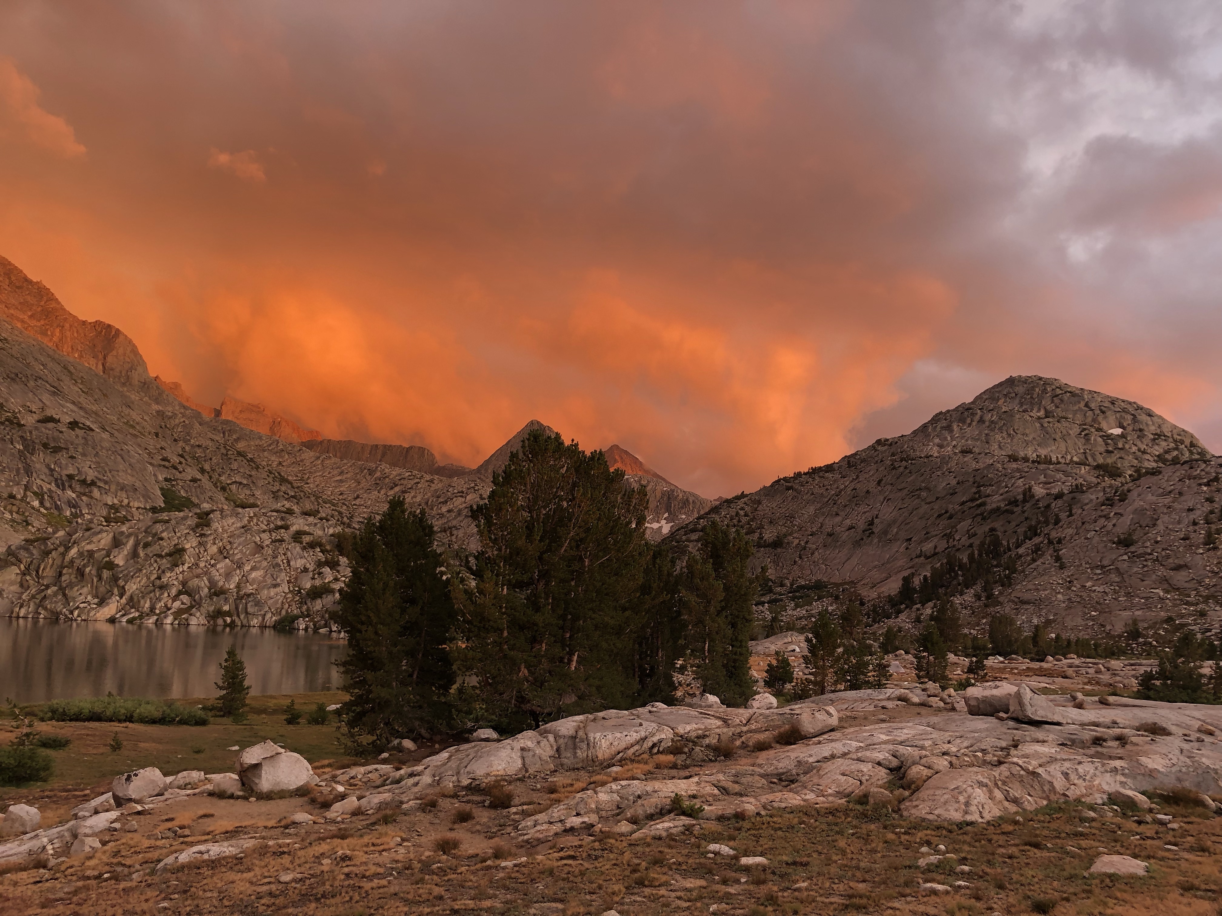
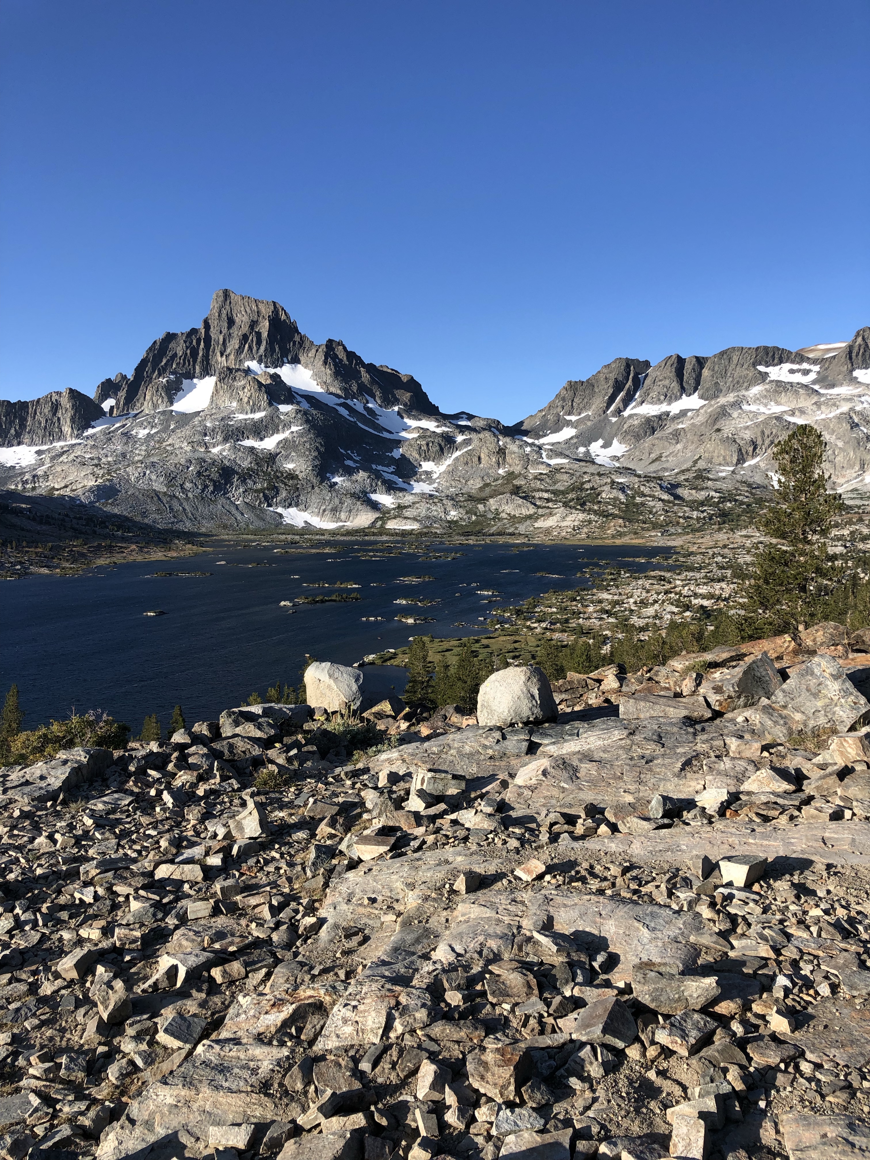
8/6 I woke to a soaking wet tent, a lot of condensation since I camped next to a creek. It’s cool up here but the trail is beautifully designed and maintained. I made it to the historic Tungsten Mine and cabins for lunch, then it started to rain. And rained. For 3 hours over spectacular Cathedral Pass where the wind hit me and my hands got too cold for photos. Guess I’ll have to go back! I hiked down a bit lower before the ranger station and camped, crawled into my bag to warm up as the rain died and the wind didn’t. The rain cut the dust, the Pasayten is beautiful and Cathedral Pass reminded me of a kinder, shorter Pinchot Pass but with uniquely gorgeous rock formations.
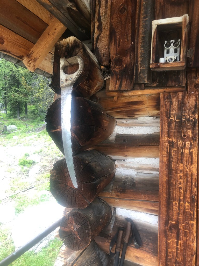
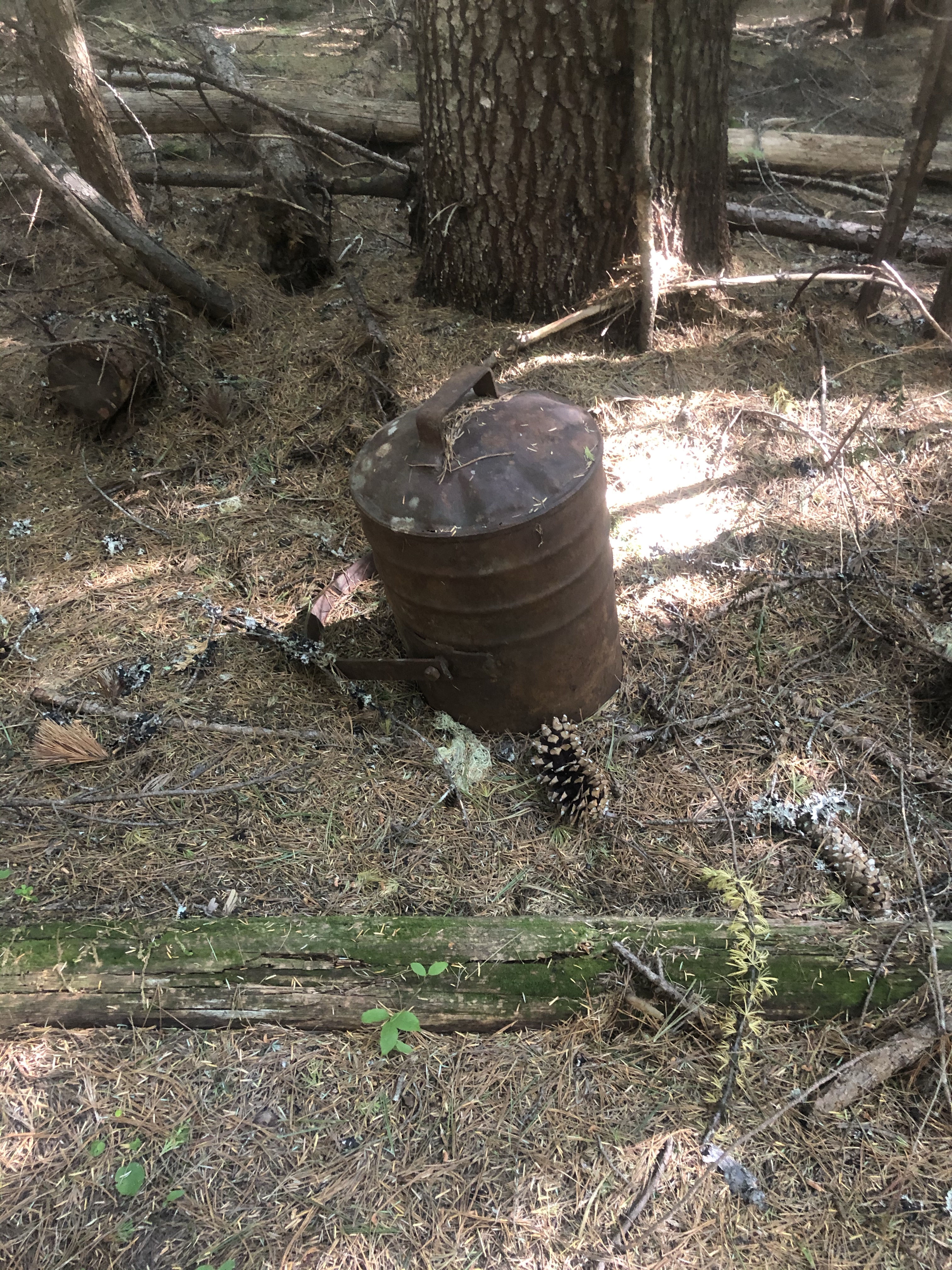
Not as rusty as my old mine saw
8/7 I wore all my layers until 11 am. There were some beautiful views but the trail is not what it was. Burn area forever. Oh well. Dead trees, down trees, fried soil turned to ashy sand, no visible path in places. I got some water then found a flat stand of green trees off the trail for a peaceful night. Didn’t get as far as I wanted, so it goes.
8/8 I was in a cloud till 10, so there was no view from Bunker Hill. The blowdown burn area went on forever. In the heat and view less burn area coming down from Bunker Hill, I counted over 150 blowdowns an hour, all day long. Practice clambering over, under and around them makes perfect.
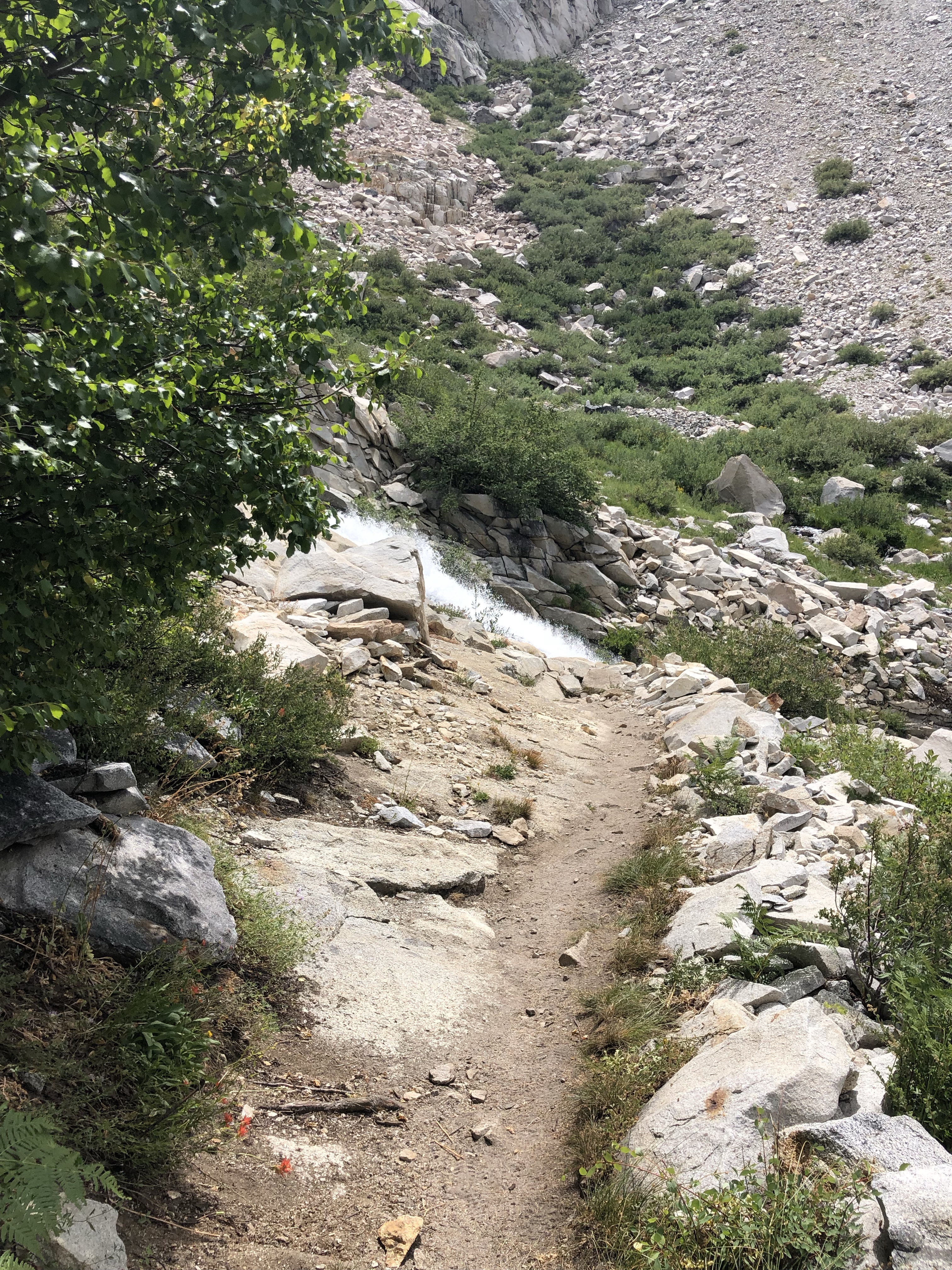
Finally I turned up from the old Pasayten Airfield into a lush living forest. Instant happiness even though I hiked another 7.8 miles just to find a tent site, a sweet little spot out of the blowdowns right next to the trail but with no dead trees threatening to fall on me. And with an annoying babbling stream talking at me all night. Took nearly 12 hours but I made my required average miles, 18, so as not to run out of food over the next couple of days.
See the sign for the trail junction?Mellow stuff
8/9 Blowdown Showdown! I’ve invented a hiker contest.
All due credit for the name goes to Jason Borgstede, pro snowboarder and business owner (Blue&Gold Boardshop in Anchorage, Alaska—go there for all gear needed to slide sideways, summer or winter) who holds the Throwdown Showdown event for boarders every winter at Alyeska Ski Resort in Girdwood, Alaska.
Full disclosure: I declare myself the winner of my age group. Here’s how I did it. Basically it’s a freestyle event—you get points for getting through massive sections of blowdowns using a variety of skills, tricks and techniques. As this event grows and develops you may get bonus points for naming maneuvers. Getting through faster than another hiker gets bonus points, which may be offset though by excessive blood loss.
Try these for starters: Step over the little logs regular, then goofy. Limbo under larger logs. Belly slide under, then slide on your back face up. Creep on all fours, crawl on your knees. Lever your way over like mounting a horse, both feet off the ground. Now get on the horse from the wrong side. For those big piled up log jams, pressure your feet like a climber as you attempt to scale and see over 14’ of tangled branches, pine needles and busted up trees. With hands and without hands. What else can you come up with? No holds barred! Uh, literally.
More blowdowns, hours of them, and 3 big switchback climbs. After 3 days of nearly nonstop blowdowns, I reached the PCT! Tread, real tread, level tread, well designed tread, I nearly kissed that tread. I love the PCT. You really appreciate good trail when you’ve been dealing with not good trail for so long. Like I learned to appreciate a decent dirt road walk on the CDT. And carrying water weight in the desert.
Now that I was on the PCT, I met tons of people, a couple that said they’d started at the southern border in March. I didn’t ask about the Sierra because it sure seemed like enough time had passed for a NOBO thru hike! From Sweden, they said they flew from Europe 2 days before the travel ban. Cool!
I kept going, ecstatic to be back in the North Cascades, such views! I dry camped alone, despite the dozens of hikers I’d seen, at the junction of the PNT and PCT, completing the 14 miles the trails share.
8/10 Last day for the PNT this year and it was all PCT. 14 miles to Hart’s Pass where we’d started the PCT SOBO a few years ago, walking from Hart’s to the Canadian Border 30 miles away, and then turned around and headed back south for good.
Today in the 6 1/2 hours I was on the trail, I counted 39 humans coming towards me (including 1 baby which in some cultures is considered not quite human until age 5 or 6), 9 dogs, and 4 humans going my way, only 1 of which passed me.
PCT, I love you!
And then, back in the van for a few days, visiting Dave and Teresa in Chewelah and meeting Natasha at Hidden Mother Brewery in Spokane. And on a plane 8/14, me to the Sierra, Dan back home to Alaska.
Took a zero in Omak. On the way there we passed the sage fire near Tonasket, driving by as a plane dropped retardant, helicopters were sling loading water buckets and multiple fire departments had their trucks and fire fighters mobilized.. Because of Covid, Dan’s birthday dinner was a takeout tuna salad sandwich from Subway. The next day we visited Rockwall Winery, a lovely building amongst fruit trees.
7/30 We drove back through Republic to where trail started uphill from a little campground on Hwy 21. Talked with a guy who had been car camping there for a week and headed up the trail. After a couple miles it joined a gravel road for the rest of the day. I picked up 3 liters of water and carried them until I found a campsite past a junction above the road. A few cars passed by, invisible.
7/31 Fun morning, easy walking on the road, 12 miles in 4 hours! I saw One Gallon’s footprints ahead in the dust. About an hour into the morning, I took a water break in the shade and saw Gasket behind me. We walked and talked the rest of the way to Highway 20 where Dan soon arrived in the van. One of the things I love about hiking is getting to know people I’d never get to talk with in real life, about real stuff, deeply revealing. Gasket is awesome. We all donned our masks for the drive to breakfast at the Knotty Pine in Republic. Then we gave Gasket and One Gallon a ride back to the trail angel Artie’s where everybody has been staying, off and on, since there are 3 different road crossings, all leading to Republic. Goose and Cruise were there, Goose is recovering from a nasty rash and GI trouble, but he’s looking much recovered!
Dan took me back to trail after our breakfast break in Republic. The rest are staying another night in Republic. The hike out was uphill on trail, hot of course, but not a road walk. I managed another 5 miles for a 17 mile day. No place to camp but I managed another creative pitch with a view to the west and settled in.
8/1 So there were numerous comments about the creepiness of the private property signs where the trail joined some roads. Skulls on fences, the typical signs telling me trespassers would be shot twice, junk yards of rotting cars, etc. I heard a dog barking way in the distance but the only one I saw was a bird dog taking herself for a walk. She glanced at me and continued down to her house. No dogs at the numerous private properties tells me nobody is home. I wouldn’t live out here without a dog early warning system in place, just saying. The property owners can’t shoot trespassers if they’re not here to shoot them.
It was hot today as I hiked from trail to gravel to paved to gravel. I pretty much hated this trail today. Stupid route, at one spot, the “primary” turned off perfectly good gravel to an abandoned (remember that means blowdown covered formerly-known- as road) so I looked at a map and kept going a few hundred yards to a dirt road, cleared, shorter, no traffic, that joined back up with the main road. Good choice!
I walked into the Bonaparte Lake campground to where the van was! It didn’t cool off till 8:45 and I still had to eat freeze dried dinner but the company was good. Really nice spot Dan got away from the crowds. And I like this place, kids laughing as they swim and paddle around, largish people walking along the campground road getting their exercise, just a good vibe.
8/2 I walked through the campground to the trailhead. It was good trail to the Bonaparte Lookout alternate. I’ve been excited to see this place. The historic lookout was built in 1914, and the new lookout is staffed, one of the very few still in operation. It was a lot of uphill (duh, lookouts have to be on top of something) but I made it by 12:30. I spent quite a bit of time talking with lookout Jim Watkins, really enjoyable and interesting.
Finally I went back down the trail and eventually joined a nice soft road with Nordic ski trail signs. I had enough water and debated with myself for hours about whether to camp early up in the forest or to continue to Havillah and camp on the church grounds with access to water and a bathroom, I’d get there around dinner time. I’m the only hiker in the area so it’d just be me there. Lookout Jim assured me that Covid wouldn’t stop the church people from being trail angels.
The soft road turned to gravel and cow-calf country. I’m not camping with cows if I can help it, people on foot freak them out, plus—cow pies. And now there are barbed wire fences and cars so no camping. I got to the junction for Havillah, and a sign saying the church (a beautiful white steepled structure a quarter mile ahead) was “Closed to PNT hikers due to Covid concerns.” It was 5:30 and I am now between barbed wire protecting the creek to my left and private property on my right. I freaked out a bit but kept going, knowing it was another 6 miles of gravel road to public land. It was hot, I was tired and hungry and the prosperous looking mini ranches and pastures pissed me off. I face up belly scooted under the fence and got camping water from the creek below and continued another hour, grumbling. And then a dip in the road, mashed down fence to my left and Ponderosa pine and sage brush, not pasture. Whatever a private wildlife refuge is, there couldn’t be anything menacing left in it with a mashed down fence. I camped out of sight of the road in the heavenly smelling sage. So much for Jim reassuring me the church would not close to hikers. Oops, maybe the trail angels in Republic knew, my bad.
8/3 The 19 miles to US 97 outside Oroville took me till 2pm, not a bad day! Gravel to dirt road to trail, almost all downhill although the heat was intense. And there was Dan looking up the trail for me! Dinner at the Oroville Brewery was outstanding—the best coleslaw I’ve ever had. Clyde at the Camaray Motel was very welcoming and gave us the hiker rate and free laundry.
8/4 Zero! Visited Esther’s local winery and the lake park, drove up the “trail” in 100 degree heat, saw One Gallon using the WiFi in front of the library, and got to pet the town cat, who was walking down the sidewalk behind a random couple while proudly carrying a dead mouse. Take out pizza for dinner.
7/22 l got dropped off on the edge of the pavement from Metaline Falls at 9 am after a breakfast cooked by Dave. I hiked way farther than I’d intended but it was good dirt road to good trail. There were campsites galore at the top of the climb but it was 3:30 in the afternoon. The PNT digest or guide book claimed there were flat sites in a saddle a few miles down the other side. As happens all too often, that was bad information. The saddle was completely covered in fallen or felled trees, I’d have had to do a major log removal operation to create a patch to sit in. So I kept going to the next listed spot, a primitive USFS campground at the bottom of the trail and junction with the next “forest road.” Camped at 7:30 in an eerily deserted campground. I don’t know why it weirds me out to be in an empty campground with road access and no people.
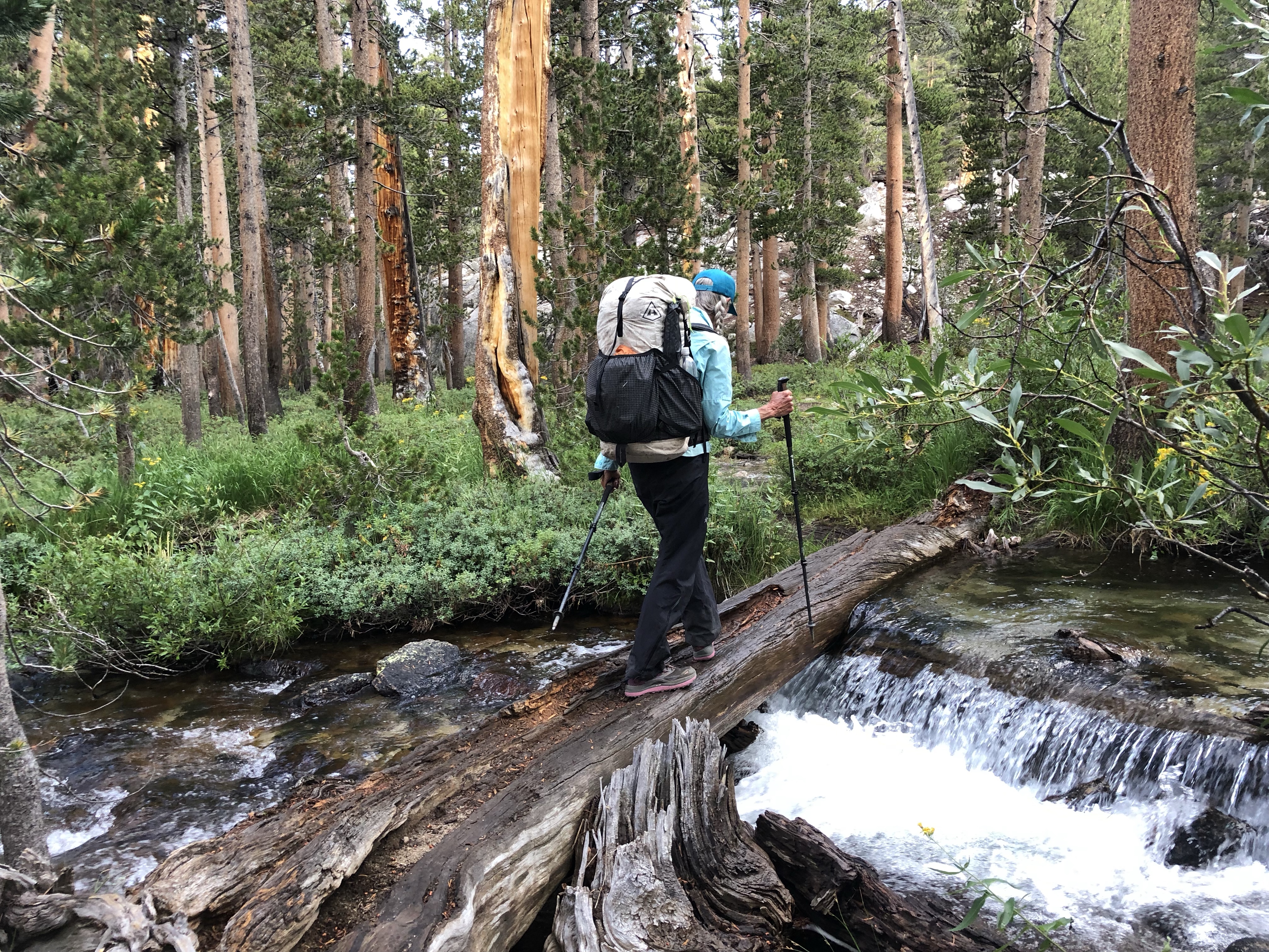
7/23 I walked 4 quick forest road miles to pavement. Road miles are quick and that helps. It’s interesting walking through ranch country with cows and horses behind barbed wire fences, and there were few cars. After awhile though slapping your feet flat down over and over hurts. I got a new blister on the end of a toe and my left shin started to ache. But an old red dump truck came up behind me, stopped and the driver leaned out with a bottle of water for me. Kindness! I grinned and accepted although I didn’t need it. As the miles went on, I turned onto the highway paralleling the Columbia River and it got hotter and hotter, with the uphill side all Private Property and the downhill side bordered by train tracks and the river. Where would I be able to camp? I satellite messaged Dan my dilemma and he found me a perfect little cabin in Northport for the night, so my attitude improved. I knew I had a bed and shower at the end of a hot, painful 22 mile day.
Is there anybody else besides me who can manage to fall on flat blacktop? Admiring the Columbia River, I failed to notice a little rockfall on the road and tripped on a loose rock, went down and got a bloody knee. I spent my entire girlhood with scabby knees and frequently with scabby elbows too. So scars on scars on scars. Fortunately, there were no cars at the time to freak out at the sight or hear the single word obscenity I yelled. A few minutes later, mini poodle Paisley came running and barking down her driveway to put her little paws on my leg and get a pat. Her mom followed and offered me water from her tap. She said they hadn’t seen any hikers this year and were pretty excited when I said there were at least a dozen maybe half a day behind me.
The walk wasn’t horrible until the last 6 miles of pavement into Northport. Hot, so hot, no shade, uphill. And then, my little cottage appeared as I got to town. I called the owner, got the key code, went inside, showered, rinsed my disgusting clothes, cooked my instant dinner and didn’t emerge till the next morning. So happy!
7/24 Road walk again, at least it wasn’t paved and there were pleasant clouds in the morning. My feet and legs hurt again by 3pm from the pounding, oh well—I much prefer dirt to pavement and I made 23 miles by dinner time. I camped in a weird place down a blocked and abandoned road, out of sight of the road and the occasional dirt biker buzzing on it. And cows today! I love cows, the baffled stares they give me, the calves freaking out and trotting.
7/25 Dan got me near the 395 after about 4 miles and took me for the night to Dave’s in Chewelah. His awesome grandson Tanner was there and I really enjoyed talking with him over dinner outside at the golf club. He’s 12, loved the time he got to go snowboarding last winter and really wants to learn to skateboard. It’s a high probability that he won’t get in-person school this fall, which really bums him out, but when he started talking about learning to skate, he lit up!
7/26 Back to the trail the next morning, or as the photos show, “non trail.” After a bunch of miles up dirt roads on the west side of 395, the route goes on an abandoned, obliterated road, politely described on the maps as not maintained. These 2 miles are my (so far) fourth place nominee for worst PNT blowdown section. After a brief stretch of double track, I walked on my second place nominee (first place for all time will be the blowdown east of Eureka, MT). It transitioned to double track for a bit, crossed Boulder Creek Road, and became the well trod Kettle Crest Trail. All day I was in burn area, as far as the eye can see behind and ahead. I camped by a fire ring in dead trees, hopefully nothing falls on me, but what else can I do? Hot as hell today too.
7/27 I took a picture of last nights camp and then came across a lovely alternative bed, if only I’d known.
I walked through the burn until noon when I got into living trees. And then the bear yodel.
“One Gallon, what are you doing behind me?”
“Zero’d in Metaline Falls and zero’d in Northpoint too!”
Then Gasket, Goose and Cruise caught up. We chatted by a fenced spring piped to a cattle tank. Nice to have hikers to talk to again! The Kettle Crest Trail was good and clear the rest of the day. Hot!
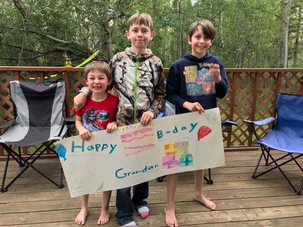
7/28 Happy Birthday, GranDan!
Dan met One Gallon and me at Sherman Pass and took us to Republic and breakfast at the Knotty Pine. I’ll take a zero, skip the section between Hwy 20 and Hwy 21, then get back on.
6 1/2 brutal uphill hours on trail but since I got a ride from Dan I skipped 9.2 miles of road walking. I could get used to this personal driver thing. There was a spring about 5 miles up so I got enough water to camp and pitched my tent at the third campsite mentioned in Guthooks. About 10 pm, voices and headlamps. Gasket and Backtrack showed up, awesome to have company! They got up at 5:30, so me too.
7/17
The Selkirk Mountains are beautiful, granite and alpine, just a few snow patches left on the ridge and fantastic cirque views, oh the rock!
So this “trail” has a bunch of bushwhack sections. The 2 options coming up midday said I should start first thing in the morning since it could take a lot of time. I looked at the maps and saw I could hike to a road at Pyramid Lake, get picked up, drive a few hours, skip the bushwhack and rejoin on a road. So Dan drove me about 72 miles to Priest Lakes to avoid a 5 mile bushwhack, brilliant! I camped next to the van.
7/18
And slept fine despite the car stopping by to warn us about a huge cinnamon black bear nearby, never saw her. The tread was actual trail today along the Priest Lakes, then into huge, ancient cedars, 2000 years old the guide says. Then gravel roads for a few miles up of course to a brushy trail. No huckleberries so no bear. That turned into more awesome cedar, shaded and cooler with soft tread. I kind of had to jury rig a tent site but it seems fine. I had a really good day and no bushwhack.
7/19
Campsite was fine. After walking an hour or two I heard One Gallon’s bear yodel, “Go away bear!” He caught up and we walked and talked the rest of the day—which really helped because it was a brutal day. I took one bad fall in endless blowdown, raising a lovely hematoma on my shin with blood running into my sock. You’re working so hard and your heart is pumping so it takes awhile for even minor cuts to clot. I got low on water because there wasn’t any where the map predicted and it was another hot day. But we made it to cleared trail and camped by Noisy Creek at last after 12 hours.
7/20
One Gallon was up early and out but I left at 6:45 on perfect trail (mountain bike tracks) to the Sullivan Lake campground trail to gravel road. Sometime after hitting the gravel I took a shade break and heard the bear yodel. One Gallon had stopped to swim in the lake. We walked and talked for a few miles down the road until the 3 Sterley boys rolled up in Dave’s pickup and whisked me off to the Metaline Falls grocery store while One Gallon turned down a ride of course. Then off we went to a campground by Boundary Dam about 10 miles beyond. Since the hotel in Metaline Falls was full I took a shower in Dave’s trailer—perfect! Doug, Dan and Dave are here camping and fishing from kayaks, it’s a beautiful place.
7/9 Walked up from 1972’s “most beautiful bridge” on a lovely day, but yeah, up. After awhile from below me on the trail I heard a “Go away bear!” yodeled periodically through the brush until finally One Gallon appeared, about 60, walking strong, lightweight backpack with no waist or sternum strap, no sticks. I caught up at the lookout and we had lunch and good conversation. Much later I saw him again when I walked in to camp and he was cooking dinner and then moving on. I had a crap camp spot, but oh well, no bears.
7/10
Biggest day so far, over 18 miles, because I couldn’t find a place to pitch my tent. 4 good climbs but I didn’t go up Mt Henry because I couldn’t tell from Guthook’s app, the PNTA maps or the guide whether it was an out and back. Not, as it turns out. It rained today for maybe 30” which is how long I wore my rain gear despite it not being cold. I could tell from the topo map that the top of the last climb would be flat, but there wasn’t any place to put a tent on the jagged rocks and burnt trees. Finally I found an abandoned road on the downside with even a little trickle of water and camped at 7, perfect!
7/11
I got to the road to Yaak at 8:30 am, not the planned road where Dan would meet me, but there he was constructing an “x” with sticks and flagging on the non-trail across the road, but listed as the red line, the primary PNT, that made Petra and Retune (and later Click) crazy trying to find it. I grabbed my resupply from the van and he drove me 2 miles where I trudged yet another gravel road for 13 miles, not steep, just relentless. 3 out of 4 cars stopped to talk to me—a guy getting wood, a USFS guy, and a hiker woman who didn’t stop on the way up but gave me Oreos on her way down. The 4th car was a family who parked and walked the short way to the lookout and back and talked to me where I sat before pitching my tent. They said 2 hikers were camping in the lookout (Petra and Retune must have got a ride past me on the road walk, the other 3 cars had only seen a single male ahead of me—One Gallon). So at 8 pm a car drove through the locked gate to their reserved night at the lookout. Uh oh. At 9, pistol poppings, at 10, Petra and Retune looking for another place to camp, bummer!
7/12
A lovely 4 miles of trail to another dirt road. Many easy miles later, the only vehicle I saw all day (seriously the locals are so nice here!) stopped and asked if I wanted a ride. I said no and then the back seat window rolled down and Retune and Petra were there, getting a ride to an alternative route. “We hate road walking,” she said.
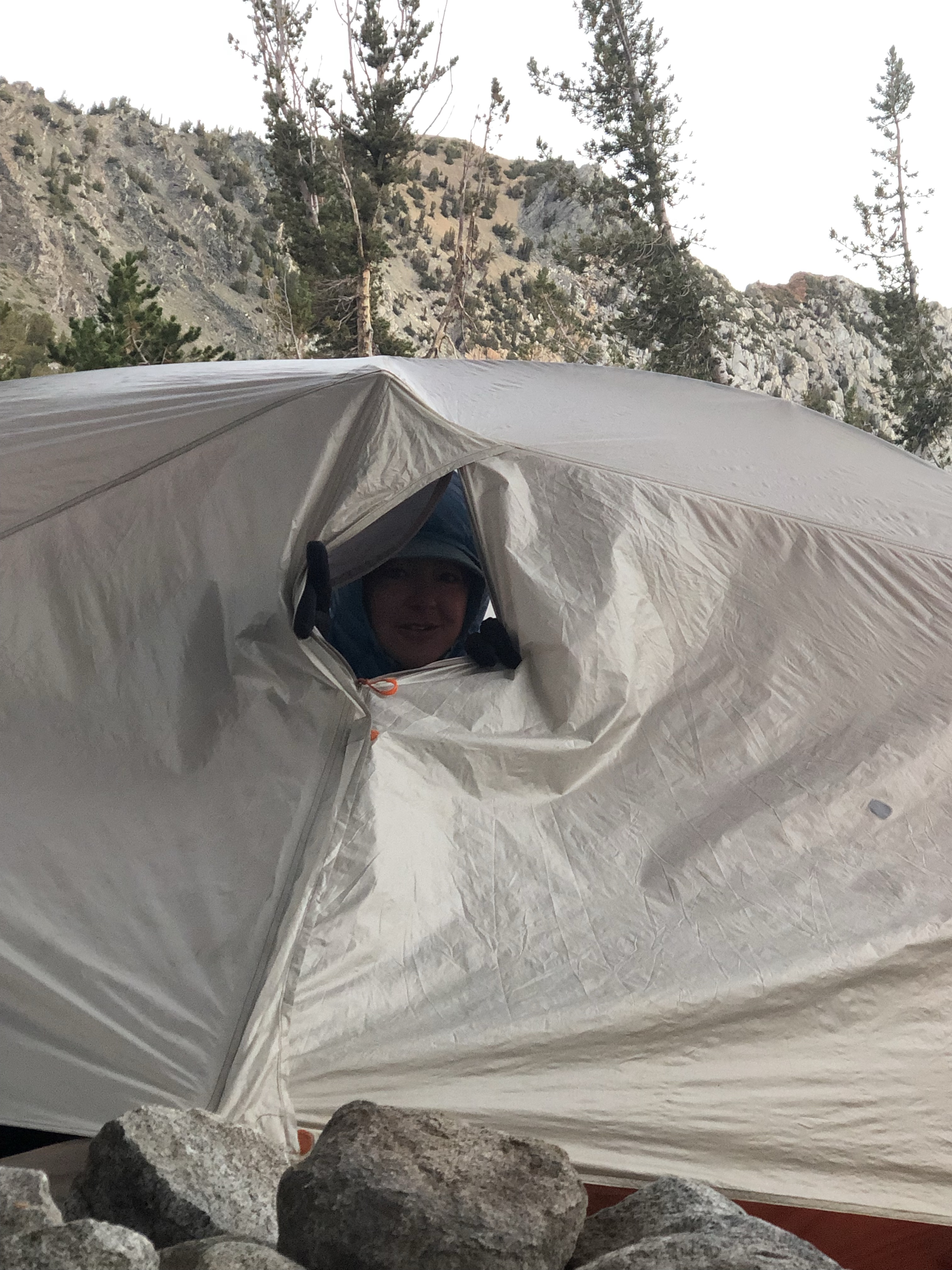
The wind, I’m sick of it! All day and as I climbed I got cold. I totally lucked out and found a campsite in a little saddle at 6000’, protected and soft, absorbing 4 hours of rain and hail no problem. I’m actually kind of giddy that I found this spot. P & R came by again tonight, they had to abandon the NW Alt because of the wind and will camp a few more miles at a “trail camp.”
7/13
In the trail register today I saw that 2 days ahead of me are Backtrack, Gasket, Chance and Cougar. 1 day ahead is One Gallon. Seems like there were more miles today than what the maps show. I did not stop at Fiest Resort, good thing because I later heard they weren’t serving food today anyway. I did meet a local riding his bike with 3 enormous dogs galloping ahead to say “hi” to me. He said I was the first PNT hiker he’d seen all season and that normally he met and gave mostly European hikers rides to Bonner’s. We talked about the travel ban from Europe and Canada and how different summer felt this year.
7/14
P &R camped nearby last night with plans to get up early to get to town early. I slept well and got to the top of the climb on good trail by 10 am and messaged Dan I’d be at Hwy 95 by 3pm after walking many miles of dirt roads. After hours of road and no cars at all, I was trudging uphill in the heat and suddenly a pickup truck was parked. I had one of those funny jolts that happen when you’re locked into trail narcosis. In my mind I heard ominous movie music and the audience saying, “Reach for your bear spray, don’t be an idiot!” And in real life suddenly a friendly voice from the huckleberry bushes, “How’s it going? Look at all these berries we’re picking.” Ha ha, first huckleberry pickers I’ve seen this summer.
Dan got me a few minutes late because he’d just given P & R a ride into town, they beat me by about 45”! We first went up to where Dan and his brothers Doug and Dave were camping and fishing and I got to visit awhile before heading to Bonner’s Ferry.
We got a beautiful room on the river and relaxed enjoying watching an Osprey catch a fish and some jet skiers. Shower, laundry, dinner on the deck, happiness.
Dirt bikes allowed on this trail, this looks to be a great way to stabilize it
7/15
Zero day! Natasha came up from Spokane to visit—we met and hiked some of the PCT together in 2015 till she had to go home and she hiked Glacier NP on the CDT with me in 2018. She brought most excellent beer from Whistle Punk Brewery. I really like her, she’s happy, smart, extroverted and it was so great to spend an afternoon catching up. Thanks Natasha!
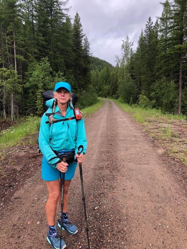
Slide Rule drove me out the road from Polebridge so I started the PNT at about Mile 60.5. As we were driving, we stopped and met Backtrack. He hiked by again as I was packing up for the first stretch of my 6 weeks stint on the PNT.
It was wet, soggy and cloudy all day. Who cares? I’m hiking! I was all set to fly to Atlanta and start the Appalachian Trail on April 15. Completing the AT would give me the hiking Triple Crown of the 3 big National Scenic Trails, the PCT, CDT and AT. Instead I’ve spent the last few months like everybody else, socially isolated, masked, weirding out, and chubbing up. At last I formulated a plan to hike responsibly in a pandemic. Dan can give me 6 weeks in our ‘97 Ford Sportsmobile carrying my resupply so I don’t have to hitch or otherwise rely on the kindness of strangers. So I won’t be thru hiking this 1200 mile trail but as I texted Tarcey:
I’m going hiking! I want to hate rain, wind, uphills, being freezing, shitty campsites, bushwhacking, and wandering around hoping my GPS points me in the right direction. I want to yell at the wilderness and listen to audiobooks when it’s boring, not read any news, have every piece of me hurt then fall down and have bloody knees too, surprise deer, elk and moose in the morning, drink Starbucks Via with instant oatmeal mixed in and get swarmed by mosquitoes and biting flies. I want to walk dirt roads and uncleared trails and crawl over blowdowns, kick up ash through burn areas, and find wildflowers suddenly yellow and pink in eroding hillsides. I’m going hiking!
I camped off trail at a campground chock full of people. I could see what looked like a hiker campsite, full, and kept walking around the lake on the road till I found a tent site. It was perfect and quiet. First night on the trail since last September, wahoo!
Day 2
A hard, slow day but sunny. Lots of consolidated snow covering the trail, but at least there was a single set of tracks ahead of me. A few hours into the day, Backtrack caught me, and we chatted and walked together. He stopped ahead of me to dry his tent out, then caught me again. I was stoked to have him set tracks for me. There was an insane amount of uphill and I camped 4 miles early, exhausted. About 1 1/2 hours later, Petra and Retune walked by, I am so glad there’s other hikers out here. I knew from FB there were, but who knows this year, this trail.
Day 3
Well that was a good choice, those 4 miles took me 4 hours in the morning. I got lost on Mt Lowe looking for the trail after 2 miles uphill. The next 2 were downhill through blowdown which was OK till I got to the mother of all blowdowns, massive trees stacked over each other, green growing trees with branches and root wads. I knew the trail headed down a creek more or less but there was no way through and no way to know how long I’d have to keep going over, under, through, around. I got lacerated to bits, fell, stepped in holes, yelled at nothingness, and was pretty sure I’d get stuck and have to activate my SOS for help. After an hour, I emerged, about 0.2 miles later. And then the trail became another wonderful old double track road bed, gently graded about 4 miles downhill to a wide, gravel road uphill another 4 miles to trail again. I camped early, a lovely quiet spot after 16 miles, sore, bleeding, exhausted.
Day 4
A lot of walking in snow on side slopes. Not particularly treacherous, low consequences if I slid, it’s just really, really slow. Uphill, downhill, flat hill, it went on forever. I went up to Mt Kam to an old lookout with a hiker register in it, I saw Backtrack and Mosey had been there the day before!
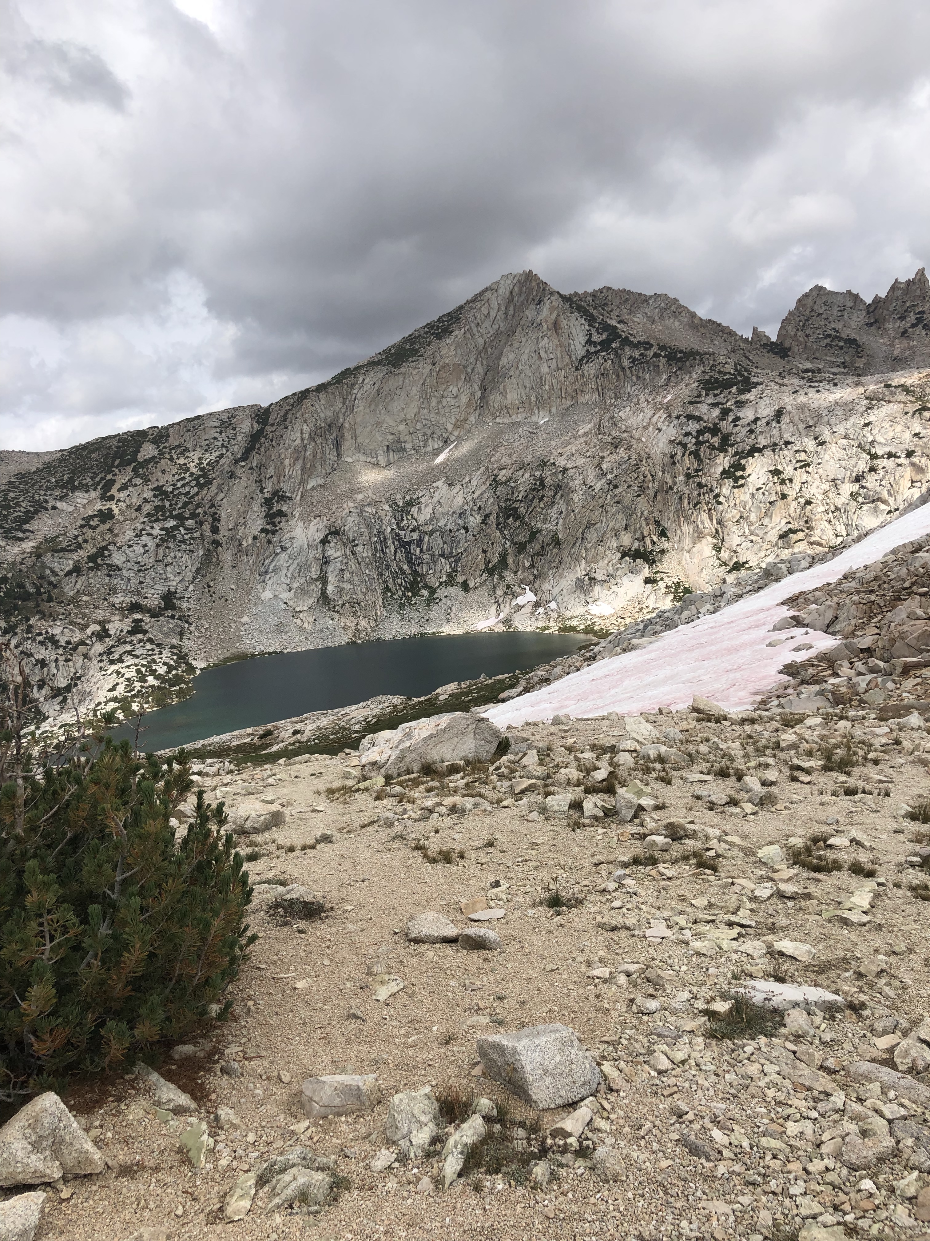
Finally I made it to Bluebird Lake and thought I saw black bear mama and cub tracks. I went looking for the bear hang and more tracks, freshish. Too tired to walk on so I camped away from the fire ring and pole—paranoid—and ate a cold bagel and cheese, tomorrow’s lunch, rather than cook and send food smells to the bears. 2 hours later, a family of 4 walked in. Yay, do t think they know I’m here and they’re making so much joyous kid noise. Plus they get the good campsite and bears! Then I sprang a leak in my NeoAir because I pitched on a sharp rock in my paranoia. I think I’ve patched it for the night with the repair tape I pack for my dyneema tent, I’ll need to patch the tent floor, but manana. I’ve spent a miserable night before using my pack and spare clothes for insulation from the ground in a similar situation and survived, but yuck. At least I only have to worry about my pad tonight, not bears with the family nearby. I love you guys. Life is weird. 10 miles tomorrow, I can go backwards if the snow ahead is too scary but I’d rather get to the road, Dan and a motel
Day 5
Did it! Easy 2 miles up from the lake, beautiful alpine flowers and views, then a long easy 10 miles to old road and dirt road. Dinner, shower, motel in Eureka, resting my slightly strained right quad and swollen, ridiculously normal-for-me sprained left ankle, rolled on the easy downhill about 3 miles from the end of my day. Damn.
7/7
We decided to zero in Eureka since the weather report looked bad. We drive the 50 miles to Kalispell REI where I got the last Xtherm on the shelf and I thanked the REI employee outside the store passing out face masks and the REI checkout employee for the requirement. The restaurants and motels in Eureka believe Covid is a hoax and do not mask up. After taking the plunge and flying from Alaska on Alaska Air where masks were required, but not enforced, and watching cases explode in my State, I’m sick of morons and find a happy little nod of solidarity with fellow mask wearers in stores or wherever makes my day in civilization.
As we drove into our motel parking lot, we talked with 4 more hikers who just walked in! Then met Petra and Retune who also zeroed here. They say Backtrack took the Alternate and is here too. Life is good. Dan and I intend to slackpack tomorrow, from opposite ends, the Rail to Trail few miles, exchange car key and camp.
We had dropped off our resupply at Independence Inn, so that was easy. Innkeeper Jim brought us back up to the Onion Valley trailhead at 6:45 am for a proper early start. Amazing he was willing to drive us so early! That never happens.
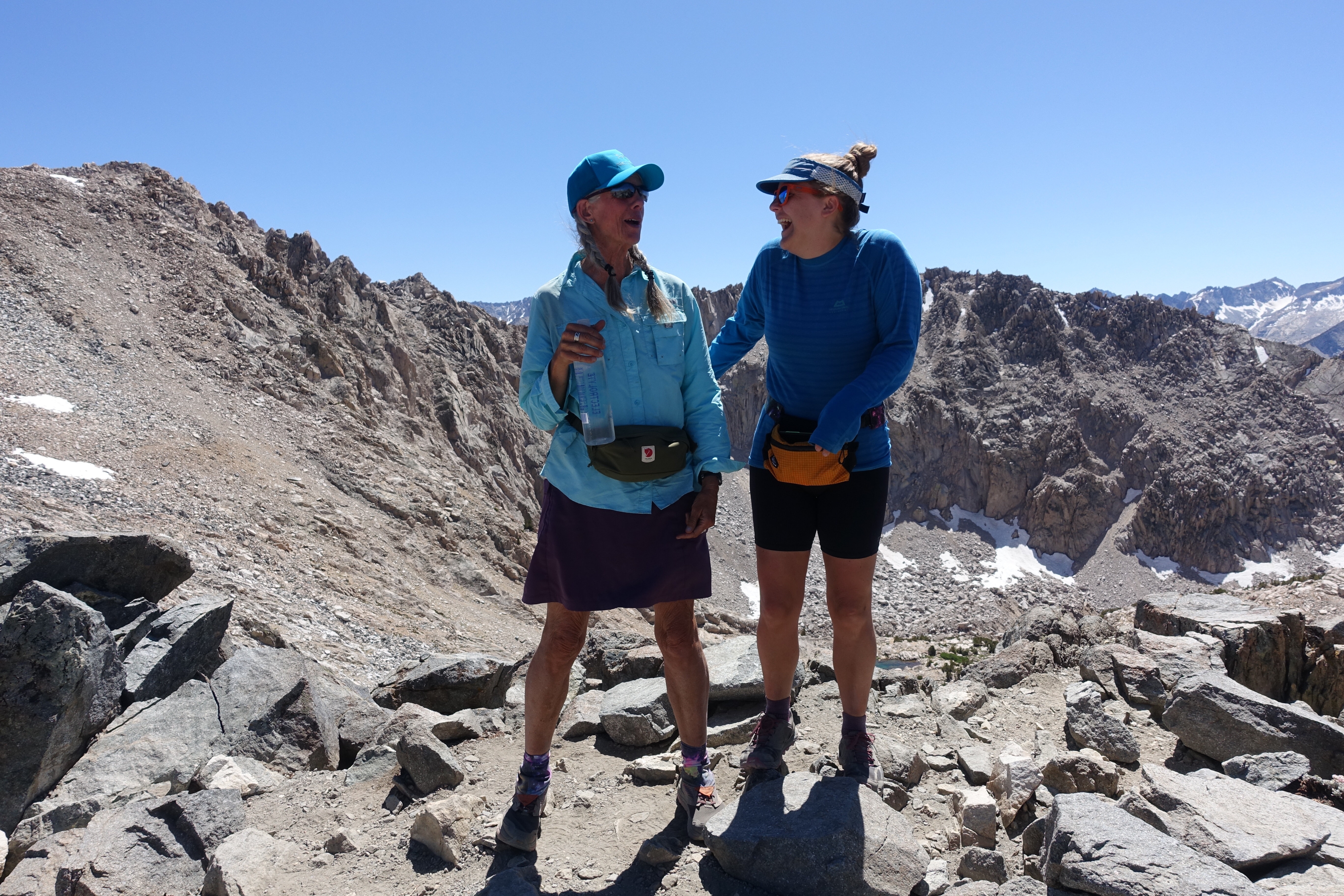
We hiked over Kearsarge Pass back to the JMT and headed up Glen Pass. It was a lot of climbing. We walked down and along beautiful Rae Lakes, reminiscing about 2016. Puff Puff recollected that she’d struggled up this Pass, I recollected I was called a goddess by some older, slower hikers.
We got to Dollar Lakes and I pitched my tent in the same place I put it in 2013, 2014, and 2018. A couple hours later a ranger came by and asked us to move. I said we would of course but pointed out it wouldn’t make any difference unless actual restoration work happened. I don’t disagree that people shouldn’t camp next to the lake and asked if he’d like me to move some obstructions to the nice flat, hammered tent sites. After he left, that’s what I did the next morning, for all the good it will do–people will just move them out of the way. I should join a volunteer crew next summer, this park doesn’t have any volunteers that I’ve ever seen, although I have thanked professional trail crews out here.
Glen Pass
9/2 16.1 7-5pm
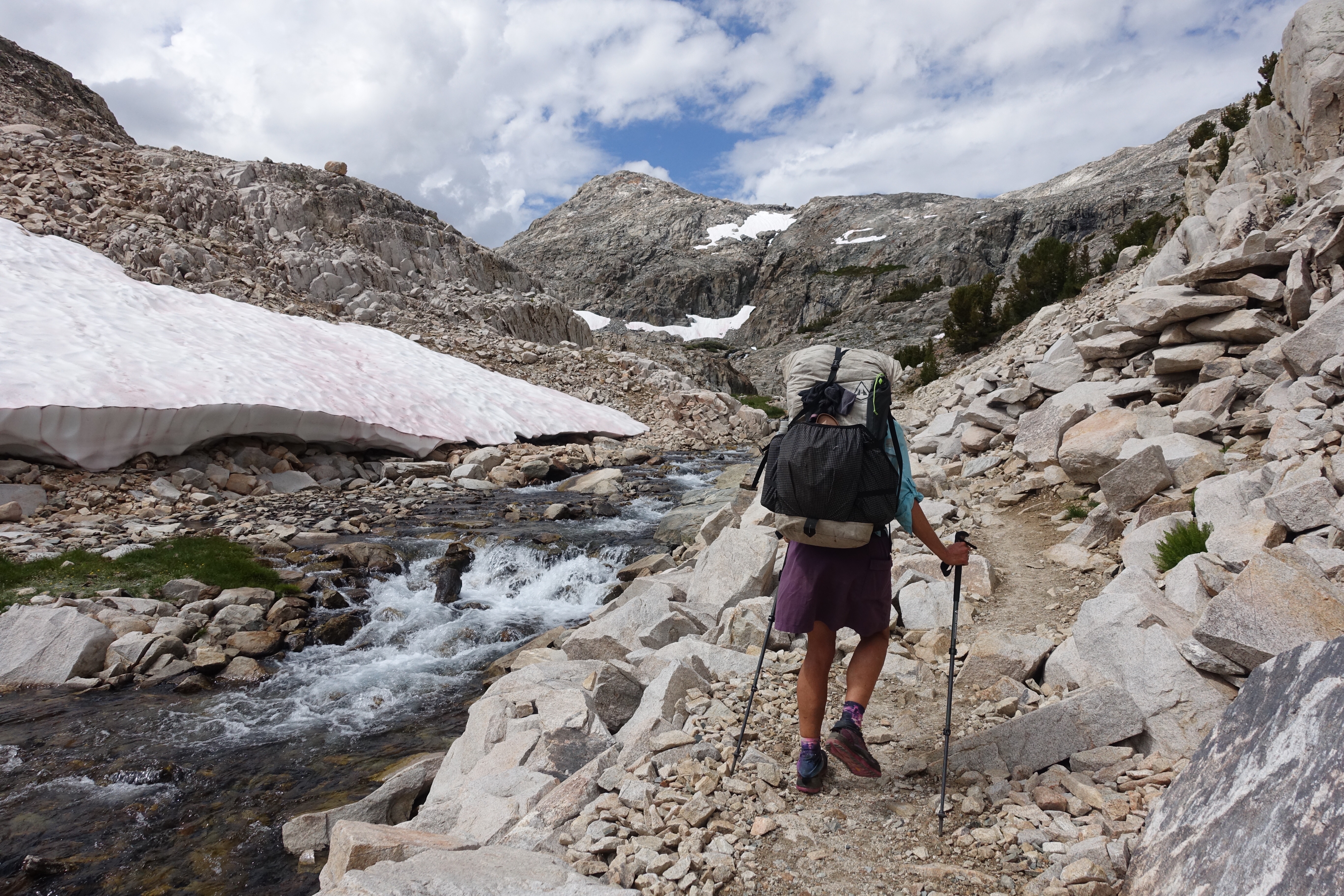
We were both dreading the climb up Pinchot Pass. We’d had similar experiences in 2015 on the PCT, it’s just a long, awful climb, and we’d both wound up camping on the uphill after not enough miles and way too much fatigue. Together in 2016 going SOBO, this was a day that went on forever, we had camped at the bottom of Mather Pass and we went up and over Mather, then up and over Pinchot Pass, one of the few times we camped after dark. We kept pushing because of the wind and cold, Puff Puff’s tent was jury rigged and we needed to find wind protection. I lagged way behind. But in 2016, I woke up the next day and absolutely stomped it, going up and over both Glen and Kearsarge Passes.
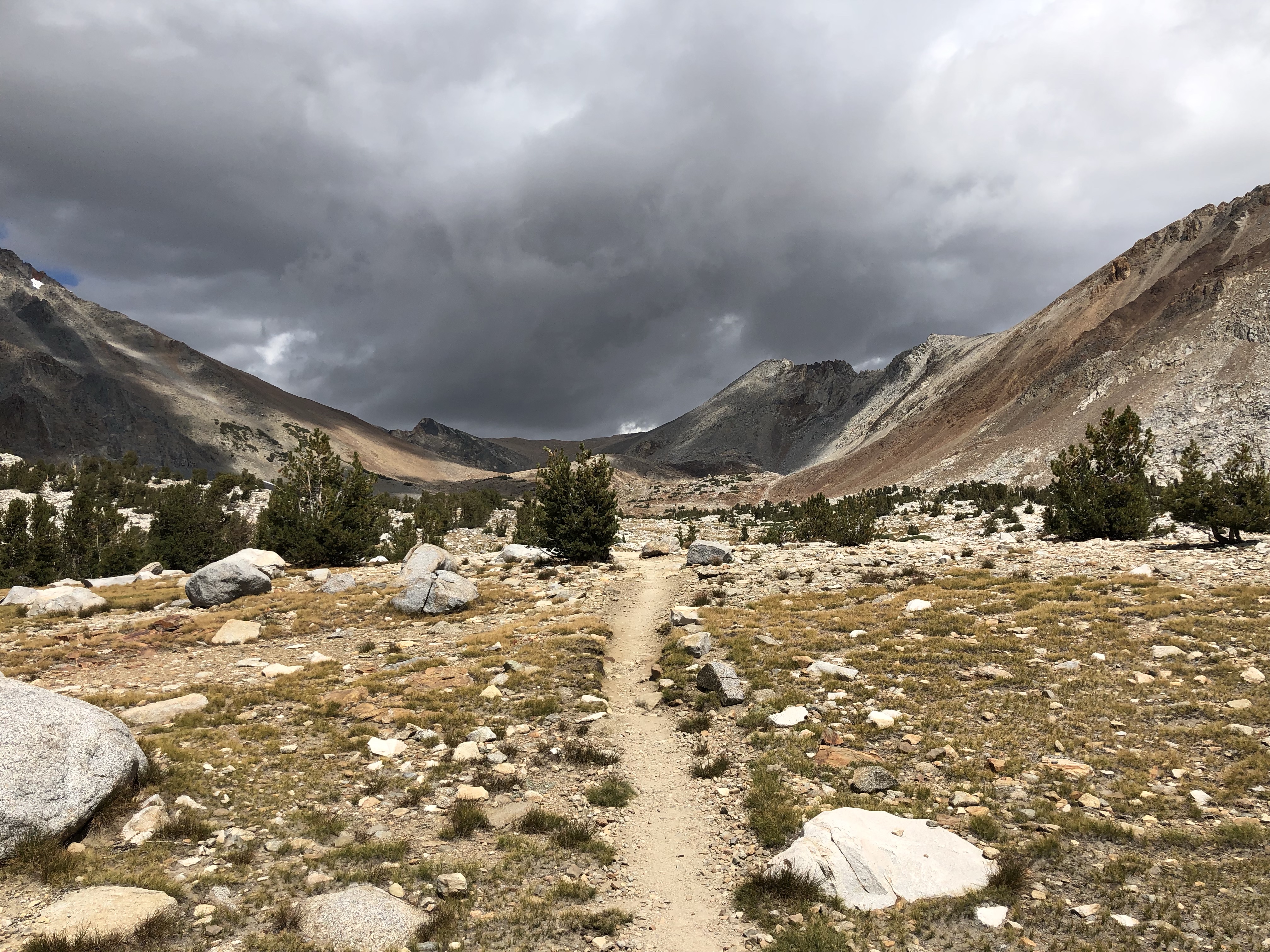
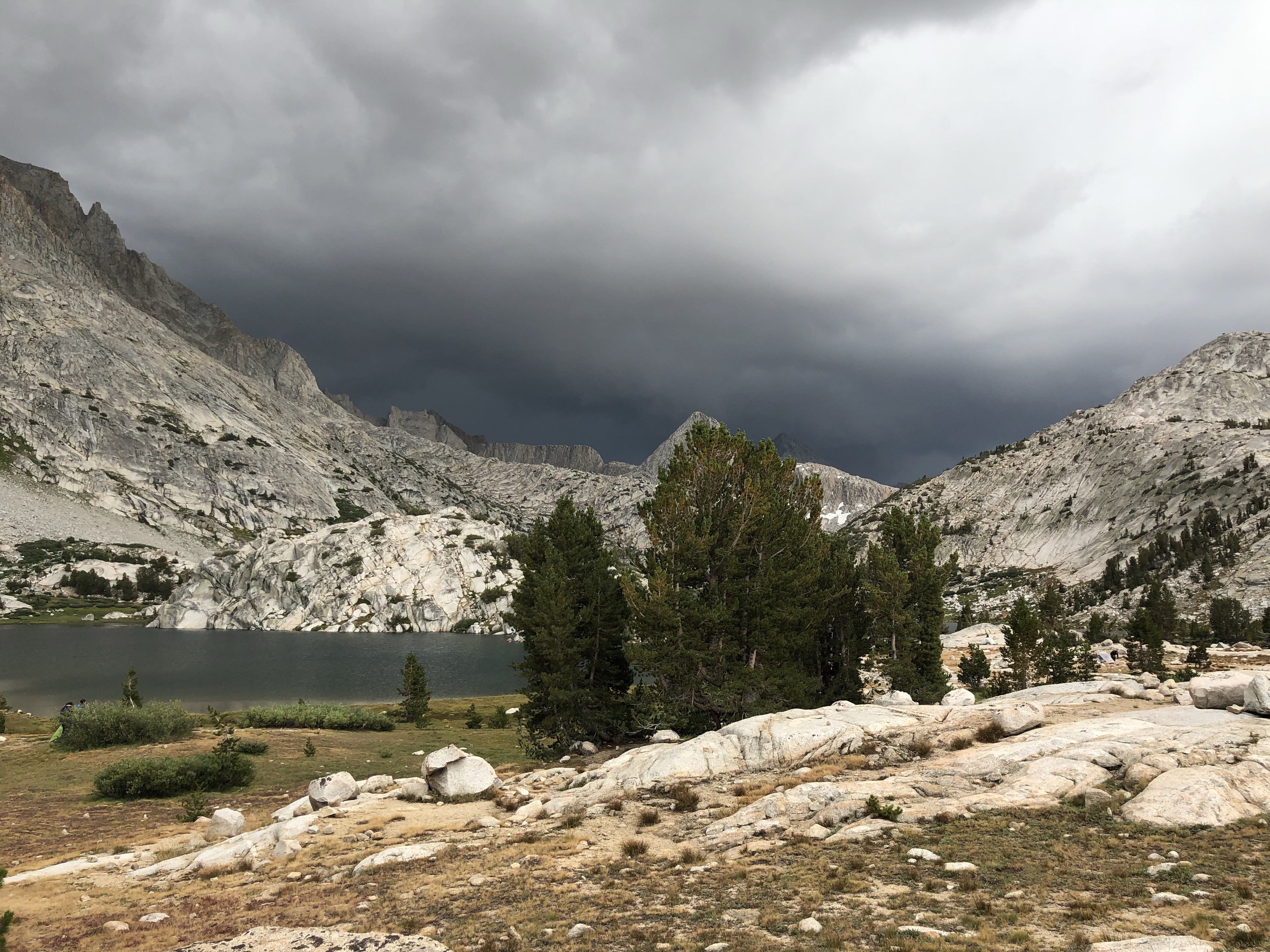
So we grumbled and just got it done, it was an easy down from Dollar Lake to the suspension bridge, then 5 hours to the top of Pinchot. The last bit is a short set of switchbacks, like Forester and Glen before them so I waited at the top as it started raining at 1 pm. We started to hustle on the way down as thunderstorms moved closer and closer. Wind, rain, then skin breaking hail. I stopped to pull on my rain pants and yelled at Puff Puff as she passed me, “Run!” Each woman for herself in a bid to survive, it was hypothermia cold, the lightening was right on us and we were totally exposed on slab granite. She was out of sight in seconds and then I too ran downhill to the lake and trees. Down, down, down past the lakes and down to the river, the tree sheltered hole with a river run I g through it, between Pinchot and Mather. We found the campsite I’d talked about, protected. It started to rain shortly after we got our tents up, protection from both the horrendous bugs and the rain.
As I lay in my tent I heard a bear bell, turns out it was on a horse with a rider who was herding a mule train ahead of him. Much later, 11-ish, I heard a bear bell again, but I either fell asleep or I didn’t hear the mules heading back the other way. I love mules on the trail, they work hard and do their job, and have sweet faces and adorable personality quirks that the packers learn to manage.
9/3 16.9 miles
I woke up to the sight of 3 deer across the way munching some mushrooms. A good start to a beautiful day. I felt great and pretty much lead to the top of Mather Pass, passing two couples going our way. What a difference a day makes in the Sierra. Mather was clear and I didn’t mind waiting a half hour for Puff Puff and taking time for photos and contemplation. She blazed out downhill and I didn’t catch her for hours, which I didn’t mind. So many favorite spots on this trail, so many memories. We decided to camp at Grouse Meadow where I’ve never camped before. It feels like there are a lot of people on the trail in this section, I know there’s several side trails leading to the JMT. I met Just Jeff, finishing up the PCT in the Sierra which he had to skip due to the big snow year, and his trail friend from Germany I think, Christine. We camped just past them and zipped ourselves into our tents pretty quickly again away from the mosquito hell. Well after dark, some dork came hiking by with his speakers blasting Jimi Hendrix, probably thinks All Along the Watchtower is going to scare some bears. Funny, I’ve seen a bear right here before and they already know to hightail it to higher ground, Jimi or no Jimi. At least the dork had good taste in music.
Morning, deer!
Looking back where we came from, Mather Pass
Grouse Meadow
9/4 16.4 miles to Evolution Basin
Glorious! Since the sketchy weather day coming down Pinchot, we’re a tad aware of the building clouds as we head up Muir Pass. I’ve probably said it before, but there are some nationalities on the trail that I really like, not that there are nationalities on the trail that I don’t like. If you’re hiking, backpacking, we share a common language. We leap frogged with 2 Korean guys, one of whom was having knee problems and going slow according to his partner who we passed as he was waiting. Puff Puff and I heard a tremendous squawking of birds behind us, crows maybe, and joked with each other that that was the last time we’d see Bum Knee again, the vultures were eating him already. (For the rest of the JMT, everytime we’d hear a bunch of noisy birds again, we’d make a crack along the lines of “Hiker down.”)
We got to Muir Hut just before the storm hit, but it was not a big deal and petered out pretty quickly on the descent after the obligatory photo session. Today I counted 100 SOBOs and we passed 5 NOBOs going our way. Our goal, early or late, was to camp at Evolution Lake. We both remembered this place from 2016. A few campsites are just places to pitch your tent and rest. This place though—pellucid, luminous, serene, when we were together here before. Last year, also perfect, I camped here in the still, cool Sierra air. We lucked out again, pitching camp before a spectacular storm rolled through, with winds so fierce I was hanging onto my tent from inside as a stake popped out and the poles flexed hard. The sky darkened over the mountains, not a solid bank of black, but layers and layers of neutral grays and blacks, and the wind pushed that dank smell of wet granite up my nose. It blew and rained fiercely, flash flood amounts of water that poured under and around our tents, the sandy gravel and granite providing no resistance. And then, it was like that game the teacher played with us as school kids– rub your hands together for the sound of the storm gathering, snap your fingers for the sound of raindrops on the tent, clap and stomp for thunder, then snap fingers, rub hands together and stop. The clouds lifted and lightened, the setting sun lit up rock and clouds and lake and it was over. We came out of our tents, laughing and cheering as I made little sand check dams to direct the runoff away from my tent. It was spectacular. Oh this place, these mountains own my soul.
9/5 18.5 miles
We made quick work of the downhill to Muir Trail Ranch (MTR) the next day. MTR does a brisk business in holding resupply buckets for hikers and every time I’ve been here before (I usually rent a cabin for a rest day and the family style meals) the extra food and supplies have filled buckets to overflowing with anything you might need to hike on for a few more days. This year though we walked the extra couple miles in to a weird vibe. I had sent my resupply box to Vermillion Valley Resort (VVR) a couple more days ahead but we hoped to get a few more calories to tide us over. The pickings were slim, partly due to a couple who were grabbing every freeze dried dinner that hit the table, so much so that they’d filled their packs and were now filling 5 gallon buckets. They claimed they were going 250 miles to their next resupply. Weird. Fortunately, Craig and Scott, from the Whitney/Forester section, had redirected Scott’s girlfriend’s resupply to Puff Puff, since the woman couldn’t hike the trail and she’d already sent the bucket. So cool. We also saw Just Jeff and Christine again, and she was giving all her spare resupply to Jeff. Anyway we kept going, thinking to get part way up the climb to Selden Pass. Puff Puff talked me into getting up all the switchbacks (“You’ll be glad you did when it’s over.” And I was) and we found a lovely little campsite in the trees near water, a complete contrast from last night’s campsite high in the granite) and camped early again at about 5pm. This is the second day that she’s dogged my heels, insisting that I take the lead, even when I say I’d rather follow. I find it annoying and a change from all the days that came before and how it was in 2016. Oh well.
9/6 24 miles we think, who knows? To VVR
VVR is well off the JMT/PCT and there are 2 different trails to get there from the southside of the trail. I’ve hiked down to and up out of there on Bear Ridge Trail I think it’s called but in 2015 Puff Puff, Growler and Cool Breeze took a different cut-off at Bear Creek Trail so we decided to try that. It cuts out a PUD, in this case a pointless climb up switchbacks, followed by a really long down. The maps were a little vague about the mileage but we figured we could camp along the way if it was too far. Up and over Selden Pass and along gorgeous Marie Lake, then down past my favorite secret campsite (shh, only Tarcey knows where it is), just below which Humpty Dumpty took a big fall, tripping over a root or rock going downhill. It hurt my knees, forearm and finger but since Puff Puff was on my heels I didn’t yell “F**k” as much as I would if I was alone, I didn’t need to overly alarm her, it hurt but after the quick little assessment your brain does, I knew nothing was too bent or broken. I took a few minutes and got her to go ahead for awhile.
Selden Pass looking north over Marie Lake
Showing off my boo boos
Pretty cool having someone taking my photo, I suck at selfies
Dave’s giving us a ride!
Puff Puff’s one true love, Dave
Cheers!
We got to the junction and she followed me onto trail new to me, and forgotten to her. It follows Bear Creek, more or less, then turns off uphill (dang, really?, the lake is below!) before eventually coming out at an uninhabited campground accessed by a dirt road, about 14 fairly quick miles from the JMT. We figured we’d head down to the dam and walk the shorter route along the edge of the water to VVR. But I’d read that you might be able to get a ride so we semi-had our hopes up all day even though it’s definitely not the height of summer anymore. Nobody, no traffic, no campers so we started out on the dirt road when a pick up truck appeared behind us. If we’d been 2 minutes slower, we wouldn’t have got this amazing ride from Dave who was hauling hiker resupply boxes and buckets to VVR! I figure the trail gods had accepted my blood sacrifice and gave us Dave. Puff Puff said although a little old for her, Dave is the love of her life.
There’s a backpacker’s campground in front of the store, a laundry and shower room, some motel rooms, tent cabins, RV park, and a cafe–everything a hiker needs. And it was packed, so many tents pitched. I asked about a room but hit the jackpot with a wall tent with 4 cots for $70 with the shower/laundry building blocking the raucous party developing at the fire pit and deck outside the cafe. Dinner, shower, laundry done and we spread out in our comfy canvas kingdom.
9/7 14.8 miles VVR to Virginia Lake
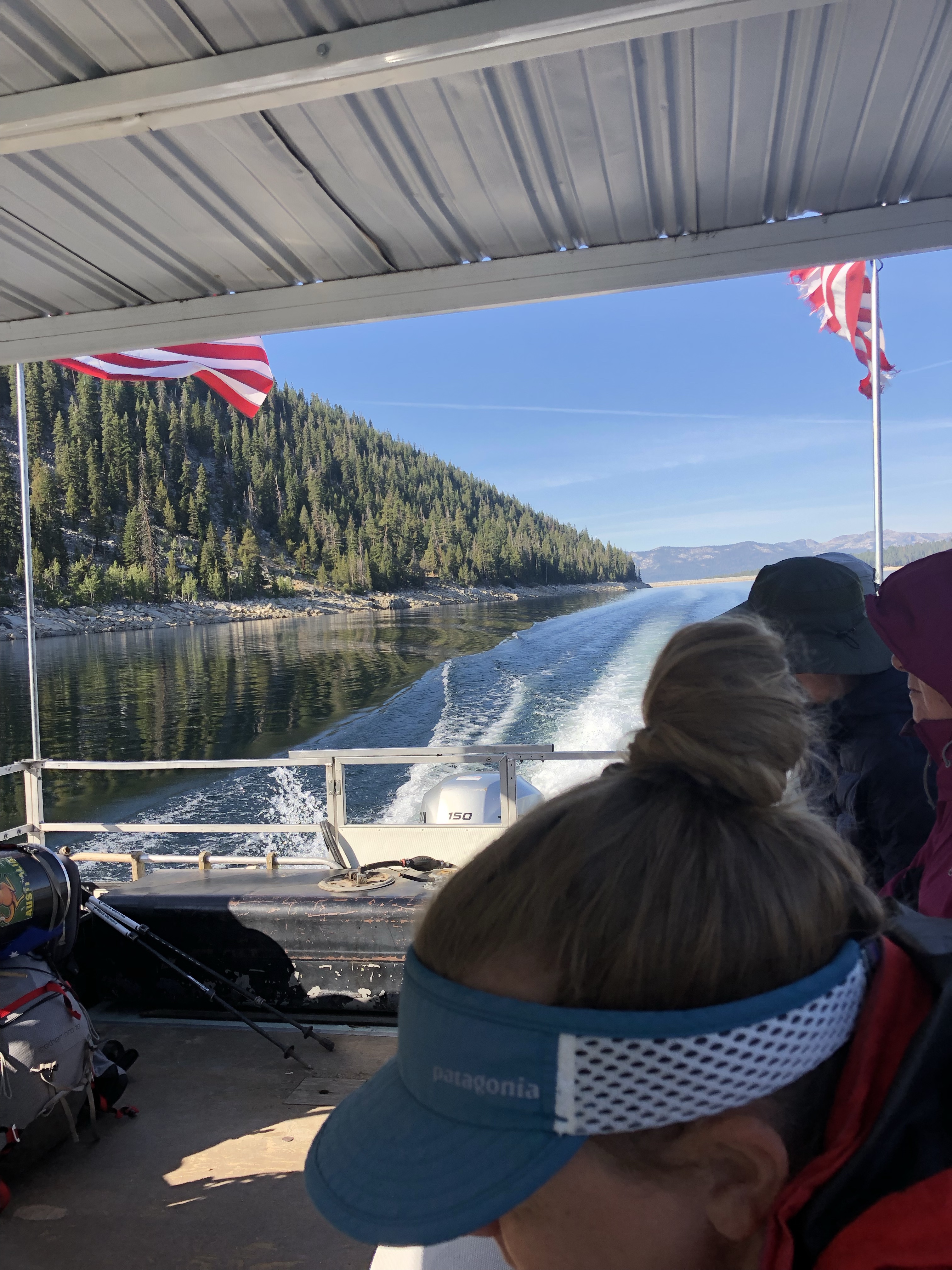
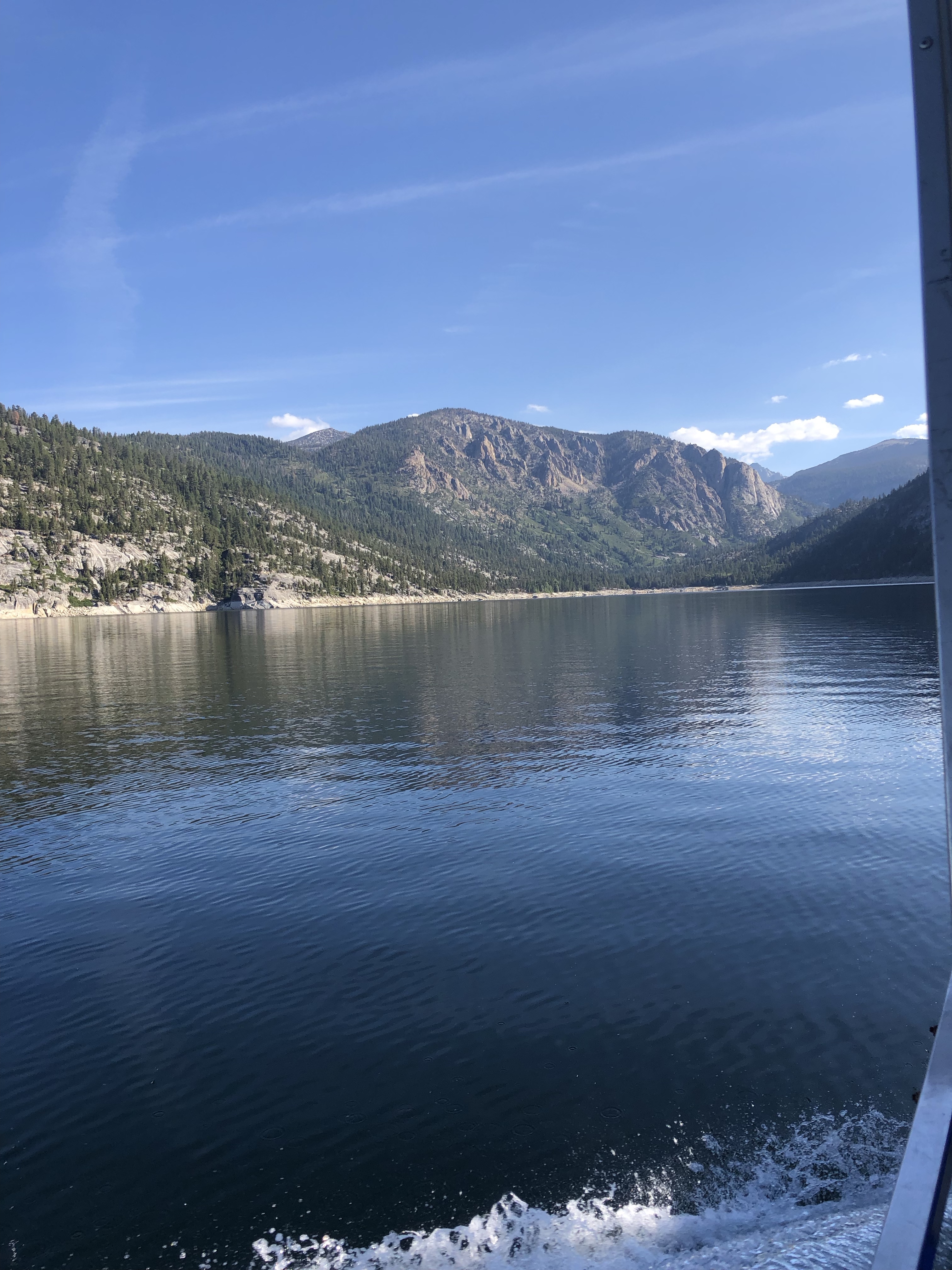
So I had no idea it was her birthday today. It really would have been useful information and maybe besides paying for the cabin, as usual, I could have bought her breakfast as a gift, or a Twix. We had a comfy night and a good breakfast, then got on the first shuttle boat ride to the north end of the lake where a mile long access trail connects to the JMT/PCT. If you have ATT, which I don’t, you can get a connection on the lake. It felt annoyingly like the real world as I looked around at the 12-15 other people on the boat all staring at their phones.
9/8 15.2 miles to Red’s Meadow
We camped last night at Virginia Lake, again making it just as the weather hit. We were up on the same knob where Tarcey camped in 2013, and where Puff Puff, Growler and Cool Breeze camped in 2015.
An easy day to Red’s Meadow where Noreen and the best dog in the world, Walker, is going to meet us and camp. We got there at 2pm and I took a shower and did laundry, ate in the cafe, and had some good conversations with some Canadians heading SOBO on the JMT. One of them, Ken, says he and his 21-year old daughter plan to hike the PCT next year, starting from opposite ends and meeting on the trail. Cool!
Noreen and Walker brought us beer! Pizza! Twix for Puff Puff! We camped together in the nearby campground and it was so good to spend some time with my friend! Plus, I’m still laughing over her question, a first for me after all these years of hiking in a Purple Rain skirt. “Do you wear underwear under your skirt?” Noreen! Yes!
Might have been cold at Virginia Lake
Noreen, Catwater, Walker
9/9 15.6 miles via JMT not PCT
We all ate hot breakfast at Red’s. Well, not Walker. Then we said goodbye and took the JMT, not PCT, route across the river. There was a lot of up and lots and lots of hikers. We passed tons of tents pitched already by 3 pm. It was getting really windy and I hoped to camp in the trees somewhere with a little wind blocking. So we stopped on the near side of Thousand Island Lake and huddled in our tents out of the cold.
9/10 21.6 to Tuolumne Meadows
Craziness! The original plan was to camp in Lyell Canyon at least 4 miles before getting to Tuolumne Meadows, then walk in the next morning, get breakfast at the Grill, try for a Half Dome permit and continue out towards Cathedral Lakes. But we made good time over Island and Donahue Passes and it’s pretty much down or flat all the way to Tuolumne Meadows. Just Jeff was at the top of Donahue talking with Puff Puff. Christine stayed in Mammoth for free at a trail friend’s place for a few days so as not to get done too soon before her flight back to Germany. Jeff needs to get to Tahoe to finish the PCT before his flight, I don’t see how he can make it in the time left. We met 2 women Katlyn and Hannah, hiking the JMT before starting grad school, obviously trail runners. We’d met them before and one of them heard my name as Cat Pee, which made Puff Puff laugh. I think it’s funny too, because of course the thought runs through most people’s minds when they hear my trail name is Catwater. Duh.
Puff Puff kept on ahead and Jeff and I walked some miles together with the new revise plan, get to the Grill before it closed at 6 pm. I saw the NPS Restoration crew is just volunteered with before starting this hike on the trail and they recognized me! That was fun! I showed Jeff the trail to the campground and we got to the Grill with plenty of time to spare. Burger! Puff Puff was there, not having waited for me at all. We ate and found the backpacker’s campground and settled in for another cold night.
9/11 18.3 to Cloud’s Rest/JMT Junction
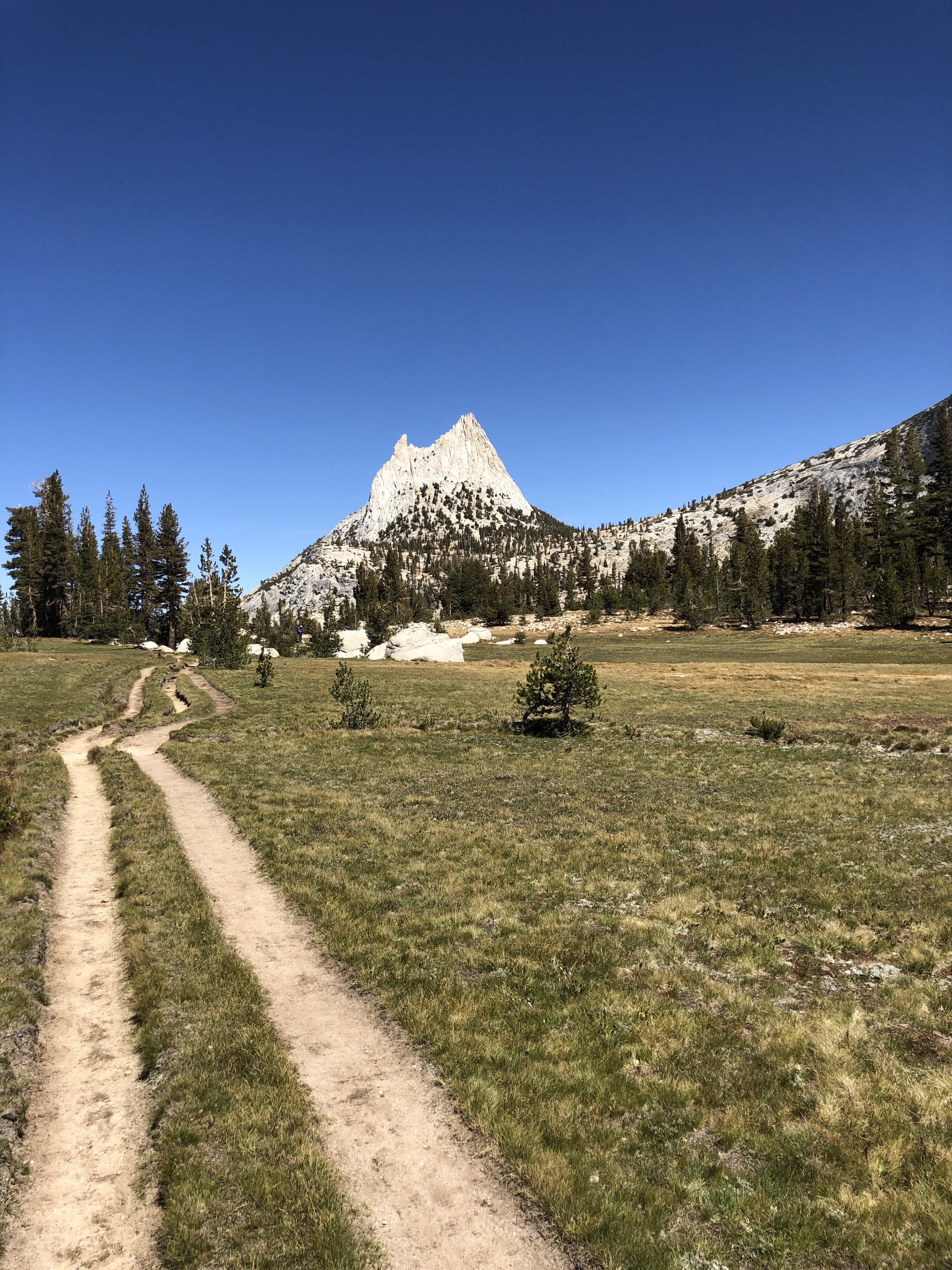
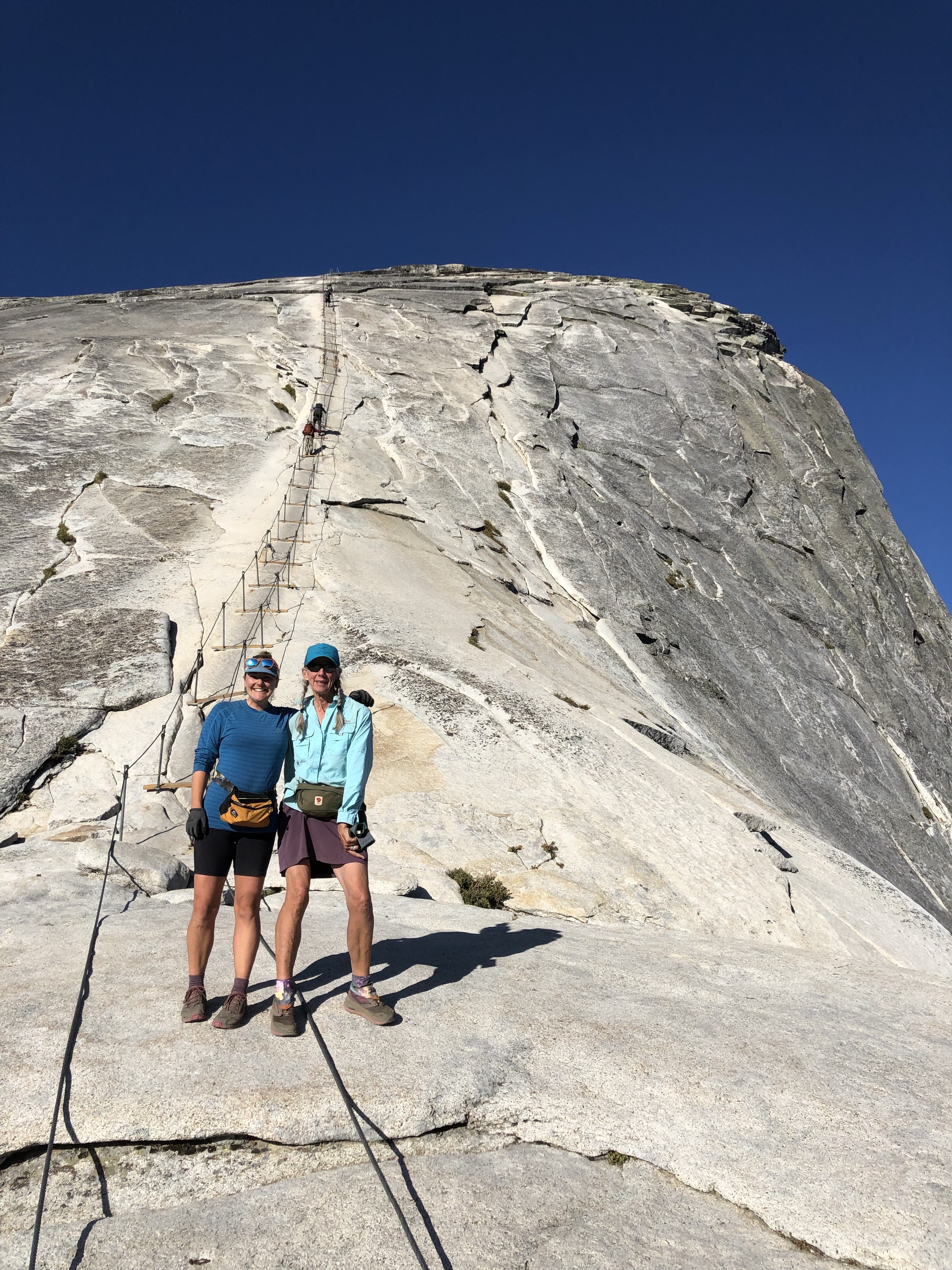
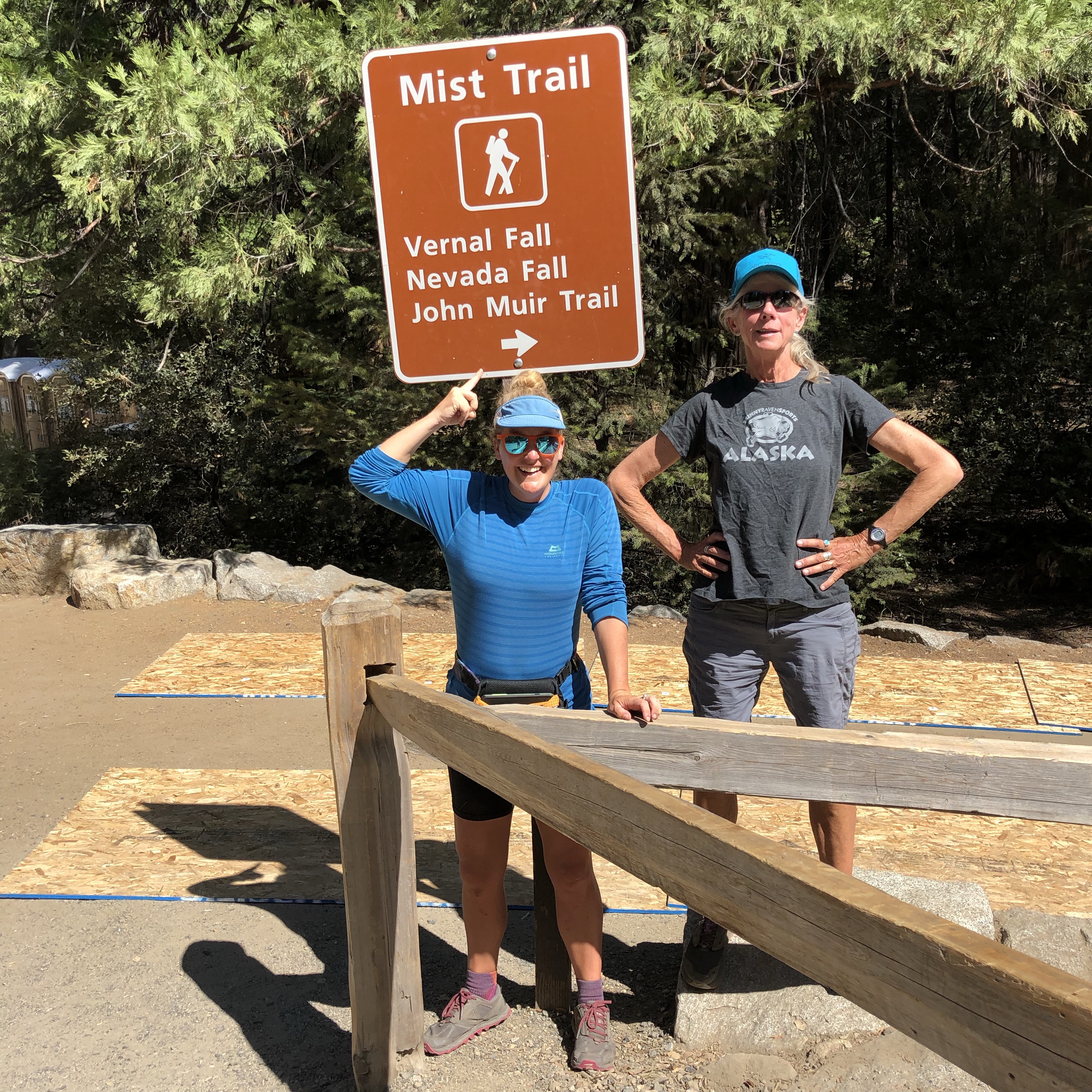
We ate a hot breakfast at the Grill when they opened at 8 am, then walked over to the Wilderness Permit office on the off chance that there might be Half Dome permits for the next day or maybe the day after that. Most of the permits are by lottery months in advance but they hold a few back for walk ins. Holy moly, we got the last 2 for tomorrow! I’ve been up the cables a few times, but Puff Puff never has. The PCT and JMT separate at Tuolumne Meadows so if you’re on the PCT it’s a side trip to Yosemite Valley, just like it’s a side trip off the PCT to the top of Whitney. We hefted our packs and headed out over one last Pass–Cathedral. We got a great tip from a woman heading the opposite direction and camped near the junction of the JMT and Clouds Rest Trail, which lines us up for a quick hike to the Half Dome trail in the morning and hopefully up the cables before the crowds get there and it looks like the 1898 Gold Rush over Chilkoot Pass in Alaska.
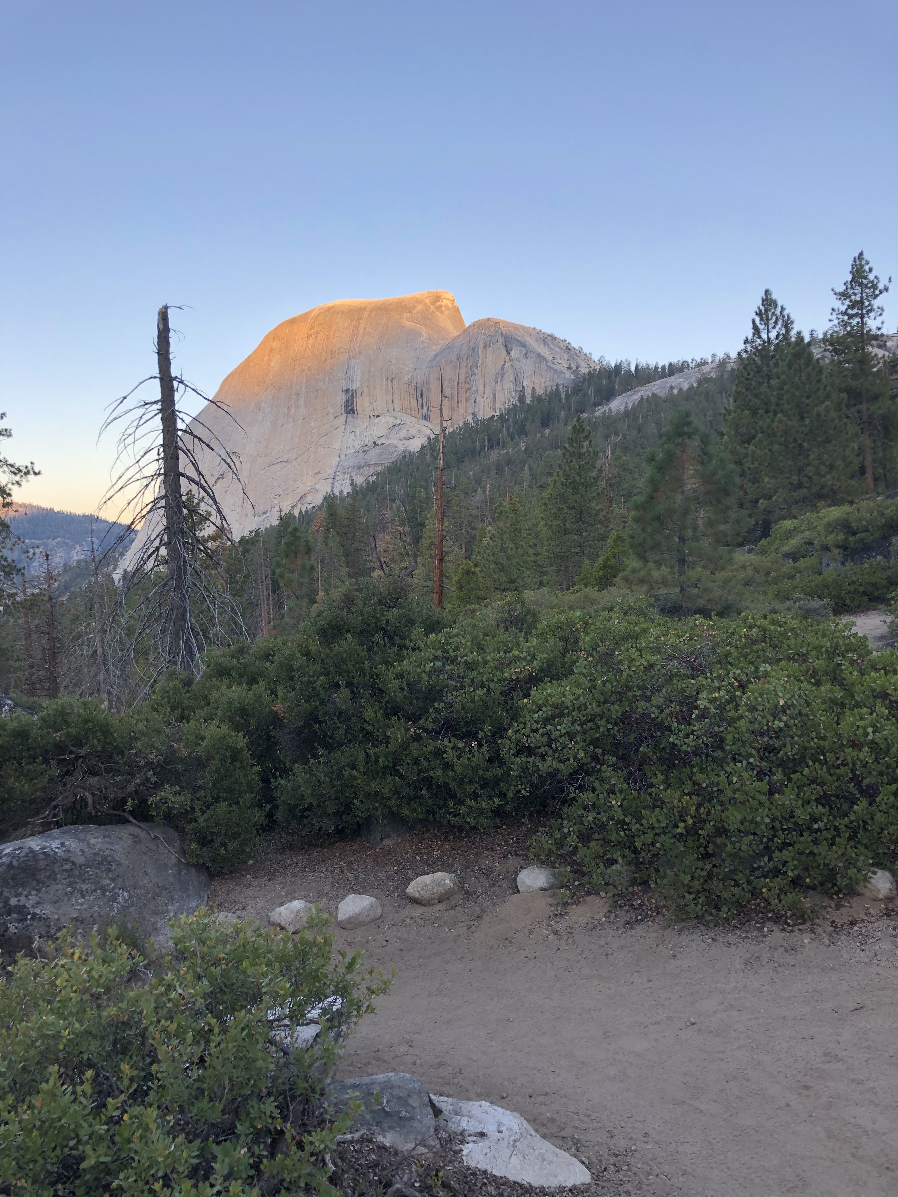
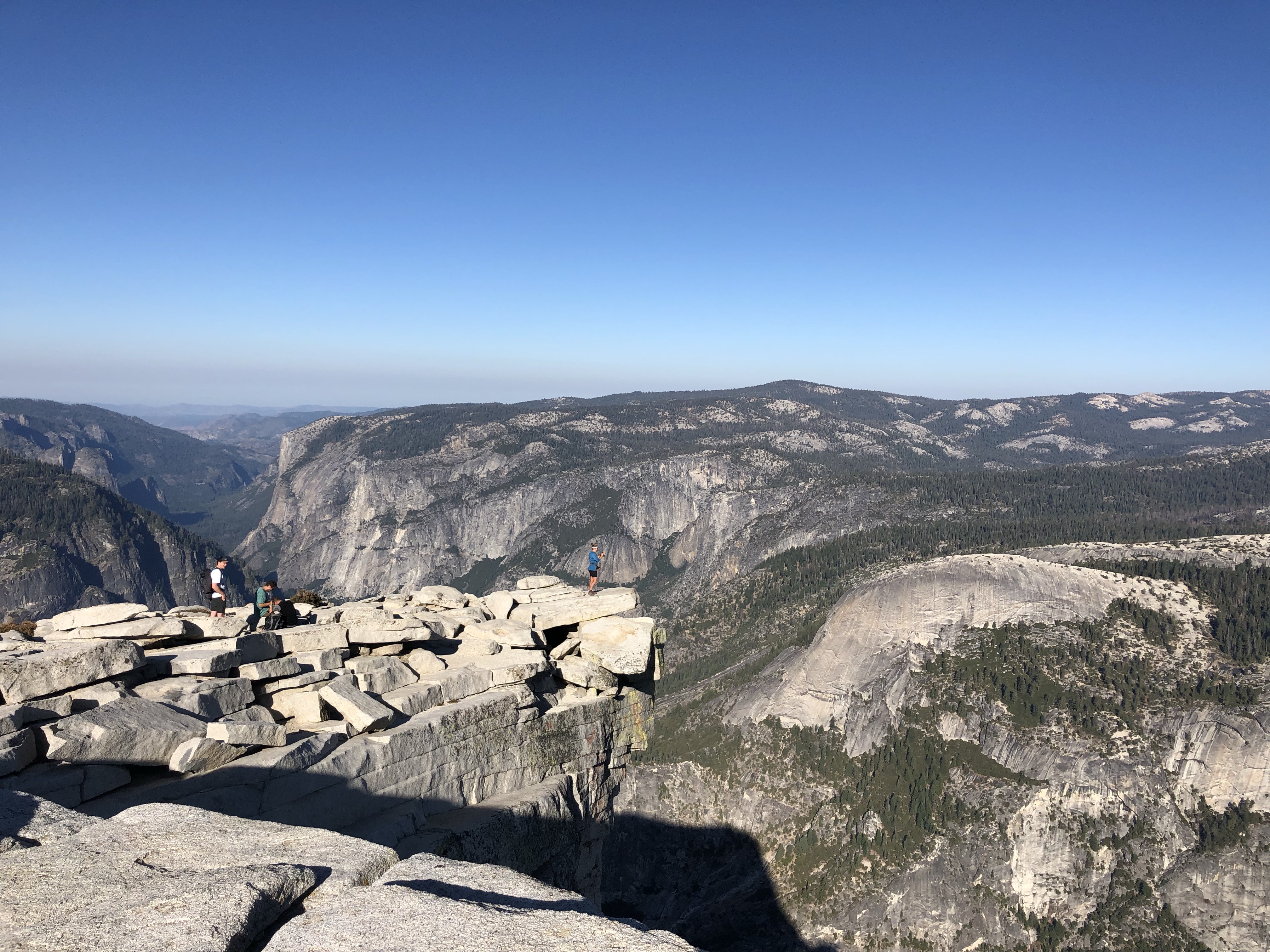
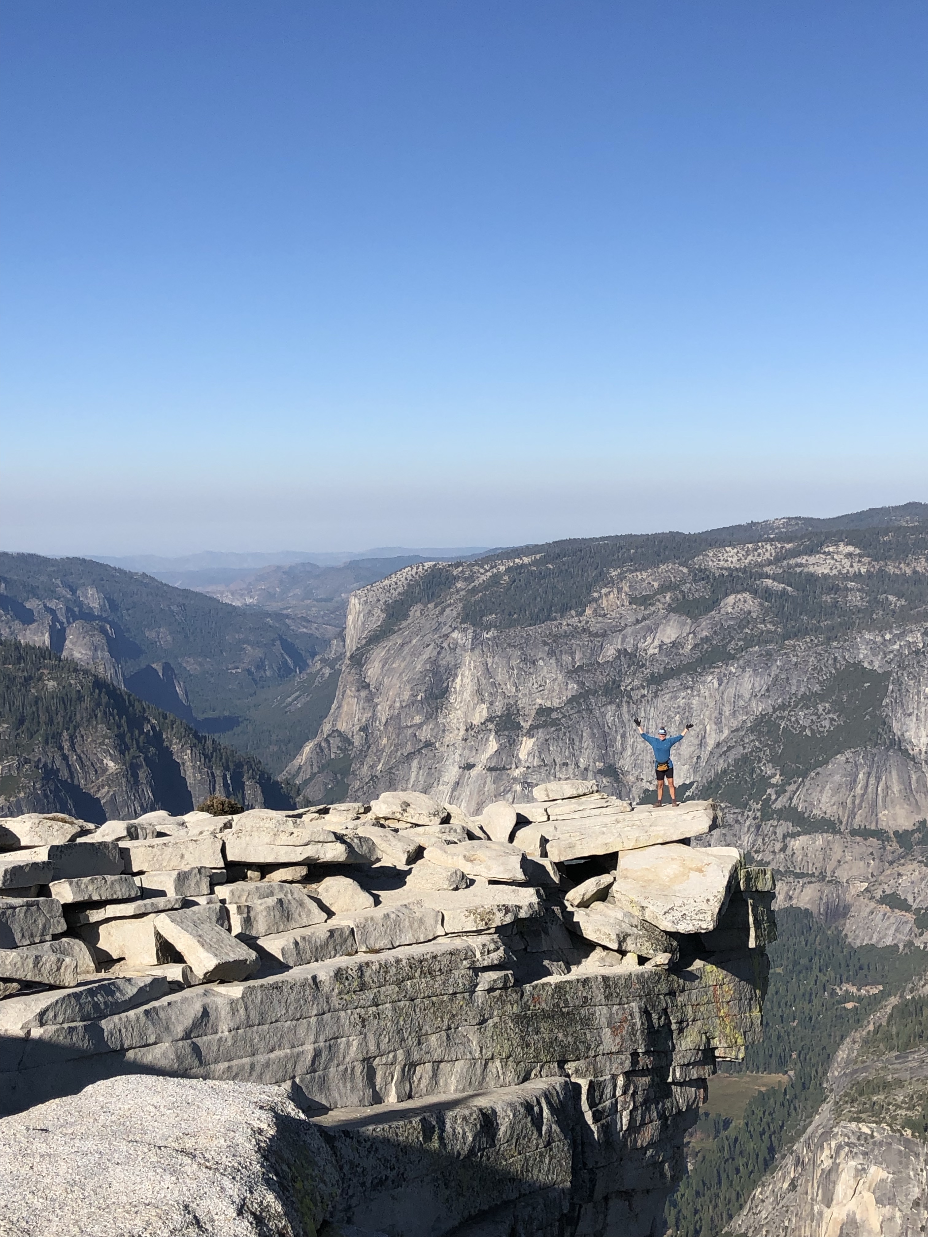
9/12 up Half Dome, down to the JMT by 9:30, Happy Isles by 2:30 pm
Well that was the perfect day to be on Half Dome! We got down to Happy Isles, got on the shuttle bus, got off at Camp Curry and a while later Jim, Joan, and Annie met us. Jim drove us up to Noreen’s beautiful rental, Cloud’s Rest Cabin, in Foresta, which she is gifting us for 2 nights until Saturday when we’ll catch a ride to Fresno with Jim to put Annie on the plane home to Alaska and to put me in a rental car for a few days. I’ve got some business to do in Calaveras County, a visit to my stepmom Merry in Davis, and a Mumford and Sons concert in San Francisco with Tarcey. Then I fly home to Alaska. Puff Puff will tag along until San Francisco and experience a bit more of California and people I love. Her flight home is a few days after mine and she has a trail friend who will host her for a few days.